Sounding Springfield.
Setup favourable for non mesocyclone Tornados ( little CINH, high cape ), but vorticity at low levels, so Tornados unlikely but possible

Have a nice day and stay safe !
Regards from Hamburg, Germany
Moderator: S2k Moderators


Bunkertor wrote:CrazyC83 wrote:Is it just me, or is a derecho trying to develop?
Where ? I ´ve never seen a derecho on a radar
CrazyC83 wrote:Bunkertor wrote:CrazyC83 wrote:Is it just me, or is a derecho trying to develop?
Where ? I ´ve never seen a derecho on a radar
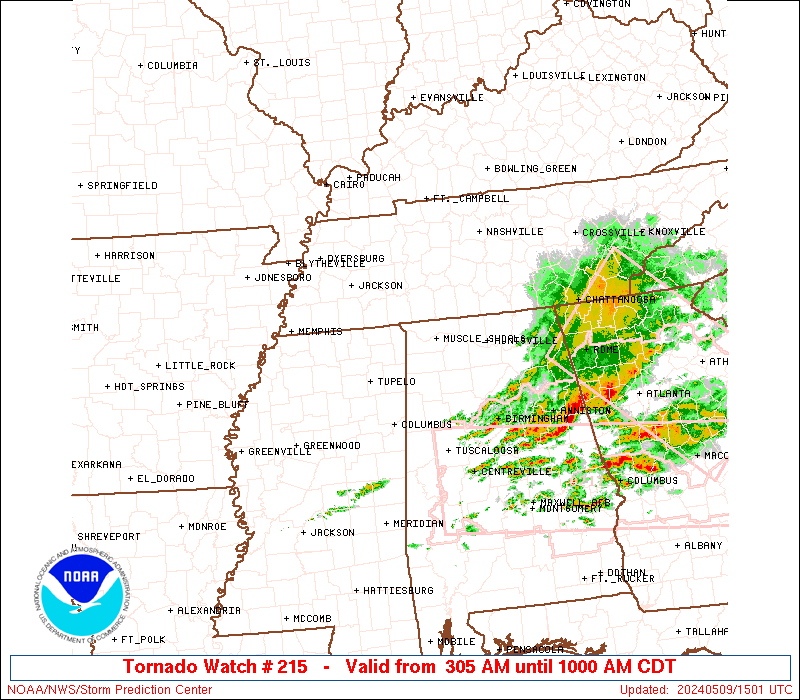
Pretty solid bow echo stretching across NE Arkansas, NW Tennessee into SE Missouri. Not sure if the winds are getting to the surface though...


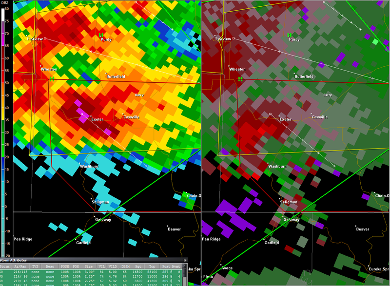
BULLETIN - EAS ACTIVATION REQUESTED
TORNADO WARNING
NATIONAL WEATHER SERVICE SPRINGFIELD MO
416 PM CDT TUE APR 22 2008
THE NATIONAL WEATHER SERVICE IN SPRINGFIELD HAS ISSUED A
* TORNADO WARNING FOR...
SOUTHERN BARRY COUNTY IN SOUTHWEST MISSOURI...
* UNTIL 530 PM CDT.
* AT 411 PM CDT...NATIONAL WEATHER SERVICE DOPPLER RADAR INDICATED A
TORNADO NEAR EXETER...OR 6 MILES WEST OF CASSVILLE...MOVING
SOUTHEAST AT 14 MPH.
* THE TORNADO WILL BE NEAR...
CASSVILLE BY 430 PM CDT.
7 MILES NORTHEAST OF SELIGMAN BY 435 PM CDT.
THE TOWNS OF EAGLE ROCK AND GOLDEN ARE ALSO IN THE PATH OF THIS
TORNADIC STORM


CajunMama wrote:What's with the stationary storms in central la? Some places have had 8-10" and they don't look to be weakening.
BULLETIN - IMMEDIATE BROADCAST REQUESTED
SEVERE THUNDERSTORM WARNING
NATIONAL WEATHER SERVICE NORMAN OK
747 AM CDT WED APR 23 2008
THE NATIONAL WEATHER SERVICE IN NORMAN HAS ISSUED A
* SEVERE THUNDERSTORM WARNING FOR...
EXTREME EASTERN JACKSON COUNTY IN SOUTHWEST OKLAHOMA...
SOUTHERN KIOWA COUNTY IN SOUTHWEST OKLAHOMA...
NORTHWESTERN TILLMAN COUNTY IN SOUTHWEST OKLAHOMA...
* UNTIL 830 AM CDT
* AT 747 AM CDT...NATIONAL WEATHER SERVICE DOPPLER RADAR INDICATED A
SEVERE THUNDERSTORM EXTENDING FROM NEAR TIPTON TO JUST SOUTH OF
HEADRICK...MOVING EAST-NORTHEAST AT 5 MPH. HAIL UP TO THE SIZE OF
QUARTERS IS LIKELY.
* LOCATIONS IN THE WARNING INCLUDE MANITOU...SNYDER AND TIPTON.
CrazyC83 wrote:Major hail threat and a moderate tornado threat now. Could see hail up to softball size.
Bunkertor wrote:CrazyC83 wrote:Major hail threat and a moderate tornado threat now. Could see hail up to softball size.
Is softballsize hail predictable ? I think only in some extreme cases.
btw. Anyone an idea where SPC sounding page has moved to ?
Return to “USA & Caribbean Weather”
Users browsing this forum: No registered users and 111 guests