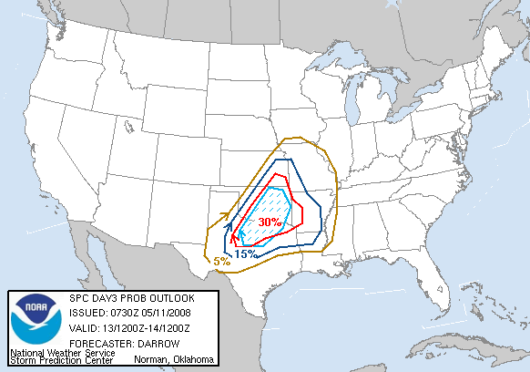
Utah U web site hasn't updated the GFS or WRF models since April 30th, so no posting images, but AccuWeather PPV site 18Z WRF shows rain breaking out before 4 pm CDT Tuesday afternoon in North Central Texas, with 50 to 70 knots shear in the area, and in excess of 2000 Joules/Kg CAPE, with a narrow area near Wichita Falls over 3500 Joules/Kg.
Storm relative helcities 100 to 150 J/Kg at 4 pm, increasing to in excess of 150 J/Kg.
Surface winds of 10 to 15 knots limit the helicity a tad. Ditto 20 to 30 knot 850 mb winds, which would suggest more of a large hail threat than a tornado threat, but I've read enough SPC and local NWS discussions to know that helicity may be enhanced near boundaries and boundary intersections, and high CAPE and strong deep shear might still be a recipe for trouble.
0Z WRF starting to come in.
older 12Z GFS had a similar depiction, storms in the area, strong mid level winds and instability, relatively weak low level winds.


