Global Model Runs for W.Caribbean Early Season Development
Moderator: S2k Moderators
Forum rules
The posts in this forum are NOT official forecasts and should not be used as such. They are just the opinion of the poster and may or may not be backed by sound meteorological data. They are NOT endorsed by any professional institution or STORM2K. For official information, please refer to products from the National Hurricane Center and National Weather Service.
Still think we are going to have to watch the EPAC system given its drifting off to the ENE right now closer and closer to central America. As long as there is high enough voricity Ed these sorts of circulations can last a heck of a long time overland in this region of the world, esp if the system does reach TS force before landfall simply because strong convection tends to fire up overland anyway which helps sustained systems for longer.
Orginal idea of the GFS looking less likely now though has to be said, esp given 90E looks very close to depression status IMO.
Orginal idea of the GFS looking less likely now though has to be said, esp given 90E looks very close to depression status IMO.
0 likes
Re: Global Model Runs for W.Caribbean Early Season Development
surely it bears watching.
the circulation is only 125 miles (+,-) from the sw caribean
so i'm not sure why Ed says 4-5 days
also could we not have two decent lows out of this?
the circulation is only 125 miles (+,-) from the sw caribean
so i'm not sure why Ed says 4-5 days
also could we not have two decent lows out of this?
0 likes
-
Ed Mahmoud
Re: Global Model Runs for W.Caribbean Early Season Development
cpdaman wrote:surely it bears watching.
the circulation is only 125 miles (+,-) from the sw caribean
so i'm not sure why Ed says 4-5 days
also could we not have two decent lows out of this?
Just from a couple of decades of amateur observation, a storm will not form in the Gulf or Western Caribbean if there is a pre-existing storm on the Pacific side, maybe a 10 to 15º separation. The dominant system's outflow will shear the weaker system, and the dominant system has an advantage in low level inflow.
The UK Met has 90E making a run for the Bay of Campeche, but dying near Tehuanepec. If a mid-level remnant makes the BOC, if conditions are favorable, it could ramp back up. But that is several days away.
Hence, my amateur and unofficial opinion that the Caribbean is TC free for the next few days.
0 likes
- gatorcane
- S2K Supporter

- Posts: 23703
- Age: 47
- Joined: Sun Mar 13, 2005 3:54 pm
- Location: Boca Raton, FL
The EPAC low is certainly winning the battle, at least over the past 12 hours.....in some ways this EPAC low is protecting the Atlantic basin from something getting going in the SW Carribean.
But I see no reason why the EPAC low couldn't creep into the SW Caribbean at this point. Steering currents are very weak in the area
But I see no reason why the EPAC low couldn't creep into the SW Caribbean at this point. Steering currents are very weak in the area
0 likes
-
Ed Mahmoud
Re:
cpdaman wrote:Ed i'll trust your experience with the two lows thing
but are you that confident it would take the EPAC low several days to drift ENE'ly into the SW caribean, or was this just based on it taking a different route to the north.
More the different route to the North. I will say, 6Z NOGAPS initializes two lows, and develops the Caribbean low and kills the Pacific low, and eventually runs towards Cuba and the Bahamas, but I think the EastPac system has too much of a head start.
0 likes
-
Ed Mahmoud
Re:
gatorcane wrote:The EPAC low is certainly winning the battle, at least over the past 12 hours.....in some ways this EPAC low is protecting the Atlantic basin from something getting going in the SW Carribean.
But I see no reason why the EPAC low couldn't creep into the SW Caribbean at this point. Steering currents are very weak in the area
I looked at the various levels of CIMMS steering, and the existing low has pretty much dominated all the maps, making steering hard to guess at. A slow drift East would get it into the Caribbean, but it sure would knock it back down some crossing land, and a slow drift would still mean 2 or 3 days before it was back over water in the Caribbean, and most models, at least, seem to imply a Northeast to North or North-Northwest drift.
0 likes
- cycloneye
- Admin

- Posts: 148741
- Age: 69
- Joined: Thu Oct 10, 2002 10:54 am
- Location: San Juan, Puerto Rico
Re: Global Model Runs for W.Caribbean Early Season Development
I would not rule out NHC releasing a Special Tropical Disturbance Statement,not because of any TC formation that may or not occur in the Caribbean shortly,but about the potential for flooding and mudslides in Central-America.I know that the EPAC TWO'S are taking care of that,however it may be important to let know the people of the Caribbean side of CA what is going on.
0 likes
- gatorcane
- S2K Supporter

- Posts: 23703
- Age: 47
- Joined: Sun Mar 13, 2005 3:54 pm
- Location: Boca Raton, FL
Re: Re:
Ed Mahmoud wrote:gatorcane wrote:The EPAC low is certainly winning the battle, at least over the past 12 hours.....in some ways this EPAC low is protecting the Atlantic basin from something getting going in the SW Carribean.
But I see no reason why the EPAC low couldn't creep into the SW Caribbean at this point. Steering currents are very weak in the area
I looked at the various levels of CIMMS steering, and the existing low has pretty much dominated all the maps, making steering hard to guess at. A slow drift East would get it into the Caribbean, but it sure would knock it back down some crossing land, and a slow drift would still mean 2 or 3 days before it was back over water in the Caribbean, and most models, at least, seem to imply a Northeast to North or North-Northwest drift.
But from the latest NHC TWO I bolded the key part. Notice they say it should drift E to ENE into Central America. If you look where it is now, it wouldn't have alot of land to go over if it chose the Costa Rica, Southern Nicaragua route....and considering there is water on both sides, I see little if any weakening crossing Central America there.
000
ABPZ20 KNHC 281132
TWOEP
TROPICAL WEATHER OUTLOOK
NWS TPC/NATIONAL HURRICANE CENTER MIAMI FL
500 AM PDT WED MAY 28 2008
FOR THE EASTERN NORTH PACIFIC...EAST OF 140 DEGREES WEST LONGITUDE..
A LARGE AREA OF DISTURBED WEATHER ASSOCIATED WITH BROAD AREA OF LOW
PRESSURE IS CENTERED A COUPLE OF HUNDRED MILES WEST OF COSTA RICA.
THIS SYSTEM SHOWS SIGNS OF ORGANIZATION AND IT COULD BECOME A
TROPICAL DEPRESSION WITHIN THE NEXT DAY OR TWO...AS IT DRIFTS
EASTWARD OR NORTHEASTWARD OVER CENTRAL AMERICA. REGARDLESS OF
ADDITIONAL DEVELOPMENT...LOCALLY TORRENTIAL RAINS ARE EXPECTED OVER
PORTIONS OF PANAMA...COSTA RICA...NICARAGUA AND HONDURAS DURING THE
NEXT DAY OR TWO. THESE RAINS COULD CAUSE LIFE-THREATENING FLASH
FLOODS AND MUD SLIDES.
$$
FORECASTER AVILA/LANDSEA
0 likes
Yeah its heading ENE and therefore given its not all that far away central America and given its moved nearly 4 degrees eatward since 90E was tagged as an invest you can assume that even though it has slowed down it could well be inland by Thursday/Friday.
Also remember what Derek said, in this location systems have actually strengthened overland I guess because of the explosive convection you can get overland that far south in the tropics given the moisture levels probably present.
Also remember what Derek said, in this location systems have actually strengthened overland I guess because of the explosive convection you can get overland that far south in the tropics given the moisture levels probably present.
0 likes
Re: Global Model Runs for W.Caribbean Early Season Development
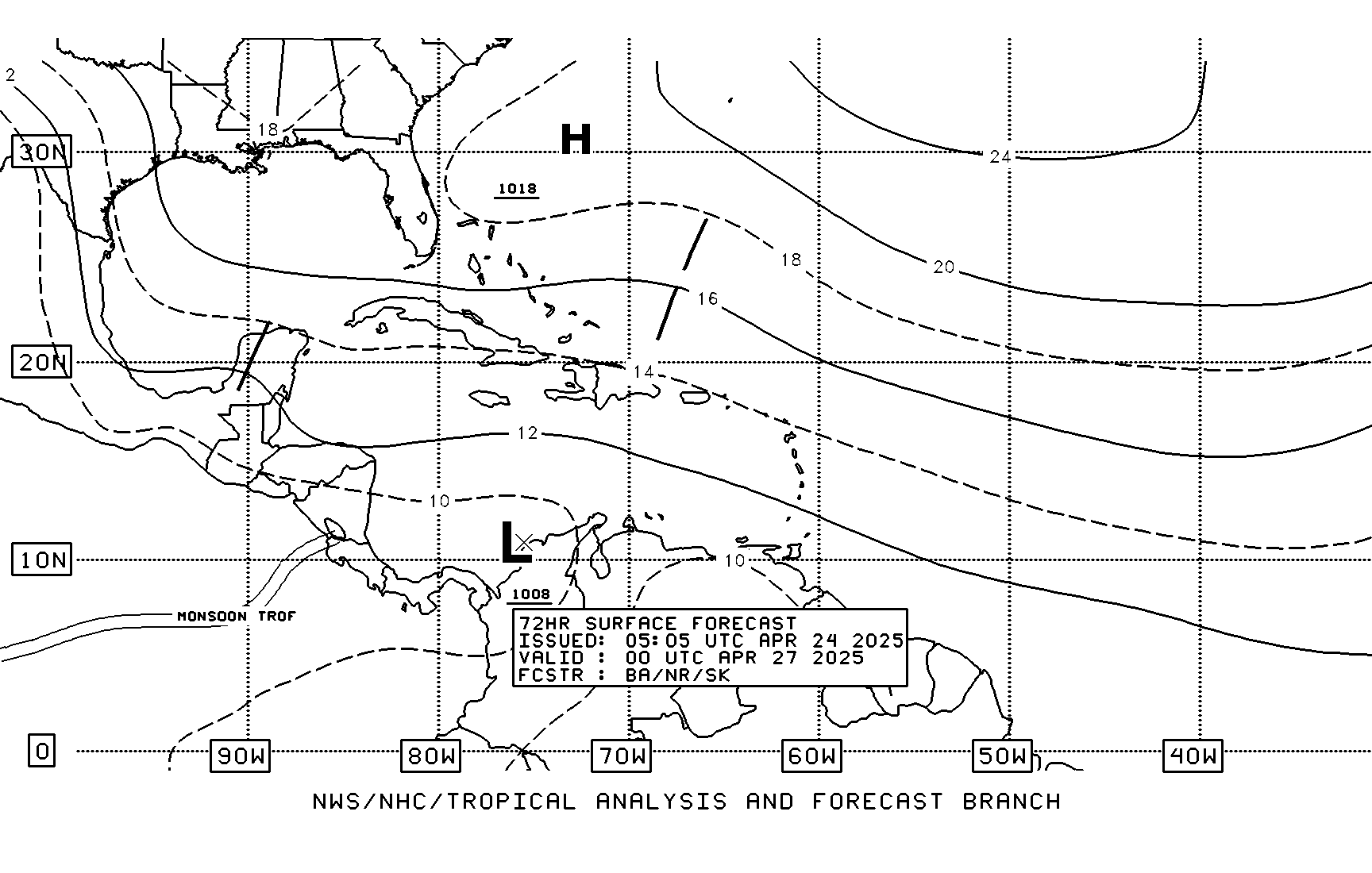
TPC's 72 hour forecast shows two lows - one western caribbean and one Pacific (possible tropical cyclone). Looks like Pacific one will dominate, but the western caribbean has favorable upper level conditions forecast over the next 72 -120 hours.


0 likes
Re: Global Model Runs for W.Caribbean Early Season Development
12Z NAM actually looks very reasonable through H+48
Thru H+48 Loop
http://www.nco.ncep.noaa.gov/pmb/nwprod ... el_l.shtml
Thru H+48 Loop
http://www.nco.ncep.noaa.gov/pmb/nwprod ... el_l.shtml
0 likes
- Evil Jeremy
- S2K Supporter

- Posts: 5463
- Age: 32
- Joined: Mon Apr 10, 2006 2:10 pm
- Location: Los Angeles, CA
Re: Global Model Runs for W.Caribbean Early Season Development
Vortex wrote:12Z NAM actually looks very reasonable through H+48
Thru H+48 Loop
http://www.nco.ncep.noaa.gov/pmb/nwprod ... el_l.shtml
Again, a model is developing a system in the EPac and bringing it over to the Caribbean, although this NAM run has the entire process going on within a few days.
0 likes
- gatorcane
- S2K Supporter

- Posts: 23703
- Age: 47
- Joined: Sun Mar 13, 2005 3:54 pm
- Location: Boca Raton, FL
Re: Global Model Runs for W.Caribbean Early Season Development
Aric are you still observing a surface low east of Nicaragua? I think I am seeing some cyclonic spin just east of Nicaragua but I am not sure.
I agree though -- the UL SW winds are blowing the 90E cloud tops NE into the Caribbean....and the whole blob is gradually moving ENE into Central America. We could see a center reformation farther East....
I agree though -- the UL SW winds are blowing the 90E cloud tops NE into the Caribbean....and the whole blob is gradually moving ENE into Central America. We could see a center reformation farther East....
0 likes
- Evil Jeremy
- S2K Supporter

- Posts: 5463
- Age: 32
- Joined: Mon Apr 10, 2006 2:10 pm
- Location: Los Angeles, CA
Re: Global Model Runs for W.Caribbean Early Season Development
These are my observations right now:
1: The convection in the SW Caribbean is continuing to expand as it expands with the tropical wave
2: The SW Caribbean blobs are drifting North or NNW slowly
3: 90E is slowly drifting eastward into Central America
4: Call me crazy, but it looks like 90E has become less organized in the past hour or so as it nears the coastline, at least with its convection. Is anyone else seeing this?
http://www.ssd.noaa.gov/goes/east/watl/loop-wv.html
http://www.ssd.noaa.gov/goes/flt/t7/loop-vis.html
0 likes
Who is online
Users browsing this forum: Iceresistance and 57 guests

