

Central Atlantic / Eastern Atlantic
Moderator: S2k Moderators
Forum rules

The posts in this forum are NOT official forecasts and should not be used as such. They are just the opinion of the poster and may or may not be backed by sound meteorological data. They are NOT endorsed by any professional institution or STORM2K. For official information, please refer to products from the National Hurricane Center and National Weather Service.


Re: Central Atlantic / Coast of Africa
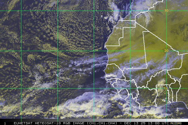
what do yall think of the second wave?
http://www.ssd.noaa.gov/eumet/eatl/rgb-l.jpg
http://www.ssd.noaa.gov/eumet/eatl/rgb-l.jpg
0 likes
-
Gustywind

- Category 5

- Posts: 12334
- Joined: Mon Sep 03, 2007 7:29 am
- Location: Baie-Mahault, GUADELOUPE
Hi punkyg glad to see you , monsters waves very muscled AWESOME punkyg, but its seems that they're emerging rounds after rounds without calm, hé hé hé...maybe ours firsts TDs in June ?,Hope the very best looking at these monster twaves 

http://www.ssd.noaa.gov/eumet/eatl/rb-l.jpg are we in AUGUST??!
http://www.ssd.noaa.gov/eumet/eatl/rb-l.jpg
0 likes
-
Gustywind
- Category 5
- Posts: 12334
- Joined: Mon Sep 03, 2007 7:29 am
- Location: Baie-Mahault, GUADELOUPE
000
AXNT20 KNHC 291750
TWDAT
TROPICAL WEATHER DISCUSSION
NWS TPC/NATIONAL HURRICANE CENTER MIAMI FL
205 PM EDT THU MAY 29 2008
TROPICAL WEATHER DISCUSSION FOR NORTH AMERICA...CENTRAL
AMERICA...THE GULF OF MEXICO...THE CARIBBEAN SEA...NORTHERN
SECTIONS OF SOUTH AMERICA...AND THE ATLANTIC OCEAN TO THE
AFRICAN COAST FROM THE EQUATOR TO 32N. THE FOLLOWING INFORMATION
IS BASED ON SATELLITE IMAGERY...METEOROLOGICAL ANALYSIS...
WEATHER OBSERVATIONS...AND RADAR.
BASED ON 1200 UTC SURFACE ANALYSIS AND SATELLITE IMAGERY THROUGH
1715 UTC.
...TROPICAL WAVES...
TROPICAL WAVE IS ALONG 29W/30W S OF 15N MOVING W NEAR 15 KT.
WELL DEFINED INVERTED-V CURVATURE AHEAD OF A SURGE COMING OFF
THE COAST OF AFRICA. SCATTERED MODERATE/ISOLATED STRONG
CONVECTION FROM 5N-8N 28W-31W.
0 likes


-
Gustywind
- Category 5
- Posts: 12334
- Joined: Mon Sep 03, 2007 7:29 am
- Location: Baie-Mahault, GUADELOUPE
Re:
KWT wrote:They certainly are impressive waves for the time of year, not even a hint of SAL as of yet that would normally totally inhibit these waves from about this time through to late July so thats a very interesting situtation to find ourselves in.
Definitively, what a situation!!!!I wonder if we were in August
the waves are pushing themselves days after after days suspciously, things to watch maybe earlier than predicted for sure
0 likes
-
Gustywind
- Category 5
- Posts: 12334
- Joined: Mon Sep 03, 2007 7:29 am
- Location: Baie-Mahault, GUADELOUPE
Re:
RL3AO wrote:Some of the stuff coming off of Africa in the past few weeks has been crazy.
Oh Yeah since mid april waves are cooking steadily for the happiness of our eyes for the moment ....
0 likes
-
Gustywind
- Category 5
- Posts: 12334
- Joined: Mon Sep 03, 2007 7:29 am
- Location: Baie-Mahault, GUADELOUPE
Re:
KWT wrote:IF we were in August we'd have almost certainly have had a tropical system develop from that large wave that came off Africa about 24hrs ago IMO.
Oh yeah my friend or more these waves are nasty tremendous sometimes these numbers of huge waves are pretty rare in august and in September in some poor or inactive season.....that doesn't that the one poor can't be a cane too, but your understood what i mean....AWESOME waves are churning near us, let's see what happens during the next 2 weeks, this will gave us a better idea of the pattern
0 likes
-
dixiebreeze

- S2K Supporter

- Posts: 5140
- Joined: Wed Sep 03, 2003 5:07 pm
- Location: crystal river, fla.
Yep thats the one, if this was August I'd expect that either one of those big waves could become a strong tropical system. However the fact we are in May makes those potent waves even more impressive, really deep convection in both of them and they are pretty large in coverage as well. The 1st one will probably poof sooner rather then later though I reckon.
0 likes
Re: Central Atlantic / Coast of Africa
dixiebreeze wrote:I guess you mean this one -- pretty impressive!
http://www.ssd.noaa.gov/eumet/eatl/rb-l.jpg
Is that the latest pic of the wave? if so then its holding up well.
0 likes

-
Ed Mahmoud
Re: Central Atlantic / Coast of Africa
Just noticed, it is still the 06Z image from way, early this morning.
0 likes
-
Gustywind
- Category 5
- Posts: 12334
- Joined: Mon Sep 03, 2007 7:29 am
- Location: Baie-Mahault, GUADELOUPE
Re: Central Atlantic / Coast of Africa
dixiebreeze wrote:I guess you mean this one -- pretty impressive!
http://www.ssd.noaa.gov/eumet/eatl/rb-l.jpg
Absolutely the best with my untrained eyes no doubts....AWESOME, if it's already that only in may, we can bet for 3 cat 5 in august or earlier better than Dean and Felix

0 likes
-
Gustywind
- Category 5
- Posts: 12334
- Joined: Mon Sep 03, 2007 7:29 am
- Location: Baie-Mahault, GUADELOUPE
000
AXNT20 KNHC 292359
TWDAT
TROPICAL WEATHER DISCUSSION
NWS TPC/NATIONAL HURRICANE CENTER MIAMI FL
805 PM EDT THU MAY 29 2008
TROPICAL WEATHER DISCUSSION FOR NORTH AMERICA...CENTRAL
AMERICA...GULF OF MEXICO...CARIBBEAN SEA...NORTHERN SECTIONS OF
SOUTH AMERICA...AND ATLANTIC OCEAN TO THE AFRICAN COAST FROM THE
EQUATOR TO 32N. THE FOLLOWING INFORMATION IS BASED ON SATELLITE
IMAGERY...METEOROLOGICAL ANALYSIS...WEATHER OBSERVATIONS...AND
RADAR.
BASED ON 1800 UTC SURFACE ANALYSIS AND SATELLITE IMAGERY THROUGH
2315 UTC.
...TROPICAL WAVES...
TROPICAL WAVE HAS MOVED PAST THE CAPE VERDE ISLANDS ALONG 31W S
OF 15N MOVING W 15 KT. TPW PRODUCTS CONTINUE TO SHOW A
WELL-DEFINED DEEP-LAYERED MOISTURE SURGE EXTENDING FROM THE
TROPICS NWD TO ABOUT 21N EVEN THOUGH THERE IS VERY LITTLE
SIGNATURE IN CONVECTIONAL SATELLITE IMAGERY. A SMALL INFLECTION
IS NOTED WITHIN THE ITCZ AND ALL ASSOCIATED CONVECTION IS
CONCENTRATED ALONG THE ITCZ AXIS ITSELF.
LOW-LATITUDE TROPICAL WAVE ALONG 44W/45W S OF 8N...ABOUT 450 NM
E OF FRENCH GUIANA...MOVING W 15 KT. THIS WAVE HAS CONTINUED TO
BECOME MORE WELL-DEFINED OVER THE PAST SEVERAL
DAYS...SPECIFICALLY ASSOCIATED WITH THE MOISTURE FIELD. IT IS
EXPECTED TO REACH THE COAST OF SOUTH AMERICA BY THIS TIME
TOMORROW AND WILL LIKELY INCREASE TSTM COVERAGE OVER THE GUIANAS
OVER THE NEXT 2-3 DAYS. ALL ASSOCIATED CONVECTION IS CURRENTLY
WITHIN THE ITCZ.
At each round right now they are at least defined twave
AN UPPER HIGH IS LOCATED FARTHER S NEAR THE CAPE
VERDE ISLANDS AND IS PULLING SOME UPPER LEVEL MOISTURE FROM THE
TROPICS BACK TOWARDS AFRICA. HOWEVER...DEEP MOISTURE REMAINS
SCANT E OF 60W AND THUS ALL DEEP CONVECTION IS LIMITED TO THE
ITCZ.
0 likes
-
Gustywind
- Category 5
- Posts: 12334
- Joined: Mon Sep 03, 2007 7:29 am
- Location: Baie-Mahault, GUADELOUPE
000
AXNT20 KNHC 301157
TWDAT
TROPICAL WEATHER DISCUSSION
NWS TPC/NATIONAL HURRICANE CENTER MIAMI FL
805 AM EDT FRI MAY 30 2008
TROPICAL WEATHER DISCUSSION FOR NORTH AMERICA...CENTRAL
AMERICA...GULF OF MEXICO...CARIBBEAN SEA...NORTHERN SECTIONS OF
SOUTH AMERICA...AND ATLANTIC OCEAN TO THE AFRICAN COAST FROM THE
EQUATOR TO 32N. THE FOLLOWING INFORMATION IS BASED ON SATELLITE
IMAGERY...METEOROLOGICAL ANALYSIS...WEATHER OBSERVATIONS...AND
RADAR.
BASED ON 0600 UTC SURFACE ANALYSIS AND SATELLITE IMAGERY THROUGH
1015 UTC.
...TROPICAL WAVES...
TROPICAL WAVE IS ALONG 33W/34W S OF 16N MOVING W 15 KT.
MIMIC-TPW SHOWS A WELL-DEFINED DEEP-LAYERED MOISTURE SURGE
EXTENDING FROM THE TROPICS NWD TO ABOUT 16N EVEN WITH A WEAK
SIGNATURE ON SATELLITE IMAGERY. ANY CONVECTION IS CONCENTRATED
ALONG THE ITCZ AXIS AND FURTHER SOUTH.
TROPICAL WAVE IS ALONG 49W S OF 8N MOVING W 10-15 KT. THIS
POSITION IS BASED PRIMARILY ON MIMIC-TPW. THE WAVE IS AT A VERY
LOW AMPLITUDE AND SO EMBEDDED WITHIN THE ITCZ...SATELLITE
SIGNATURE IS INDISCERNIBLE. ANY CONVECTION IS CONCENTRATED ALONG
THE ITCZ AXIS.
0 likes
Who is online
Users browsing this forum: No registered users and 197 guests