EPAC: Invest 91E - Southern México
Moderator: S2k Moderators
EPAC: Invest 91E - Southern México
ABPZ20 KNHC 021154
TWOEP
TROPICAL WEATHER OUTLOOK
NWS TPC/NATIONAL HURRICANE CENTER MIAMI FL
500 AM PDT SUN JUN 1 2008
FOR THE EASTERN NORTH PACIFIC...EAST OF 140 DEGREES WEST LONGITUDE..
A LARGE AREA OF SHOWERS AND THUNDERSTORMS EXTENDS FROM THE GULF OF
TEHUANTEPEC SOUTHWARD FOR A FEW HUNDRED MILES OVER THE EASTERN
PACIFIC. THIS ACTIVITY IS ASSOCIATED WITH THE SAME BROAD AREA OF
LOW PRESSURE THAT HAS ALREADY PRODUCED TROPICAL STORMS ALMA AND
ARTHUR. UPPER-LEVEL WINDS ARE EXPECTED TO BECOME A LITTLE MORE
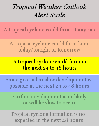
FAVORABLE FOR DEVELOPMENT...AND A TROPICAL DEPRESSION COULD FORM
WITHIN THIS AREA DURING THE NEXT DAY OR TWO. REGARDLESS OF
DEVELOPMENT...LOCALLY HEAVY RAINS ARE POSSIBLE OVER PORTIONS OF EL
SALVADOR...GUATEMALA...AND SOUTHEASTERN MEXICO.
ELSEWHERE...TROPICAL CYCLONE FORMATION IS NOT EXPECTED DURING THE
NEXT 48 HOURS.
$$
FORECASTER RHOME/FRANKLIN
0 likes
Re: EPac disturbance (former Alma/Arthur): GTWO: Orange
If this one develops in the GOT, it may be able to crossover into the BOC. The models show a large and deep-layer trough digging into southern plains later this week, that would at least break down the ridge over GOM to allow this system to come northward.
0 likes
- gatorcane
- S2K Supporter
- Posts: 23499
- Age: 46
- Joined: Sun Mar 13, 2005 3:54 pm
- Location: Boca Raton, FL
Re: EPac disturbance (former Alma/Arthur): GTWO: Orange
Thunder44 wrote:If this one develops in the GOT, it may be able to crossover into the BOC. The models show a large and deep-layer trough digging into southern plains later this week, that would at least break down the ridge over GOM to allow this system to come northward.
Yes indeed I was thinking the same thing so we'll have to see how this all unfolds.
Latest:
0 likes
-
- Professional-Met
- Posts: 11430
- Age: 33
- Joined: Sat Dec 24, 2005 9:00 pm
- Location: School: Florida State University (Tallahassee, FL) Home: St. Petersburg, Florida
- Contact:
- DESTRUCTION5
- Category 5
- Posts: 4391
- Age: 42
- Joined: Wed Sep 03, 2003 11:25 am
- Location: Stuart, FL
Re:
DESTRUCTION5 wrote:I think ita a Development battle...I think which ever side dev's 1st will steal the energy from the other side...
I don't think we'll see any development in the Carribean this week. The upper-level winds are becoming unfavorable again there.The Pacific will win again.
0 likes
Re: EPac disturbance (former Alma/Arthur): GTWO: Orange
Thunder44 wrote:If this one develops in the GOT, it may be able to crossover into the BOC. The models show a large and deep-layer trough digging into southern plains later this week, that would at least break down the ridge over GOM to allow this system to come northward.
Alma to Arthur to Boris to Bertha would be incredible.
0 likes
Re: EPac disturbance (former Alma/Arthur): GTWO: Orange
91E Invest is up for this system:
http://www.nrlmry.navy.mil/tc_pages/tc_home.html
I see this thread has moved to the Active Forum. I deleted the other thread I made for it.
http://www.nrlmry.navy.mil/tc_pages/tc_home.html
I see this thread has moved to the Active Forum. I deleted the other thread I made for it.
0 likes
-
- Professional-Met
- Posts: 11430
- Age: 33
- Joined: Sat Dec 24, 2005 9:00 pm
- Location: School: Florida State University (Tallahassee, FL) Home: St. Petersburg, Florida
- Contact:
- Extremeweatherguy
- Category 5
- Posts: 11095
- Joined: Mon Oct 10, 2005 8:13 pm
- Location: Houston, TX
The 12z GFS brings 91E northward into the southern BOC as a 1008mb low in 36 hours... http://www.nco.ncep.noaa.gov/pmb/nwprod ... n_036l.gif
1007mb low in the BOC in 48 hrs... http://www.nco.ncep.noaa.gov/pmb/nwprod ... n_048l.gif
The GFS then strangely dissipates the BOC low in 60 hours and another 1007mb low forms near Belize... http://www.nco.ncep.noaa.gov/pmb/nwprod ... n_060l.gif
A 1005mb low reappears in the BOC in 72 hours... http://www.nco.ncep.noaa.gov/pmb/nwprod ... n_072l.gif
The low is inland in eastern Mexico in 102 hours, but there continues to be quite a bit of moisture hanging over the Gulf. A new low may even be trying to form west of Florida... http://www.nco.ncep.noaa.gov/pmb/nwprod ... n_102l.gif
Last edited by Extremeweatherguy on Mon Jun 02, 2008 11:09 am, edited 5 times in total.
0 likes
- srainhoutx
- S2K Supporter
- Posts: 6919
- Age: 66
- Joined: Sun Jan 14, 2007 11:34 am
- Location: Haywood County, NC
- Contact:
Re: EPAC: Invest 91E - Gulf of Tehuantepec
It is my belief that the current monsoon trough setup will be our focal point for awhile concerning EPAC and Atlantic/Caribbean Basins. Every year we have surprises, and this setup certainly is something to watch in my humble opinion.
0 likes
- cycloneye
- Admin
- Posts: 139716
- Age: 67
- Joined: Thu Oct 10, 2002 10:54 am
- Location: San Juan, Puerto Rico
Re: EPAC: Invest 91E - Gulf of Tehuantepec
WHXX01 KMIA 021443
CHGE77
TROPICAL CYCLONE GUIDANCE MESSAGE
NWS TPC/NATIONAL HURRICANE CENTER MIAMI FL
1443 UTC MON JUN 2 2008
DISCLAIMER...NUMERICAL MODELS ARE SUBJECT TO LARGE ERRORS.
PLEASE REFER TO NHC OFFICIAL FORECASTS FOR TROPICAL CYCLONE
AND SUBTROPICAL CYCLONE INFORMATION.
EAST PACIFIC OBJECTIVE AIDS FOR
DISTURBANCE INVEST (EP912008) 20080602 1200 UTC
...00 HRS... ...12 HRS... ...24 HRS. .. ...36 HRS...
080602 1200 080603 0000 080603 1200 080604 0000
LAT LON LAT LON LAT LON LAT LON
BAMS 14.0N 93.5W 14.5N 93.3W 14.9N 93.3W 15.4N 93.3W
BAMD 14.0N 93.5W 14.4N 94.1W 14.9N 94.7W 15.7N 95.4W
BAMM 14.0N 93.5W 14.6N 93.8W 15.1N 94.1W 15.8N 94.5W
LBAR 14.0N 93.5W 14.7N 93.7W 15.9N 94.2W 17.5N 95.0W
SHIP 25KTS 30KTS 37KTS 46KTS
DSHP 25KTS 30KTS 37KTS 46KTS
...48 HRS... ...72 HRS... ...96 HRS. .. ..120 HRS...
080604 1200 080605 1200 080606 1200 080607 1200
LAT LON LAT LON LAT LON LAT LON
BAMS 15.8N 93.1W 16.9N 93.0W 19.1N 94.0W 20.5N 96.2W
BAMD 16.4N 95.8W 17.4N 96.8W 18.2N 98.6W 18.9N 101.7W
BAMM 16.2N 94.6W 16.9N 95.2W 17.6N 96.5W 18.0N 99.2W
LBAR 18.9N 95.8W 21.4N 97.1W 23.8N 98.2W 25.7N 99.4W
SHIP 54KTS 65KTS 71KTS 78KTS
DSHP 41KTS 29KTS 27KTS 27KTS
...INITIAL CONDITIONS...
LATCUR = 14.0N LONCUR = 93.5W DIRCUR = 40DEG SPDCUR = 4KT
LATM12 = 13.4N LONM12 = 94.0W DIRM12 = 44DEG SPDM12 = 4KT
LATM24 = 12.8N LONM24 = 94.5W
WNDCUR = 25KT RMAXWD = 0NM WNDM12 = 25KT
CENPRS = 1009MB OUTPRS = 1010MB OUTRAD = 200NM SDEPTH = S
RD34NE = 0NM RD34SE = 0NM RD34SW = 0NM RD34NW = 0NM
$$
0 likes
Well once again as others have said we have another developmental battle. 91E may well end up forming first simply becuase it probably has a better set-up to work with but its goibng to have to form a closed circulation soon as models put it inland within 36hrs.
Once again the cross-over is going to have to be watched, should also be noted that current direction of this system in very close to being NE according to the data which makes the BAMS solution which brings it into the BoC fair more possible.
Also still have to watch the Yucatan region, we saw how Arthur formed pretty much straight after Alma decayed compeltely.
0 likes
- Ivanhater
- Storm2k Moderator
- Posts: 10859
- Age: 37
- Joined: Fri Jul 01, 2005 8:25 am
- Location: Pensacola
Re:
gatorcane wrote:Those BAM models are not seeing a trough that should be pushing SE into the southern CONUS by end-of-week. I'd like to see what the global model runs are going to look like. I imagine we will see some more tracks to the right towards the BOC/southern GOM of those above.
Remember Gatorcane..the bam models are meant for the deep tropics..they dont handle mid latitude systems so your right, the globals will be interesting.
Last edited by Ivanhater on Mon Jun 02, 2008 11:51 am, edited 1 time in total.
0 likes
Yep thats a good point they are just statistical models and so won't know about the developing trough that is going to help to erode the gulf high that sent Arthur to the WSW. Also right now BAMS is far the better one to use as it appears to have a better grip on how to handle this invest given its has it heading N/NN rather then NW like the other BAM's, which is line with the last 24hrs worth of movement from this invest region.
0 likes
- MGC
- S2K Supporter
- Posts: 5799
- Joined: Sun Mar 23, 2003 9:05 pm
- Location: Pass Christian MS, or what is left.
Re: EPAC: Invest 91E - Gulf of Tehuantepec
Nice little spin down there this morning....odds look good for another TD to form....MGC
0 likes
Who is online
Users browsing this forum: No registered users and 7 guests