As Fr. Mulchahy (MASH) would say on hearing propoganda radio in the OR:
"Not true! Not true! Don't listen to her [in this case, him]
to use another MASH expression when it comes to JB:
"What a pip"
P.S. That AW graphic can also be folded and used as a paper airplane...
P.P.S. To take the MASH theme a step further - JB seems to want the title of "Frank Burns of Meteorology"
TC Bertha
Moderator: S2k Moderators
-
Eyewall
Re: INVEST 92L in the Eastern Atlantic
Last edited by Eyewall on Tue Jul 01, 2008 12:39 pm, edited 1 time in total.
0 likes
-
Ed Mahmoud
Re: INVEST 92L in the Eastern Atlantic
Hurakan's post with AccuWx image seems to show what JB is suggesting, a path generally West/West-Northwest toward the general position suggested in the PPV video. JB also showed 500 mb height fields from Euro, day 9 and 10, to show building ridge apparently trapping 92L from recurving. Also showed GFS/Euro analogs from PSU e-Wall and compared to a map with heights and surface pressures from 1996, when Bertha was near the Bahamas. Probably from Plymouth State site. The GFS and Euro analogs looked a bit like the Bertha map, but the Bertha map showed a deeper East Coast trough which looked like it should recurve Bertha, but didn't.
Disclaimer: If above description of PPV video violates my AccuWx terms of service agreement, I apologize.
0 likes
-
Category 5

- Category 5

- Posts: 10074
- Age: 36
- Joined: Sun Feb 11, 2007 10:00 pm
- Location: New Brunswick, NJ
- Contact:
Re: INVEST 92L in the Eastern Atlantic
Ed Mahmoud wrote:Just watched Bastardi's "Big Dog".
JB is predicting "wailing and gnashing of teeth" for the SE US in about 10 days with 92L, which he predicts will be Bertha.
Fear for ratings time.
0 likes
That bunk really angers me - the FCC should not allow media pundits like him to create fear and dread among innocent viewers...
I belong to an amateur radio club, and, the FCC would pull our licenses today if we did the same thing - since it's on "everything goes cable", that's all right, however...
Everyone has enough to be upset about right now than to listen to someone who's only goal in life is to eclipse TWC and the NHC...
Sorry to go off topic, folks...
Last edited by Frank2 on Tue Jul 01, 2008 12:39 pm, edited 3 times in total.
0 likes
-
Ed Mahmoud
Re: INVEST 92L in the Eastern Atlantic
Category 5 wrote:Ed Mahmoud wrote:Just watched Bastardi's "Big Dog".
JB is predicting "wailing and gnashing of teeth" for the SE US in about 10 days with 92L, which he predicts will be Bertha.
Fear for ratings time.
And an allusion to Matthew, Chapter 13.
0 likes
-
Ed Mahmoud
Re:
Frank2 wrote:That bunk really angers me - the FCC should not allow such media pundits to create fear and dread among their viewers...
I belong to an amateur radio club, and, the FCC would pull our licenses today if we did the same thing - since it's on "everything goes cable", that's all right, however...
Everyone has enough to be upset about right now than to listen to someone who's only goal in life is to eclipse TWC and the NHC...
Its on internet and PPV. The FCC doesn't have jurisdiction.
As JB himself says, if he screws up too often, he loses business.
0 likes

Re: INVEST 92L in the Eastern Atlantic
JB may be on to something - granted it's the 12Z CMC - but it does show an initial W-NW or NW path for a few days and then a more westerly path as it weakens some in 4-6 day time frame. Intensity, as others have said, will probably play a big role in a early recurvature or not.
http://moe.met.fsu.edu/cgi-bin/cmctc2.cgi?time=2008070112&field=Sea+Level+Pressure&hour=Animation
http://moe.met.fsu.edu/cgi-bin/cmctc2.cgi?time=2008070112&field=Sea+Level+Pressure&hour=Animation
0 likes


-
gatorcane

- S2K Supporter

- Posts: 23708
- Age: 48
- Joined: Sun Mar 13, 2005 3:54 pm
- Location: Boca Raton, FL
Well that Accuweather graphic certainly looks menacing and suggest that something tropical could easily enter the dreaded Herbert Box.
I do forsee a generally west movement though as I have been predicting. I see nothing to indicate a recurve unless it deepens rapidly which I doubt.....
Still, could easily go poof as well.
I do forsee a generally west movement though as I have been predicting. I see nothing to indicate a recurve unless it deepens rapidly which I doubt.....
Still, could easily go poof as well.
0 likes
-
Category 5
- Category 5
- Posts: 10074
- Age: 36
- Joined: Sun Feb 11, 2007 10:00 pm
- Location: New Brunswick, NJ
- Contact:
Re: Re:
Ed Mahmoud wrote:Frank2 wrote:That bunk really angers me - the FCC should not allow such media pundits to create fear and dread among their viewers...
I belong to an amateur radio club, and, the FCC would pull our licenses today if we did the same thing - since it's on "everything goes cable", that's all right, however...
Everyone has enough to be upset about right now than to listen to someone who's only goal in life is to eclipse TWC and the NHC...
As JB himself says, if he screws up too often, he loses business.
With predictions like that he won't have any left by this time next week. Taking a system off africa into the United States is irresponsible and unprofessional, and obviously to attract viewers, not to inform.
Now lets drop JB and go back to 92L.
Last edited by Category 5 on Tue Jul 01, 2008 12:43 pm, edited 1 time in total.
0 likes
-
Ed Mahmoud
Re: INVEST 92L in the Eastern Atlantic
Edit to delete "Parable of the Weeds in the Field", from which JB gets "wailing and gnashing of teeth".
Last edited by Ed Mahmoud on Tue Jul 01, 2008 12:47 pm, edited 2 times in total.
0 likes
-
cheezyWXguy

- Category 5
- Posts: 6282
- Joined: Mon Feb 13, 2006 12:29 am
- Location: Dallas, TX
Re:
Frank2 wrote:That bunk really angers me - the FCC should not allow media pundits like him to create fear and dread among innocent viewers...
I belong to an amateur radio club, and, the FCC would pull our licenses today if we did the same thing - since it's on "everything goes cable", that's all right, however...
Everyone has enough to be upset about right now than to listen to someone who's only goal in life is to eclipse TWC and the NHC...
Sorry to go off topic, folks...
I dont think hes trying to create "fear and dread" as much as just boost his ratings. Besides, hes on pay per view...only people who know about the weather are going to be on there, so there's a good chance that most of the people that subscribe to his blogs know that he exaggerates practically everything
0 likes

-
Extremeweatherguy

- Category 5
- Posts: 11095
- Joined: Mon Oct 10, 2005 8:13 pm
- Location: Florida
Re:
Frank2 wrote:That bunk really angers me - the FCC should not allow media pundits like him to create fear and dread among innocent viewers...
I belong to an amateur radio club, and, the FCC would pull our licenses today if we did the same thing - since it's on "everything goes cable", that's all right, however...
Everyone has enough to be upset about right now than to listen to someone who's only goal in life is to eclipse TWC and the NHC...
Sorry to go off topic, folks...
I don't really think anyone is feeling fear or dread from watching JB's videos. First off, it is a pay service, so it is not like just anyone can stumble across the video. Second, he isn't naming a place where this will hit or even saying how strong it will be if it does eventually make landfall, all he is saying is that he thinks the system will become Bertha and may be something to watch along the SE coast in 7-10 days. Third, though he does hype things up, that doesn't mean he doesn't have good reasoning behind his predictions. In this case, he shows the comparisons to '96 and the 500mb maps and he had evidence to back up his claim. It wasn't like he was just pulling the prediction out of thin air.
All in all, I think JB's prediction should be viewed in the same light as any other current prediction out there at this time. His ideas should not be raised above those of other forecasters, but they should not be shoved below either.
0 likes
-
cycloneye

- Admin

- Posts: 149371
- Age: 69
- Joined: Thu Oct 10, 2002 10:54 am
- Location: San Juan, Puerto Rico
Re: INVEST 92L in the Eastern Atlantic
200
ABNT20 KNHC 011746
TWOAT
TROPICAL WEATHER OUTLOOK
NWS TPC/NATIONAL HURRICANE CENTER MIAMI FL
200 PM EDT TUE JUL 1 2008
FOR THE NORTH ATLANTIC...CARIBBEAN SEA AND THE GULF OF MEXICO...
A STRONG TROPICAL WAVE IS LOCATED OVER THE EXTREME EASTERN ATLANTIC
OCEAN NEAR THE WEST COAST OF AFRICA...AND IS ACCOMPANIED BY A BROAD
AREA OF DISORGANIZED SHOWERS AND THUNDERSTORMS AND A WEAK SURFACE
LOW. ENVIRONMENTAL CONDITIONS COULD ALLOW FOR SOME SLOW
DEVELOPMENT OF THIS SYSTEM DURING THE NEXT COUPLE OF DAYS AS IT
MOVES WESTWARD AT ABOUT 15 TO 20 MPH.
ELSEWHERE...TROPICAL CYCLONE FORMATION IS NOT EXPECTED DURING THE
NEXT 48 HOURS.
$$
FORECASTER KNABB/ROBERTS
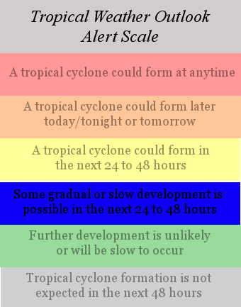
RL3AO,what is the scale for this TWO?
ABNT20 KNHC 011746
TWOAT
TROPICAL WEATHER OUTLOOK
NWS TPC/NATIONAL HURRICANE CENTER MIAMI FL
200 PM EDT TUE JUL 1 2008
FOR THE NORTH ATLANTIC...CARIBBEAN SEA AND THE GULF OF MEXICO...
A STRONG TROPICAL WAVE IS LOCATED OVER THE EXTREME EASTERN ATLANTIC
OCEAN NEAR THE WEST COAST OF AFRICA...AND IS ACCOMPANIED BY A BROAD
AREA OF DISORGANIZED SHOWERS AND THUNDERSTORMS AND A WEAK SURFACE
LOW. ENVIRONMENTAL CONDITIONS COULD ALLOW FOR SOME SLOW
DEVELOPMENT OF THIS SYSTEM DURING THE NEXT COUPLE OF DAYS AS IT
MOVES WESTWARD AT ABOUT 15 TO 20 MPH.
ELSEWHERE...TROPICAL CYCLONE FORMATION IS NOT EXPECTED DURING THE
NEXT 48 HOURS.
$$
FORECASTER KNABB/ROBERTS
RL3AO,what is the scale for this TWO?
0 likes
-
gatorcane
- S2K Supporter
- Posts: 23708
- Age: 48
- Joined: Sun Mar 13, 2005 3:54 pm
- Location: Boca Raton, FL
Well again to back JB, he is providing supporting evidence of a no recurve scenario with the 500mb height maps so we'll have to see if he is right. As soon as the GFS can come on board, that we may have some overall consensus...I anxiously await the next several GFS runs to see if it jumps on board with the CMC.
NHC forecast is no surprise (see above) as it has our invest racing westward at 15 to 20mph for the forseeable future with only slow development possibilities.

NHC forecast is no surprise (see above) as it has our invest racing westward at 15 to 20mph for the forseeable future with only slow development possibilities.
0 likes

-
Ed Mahmoud
Re: INVEST 92L in the Eastern Atlantic
12Z UK Met moves it to 14.8N 35.3W in 4 1/2 days before dropping it below "tropical storm strength". That is 3.5º of latitude gained for 19.2º of longitude.
0 likes
Who is online
Users browsing this forum: No registered users and 28 guests