mattpetre wrote:Welcome to another hurricane season... I have just spent the last hour reading the last days worth of posts and am happy to see this board as lively as ever. Looks like we have quite the anomaly on our hands. Too soon to make any predictions (since I usually make "homer" predictions for the Houston area anyway), but this does look to be an interesting week with the tropics.
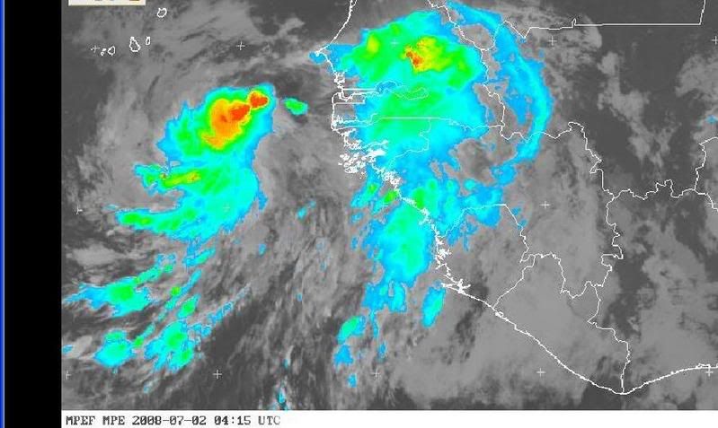
Can anyone tell me how rare this strong of a wave is coming off the coast in July?
it's rarer than the Cubs Winning the World series.


