TC Bertha
Moderator: S2k Moderators

-
Category 5

- Category 5

- Posts: 10074
- Age: 36
- Joined: Sun Feb 11, 2007 10:00 pm
- Location: New Brunswick, NJ
- Contact:
Re: INVEST 92L in the Eastern Atlantic
Duddy wrote:Category 5 wrote:simeon9benjamin wrote:This should be a TD in the morning.
Good now you can support your claims here as well.
Posting outragous claims without any evidence (especially without a disclaimer) is against the rules BTW.
Sorry but I gotta step in.
Saying that a depression of the coast of Texas will become a Cat 5 by morning is an outrageous claim.
Saying a cluster of storms may become a depression within 12 hours is not.
Point taken but don't just say in a one sentence post that this is a TD without any sort of data or facts to back it up.
0 likes
-
brunota2003

- S2K Supporter

- Posts: 9476
- Age: 35
- Joined: Sat Jul 30, 2005 9:56 pm
- Location: Stanton, KY...formerly Havelock, NC
- Contact:


-
Category 5
- Category 5
- Posts: 10074
- Age: 36
- Joined: Sun Feb 11, 2007 10:00 pm
- Location: New Brunswick, NJ
- Contact:
Re:
brunota2003 wrote:Aww...no talking about the Universe too? *pout* xD j/k
Seriously, only 30 minutes until the new TWO comes out!
This TWO will be very interesting and will hopefully answer some of the speculation on the immediate future of 92L.
0 likes
-
Weatherfreak000
Re: INVEST 92L in the Eastern Atlantic
The point is simple here, is that a Tropical Depression? Better chance than not.
But its all for naught if the storm dies immediately after it's classified and after all the terribly organized storms that get bashed here so often I figured that would be obvious.
It's not like we're magicians enchanting the storm to not develop....tomorrow morning at 8 A.M. will provide the short-term answers.
0 likes

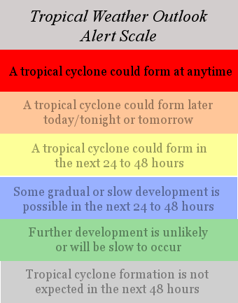
TROPICAL WEATHER OUTLOOK
NWS TPC/NATIONAL HURRICANE CENTER MIAMI FL
200 AM EDT THU JUL 3 2008
FOR THE NORTH ATLANTIC...CARIBBEAN SEA AND THE GULF OF MEXICO...
SATELLITE IMAGES INDICATE THAT THE LOW PRESSURE AREA CENTERED ABOUT
200 MILES SOUTHEAST OF THE CAPE VERDE ISLANDS CONTINUES TO BECOME
BETTER ORGANIZED. ENVIRONMENTAL CONDITIONS APPEAR CONDUCIVE FOR
ADDITIONAL DEVELOPMENT AND THIS SYSTEM COULD BECOME A TROPICAL
DEPRESSION AT ANY TIME TODAY AS IT MOVES WESTWARD AT 10 TO 15 MPH.
0 likes

-
Fego

- S2K Supporter
- Posts: 767
- Age: 66
- Joined: Sun Apr 18, 2004 7:58 pm
- Location: San Juan, Puerto Rico
- Contact:
Re: INVEST 92L in the Eastern Atlantic
Just a bit more..
000
AXNT20 KNHC 030556
TWDAT
TROPICAL WEATHER DISCUSSION
NWS TPC/NATIONAL HURRICANE CENTER MIAMI FL
205 AM EDT THU JUL 03 2008
TROPICAL WEATHER DISCUSSION FOR NORTH AMERICA...CENTRAL
AMERICA...GULF OF MEXICO...CARIBBEAN SEA...NORTHERN SECTIONS OF
SOUTH AMERICA...AND ATLANTIC OCEAN TO THE AFRICAN COAST FROM THE
EQUATOR TO 32N. THE FOLLOWING INFORMATION IS BASED ON SATELLITE
IMAGERY...METEOROLOGICAL ANALYSIS...WEATHER OBSERVATIONS...AND
RADAR.
BASED ON 0000 UTC SURFACE ANALYSIS AND SATELLITE IMAGERY THROUGH
0530 UTC.
...SPECIAL FEATURE....
AN AREA OF LOW PRESSURE...ASSOCIATED WITH A STRONG TROPICAL
WAVE...IS CENTERED A COUPLE HUNDRED NM SOUTH OF THE CAPE VERDE
ISLANDS NEAR 12N22W...ANALYZED 1009 MB. THIS LOW HAS BEEN
TRACKING W ABOUT 10 KT OVER THE PAST COUPLE OF DAYS. THE
CIRCULATION IS WELL DEFINED AND CONVECTION (SCATTERED TO
NUMEROUS MODERATE IN NATURE) HAS INCREASED SLIGHTLY WITHIN
90-120 NM OF THE CENTER. ENVIRONMENTAL CONDITIONS APPEAR
CONDUCIVE FOR SOME ADDITIONAL DEVELOPMENT AND THERE IS THE
POTENTIAL FOR IT TO BECOME A TROPICAL DEPRESSION AT ANY TIME
TODAY.
0 likes
-
Category 5
- Category 5
- Posts: 10074
- Age: 36
- Joined: Sun Feb 11, 2007 10:00 pm
- Location: New Brunswick, NJ
- Contact:
Re: INVEST 92L in the Eastern Atlantic
Now it's a question of when. They might wait for VIS to come up before they make the call. Not sure though.
0 likes
-
hurricane
Re: INVEST 92L in the Eastern Atlantic
Looks like this will be a fish strom going by the computers. 
0 likes
-
Fego
- S2K Supporter
- Posts: 767
- Age: 66
- Joined: Sun Apr 18, 2004 7:58 pm
- Location: San Juan, Puerto Rico
- Contact:
Re:
NDG wrote:Good chance of being upgraded by 5 AM if not by 11AM at the latest if deep convection continues near LLC, a couple of more hours and the first vis sat pic should come in.
Lets say 8:00 a.m or 2:00 p.m. btw I don't like that change from 5-11 to 2-8.
0 likes
Who is online
Users browsing this forum: No registered users and 70 guests