

It doesn't look too bad right now though its not as good in terms of organisation as it was a few hours ago, maybe signs that the cooler water is starting to weaken this a little. Good to have another floater on the system.
Ok Derek got ya, so I take it if it looked like Bertha could be a risk to Bermuda the NHC could task recon to check it out?
TC Bertha
Moderator: S2k Moderators
-
gatorcane

- S2K Supporter

- Posts: 23708
- Age: 48
- Joined: Sun Mar 13, 2005 3:54 pm
- Location: Boca Raton, FL
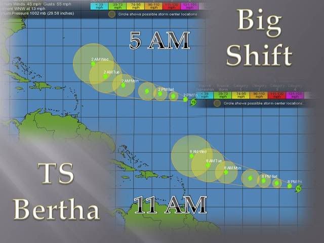
I'm tracking a movement of 290 with an increasingly more disogranized system. The center appears south of the deep convection burst. Note the plentiful ridging building in now north of Bertha. If she gets stronger now, she'll be pushed more west....(its the opposite situation when you have a weakness). In the long-term though she'll turn more NW out to sea because of a weakness if she is a deep system.
0 likes
-
cycloneye

- Admin

- Posts: 149570
- Age: 69
- Joined: Thu Oct 10, 2002 10:54 am
- Location: San Juan, Puerto Rico
Re: Tropical Storm Bertha in East Atlantic
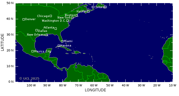
Here is why the Formation of Bertha at 25w was the most east system to form in July:

And then the historic event made.No matching formations:

And then the historic event made.No matching formations:
0 likes
Hold up cycloneye that map is missing Bertha 96?!
gatorcane, yep NHC also shows a 290 degree movement and the models pretty much continue close to that motion for the next 96hrs. As you mention it does look like its becoming a little less organised but that is to be expected given the sort of sea surface temperatures we have at the moment, by the time it comes back towards the warmer temps it will probably be a very minimal (35kts) TS IMO.
gatorcane, yep NHC also shows a 290 degree movement and the models pretty much continue close to that motion for the next 96hrs. As you mention it does look like its becoming a little less organised but that is to be expected given the sort of sea surface temperatures we have at the moment, by the time it comes back towards the warmer temps it will probably be a very minimal (35kts) TS IMO.
0 likes
-
cycloneye
- Admin
- Posts: 149570
- Age: 69
- Joined: Thu Oct 10, 2002 10:54 am
- Location: San Juan, Puerto Rico
Re: Tropical Storm Bertha in East Atlantic
Those are systems that developed east of 40w.The 1996 Bertha was named a little west of 40w.
Date: 5-14 JUL 1996
Hurricane BERTHA
ADV LAT LON TIME WIND PR STAT
1 10.20 -35.10 05/03Z 30 1009 TROPICAL DEPRESSION
2 10.20 -37.60 05/09Z 30 1009 TROPICAL DEPRESSION
3 11.10 -40.20 05/15Z 35 1005 TROPICAL STORM
Date: 5-14 JUL 1996
Hurricane BERTHA
ADV LAT LON TIME WIND PR STAT
1 10.20 -35.10 05/03Z 30 1009 TROPICAL DEPRESSION
2 10.20 -37.60 05/09Z 30 1009 TROPICAL DEPRESSION
3 11.10 -40.20 05/15Z 35 1005 TROPICAL STORM
0 likes
-
wxman57

- Moderator-Pro Met

- Posts: 23175
- Age: 68
- Joined: Sat Jun 21, 2003 8:06 pm
- Location: Houston, TX (southwest)
Re: Tropical Storm Bertha in East Atlantic
3-hr movement 308 deg at about 15 kts based on visible imagery and the center to the SW of the convection.
0 likes

Bertha would have to make a sharp right turn before the weakenss in the Central Atlantic lifts out or flatens out (which is not likely since she will be weak system at least for the next 2-3 days), otherwise she will become influnced by the ridge over Bermuda and a more westward track along 20N.
0 likes
Maybe NDG but alot of the models do still weaken the high slowly enough to allow at least a WNW track to continue where the system is weak and maybe more to the NW if it gets stronger. We will have to see what turns out to be the case.
308 degrees is pretty much NW which is more then some of the models were expecting.
308 degrees is pretty much NW which is more then some of the models were expecting.
0 likes

258
WTNT22 KNHC 041448
TCMAT2
TROPICAL STORM BERTHA FORECAST/ADVISORY NUMBER 6
NWS TPC/NATIONAL HURRICANE CENTER MIAMI FL AL022008
1500 UTC FRI JUL 04 2008
TROPICAL STORM CENTER LOCATED NEAR 14.9N 29.7W AT 04/1500Z
POSITION ACCURATE WITHIN 30 NM
PRESENT MOVEMENT TOWARD THE WEST-NORTHWEST OR 290 DEGREES AT 14 KT
ESTIMATED MINIMUM CENTRAL PRESSURE 1000 MB
MAX SUSTAINED WINDS 45 KT WITH GUSTS TO 55 KT.
34 KT....... 75NE 30SE 0SW 75NW.
12 FT SEAS..120NE 120SE 60SW 90NW.
WINDS AND SEAS VARY GREATLY IN EACH QUADRANT. RADII IN NAUTICAL
MILES ARE THE LARGEST RADII EXPECTED ANYWHERE IN THAT QUADRANT.
REPEAT...CENTER LOCATED NEAR 14.9N 29.7W AT 04/1500Z
AT 04/1200Z CENTER WAS LOCATED NEAR 14.7N 29.0W
FORECAST VALID 05/0000Z 15.7N 32.1W
MAX WIND 45 KT...GUSTS 55 KT.
34 KT... 75NE 45SE 30SW 75NW.
FORECAST VALID 05/1200Z 16.5N 35.6W
MAX WIND 45 KT...GUSTS 55 KT.
34 KT... 75NE 45SE 30SW 75NW.
FORECAST VALID 06/0000Z 17.2N 39.2W
MAX WIND 50 KT...GUSTS 60 KT.
50 KT... 30NE 0SE 0SW 30NW.
34 KT... 75NE 50SE 30SW 75NW.
FORECAST VALID 06/1200Z 17.9N 42.9W
MAX WIND 55 KT...GUSTS 65 KT.
50 KT... 30NE 0SE 0SW 30NW.
34 KT... 75NE 50SE 30SW 75NW.
FORECAST VALID 07/1200Z 19.5N 49.5W
MAX WIND 60 KT...GUSTS 75 KT.
50 KT... 40NE 20SE 20SW 40NW.
34 KT...100NE 60SE 60SW 100NW.
EXTENDED OUTLOOK. NOTE...ERRORS FOR TRACK HAVE AVERAGED NEAR 225 NM
ON DAY 4 AND 300 NM ON DAY 5...AND FOR INTENSITY NEAR 20 KT EACH DAY
OUTLOOK VALID 08/1200Z 21.5N 54.5W
MAX WIND 60 KT...GUSTS 75 KT.
OUTLOOK VALID 09/1200Z 24.0N 59.0W
MAX WIND 60 KT...GUSTS 75 KT.
REQUEST FOR 3 HOURLY SHIP REPORTS WITHIN 300 MILES OF 14.9N 29.7W
NEXT ADVISORY AT 04/2100Z
$$
FORECASTER BROWN
0 likes


-
cycloneye
- Admin
- Posts: 149570
- Age: 69
- Joined: Thu Oct 10, 2002 10:54 am
- Location: San Juan, Puerto Rico
Re: Tropical Storm Bertha in East Atlantic
This is a change as the 4 and 5 day track is not more north than before.

0 likes
-
Ed Mahmoud
Re:
CycloneNL wrote:Bertha : 45kts -
maybe she hit the us coast ??
Probably not, but not impossible. GFS 500 mb suggests that while it is feeling the trough coming off the East Coast in 6 days, it may not be recurved before the trough moves out, and may start moving Westward again. Maybe.
So, I will boldy go on a limb, and say it either affects North America, or it doesn't.

Above bold forecast is not official, nor endorsed by Storm2K
0 likes
-
wxman57
- Moderator-Pro Met
- Posts: 23175
- Age: 68
- Joined: Sat Jun 21, 2003 8:06 pm
- Location: Houston, TX (southwest)
Re: Tropical Storm Bertha in East Atlantic
Center is now fully exposed. I'm not surprised at all by the adjustment west/south in the track at days 4/5, but I am surprised that the intensity doesn't match the track. I think a more WNW track is in order if the system is weaker. But if it's stronger as the NHC is forecasting (60kts) it may take more of a NW-N turn. Note that the NHC mentions the GFDL and HWRF turning Bertha northward because they think it'll be a hurricane. Weak, sheared storms go west, more organized and stronger storms turn north in the current flow.
No threat to the Caribbean and I think only a slim chance it could survive to reach the eastern U.S.
Here's a current GARP image with the NHC Position plotted on there:

No threat to the Caribbean and I think only a slim chance it could survive to reach the eastern U.S.
Here's a current GARP image with the NHC Position plotted on there:
0 likes
-
Ed Mahmoud
Re: Tropical Storm Bertha in East Atlantic
Why is the heaviest convection displaced from the center? I didn't think shear was that strong.
0 likes


-
wxman57
- Moderator-Pro Met
- Posts: 23175
- Age: 68
- Joined: Sat Jun 21, 2003 8:06 pm
- Location: Houston, TX (southwest)
Re: Tropical Storm Bertha in East Atlantic
Ed Mahmoud wrote:Why is the heaviest convection displaced from the center? I didn't think shear was that strong.
Clearly, there's enough southwesterly shear to disrupt the storm. It doesn't take much, sometimes. Also, the center looks a bit more broad. Hard to get convergence over the center if it's more broad. I'd go with a 35-40 kt storm for 72 hours and perhaps longer, maybe even dropping below TS strength if I was a betting person...
In 48 hours, it would have to track south of west to have a shot at bringing a few squalls to the northernmost east Caribbean islands.
0 likes
-
Ed Mahmoud
Re: Tropical Storm Bertha in East Atlantic
Well, Bastardi still thinks this could be a threat Mid-Atlantic to Canada, but I don't think he has locked himself in, as he says it could still escape, depending on how strong it gets.
JB also sees a possible threat off Louisiana or Texas early next week from former 93L, but I don't see any model support for that.
Edit to add: I don't think it happens, but after calling Humberto from a week away, I don't automatically dismiss anything JB predicts.
JB also sees a possible threat off Louisiana or Texas early next week from former 93L, but I don't see any model support for that.
Edit to add: I don't think it happens, but after calling Humberto from a week away, I don't automatically dismiss anything JB predicts.
0 likes
Yep wxman57 the SHIPS only shows 8-10kts but I suppose with very very marginal SST's present the shear may be enough with the broad circulation to displace the convection a little, I also think this may have a ahrd time for a little while. It also shows that if its getting displaced center now, what will happen when it hits the real hardcore shear further NW?
On this track its going to get closer to the USA then many of us first thought, looking likely its going to just keep going WNW.
On this track its going to get closer to the USA then many of us first thought, looking likely its going to just keep going WNW.
0 likes
Re: Tropical Storm Bertha in East Atlantic
Ed Mahmoud wrote:Why is the heaviest convection displaced from the center? I didn't think shear was that strong.
At the current time there is an UL trough to her north, she is probably feeling some UL shear from that, the UL anticyclone that was on top of her is getting left behind, so she is feeling some southerly shear, at least for now, being that she is over cooler waters is also not helping her since she is not getting any stronger, a more westerly course should take place soon.
0 likes
Who is online
Users browsing this forum: No registered users and 77 guests