Why not just storms in July? Once again, this is climatological and the database of storm for July in this region is obviously too small to make any meaningful predictions of future trends.[/quote]
How about the fact there is no known storm that started that far east as a ts this early in the season and is getting stronger right now. All bets are off to rely solely on climatology this may defy climatology. It might be rare for this to continue straight west and head towards fl but so is the fact this storm started this far east this early in the season. I think this storm will really be fun to track.[/quote]
To be to the point, I would not pay to much on climatology, knowing the fact that we have maybe 150 something years of data to go by. To make things worst: we only have about 50-60 years of really good data, with 45-50 years of satellite. That takes us up intil the end of the last active phase. We don't really know besides what we have learned in this active phase and the tail end of the last...Yes it is useful, but it is not god!
TC Bertha
Moderator: S2k Moderators
-
Matt-hurricanewatcher
Re: Tropical Storm Bertha in East Atlantic
Last edited by Matt-hurricanewatcher on Sat Jul 05, 2008 9:05 pm, edited 2 times in total.
0 likes
-
wxman57

- Moderator-Pro Met

- Posts: 23172
- Age: 68
- Joined: Sat Jun 21, 2003 8:06 pm
- Location: Houston, TX (southwest)
Re: Tropical Storm Bertha in East Atlantic
robbielyn wrote:How about the fact there is no known storm that started that far east as a ts this early in the season and is getting stronger right now. All bets are off to rely solely on climatology this may defy climatology. It might be rare for this to continue straight west and head towards fl but so is the fact this storm started this far east this early in the season. I think this storm will really be fun to track.
The trouble is, the reliable database doesn't go that far back, only to the 1970s. Before the age of satellites we didn't really pick up on storms until they got much farther west. So we really can't say it's THAT unusual for a storm to form so far east - we just couldn't detect them before the 1970s.
Oh, and the reason I didn't post an image of those storms which have passed within 50nm of Bertha's current position is because I already posted it about 10 pages back. But here it is again. Only 1. Again, we probably missed a lot of them pre-satellite:

0 likes
-
z1z2
Re: Tropical Storm Bertha in Central Atlantic
If this does head harmlessly out to sea then the HWRF would have outperformed not only all the models, but the NHC and every forecaster I have seen. There might be some forecasts out there that consistently gave 100% certainty of a fish storm with 0% chance of ever impacting the United States, but I've not seen one.
0 likes
Re: Tropical Storm Bertha in Central Atlantic
DISCLAIMER: NOT OFFICIAL FORECAST/DATA. USE LOCAL OFFICIALS/NHC FOR THAT STUFF
I say this is 50kts right now. Could reach 60kts by 11a tomorrow.
4:02pm ET

6:38pm ET

I say this is 50kts right now. Could reach 60kts by 11a tomorrow.
4:02pm ET
6:38pm ET
0 likes
-
Derek Ortt
Re: Tropical Storm Bertha in Central Atlantic
z1z2 wrote:If this does head harmlessly out to sea then the HWRF would have outperformed not only all the models, but the NHC and every forecaster I have seen. There might be some forecasts out there that consistently gave 100% certainty of a fish storm with 0% chance of ever impacting the United States, but I've not seen one.
Uh, no! If this goes out to sea at 70W... HWRF will have failed miserably and the other models/forecasts would have been spot on
0 likes
-
z1z2
I never understood why the NHC went with the powerful storm scenario and yet did not forecast recurvature. It made no sense. They used the HWRF intensity guidance and the gfs/ukmet/ecmwf track. Stronger always meant recuravture and weaker always meant west. You can't have strong and west with this thing.
0 likes
-
soonertwister
- Category 5

- Posts: 1091
- Joined: Mon Jun 16, 2003 2:52 pm
Re: Tropical Storm Bertha in Central Atlantic
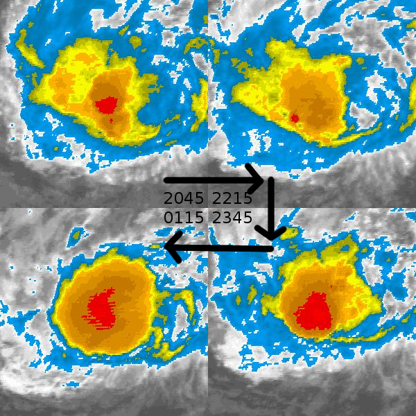
I don't know about the overall structural dynamics of Bertha right now, but she sure is pretty. Great symmetry in all quadrants from what I can see.
0 likes
-
senorpepr

- Military Met/Moderator

- Posts: 12542
- Age: 43
- Joined: Fri Aug 22, 2003 9:22 pm
- Location: Mackenbach, Germany
- Contact:
wxman57,
Thanks for the input regarding the future track. You hit a VERY good point regarding climatology: "while you can't use climatology to make a forecast, you can't ignore climatology."
Regardless to other opinion, you bring up valid points on why a low probability for a Florida / SE US landfall.
Thanks.
0 likes


-
cycloneye

- Admin

- Posts: 149283
- Age: 69
- Joined: Thu Oct 10, 2002 10:54 am
- Location: San Juan, Puerto Rico
Re: Tropical Storm Bertha in Central Atlantic
From 11 PM discussion:
IT SHOULD BE NOTED THAT THERE IS LARGER THAN NORMAL UNCERTAINTY IN
BOTH THE TRACK AND INTENSITY FORECASTS OF BERTHA. ACCORDINGLY...IT
IS MUCH TOO EARLY TO DETERMINE IF BERTHA WILL OR WILL NOT POSE A
THREAT TO ANY LAND AREAS.
IT SHOULD BE NOTED THAT THERE IS LARGER THAN NORMAL UNCERTAINTY IN
BOTH THE TRACK AND INTENSITY FORECASTS OF BERTHA. ACCORDINGLY...IT
IS MUCH TOO EARLY TO DETERMINE IF BERTHA WILL OR WILL NOT POSE A
THREAT TO ANY LAND AREAS.
0 likes


Re: Tropical Storm Bertha in Central Atlantic
From NHC 11 PM Disc:
IN FACT...THE SPREAD IN THE TRACK MODELS SPAN NEARLY 1300 MILES AT DAY 5 WITH THE UKMET MODEL KEEPING BERTHA HEADED WESTWARD AND THE HWRF TURNING THE CYCLONE NORTHWARD. GIVEN THE UNCERTAINTY...THE OFFICIAL FORECAST
IS SIMILAR TO THE PREVIOUS FORECAST AND LIES IN THE MIDDLE OF THE TRACK MODEL ENVELOPE.
0 likes
-
z1z2
Re:
Chacor wrote:Cone and track shifted northward.
Just barely. They must not want to make a drastic shift in one update. They'll gradually nudge it further and further north every update so it's not such a shock to people when they see it. I've seen it many times before. Still favor the HWRF track and intensity.
0 likes
-
MiamiensisWx
Reposted from http://www.storm2k.org/phpbb2/viewtopic.php?p=1729273#p1729273:
The following post is NOT an official prognosis.
It honestly looks like the upper level ridge is already building west as the TUTT quickly lifts out of the area. Note that Bertha's forward movement during tomorrow and the next few days is going to exert some significant influences in regards to its track. Currently, a shortwave trough at H5 is moving east from the Ohio Valley to the Mid-Atlantic region. Water vapor imagery of the upper levels indicates the shortwave trough is moving rather rapidly to the east as the weak H5 vort max transects the area. The fast northern stream suggests the shortwave trough will exit the Mid-Atlantic fairly quickly, allowing the upper level ridge to H5 to re-assert itself and briefly build to the west. This trend may likely commence as soon as tomorrow and the following day. If you combine the unfolding current situation with an extrapolation of Bertha's ongoing rapid movement, it could indicate that Bertha may be closer to the CONUS earlier than some people anticipate. Bertha has been persistently moving further west faster than expected over the past ~24-36 hours. I highly doubt that Bertha will only come within a certain distance of the CONUS by late next week. After analysis of current trends and the pattern, it appears that it may occur earlier than that time frame. Depending on the timing of the next H5 trough progged to affect the East and the amplification of the upper ridge in the West, Bertha could certainly pose a threat to the Southeast (primarily North Carolina).
One possible concern in regards to the intensity is the fact that a small upper low NE of Bermuda is moving SSE as the TUTT moves NE. This new upper low could deepen and develop a new TUTT (the second one progged by the operational GFS at 200-250 mb?) over the next few days in a similar position to the current TUTT. This could increase the upper level divergence/shear in the vicinity north of the Leeward Islands and Puerto Rico. Therefore, after gradual intensification, Bertha's intensity could fluctuate in that area. That leads to the possibility of a more southerly and westerly track in the long range, depending on the actual intensity of Bertha at that time and the degree of the possible TUTT's influence.
I'm not a person who casually ignores or disputes models, especially if they are latching on to a pattern. I also regularly utilize climatology in my analysis. However, based on all available evidence, I believe it is premature to sound the all clear for the Southeast. It is also premature to make a definite statement that Bertha will strike the CONUS, Bermuda, the NE Caribbean, or any land mass. Both approaches should be discouraged, especially given the considerable uncertainties and complexities involved. Everyone should be prepared, regardless of their location. The evolution of this system, the analysis of the models, and the "kinks" thrown in to the synoptic pattern will present an exceptionally fascinating and extremely intriguing situation. Regardless of the final result, Bertha will present an incredibly tough forecasting challenge and a bastion of knowledge for everyone involved. This system has already been impressive itself.
0 likes


Re: Re:
z1z2 wrote:Chacor wrote:Cone and track shifted northward.
Just barely. They must not want to make a drastic shift in one update. They'll gradually nudge it further and further north every update so it's not such a shock to people when they see it. I've seen it many times before. Still favor the HWRF track and intensity.
you only have 4 posts. how many times could you possibly say it before, other than 3?
0 likes
Who is online
Users browsing this forum: No registered users and 44 guests