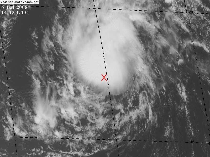
TheShrimper wrote:If the NHC's coordinates are correct, the convection is running ahead and to the north of the LLC.
Actually, those coordinates place the LLC right about in the center of the convection.
http://www.ssd.noaa.gov/goes/flt/t1/loop-vis.html