TC Bertha
Moderator: S2k Moderators


Re: Hurricane Bertha in Western Atlantic
Chacor wrote:cycloneye wrote:ACE for Bertha continues to go up,now 13.915,the season in total is at 14.3:Code: Select all
Season total
Storm Type ACE (104 kt2)
01L (Arthur) Operational 0.3675
02L (Bertha) Operational 13.915
Total  14.2825
http://en.wikipedia.org/wiki/2008_Atlan ... ane_season
That's, again, wrong. Operationally it's 13.5475; best-track is 13.4125. Not 13.915.
I can confirm that:

The above was generated by a program that I wrote.
0 likes
-
cycloneye

- Admin

- Posts: 149297
- Age: 69
- Joined: Thu Oct 10, 2002 10:54 am
- Location: San Juan, Puerto Rico
Re: Hurricane Bertha in Western Atlantic
I wont follow wiki anymore as they are slightly behind.I will follow those tables with the updated ACE.
0 likes
-
HurricaneHunter914
- Category 5

- Posts: 4439
- Age: 32
- Joined: Fri Mar 10, 2006 7:36 pm
- Location: College Station, TX
http://www.ssd.noaa.gov/goes/flt/t1/loop-avn.html
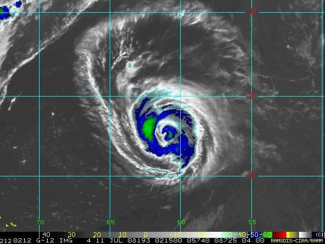
Kinda seems as if she's falling apart....like she does every single night.
Kinda seems as if she's falling apart....like she does every single night.
0 likes
-
jasons2k

- Storm2k Executive
- Posts: 8290
- Age: 52
- Joined: Wed Jul 06, 2005 12:32 pm
- Location: The Woodlands, TX
Re: Hurricane Bertha in Western Atlantic
Mostly lurking but it looks like dry air intrusion to me
0 likes
-
Derek Ortt
-
wxmann_91

- Category 5
- Posts: 8007
- Age: 34
- Joined: Fri Jul 15, 2005 2:49 pm
- Location: Southern California
- Contact:
Re: Hurricane Bertha in Western Atlantic
jasons wrote:Mostly lurking but it looks like dry air intrusion to me
99.99% sure it's ERC.
0 likes
-
txwatcher91
- Category 5
- Posts: 1498
- Joined: Tue Aug 02, 2005 2:29 pm
Re: Hurricane Bertha in Western Atlantic
wxmann_91 wrote:jasons wrote:Mostly lurking but it looks like dry air intrusion to me
99.99% sure it's ERC.
It looks like it is going to have one big eye when she is through
0 likes

-
JonathanBelles
- Professional-Met

- Posts: 11430
- Age: 35
- Joined: Sat Dec 24, 2005 9:00 pm
- Location: School: Florida State University (Tallahassee, FL) Home: St. Petersburg, Florida
- Contact:

Re: Hurricane Bertha in Western Atlantic
Can't have an eye THAT big. The Atlantic could be changing it.
0 likes
-
MiamiensisWx
Re: Hurricane Bertha in Western Atlantic
Sanibel wrote:Can't have an eye THAT big. The Atlantic could be changing it.
There have been numerous typhoons in the western Pacific that exhibited very large eyes after an ERC. They also featured similar intensities on the Saffir-Simpson Hurricane Scale to Bertha at the time.
I believe the bolded statement is false.
0 likes

-
Squarethecircle
- Category 5
- Posts: 2165
- Joined: Fri Oct 19, 2007 4:00 pm
- Location: Fairfax, VA

-
AJC3

- Admin
- Posts: 4153
- Age: 62
- Joined: Tue Aug 31, 2004 7:04 pm
- Location: Ballston Spa, New York
- Contact:
Re: Hurricane Bertha in Western Atlantic
MiamiensisWx wrote:Sanibel wrote:Can't have an eye THAT big. The Atlantic could be changing it.
There have been numerous typhoons in the western Pacific that exhibited very large eyes after an ERC. They also featured similar intensities on the Saffir-Simpson Hurricane Scale to Bertha at the time.
I believe the bolded statement is false.
Indeed. There are many many cases of annular typhoons with enormous eyes, and while they are much more common in the Pacific, the Atlantic has seen a few as well (most notably in recent years, Isabel).
1997's STY Winnie... https://metocph.nmci.navy.mil/jtwc/atcr ... 3/14ww.htm had an enormous eye once it became annular after and EWRC. So did 2000's Jelawat. You wanna talk a ginormously sick eye....try the 200NM diameter eye of 1960's Carmen on for size. Somewhere on line is a radar image of it...too lazy to look for it right now.
edit: grainy radar image can be found here: https://metocph.nmci.navy.mil/jtwc/atcr ... wnp/31.pdf
Last edited by AJC3 on Thu Jul 10, 2008 10:22 pm, edited 2 times in total.
0 likes

-
AJC3
- Admin
- Posts: 4153
- Age: 62
- Joined: Tue Aug 31, 2004 7:04 pm
- Location: Ballston Spa, New York
- Contact:
Re:
HURAKAN wrote:1974: Carmen
Sandy, if that's from 1974, then it's the wrong Carmen (although, interestingly enough, it appears from that radar image that 1974's Carmen may have had a concentric double eye structure!)
0 likes
Who is online
Users browsing this forum: No registered users and 55 guests