Disturbance off NE Florida (Now invest 96L)
Moderator: S2k Moderators
Forum rules
The posts in this forum are NOT official forecasts and should not be used as such. They are just the opinion of the poster and may or may not be backed by sound meteorological data. They are NOT endorsed by any professional institution or STORM2K. For official information, please refer to products from the National Hurricane Center and National Weather Service.
It is most likely in the mid levels, surface low pressure center is further north, which may continue to move southward closer to where the convection is this morning.


Last edited by NDG on Tue Jul 15, 2008 8:10 am, edited 1 time in total.
0 likes
-
Ed Mahmoud
Re: JB homebrew-Different from MLC Gulf thread.
I can't tell if there is mid-level rotation or not (at this distance radar isn't looking low level), but I'll check back often.
Tampa long range radar loop.
Georgia still needs rain, right? This is a good thing if it happens?
Tampa long range radar loop.
Georgia still needs rain, right? This is a good thing if it happens?
0 likes
-
Matt-hurricanewatcher
Re: JB homebrew-Different from MLC Gulf thread.
Appears based on that surface map that there is a broad surface low. If it can move more southward, maybe it can tighten up and become a LLC. We will see. This looks very interesting.
0 likes
-
Matt-hurricanewatcher
Re: JB homebrew-Different from MLC Gulf thread.
Appears based on that surface map that there is a broad surface low. If it can move more southward, maybe it can tighten up and become a LLC. We will see. This looks very interesting.
0 likes
- Extremeweatherguy
- Category 5

- Posts: 11095
- Joined: Mon Oct 10, 2005 8:13 pm
- Location: Florida
-
Ed Mahmoud
Re: JB homebrew-Different from MLC Gulf thread.
Double Post Alert
After looking at convergence, divergence and shear maps EWG posted on Northeast GOMEX thread, and comparing satellite presentation, while the NE GOMEX is far from a lock to develop, it has a better chance than this does.
Yesterday, I thought a tropical storm reaching the mid Lesser Antilles, a path W-NW through the Caribbean to a point somewhere South of Cuba, and a turn Northwest across Cuba, coming out either side of Florida or maybe over South Florida, and a threat anywhere (depending on where it crossed Cuba) from near Mobile to Hatteras.
Now, I strongly suspect an open wave that crosses the Caribbean, hits Central America, and maybe pops in the Pacific, although the MJO phase isn't super-favorable.
The wave behind 94L also has a better chance to develop, based on presentation, shear, low level convergence, upper divergence and water vapor imagery.
The Northeast Gulf system could wind up an invest, maybe even a TD or weak storm, but I suspect it'll be more a beneficial rain maker than a threat. Too soon to tell about wave near 30ºW
Disclaimer: Unofficial, amateur, and not endorsed by Storm2K or the American Dental Association.
0 likes
- Extremeweatherguy
- Category 5

- Posts: 11095
- Joined: Mon Oct 10, 2005 8:13 pm
- Location: Florida
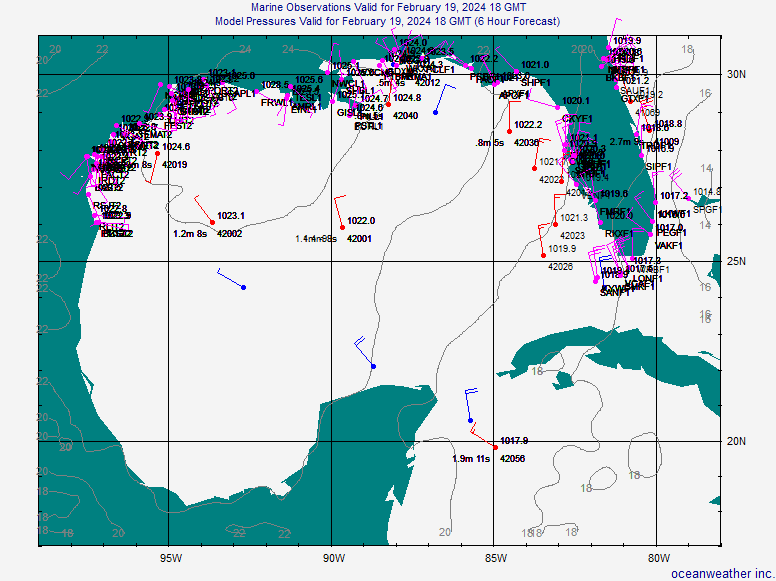
The NHC loop overlay shows a 1012mb surface low currently sitting over the north FL peninsula with some kind of trough axis extending back into the NE Gulf...
http://www.ssd.noaa.gov/goes/east/gmex/loop-vis.html
Click the box above the visible loop that says "NWS Fronts".
http://www.ssd.noaa.gov/goes/east/gmex/loop-vis.html
Click the box above the visible loop that says "NWS Fronts".
Last edited by Extremeweatherguy on Tue Jul 15, 2008 9:24 am, edited 1 time in total.
0 likes
- Extremeweatherguy
- Category 5

- Posts: 11095
- Joined: Mon Oct 10, 2005 8:13 pm
- Location: Florida
12z NAM is still trying to spin "something" up just west of Tampa by tomorrow afternoon and then it moves is SLOWLY northward...
Hour 30...
http://www.nco.ncep.noaa.gov/pmb/nwprod ... 0_030m.gif
http://www.nco.ncep.noaa.gov/pmb/nwprod ... 0_030m.gif
http://www.nco.ncep.noaa.gov/pmb/nwprod ... 0_030m.gif
http://www.nco.ncep.noaa.gov/pmb/nwprod ... p_030m.gif
Hour 60...
http://www.nco.ncep.noaa.gov/pmb/nwprod ... 0_060m.gif
http://www.nco.ncep.noaa.gov/pmb/nwprod ... 0_060m.gif
http://www.nco.ncep.noaa.gov/pmb/nwprod ... 0_060m.gif
http://www.nco.ncep.noaa.gov/pmb/nwprod ... p_060m.gif
0 likes
- Extremeweatherguy
- Category 5

- Posts: 11095
- Joined: Mon Oct 10, 2005 8:13 pm
- Location: Florida
The 12z GFS is also showing "something" forming near the west coast of FL during the day tomorrow and then lasting through Wednesday...
http://www.nco.ncep.noaa.gov/pmb/nwprod ... n_018l.gif
http://www.nco.ncep.noaa.gov/pmb/nwprod ... n_024l.gif
http://www.nco.ncep.noaa.gov/pmb/nwprod ... n_030l.gif
http://www.nco.ncep.noaa.gov/pmb/nwprod ... n_036l.gif
http://www.nco.ncep.noaa.gov/pmb/nwprod ... n_042l.gif
http://www.nco.ncep.noaa.gov/pmb/nwprod ... n_048l.gif
http://www.nco.ncep.noaa.gov/pmb/nwprod ... n_054l.gif
0 likes
Re: JB homebrew-Different from MLC Gulf thread.
Am very curious to know if something is indeed brewing around SW Florida...All I can tell you is that Naples has been pounded by rain for 3 days now!
Nice to see our lakes and canals filled again but........
Here's the latest radar out of Key West: (which as looked pretty similar for 3 days)
http://radar.weather.gov/radar_lite.php ... R&loop=yes
And here's the latest Hazardous Weather Outlook for the region:
http://forecast.weather.gov/showsigwx.p ... er+Outlook
Any info would be most appreciated!
Nice to see our lakes and canals filled again but........

Here's the latest radar out of Key West: (which as looked pretty similar for 3 days)
http://radar.weather.gov/radar_lite.php ... R&loop=yes
And here's the latest Hazardous Weather Outlook for the region:
http://forecast.weather.gov/showsigwx.p ... er+Outlook
Any info would be most appreciated!
0 likes
- Category 5
- Category 5

- Posts: 10074
- Age: 36
- Joined: Sun Feb 11, 2007 10:00 pm
- Location: New Brunswick, NJ
- Contact:
Re: JB homebrew-Different from MLC Gulf thread.
This appears to be a stalled front, nothing more. I see no sign of anything.
0 likes
-
Jason_B
Re: JB homebrew-Different from MLC Gulf thread.
Though really unlikely you always have to keep an eye on these things, the GOM is really weird and I've seen things spin up out of nowhere.
With that said...you can't even tell there's a disturbance in the Gulf today here in the panhandle...not a single cloud in the sky and even a nice cool breeze.
With that said...you can't even tell there's a disturbance in the Gulf today here in the panhandle...not a single cloud in the sky and even a nice cool breeze.
0 likes
-
Stormcenter
- S2K Supporter

- Posts: 6689
- Joined: Wed Sep 03, 2003 11:27 am
- Location: Houston, TX
Re:
KWT wrote:Well there is a chance that this may do something but its going to have to do something pretty soon if we are going to get any more other thena minimal TD.
It all depends on where it develops if it does at all.
0 likes
Re: JB homebrew-Different from MLC Gulf thread.
AREA FORECAST DISCUSSION
NATIONAL WEATHER SERVICE TAMPA BAY RUSKIN FL
152 PM EDT TUE JUL 15 2008
.SHORT TERM (TONIGHT-THU)...A WEAK TROUGH IS IN PLACE OVER THE
REGION ALOFT WITH AN AREA OF LOW PRESSURE AND A STALLED FRONTAL
BOUNDARY ACROSS THE NORTHERN HALF OF FL AT THE SURFACE. THE
SCATTERED TO NUMEROUS THUNDERSTORMS ACROSS THE AREA WILL CONTINUE TO
TRANSITION INLAND THROUGH THE REST OF THE AFTERNOON AND DIMINISH
THROUGH THE EVENING. THE WEAK UPPER TROUGH WILL REMAIN IN PLACE
ACROSS THE AREA THROUGH WEDNESDAY AND THEN BEGIN TO SHIFT NW THROUGH
THURSDAY AS WEAK RIDGING BUILDS ACROSS THE STATE FROM THE ATLANTIC.
AT THE SURFACE...THE AREA OF LOW PRESSURE WILL MEANDER OVER THE
NORTHERN HALF OF THE STATE THROUGH WEDNESDAY OR WED NIGHT AND THEN
LIFT NW OVER THE FL PANHANDLE AS HIGH PRESSURE BEGINS TO RIDGE BACK
ACROSS THE SOUTHERN HALF OF THE STATE FROM THE ATLANTIC. RAIN
CHANCES WILL CONTINUE TO BE SCATTERED TO NUMEROUS THROUGH THE PERIOD
WITH BEST CHANCES WEDNESDAY BEING COASTAL IN THE MORNING AND EARLY
AFTERNOON THEN TRANSITIONING INLAND FOR THE LATER AFTERNOON. /snip
The bolded area is what I think the models you all are referring to are seeing.
0 likes
- Extremeweatherguy
- Category 5

- Posts: 11095
- Joined: Mon Oct 10, 2005 8:13 pm
- Location: Florida
- Extremeweatherguy
- Category 5

- Posts: 11095
- Joined: Mon Oct 10, 2005 8:13 pm
- Location: Florida
There definitely appears to be a broad spin over the state this afternoon. The storms on the east side of the peninsula are lifting more northward, while the storms off the west coast are moving more southward...
http://radar.weather.gov/radar.php?prod ... W&loop=yes
Wind directions also seem to indicate the presence of this broad low...

http://radar.weather.gov/radar.php?prod ... W&loop=yes
Wind directions also seem to indicate the presence of this broad low...

0 likes
Re: JB homebrew-Different from MLC Gulf thread.
I'm definitely keeping my south of Texas/La.
0 likes
Who is online
Users browsing this forum: No registered users and 200 guests


