ATL: Tropical Storm Cristobal in North Atlantic
Moderator: S2k Moderators
-
storms in NC

- S2K Supporter

- Posts: 2338
- Joined: Thu Jul 28, 2005 2:58 pm
- Location: Wallace,NC 40 miles NE of Wilm
- Contact:
-
senorpepr

- Military Met/Moderator

- Posts: 12542
- Age: 43
- Joined: Fri Aug 22, 2003 9:22 pm
- Location: Mackenbach, Germany
- Contact:
Re: ATL: INVEST 96L=Special Tropical Disturbance Statement
storms in NC wrote:MGC wrote:96L looks on the verge of becoming a TD. Recon should have been diverted from 94L to 96L. Seems to be slowly drifting to the SE. If this developes at a good pace it could be a TS later tonight......MGC
I have look really hard and i don't see a South movement. I think it is a TD Now.
Surface observations and buoys in the area don't support a tropical depression. (They can be used since the circulation is close to land) As exposed as 96L is, there was no reason to send a flight into the system. It's still a weak system--definitely not a depression. At best, we're looking at a small area of 30 mph winds... maybe.
0 likes
-
Stormtrack03

- Category 1

- Posts: 377
- Age: 44
- Joined: Fri Sep 03, 2004 9:06 pm
- Location: Downingtown, PA
Re: ATL: INVEST 96L off Southeast U.S
Most of the rain (for now) appears to be staying offshore:
http://radar.weather.gov/radar.php?rid= ... 1&loop=yes
http://radar.weather.gov/radar.php?rid= ... 1&loop=yes
0 likes

-
seahawkjd
- S2K Supporter
- Posts: 632
- Joined: Wed Sep 10, 2003 4:12 pm
- Location: Morehead City, NC
- Contact:
Re: ATL: INVEST 96L off Southeast U.S
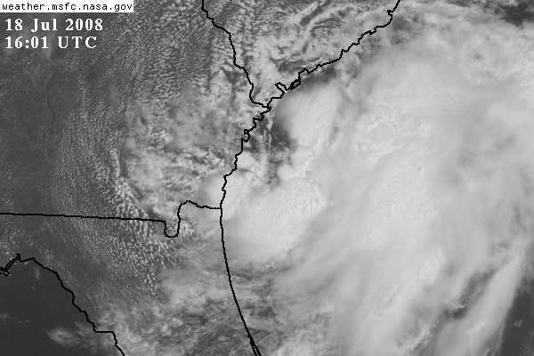
Can definitely see storms starting to build on the south and the north of the center so it doesn't look anywhere near as exposed as it was earlier this morning.
0 likes
-
brunota2003

- S2K Supporter
- Posts: 9476
- Age: 35
- Joined: Sat Jul 30, 2005 9:56 pm
- Location: Stanton, KY...formerly Havelock, NC
- Contact:
MHX Morning Discussion:
.SHORT TERM /6 PM THIS EVENING THROUGH SATURDAY NIGHT/...
GIVEN WEAK STEERING THE LOW TO THE S WILL MOVE SLOWLY WITH MDLS
SHOWING IT STAYING CLOSE THE THE CST AS IT MOVES MAINLY NNE.
FOLLOWED CLOSE TO THE GFS WITH INCREASING CHCS OF SHRA AND A FEW
TSRA SAT INTO SUN WHEN THE LOW MOVES CLOSE TO NC. KEPT LIKELY
POPS CONFINED TO SRN AND IMD CSTL SITES WHERE MOISTURE/CONVERGENCE
EXPECTED TO BE BETTER. WITH INCREASING MOISTURE AND SLOW MOTION OF
LOW SOME AREAS COULD SEE SOME TRAINING OF SHRA/TSRA WITH LOCALLY
VERY HEAVY RAINFALL POSS. WILL HAVE TO MONITOR LOW CLOSELY FOR
INCREASING TROPICAL DEVELOPMENT ESPCLY IF IT STAYS OVER WARM WTR
AND DOESNT MOVE OVER LAND. HIGHS WILL CONT AROUND 90 INLAND AND N
SAT AND SUN WITH LESS RAIN POTENTIAL WITH MAINLY MID 80S CST.
0 likes
-
cycloneye

- Admin

- Posts: 149276
- Age: 69
- Joined: Thu Oct 10, 2002 10:54 am
- Location: San Juan, Puerto Rico
Re: ATL: INVEST 96L off Southeast U.S
Recon tommorow and beyond if necessary:
000
NOUS42 KNHC 181555
WEATHER RECONNAISSANCE FLIGHTS
CARCAH, NATIONAL HURRICANE CENTER, MIAMI, FL.
1155 AM EDT FRI 18 JULY 2008
SUBJECT: TROPICAL CYCLONE PLAN OF THE DAY (TCPOD)
VALID 19/1100Z TO 20/1100Z JULY 2008
TCPOD NUMBER.....08-048
I. ATLANTIC REQUIREMENTS
1. SUSPECT AREA...(OFF S.E. COAST)
FLIGHT ONE -- TEAL 76
A. 19/1700Z
B. AFXXX 01BBB INVEST
C. 19/1445Z
D. 32.6N 78.8W
E. 19/1630Z TO 19/2130Z
F. SFC TO 10,000 FT
FLIGHT TWO -- TEAL 77
A. 20/0600Z
B. AFXXX 02BBB CYCLONE
C. 20/0245Z
D. 33.7N 77.3W
E. 20/0500Z TO 20/0830Z
F. SFC TO 10,000 FT
2. SUCCEEDING DAY OUTLOOK...CONTINUE 12 HRLY FIXES.
0 likes
-
Stormtrack03
- Category 1
- Posts: 377
- Age: 44
- Joined: Fri Sep 03, 2004 9:06 pm
- Location: Downingtown, PA
Re: ATL: INVEST 96L off Southeast U.S
11:15 am Charleston Area Forecast Discussion Update:
.NEAR TERM /UNTIL 6 PM THIS EVENING/...
WEAK SURFACE PRESSURE RISES HAVE BEEN OBSERVED THIS MORNING IN ASSOCIATION WITH THE LOW PRESSURE SYSTEM OFF THE GEORGIA
COAST. THIS SYSTEM...WHILE SHOWING SOME TROPICAL CHARACTERISTICS... REMAINS FAIRLY UNORGANIZED WITH THE COLDEST CLOUD TOPS AND
GREATEST CONVECTION TO THE EAST OF THE CENTER. THERE REMAINS THE POTENTIAL FOR THIS SYSTEM TO BECOME BETTER ORGANIZED TODAY...AND A TROPICAL DEPRESSION COULD FORM WITH THE LOW CENTER NEAR THE WESTERN WALL OF THE GULF STREAM.
0 likes
-
O Town
- S2K Supporter
- Posts: 5205
- Age: 52
- Joined: Wed Sep 07, 2005 9:37 pm
- Location: Orlando, Florida 28°35'35"N 81°22'55"W
Two web cams from Hilton Head SC.
Doesn't look that bad, not even really raining. Still people out and about. Surf doesn't look that rough either.
Looks like the wind is whippin around somewhat tho.
http://www.saltydog.com/webcam/southbeach/
http://12.156.240.124/view/index.shtml
Doesn't look that bad, not even really raining. Still people out and about. Surf doesn't look that rough either.
Looks like the wind is whippin around somewhat tho.
http://www.saltydog.com/webcam/southbeach/
http://12.156.240.124/view/index.shtml
0 likes
-
Emmett_Brown

- Category 5

- Posts: 1433
- Joined: Wed Aug 24, 2005 9:10 pm
- Location: Sarasota FL
Re: ATL: INVEST 96L off Southeast U.S
While the storm is still not well organized, you can see what appears to be a SE motion on the radar loop out of Jax:
http://radar.weather.gov/radar.php?rid=JAX&product=N0Z&overlay=11101111&loop=yes
MGC pointed this out, and I think correctly. Overall, this is still slowly but steadily organizing. I do think this will be a TD by the end of the day. While it is drifting SE now, I think this is just temporary while it is organizing. The center seems to be co-locating with the are of strongest convection offshore.
0 likes
-
curtadams
- S2K Supporter
- Posts: 1122
- Joined: Sun Aug 28, 2005 7:57 pm
- Location: Orange, California
- Contact:
Re: ATL: INVEST 96L off Southeast U.S
Closed circulation with heavy convection near the center on Jacksonville radar. Looks like a TD to me now. In what way isn't it a TD?
0 likes
-
tolakram
- Admin
- Posts: 20179
- Age: 62
- Joined: Sun Aug 27, 2006 8:23 pm
- Location: Florence, KY (name is Mark)
Re: ATL: INVEST 96L off Southeast U.S
curtadams wrote:Closed circulation with heavy convection near the center on Jacksonville radar. Looks like a TD to me now. In what way isn't it a TD?
You linked to a radar loops that provides the answer in my opinion. I don't see any clear area of convection rotating around a single center. I do see the circular motion, but nothing organized, at least in my opinion.
The posts in this forum are NOT official forecast and should not be used as such. They are just the opinion of the poster and may or may not be backed by sound meteorological data. They are NOT endorsed by any professional institution or storm2k.org. For official information, please refer to the NHC and NWS products.
0 likes

-
Brent
- S2K Supporter
- Posts: 38729
- Age: 37
- Joined: Sun May 16, 2004 10:30 pm
- Location: Tulsa Oklahoma
- Contact:
Re: ATL: INVEST 96L off Southeast U.S
I think this is going to beat 94L in getting upgraded. Who would have thought? 
0 likes
-
CrazyC83
- Professional-Met

- Posts: 34315
- Joined: Tue Mar 07, 2006 11:57 pm
- Location: Deep South, for the first time!
Re: ATL: INVEST 96L off Southeast U.S
Brent wrote:I think this is going to beat 94L in getting upgraded. Who would have thought?
I think it will too. I smell TD3 here soon - if it isn't already one.
0 likes
-
senorpepr
- Military Met/Moderator
- Posts: 12542
- Age: 43
- Joined: Fri Aug 22, 2003 9:22 pm
- Location: Mackenbach, Germany
- Contact:
Re: ATL: INVEST 96L off Southeast U.S
curtadams wrote:Closed circulation with heavy convection near the center on Jacksonville radar. Looks like a TD to me now. In what way isn't it a TD?
Yes, it as a defined circulation, but organized convection over the center is not happening. The only place significant convection is occurring is on the eastern and southeastern sections of the circulation. It's not quite enough to be classified as a depression.
0 likes
-
DESTRUCTION5

- Category 5
- Posts: 4430
- Age: 44
- Joined: Wed Sep 03, 2003 11:25 am
- Location: Stuart, FL
Re: ATL: INVEST 96L off Southeast U.S
Brent wrote:I think this is going to beat 94L in getting upgraded. Who would have thought?
Me before it was even 96L..
0 likes
-
txwatcher91
- Category 5
- Posts: 1498
- Joined: Tue Aug 02, 2005 2:29 pm
Re: ATL: INVEST 96L off Southeast U.S
senorpepr wrote:curtadams wrote:Closed circulation with heavy convection near the center on Jacksonville radar. Looks like a TD to me now. In what way isn't it a TD?
Yes, it as a defined circulation, but organized convection over the center is not happening. The only place significant convection is occurring is on the eastern and southeastern sections of the circulation. It's not quite enough to be classified as a depression.
But visible and IR shows the circulation covered, and there have been many TD's with exposed LLC's which this one doesn't have.
0 likes
Who is online
Users browsing this forum: No registered users and 143 guests