ATL: Tropical Depression Dolly
Moderator: S2k Moderators

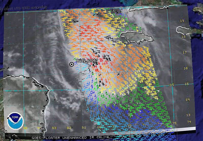
Re: ATL: INVEST 94L in Western Caribbean
Nobody believes it's dead now...or is turning their back on it even.
0 likes
-
HURAKAN

- Professional-Met

- Posts: 46084
- Age: 39
- Joined: Thu May 20, 2004 4:34 pm
- Location: Key West, FL
- Contact:
TROPICAL WEATHER DISCUSSION
NWS TPC/NATIONAL HURRICANE CENTER MIAMI FL
205 AM EDT SUN JUL 20 2008
STRONG TROPICAL WAVE IS ALONG 81W S OF 21N WITH AN ASSOCIATED
GALE LOW NEAR 15N81W 1006 MB. GALE CONDITIONS ARE FORECAST FROM
15N-20N BETWEEN 75W-82W AS CONFIRMED BY RECONNAISSANCE AIRCRAFT.
SCATTERED STRONG CONVECTION IS W OF JAMAICA FROM 14N-19N BETWEEN
78W-82W. ENVIRONMENTAL CONDITIONS APPEAR FAVORABLE FOR THIS
SYSTEM TO BECOME A TROPICAL CYCLONE WITHIN THE NEXT DAY OR
TWO AS IT MOVES WEST NORTHWESTWARD AT 15 KT. REGARDLESS OF
DEVELOPMENT...LOCALLY HEAVY RAINS WILL AFFECT PORTIONS OF
CUBA...AND THE CAYMAN ISLANDS TODAY. INTERESTS IN THE
NORTHWESTERN CARIBBEAN SEA AND THE YUCATAN PENINSULA SHOULD
CONTINUE TO MONITOR THE PROGRESS OF THIS SYSTEM.
0 likes
-
HURAKAN
- Professional-Met
- Posts: 46084
- Age: 39
- Joined: Thu May 20, 2004 4:34 pm
- Location: Key West, FL
- Contact:
TROPICAL WEATHER OUTLOOK
NWS TPC/NATIONAL HURRICANE CENTER MIAMI FL
200 AM EDT SUN JUL 20 2008
FOR THE NORTH ATLANTIC...CARIBBEAN SEA AND THE GULF OF MEXICO...
THE NATIONAL HURRICANE CENTER IS ISSUING ADVISORIES ON TROPIUCAL
STORM BERTHA...LOCATED ABOUT 545 MILES EAST OF CAPE RACE
NEWFOUNDLAND... AND ON TROPICAL STORM CRISTOBAL...LOCATED ABOUT 35
MILES EAST-SOUTHEAST OF CAPE FEAR NORTH CAROLINA.
THE STRONG TROPICAL WAVE OVER THE WESTERN CARIBBEAN SEA CONTINUES TO
PRODUCE NUMEROUS SHOWERS AND THUNDERSTORMS WITH WINDS TO GALE FORCE
IN SQUALLS. ENVIRONMENTAL CONDITIONS ARE EXPECTED TO BECOME
INCREASINGLY FAVORABLE FOR DEVELOPMENT...AND THIS SYSTEM IS LIKELY
TO BECOME A TROPICAL DEPRESSION OR A TROPICAL STORM WITHIN THE NEXT
DAY OR TWO AS IT MOVES WEST-NORTHWESTWARD AT 15 TO 20 MPH. LOCALLY
HEAVY RAINS WILL AFFECT JAMAICA...PORTIONS OF CUBA...AND THE CAYMAN
ISLANDS TODAY. INTERESTS IN THE NORTHWESTERN CARIBBEAN SEA AND THE
YUCATAN PENINSULA SHOULD CONTINUE TO MONITOR THE PROGRESS OF THIS
SYSTEM.
A SMALL AREA OF LOW PRESSURE IS LOCATED ABOUT 350 MILES
SOUTH-SOUTHEAST OF BERMUDA. THIS SYSTEM CONTINUES TO GENERATE A FEW
THUNDERSTORMS...BUT ENVIRONMENTAL CONDITIONS ARE EXPECTED TO
BECOME UNFAVORABLE FOR DEVELOPMENT OVER THE NEXT DAY OR TWO.
ELSEWHERE...TROPICAL CYCLONE FORMATION IS NOT EXPECTED DURING THE
NEXT 48 HOURS.
$$
FORECASTER PASCH
0 likes
Re: ATL: INVEST 94L in Western Caribbean
Thanks hurakan.
I would have thought the low was farther north than 15, but that just shows there's not a closed low. That can be seen yet.
With the way the winds are blowing around this system and the ULL is providing diffluence aloft, I won't be surprised if a center eventually forms somewhere else.
I would have thought the low was farther north than 15, but that just shows there's not a closed low. That can be seen yet.
With the way the winds are blowing around this system and the ULL is providing diffluence aloft, I won't be surprised if a center eventually forms somewhere else.
0 likes


Re: ATL: INVEST 94L in Western Caribbean
I had no interest in watching this thing all night Friday. Now it's a different story. What I'm seeing now looks ripe.
0 likes

-
lrak

- S2K Supporter

- Posts: 1770
- Age: 59
- Joined: Thu Jun 21, 2007 2:48 pm
- Location: Corpus Christi, TX
Re: ATL: INVEST 94L in Western Caribbean
http://www.ndbc.noaa.gov/station_page.p ... t=E&tz=CST still south, increased wind speed, and a pressure drop.
0 likes
-
Wx_Warrior
- Category 5

- Posts: 2718
- Joined: Thu Aug 03, 2006 3:58 pm
- Location: Beaumont, TX
Re: ATL: INVEST 94L in Western Caribbean
Oh, that wacky GFDL. That crazy thing had a Cat 4 @ Galveston yesterday.
0 likes
-
cheezyWXguy

- Category 5
- Posts: 6281
- Joined: Mon Feb 13, 2006 12:29 am
- Location: Dallas, TX
Re:
bigGbear wrote:Latest GFDL no longer skirts the Yucatan, but crosses it,
with landfall well south of Brownsville.
GFDL is on crack. Dont count it until 94L is officially a tc and a center is certain. Last night at this time, it had a cat5 in houston. Btw it looks like its heading is nw or nnw currently.
0 likes

-
littlevince

- S2K Supporter
- Posts: 768
- Joined: Fri Oct 21, 2005 10:45 am
- Location: Portugal
-
Wx_Warrior
- Category 5
- Posts: 2718
- Joined: Thu Aug 03, 2006 3:58 pm
- Location: Beaumont, TX
Re: ATL: INVEST 94L in Western Caribbean
LOL...If I recall yesterday, most were saying 'gfdl does well' and 'dont count gfdl out'...That was after the Cat 4 hit on Texas. Now, it could be a different story since some aren't wanting a South Tejas, North Mexico hit.
0 likes
-
Hurricanewatcher2007

- Category 2

- Posts: 578
- Joined: Sat Jul 05, 2008 8:10 pm
Re: ATL: INVEST 94L in Western Caribbean
Wx_Warrior wrote:LOL...If I recall yesterday, most were saying 'gfdl does well' and 'dont count gfdl out'...That was after the Cat 4 hit on Texas. Now, it could be a different story since some aren't wanting a South Tejas, North Mexico hit.
Well I don't want it to hit any where so I am going to say that its going to go out to sea with out even producing a rain drop on any land masses!
But no really it does look like its getting its act together and the next Recon flight should find a closed circulation.
0 likes
-
lrak
- S2K Supporter
- Posts: 1770
- Age: 59
- Joined: Thu Jun 21, 2007 2:48 pm
- Location: Corpus Christi, TX
Re: ATL: INVEST 94L in Western Caribbean
I'm scared to death of a S.TX hit of any kind. My salt tanks, a/c, paycheck...ack! You see I have my priorities staight 
0 likes
-
Hurricanewatcher2007
- Category 2
- Posts: 578
- Joined: Sat Jul 05, 2008 8:10 pm
Re: ATL: INVEST 94L in Western Caribbean
I bet you anything that the LLC will form some where between 75 west and 85 west.
0 likes
Who is online
Users browsing this forum: No registered users and 13 guests