ATL: Dolly Model Runs

Moderator: S2k Moderators

Message
Author
User avatar
dixiebreeze
S2K Supporter
S2K Supporter
Posts: 5140
Joined: Wed Sep 03, 2003 5:07 pm
Location: crystal river, fla.

Re: ATL: INVEST 94L Model Runs

#561 Postby dixiebreeze » Sun Jul 20, 2008 9:25 am

canegrl04 wrote:
Smurfwicked wrote:
cycloneye wrote:Here is the first model graphic for storm 4 Dolly.

Image


Those models looks like they're placing the center much further south than it actually is now. Am I right?


The runs will change over the coming hours.Should be reflecting a more NW component


That's my guess, too, Canegirl, only I'd say "much" more.
0 likes   

americanrebel

Re: ATL: INVEST 94L Model Runs

#562 Postby americanrebel » Sun Jul 20, 2008 9:27 am

IMHO, once again just my thoughts, no scientific evidence behind this at all.

I think the cone will be from Corpus Christi to New Orleans at first and will slowly get shrunk down to wherever they think it will go.
0 likes   

RL3AO
Moderator-Pro Met
Moderator-Pro Met
Posts: 16308
Joined: Thu Jun 14, 2007 10:03 pm
Location: NC

Re: ATL: INVEST 94L Model Runs

#563 Postby RL3AO » Sun Jul 20, 2008 9:29 am

americanrebel wrote:IMHO, once again just my thoughts, no scientific evidence behind this at all.

I think the cone will be from Corpus Christi to New Orleans at first and will slowly get shrunk down to wherever they think it will go.


They don't choose the width of the cone. The cone is 2/3rd the average error.
0 likes   

User avatar
Portastorm
Storm2k Moderator
Storm2k Moderator
Posts: 9914
Age: 63
Joined: Fri Jul 11, 2003 9:16 am
Location: Round Rock, TX
Contact:

Re: ATL: TS Dolly Model Runs

#564 Postby Portastorm » Sun Jul 20, 2008 11:33 am

So are we going to have to wait until the 0z model runs for a proper initialization or do y'all think the 18z runs might get it right?
0 likes   

chadtm80

Re: ATL: TS Dolly Model Runs

#565 Postby chadtm80 » Sun Jul 20, 2008 11:35 am

Image
0 likes   

User avatar
PTrackerLA
Category 5
Category 5
Posts: 5277
Age: 41
Joined: Thu Oct 10, 2002 8:40 pm
Location: Lafayette, LA

Re: ATL: TS Dolly Model Runs

#566 Postby PTrackerLA » Sun Jul 20, 2008 11:47 am

Hard to argue for a Texas hit with those models...
0 likes   

njweather
Tropical Storm
Tropical Storm
Posts: 169
Joined: Fri Aug 17, 2007 10:45 pm
Location: Washington, DC

Re: ATL: TS Dolly Model Runs

#567 Postby njweather » Sun Jul 20, 2008 11:50 am

PTrackerLA wrote:Hard to argue for a Texas hit with those models...


Well, look at how far south those models initialize the system. They'll be more north with the next runs.
0 likes   

RL3AO
Moderator-Pro Met
Moderator-Pro Met
Posts: 16308
Joined: Thu Jun 14, 2007 10:03 pm
Location: NC

Re: ATL: TS Dolly Model Runs

#568 Postby RL3AO » Sun Jul 20, 2008 11:52 am

PTrackerLA wrote:Hard to argue for a Texas hit with those models...


Those models initiated the low 3 or 4 degrees too far south. The models will move north with the next run.
0 likes   

Wx_Warrior
Category 5
Category 5
Posts: 2718
Joined: Thu Aug 03, 2006 3:58 pm
Location: Beaumont, TX

Re: ATL: TS Dolly Model Runs

#569 Postby Wx_Warrior » Sun Jul 20, 2008 11:53 am

we'll see
0 likes   

User avatar
PTrackerLA
Category 5
Category 5
Posts: 5277
Age: 41
Joined: Thu Oct 10, 2002 8:40 pm
Location: Lafayette, LA

#570 Postby PTrackerLA » Sun Jul 20, 2008 12:02 pm

Isn't the storm2k model map updated?
0 likes   

RL3AO
Moderator-Pro Met
Moderator-Pro Met
Posts: 16308
Joined: Thu Jun 14, 2007 10:03 pm
Location: NC

Re:

#571 Postby RL3AO » Sun Jul 20, 2008 12:03 pm

PTrackerLA wrote:Isn't the storm2k model map updated?


It will update when the models run again.
0 likes   

User avatar
KWT
Category 5
Category 5
Posts: 31415
Joined: Tue Aug 17, 2004 11:02 am
Location: UK!!!

#572 Postby KWT » Sun Jul 20, 2008 12:06 pm

Whats interesting is as has been mentioned the models started to ofar south with Dolly. IMO NHC may not be all that far off and current movement puts Dolly right in line with the NHC at least for a little while.

Will be interesting to see the 12z GFDL i think!
0 likes   

User avatar
gatorcane
S2K Supporter
S2K Supporter
Posts: 23691
Age: 47
Joined: Sun Mar 13, 2005 3:54 pm
Location: Boca Raton, FL

#573 Postby gatorcane » Sun Jul 20, 2008 12:08 pm

The posts in this forum are NOT official forecast and should not be used as such. They are just the opinion of the poster and may or may not be backed by sound meteorological data. They are NOT endorsed by any professional institution or storm2k.org. For official information, please refer to the NHC and NWS products.

If Dolly strengthens more quickly I would expect her to take a track more on the right-side of the cone. Even so, looks like the models have indeed initialized her too far south.
So would expect a right shift (or bend) in the models towards Texas especially if Dolly strengthens more quickly than expected:

I think this very-well could be a Texas storm here (I'm not sold on Mexico).

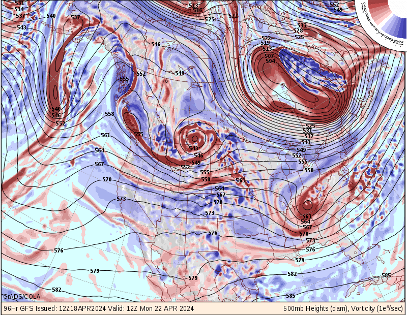
Note the trough from NHC Dolly Discussion:

THE INITIAL MOTION ESTIMATE IS 305/15...WITH STEERING PROVIDED BY A
NARROW MID-LEVEL RIDGE ACROSS FLORIDA IN BETWEEN DOLLY AND
CRISTOBAL. THAT RIDGE IS FORECAST BY THE GLOBAL MODELS TO
GRADUALLY WEAKEN AS A MID-LATITUDE TROUGH DEEPENS OVER THE GREAT
LAKES REGION.
AS A RESULT...THE FORWARD MOTION OF DOLLY IS LIKELY
TO BECOME SLOWER WHEN IT IS OVER THE GULF OF MEXICO.
0 likes   

User avatar
Extremeweatherguy
Category 5
Category 5
Posts: 11095
Joined: Mon Oct 10, 2005 8:13 pm
Location: Florida

#574 Postby Extremeweatherguy » Sun Jul 20, 2008 12:09 pm

My bet right now is that this winds up hitting south Texas between Brownsville and Corpus Christi.

The posts in this forum are NOT official forecast and should not be used as such. They are just the opinion of the poster and may or may not be backed by sound meteorological data. They are NOT endorsed by any professional institution or storm2k.org. For official information, please refer to the NHC and NWS products.


---7/23/08 2:31pm Update---

It looks like the prediction I made on Sunday morning wound up being pretty accurate..

Image
Last edited by Extremeweatherguy on Wed Jul 23, 2008 1:32 pm, edited 3 times in total.
0 likes   

User avatar
Portastorm
Storm2k Moderator
Storm2k Moderator
Posts: 9914
Age: 63
Joined: Fri Jul 11, 2003 9:16 am
Location: Round Rock, TX
Contact:

Re:

#575 Postby Portastorm » Sun Jul 20, 2008 12:19 pm

Extremeweatherguy wrote:My bet right now is that this winds up hitting south Texas between Brownsville and Corpus Christi.

The posts in this forum are NOT official forecast and should not be used as such. They are just the opinion of the poster and may or may not be backed by sound meteorological data. They are NOT endorsed by any professional institution or storm2k.org. For official information, please refer to the NHC and NWS products.


Which would be a good thing (if we can even say that in dealing with a tropical cyclone) since all that's there essentially is the King Ranch, aka Bret in 99.
0 likes   

User avatar
gatorcane
S2K Supporter
S2K Supporter
Posts: 23691
Age: 47
Joined: Sun Mar 13, 2005 3:54 pm
Location: Boca Raton, FL

#576 Postby gatorcane » Sun Jul 20, 2008 12:27 pm

Look how amplified the trough is that breaks down ridging over the Eastern CONUS:

Image
0 likes   

User avatar
Portastorm
Storm2k Moderator
Storm2k Moderator
Posts: 9914
Age: 63
Joined: Fri Jul 11, 2003 9:16 am
Location: Round Rock, TX
Contact:

Re: ATL: TS Dolly Model Runs

#577 Postby Portastorm » Sun Jul 20, 2008 12:29 pm

Holy smokes!! :eek:

I would expect to see a trough of that magnitude in January not July. If that verifies ... yeah, you gotta believe the Gulf ridge will erode some.
0 likes   

Aric Dunn
Category 5
Category 5
Posts: 21238
Age: 42
Joined: Sun Sep 19, 2004 9:58 pm
Location: Ready for the Chase.
Contact:

#578 Postby Aric Dunn » Sun Jul 20, 2008 12:42 pm

well the cmc initialized it way to far south on the 12z
http://moe.met.fsu.edu/cgi-bin/cmctc2.c ... =Animation
0 likes   

User avatar
vaffie
Category 3
Category 3
Posts: 898
Joined: Sat Sep 11, 2004 5:11 pm
Location: Houston, Texas

Re:

#579 Postby vaffie » Sun Jul 20, 2008 12:47 pm

Aric Dunn wrote:well the cmc initialized it way to far south on the 12z
http://moe.met.fsu.edu/cgi-bin/cmctc2.c ... =Animation


True, but more importantly look at how intense and how rapidly the CMC makes it in the Gulf. Let's see if the 12Z GFDL and HWRF do the same thing. Track is one of those things which is sure to change a lot, but what's important right now is to determine how favorable the conditions are going to be. What kind of storm is it going to be.
0 likes   

User avatar
cycloneye
Admin
Admin
Posts: 145295
Age: 68
Joined: Thu Oct 10, 2002 10:54 am
Location: San Juan, Puerto Rico

Re: ATL: TS Dolly Model Runs

#580 Postby cycloneye » Sun Jul 20, 2008 12:56 pm

12z GFDL:It iniciated south of the NHC position:

WHXX04 KWBC 201731
CHGQLM
ATTENTION...NATIONAL HURRICANE CENTER

NCEP COUPLED GFDL HURRICANE MODEL FORECAST MADE FOR

TROPICAL STORM DOLLY 04L

INITIAL TIME 12Z JUL 20

DISCLAIMER ... THIS INFORMATION IS PROVIDED AS GUIDANCE. IT
REQUIRES INTERPRETATION BY HURRICANE SPECIALISTS AND SHOULD
NOT BE CONSIDERED AS A FINAL PRODUCT. PLEASE SEE THE TPC/NHC
OFFICIAL FORECAST.


FORECAST STORM POSITION

HOUR LATITUDE LONGITUDE HEADING/SPEED(KT)

0 17.8 83.6 300./14.0
6 18.6 84.8 304./14.1
12 19.5 86.0 308./14.2
18 20.5 87.2 310./15.6
24 21.3 88.9 296./17.9
30 22.1 90.1 303./13.5
36 22.8 91.3 301./12.8
42 23.5 92.6 296./14.2
48 23.9 93.8 291./11.3
54 24.2 94.6 291./ 8.0
60 24.4 95.2 286./ 5.7
66 24.7 95.8 296./ 6.8
72 24.9 96.4 292./ 5.2
78 24.9 96.8 273./ 4.0
84 24.7 97.4 250./ 5.5
90 24.6 98.0 255./ 5.5
96 24.1 98.7 238./ 8.2
102 23.1 99.3 209./11.4
108 23.0 101.2 266./17.4
114 23.0 102.4 274./11.5
120 23.8 103.8 299./15.3

STORM DISSIPATED AT 120 HRS AT THE ABOVE PSN.

0 likes   


Return to “2008”

Who is online

Users browsing this forum: No registered users and 2 guests