ATL: Tropical Depression Dolly
Moderator: S2k Moderators
-
Just Joshing You

- Category 2

- Posts: 512
- Joined: Sat Nov 03, 2007 10:29 am
- Location: Nova Scotia


Re: ATL: TS Dolly in Western Caribbean
RL3AO wrote:ROCK wrote:not exactly...I would put it alittle further south but north of the RECON fixes. That is the MLC or was the MLC......
Recon was flying at 925mb. How could it be the MLC?
said was....pretty evident earlier frames of the vis. At that time, the LLC was not stacked, lopsided....still not stacked....needs to work its way around the area in question....suggests a tightening LLC from a broard area of low pressure.....IMO only...
0 likes
-
Innotech

- Category 5

- Posts: 1031
- Joined: Mon Aug 30, 2004 5:32 pm
- Location: Lafayette, Louisiana
- Contact:
Re: ATL: TS Dolly in Western Caribbean
the LLC is definitely near 18.5N ,85.5 W but I have a feeling the storm will try to align the LLC and MLC closer together and possibly lift it northward. Its done this sort of thing plenty of times already. If you go frame by frame you can see the LLC come into view on visible @ 18.2N, 84W and wobble a bit to its current position a bit ahead of the convection. However I doubt this will be its final placement.
0 likes
-
Nederlander
- S2K Supporter

- Posts: 1259
- Joined: Sat Jul 19, 2008 4:28 pm
- Location: Conroe, TX
Re: ATL: TS Dolly in Western Caribbean
ROCK wrote:RL3AO wrote:
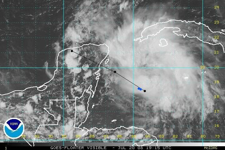
NHC 21/1545z position with the 21/0z and 21/12z forecast points plotted. The two blue dots are the two VDMs from the most recent flight.
not going to argue with the NHC....data is data but what I am seeing is not the area I would put the center....currently.
I agree, I just cant see it being that far south.. it seems obvious to me (or my eyes) that its north of that, or moving north....
0 likes
-
Innotech
- Category 5
- Posts: 1031
- Joined: Mon Aug 30, 2004 5:32 pm
- Location: Lafayette, Louisiana
- Contact:
Re: ATL: TS Dolly in Western Caribbean
Nederlander wrote:ROCK wrote:RL3AO wrote:
NHC 21/1545z position with the 21/0z and 21/12z forecast points plotted. The two blue dots are the two VDMs from the most recent flight.
not going to argue with the NHC....data is data but what I am seeing is not the area I would put the center....currently.
I agree, I just cant see it being that far south.. it seems obvious to me (or my eyes) that its north of that, or moving north....
no, it is indeed that far South. However it may not remain there is what Im saying.
0 likes

Re: ATL: TS Dolly in Western Caribbean
Think what this sucker would like like if it had its pants on.
0 likes

Re: ATL: TS Dolly in Western Caribbean
Nederlander wrote:
I agree, I just cant see it being that far south.. it seems obvious to me (or my eyes) that its north of that, or moving north....
Recon proved thats where the center is and that the center is moving WNW not north.
0 likes


-
Ed Mahmoud
Re: ATL: TS Dolly in Western Caribbean
I think the poster planning a vacation was a Texas aggie 2005 graduate, judging from his nick. Something like "TexasAggie05" or something.
I hope he brought a digital camera, although one day with tropical storm conditions in a week long vacation doesn't seem too bad to me.
The missing SW half, I'd venture an opinion, is a product of shear being more than optimal for Dolly, and the fact Dolly is not yet well organized. Motion seems very close to NHC forecast, and while center jump is possible, I guess, they seem to have a pretty good handle, although I suspect 60 knots at landfall is a smidge weak. Bastardi and Derek Ortt both seem to be predicting about 90 knots.
With the close concensus of the models, hard to argue, IMHO, with a landfall near/South of BRO. Noticed individual models not changing too much on recent runs either, ie, dModel/dTime is approaching zero.
My opinions are unofficial, but my opinion is the official NHC forecast is probably pretty close to right.
0 likes
Re: ATL: TS Dolly in Western Caribbean
Really, I trust the VDMs. This thing is naked from the waist down.
0 likes


Re: ATL: TS Dolly in Western Caribbean
Recurve wrote:Really, I trust the VDMs. This thing is naked from the waist down.
How embarrassing
0 likes
-
Cape Verde

- Category 2
- Posts: 564
- Age: 70
- Joined: Tue Aug 31, 2004 5:53 pm
- Location: Houston area
Re: ATL: TS Dolly in Western Caribbean
cheezyWXguy wrote:Cape Verde wrote:So why is there no SW/2 of the storm?
Inflow is hard to maintain due to the mountains to the west, and this is a newly developed storm. Give it time and youll see what youre looking for.
Okay, I'll buy that it is just isn't organized yet, but there are no mountains to the west for at least 300 miles, and then it's a stretch to call them mountains.
0 likes
-
AJC3

- Admin

- Posts: 4153
- Age: 62
- Joined: Tue Aug 31, 2004 7:04 pm
- Location: Ballston Spa, New York
- Contact:
Re: ATL: TS Dolly in Western Caribbean
A lot of folks here are mistaking what is simply a relatively cloud-free area for some sort of center. I can't say this any more clearer than this: There has been a plane in there all day taking continuous in situ pressure and wind observations. You cannot get a better fix from remotely sensed data than you can a recon flight - no way, no how.
0 likes
Re:
HURAKAN wrote:I think some of you guys are trying to go against the RECON findings. I don't see how you can argue that but good luck.
I am not going against the NHC however I am pointing out what I am seeing on hi-res vis attm. RECON is gone. I have been here long enough not to go against the NHC and their knowledge....this is a developing system as we speak. Possibility of center relo exists.
0 likes
Re: ATL: TS Dolly in Western Caribbean
AJC3 wrote:A lot of folks here are mistaking what is simply a relatively cloud-free area for some sort of center. I can't say this any more clearer than this: There has been a plane in there all day taking continuous in situ pressure and wind observations. You cannot get a better fix from remotely sensed data than you can a recon flight - no way, no how.
I was indeed making that mistake
0 likes
-
Dionne

- S2K Supporter
- Posts: 1616
- Age: 74
- Joined: Mon Jan 02, 2006 8:51 am
- Location: SW Mississippi....Alaska transplant via a Southern Belle.
Re: ATL: TS Dolly in Western Caribbean
AJC3 wrote:A lot of folks here are mistaking what is simply a relatively cloud-free area for some sort of center. I can't say this any more clearer than this: There has been a plane in there all day taking continuous in situ pressure and wind observations. You cannot get a better fix from remotely sensed data than you can a recon flight - no way, no how.
Thanx, we'll sleep tonight.
0 likes
Re: ATL: TS Dolly in Western Caribbean
A lot of folks here are mistaking what is simply a relatively cloud-free area for some sort of center. I can't say this any more clearer than this: There has been a plane in there all day taking continuous in situ pressure and wind observations. You cannot get a better fix from remotely sensed data than you can a recon flight - no way, no how.
Not every blue patch is an eye. The low is often on the southwest edge of convection when there's shear or other influences as TCs come together. In my amateur words.
0 likes
-
littlevince

- S2K Supporter
- Posts: 768
- Joined: Fri Oct 21, 2005 10:45 am
- Location: Portugal
Re: ATL: TS Dolly in Western Caribbean
If the center was in that cloud free area, buoy 42056 would have winds of NW, I suppose.

1950 E ( 97 deg ) 11.3 m/s
1940 ESE ( 102 deg ) 10.7 m/s
1930 E ( 100 deg ) 11.1 m/s
1920 E ( 101 deg ) 10.8 m/s
1910 E ( 100 deg ) 9.6 m/s
1900 ESE ( 102 deg ) 9.3 m/s
http://www.ndbc.noaa.gov/station_page.p ... t=M&tz=GMT
1950 E ( 97 deg ) 11.3 m/s
1940 ESE ( 102 deg ) 10.7 m/s
1930 E ( 100 deg ) 11.1 m/s
1920 E ( 101 deg ) 10.8 m/s
1910 E ( 100 deg ) 9.6 m/s
1900 ESE ( 102 deg ) 9.3 m/s
http://www.ndbc.noaa.gov/station_page.p ... t=M&tz=GMT
0 likes
-
LAwxrgal

- S2K Supporter
- Posts: 1763
- Joined: Tue Jul 06, 2004 1:05 pm
- Location: Reserve, LA (30 mi west of NOLA)
Personal Forecast Disclaimer:
The posts in this forum are NOT official forecast and should not be used as such. They are just the opinion of the poster and may or may not be backed by sound meteorological data. They are NOT endorsed by any professional institution or storm2k.org. For official information, please refer to the NHC and NWS products.
This thing will cross the Yucatan Peninsula, and personally, I don't see how this goes any further north than Corpus. Here we're very hot and dry under this ridge of high pressure. I think the NHC is dead on with this one.
Last edited by LAwxrgal on Sun Jul 20, 2008 3:36 pm, edited 1 time in total.
0 likes
Who is online
Users browsing this forum: No registered users and 19 guests