Well Defined Wave off African Coast

This is the general tropical discussion area. Anyone can take their shot at predicting a storms path.

Moderator: S2k Moderators

Forum rules

The posts in this forum are NOT official forecasts and should not be used as such. They are just the opinion of the poster and may or may not be backed by sound meteorological data. They are NOT endorsed by any professional institution or STORM2K. For official information, please refer to products from the National Hurricane Center and National Weather Service.

Help Support Storm2K
Message
Author
User avatar
wx247
S2K Supporter
S2K Supporter
Posts: 14279
Age: 41
Joined: Wed Feb 05, 2003 10:35 pm
Location: Monett, Missouri
Contact:

Re: Well Defined Wave about to emerge Africa

#201 Postby wx247 » Mon Jul 21, 2008 4:20 am

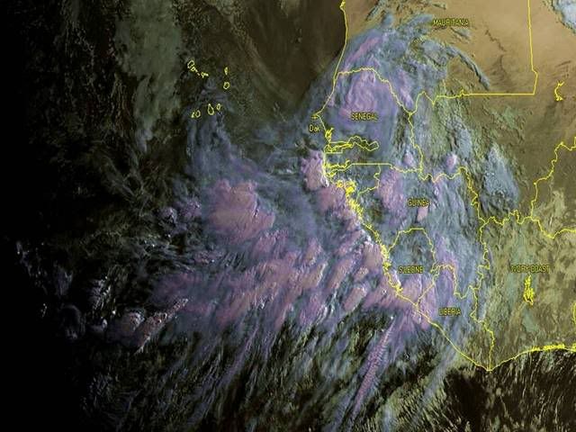
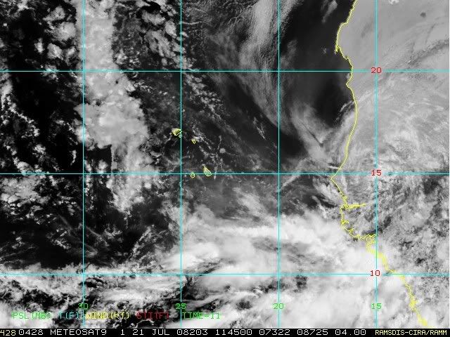
Matt-hurricanewatcher wrote:I'm really starting to doubt development of this low because of how far north it is coming off. 15 north is to far north period.

I also highly doubt that the nhc will upgrade this as it is coming off.


Well, if that is the case then we should watch for a change in the NHC's wording in their outlook. Until then, I will tend to believe what they say.
0 likes   

User avatar
Gustywind
Category 5
Category 5
Posts: 12334
Joined: Mon Sep 03, 2007 7:29 am
Location: Baie-Mahault, GUADELOUPE

#202 Postby Gustywind » Mon Jul 21, 2008 5:53 am

000
AXNT20 KNHC 211048
TWDAT

TROPICAL WEATHER DISCUSSION
NWS TPC/NATIONAL HURRICANE CENTER MIAMI FL
805 AM EDT MON JUL 21 2008

TROPICAL WEATHER DISCUSSION FOR NORTH AMERICA...CENTRAL
AMERICA...GULF OF MEXICO...CARIBBEAN SEA...NORTHERN SECTIONS
OF SOUTH AMERICA...AND ATLANTIC OCEAN TO THE AFRICAN COAST
FROM THE EQUATOR TO 32N. THE FOLLOWING INFORMATION IS BASED
ON SATELLITE IMAGERY...METEOROLOGICAL ANALYSIS...WEATHER
OBSERVATIONS...AND RADAR.

BASED ON 0600 UTC SURFACE ANALYSIS AND SATELLITE IMAGERY THROUGH
1045 UTC.
...THE ITCZ...
WIDELY SCATTERED MODERATE CONVECTION OVER A LARGE AREA ALONG THE
COAST OF W AFRICA FROM 6N-13N BETWEEN 12W-24W.
SCATTERED MODERATE TO ISOLATED STRONG CONVECTION IS FROM 5N-7N
BETWEEN 24W-29W.
$$
FORMOSA
0 likes   

User avatar
cycloneye
Admin
Admin
Posts: 145303
Age: 68
Joined: Thu Oct 10, 2002 10:54 am
Location: San Juan, Puerto Rico

Re: Well Defined Wave about to emerge Africa

#203 Postby cycloneye » Mon Jul 21, 2008 6:00 am

You can see clearly the low and the circulation embedded with the convection in Senegal.

Image
0 likes   

User avatar
wzrgirl1
S2K Supporter
S2K Supporter
Posts: 1325
Joined: Sat Sep 04, 2004 6:44 am
Location: Pembroke Pines, Florida

Re: Organized Wave=8 PM TWO=Development after low emerges

#204 Postby wzrgirl1 » Mon Jul 21, 2008 6:09 am

abajan wrote:
wzrgirl1 wrote:
alan1961 wrote:Here is a good view of the wave coming off Africa http://www.sat.dundee.ac.uk/geobrowse/g ... d=1&size=1

use this username and password to access it

username-England
password-atz538


i tried it and the password didn't work....on another note i tried to compare to 2005....and this point that year, we had 6 storms....and we could have our 5th in the next couple of days....only 1 off....eerie similar huh?

Why not just create your own account for FREE and you'll be able to view all of their satellite pix. I (and probably many other S2K members) have been using their service for years now.


I could do that....it was just easier to do it this way. Six one way....half a dozen the other. Thanks for the link though!
0 likes   

User avatar
Gustywind
Category 5
Category 5
Posts: 12334
Joined: Mon Sep 03, 2007 7:29 am
Location: Baie-Mahault, GUADELOUPE

#205 Postby Gustywind » Mon Jul 21, 2008 6:10 am

Busy for mid-late July
Mark Avery, Lead Meteorologist, The Weather Channel
7:00 a.m. ET 7/21/2008
The tropics continue to be active for mid to late July in both the Atlantic and eastern Pacific.
http://www.weather.com/newscenter/tropical/
Elsewhere in the Atlantic basin, a strong tropical wave is currently located over western Africa and is expected to emerge into the Atlantic later today. This wave will need to be monitored closely for possible development.
Nice regards from Gustywind 8-) :cheesy: .
0 likes   

User avatar
caribepr
Category 5
Category 5
Posts: 1794
Joined: Fri Sep 05, 2003 10:43 pm
Location: Culebra, PR 18.33 65.33

Re:

#206 Postby caribepr » Mon Jul 21, 2008 6:13 am

Meso wrote:This image of the wave is less than an hour old

Large Wave View


Where did you get that image, Meso? It's amazing!
0 likes   

User avatar
Meso
Category 5
Category 5
Posts: 1609
Age: 38
Joined: Mon Aug 09, 2004 12:14 pm
Location: South Africa
Contact:

#207 Postby Meso » Mon Jul 21, 2008 6:38 am

It's owned by a small South African website
http://www.weatherphotos.co.za
0 likes   

User avatar
cycloneye
Admin
Admin
Posts: 145303
Age: 68
Joined: Thu Oct 10, 2002 10:54 am
Location: San Juan, Puerto Rico

Re: Well Defined Wave about to emerge Africa

#208 Postby cycloneye » Mon Jul 21, 2008 7:01 am


ABNT20 KNHC 211200
TWOAT
TROPICAL WEATHER OUTLOOK
NWS TPC/NATIONAL HURRICANE CENTER MIAMI FL
800 AM EDT MON JUL 21 2008

FOR THE NORTH ATLANTIC...CARIBBEAN SEA AND THE GULF OF MEXICO...

THE NATIONAL HURRICANE CENTER IS ISSUING ADVISORIES ON TROPICAL
STORM CRISTOBAL...CENTERED ABOUT 110 MILES NORTHEAST OF CAPE
HATTERAS NORTH CAROLINA...AND ON TROPICAL STORM DOLLY...LOCATED
ABOUT 65 MILES EAST-NORTHEAST OF PROGRESO MEXICO.

A LARGE AND WELL-DEFINED TROPICAL WAVE IS LOCATED JUST INLAND OVER
EXTREME WESTERN AFRICA. THIS SYSTEM HAS THE POTENTIAL FOR SOME
DEVELOPMENT AFTER IT EMERGES INTO THE TROPICAL EASTERN ATLANTIC
WITHIN THE NEXT DAY OR SO.

ELSEWHERE...TROPICAL CYCLONE FORMATION IS NOT EXPECTED DURING THE
NEXT 48 HOURS.


$$
FORECASTER KNABB
0 likes   

User avatar
Gustywind
Category 5
Category 5
Posts: 12334
Joined: Mon Sep 03, 2007 7:29 am
Location: Baie-Mahault, GUADELOUPE

#209 Postby Gustywind » Mon Jul 21, 2008 7:12 am

:uarrow:
TROPICAL WEATHER OUTLOOK
NWS TPC/NATIONAL HURRICANE CENTER MIAMI FL
200 AM EDT MON JUL 21 2008

A VIGOROUS AND WELL-DEFINED TROPICAL WAVE IS LOCATED OVER WESTERN
AFRICA A COUPLE HUNDRED MILES EAST OF DAKAR SENEGAL. THIS SYSTEM
HAS THE POTENTIAL TO BECOME A TROPICAL CYCLONE VERY QUICKLY AFTER
IT EMERGES INTO THE EASTERN ATLANTIC WITHIN THE NEXT DAY OR TWO.

Were they a little bit agressive this morning at 2 AM ? They were speaking about potential for this to become a TROPICAL CYCLONE. Right now with my subjective interpretation... it seems that chances are slightly diminished or my eyes are deceiving me? "THIS SYSTEM HAS THE POTENTIAL FOR SOME
DEVELOPMENT"....All in all wait and see what happens.. :roll:
0 likes   

User avatar
HURAKAN
Professional-Met
Professional-Met
Posts: 46086
Age: 38
Joined: Thu May 20, 2004 4:34 pm
Location: Key West, FL
Contact:

#210 Postby HURAKAN » Mon Jul 21, 2008 7:12 am

Now the language used is much more NHC-like.
0 likes   

Mecklenburg

Re: Well Defined Wave about to emerge Africa

#211 Postby Mecklenburg » Mon Jul 21, 2008 7:24 am

will invest 97L would be raised immediately at the navy site once this thing emerge from senegal?
0 likes   

User avatar
HURAKAN
Professional-Met
Professional-Met
Posts: 46086
Age: 38
Joined: Thu May 20, 2004 4:34 pm
Location: Key West, FL
Contact:

#212 Postby HURAKAN » Mon Jul 21, 2008 7:25 am

Image

The LPS is still impressive.
0 likes   

Mecklenburg

Re:

#213 Postby Mecklenburg » Mon Jul 21, 2008 7:27 am

HURAKAN wrote:Image

The LPS is still impressive.


yeah it is really... i can't help but picture out what it will look like once it wallows in the open waters... :eek:
0 likes   

User avatar
HURAKAN
Professional-Met
Professional-Met
Posts: 46086
Age: 38
Joined: Thu May 20, 2004 4:34 pm
Location: Key West, FL
Contact:

#214 Postby HURAKAN » Mon Jul 21, 2008 7:28 am

Image
0 likes   

User avatar
caribepr
Category 5
Category 5
Posts: 1794
Joined: Fri Sep 05, 2003 10:43 pm
Location: Culebra, PR 18.33 65.33

Re:

#215 Postby caribepr » Mon Jul 21, 2008 8:04 am

Meso wrote:It's owned by a small South African website
http://www.weatherphotos.co.za


Thank you!
0 likes   

User avatar
tpr1967
Tropical Storm
Tropical Storm
Posts: 185
Age: 58
Joined: Sun Jun 15, 2003 8:37 pm
Location: Palmetto,FL

Re: Organized Wave emerging Africa / Low Pressure still inland

#216 Postby tpr1967 » Mon Jul 21, 2008 8:06 am

Mecklenburg wrote:
HURAKAN wrote:Image

The LPS is still impressive.


yeah it is really... i can't help but picture out what it will look like once it wallows in the open waters... :eek:


Seems to be some african dust being draw in to the system in that pic. your thoughts.
0 likes   

User avatar
alienstorm
Category 1
Category 1
Posts: 496
Joined: Tue Jul 31, 2007 1:29 pm
Location: Miami Fla western suburb

Re: Organized Wave emerging Africa / Low Pressure still inland

#217 Postby alienstorm » Mon Jul 21, 2008 8:19 am

While it is impressive I don't think this will amount to much given that it is coming out at a high latitude and that it should head off to the NW shortly after coming through the Cape Verde Islands. If this was coming out at 11N or lower than I think we would need to worry, but given it coming out at around 15 or 16 North it should prove to be short lived and just an issue to the Cape Verde Islands and then fishes.....
0 likes   

User avatar
Gustywind
Category 5
Category 5
Posts: 12334
Joined: Mon Sep 03, 2007 7:29 am
Location: Baie-Mahault, GUADELOUPE

#218 Postby Gustywind » Mon Jul 21, 2008 9:19 am

Dr. Jeff Masters' WunderBlog

Last Updated: 13:54 GMT le 21 juillet 2008
http://www.wunderground.com/blog/JeffMa ... amp=200807

Elsewhere in the tropics
There's no sign that this year's unusually early and active hurricane season is going to slow down. Three of our four reliable computer models continue to predict that a strong tropical wave about to emerge off the coast of Africa tonight will develop into a tropical depression later this week. This wave, located over Senegal (15N 15W), has a very strong rotation and a large circulation. Once it moves over the Atlantic, water temperatures that are up to 2°C above average for this time of year should allow this wave to develop.

I'll have an update later today.

Jeff Masters
0 likes   

User avatar
stormchazer
Category 5
Category 5
Posts: 2461
Joined: Fri Aug 29, 2003 12:00 pm
Location: Lakeland, Florida
Contact:

Re: Organized Wave emerging Africa / Low Pressure still inland

#219 Postby stormchazer » Mon Jul 21, 2008 10:03 am

alienstorm wrote:While it is impressive I don't think this will amount to much given that it is coming out at a high latitude and that it should head off to the NW shortly after coming through the Cape Verde Islands. If this was coming out at 11N or lower than I think we would need to worry, but given it coming out at around 15 or 16 North it should prove to be short lived and just an issue to the Cape Verde Islands and then fishes.....


That is a good point but it seems that systems often dip south when leaving the coast of Africa due to the effects of the Azores High. I wonder if the presence of the Monsoon Trough usually on the African Coast in the summer also tends to intitially draw these waves towards the ITZ as they leave Africa.

We will have to see if, and where the center develops once it is off the coast.
0 likes   

User avatar
alienstorm
Category 1
Category 1
Posts: 496
Joined: Tue Jul 31, 2007 1:29 pm
Location: Miami Fla western suburb

Re: Organized Wave emerging Africa / Low Pressure still inland

#220 Postby alienstorm » Mon Jul 21, 2008 10:11 am

Looking at the loop from EMUETSAT
http://oiswww.eumetsat.org/IPPS/html/De ... /index.htm

It is definitely moving off to the WNW or NW this is coming out at 16N, and the overall cloud coverage has decreased drastically. I don't think this may even develop now given the direction and decrease in overall coverage. Still a good spin but seems to be dimishing in intensity.
0 likes   


Return to “Talkin' Tropics”

Who is online

Users browsing this forum: IsabelaWeather and 40 guests