ATL: Invest 97L in Central Atlantic
Moderator: S2k Moderators

Re: Ex 97L in East Atlantic
Don't work at all!!!!! it's not the first time that happens .I think the webmaster had change something in the code and some of us cannot accesss, because of this change. Gusty,i will answer my brother for a solution,or someone in the board can help us???? 
0 likes

Re:
0 likes
-
Gustywind

- Category 5

- Posts: 12334
- Joined: Mon Sep 03, 2007 7:29 am
- Location: Baie-Mahault, GUADELOUPE
Re: Ex 97L in East Atlantic
HUC wrote:Don't work at all!!!!! it's not the first time that happens .I think the webmaster had change something in the code and some of us cannot accesss, because of this change. Gusty,i will answer my brother for a solution,or someone in the board can help us????
OH Huc dont' be so sad
 !!!
!!!
0 likes
-
O Town
- S2K Supporter

- Posts: 5205
- Age: 52
- Joined: Wed Sep 07, 2005 9:37 pm
- Location: Orlando, Florida 28°35'35"N 81°22'55"W
Re: Ex 97L in East Atlantic
RL3AO wrote:O Town wrote:Isn't there a backup NRL site?
https://www.fnmoc.navy.mil/tcweb/cgi-bin/tc_home.cgi
Yes thanks RL3AO. Try the link above HUC.
If that one doesn't work try this one, a bit different than the one on the previous page Gustywind posted.
http://www.nrlmry.navy.mil/tc_pages/
0 likes
-
Mecklenburg
Re: Ex 97L in East Atlantic
i believe this thing will regenerate
Last edited by Mecklenburg on Thu Jul 24, 2008 5:02 pm, edited 1 time in total.
0 likes
Re: Ex 97L in East Atlantic
Rl3Ao,don't work ..............So, i propose that we stop that discussion,because it's not the place...thanks all .I hope we will found a solution. My other links work fine,and wee are looking about 97L,isn'it????
0 likes
-
HURAKAN

- Professional-Met

- Posts: 46084
- Age: 39
- Joined: Thu May 20, 2004 4:34 pm
- Location: Key West, FL
- Contact:
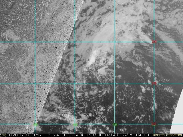
TROPICAL WEATHER DISCUSSION
NWS TPC/NATIONAL HURRICANE CENTER MIAMI FL
805 PM EDT THU JUL 24 2008
...TROPICAL WAVES...
A HIGH AMPLITUDE TROPICAL WAVE IS ALONG 35W/36W S OF 23N MOVING
W NEAR 20 KT. VIS SATELLITE IMAGERY INDICATES A BROAD CYCLONIC
CIRCULATION AND A 1010 MB LOW ALONG THE WAVE AXIS NEAR 14N. THIS
LOW IS FORECAST BY THE COMPUTER MODELS TO MOVE WEST DURING THE
NEXT 24-48 HOURS. SHOWER ACTIVITY REMAINS LIMITED AT THIS TIME
FROM 17N-23N BETWEEN 32W-39W. THE WAVE SHOWS UP VERY WELL ON THE
MIMIC-TPW PRODUCT FROM CIMSS WHERE A LARGE BULGE OF MOISTURE IS
OBSERVED. TIGHT PRESSURE GRADIENT BETWEEN THE LOW AND THE ATLC
SURFACE HIGH WILL PRODUCE AN INCREASE IN WINDS ACROSS THE
CENTRAL ATLC THROUGH THE WEEKEND.
0 likes


Re: Ex 97L in East Atlantic
Seems to me like the GFS is a little off. GFS wants to start moving this WNW to NW in 24 hrs and has it above 20N at 36hrs. I don't see how this can move that far North considering it is quite shallow and I don't see this getting any deeper in the next several days with all that dry air.
http://moe.met.fsu.edu/cgi-bin/gfstc2.c ... hour=036hr
I might be reading this chart wrong, but if it stays shallow it should continue moving W or WNW further than the GFS portrays.
http://cimss.ssec.wisc.edu/tropic/real- ... 8dlm1.html
Either way it seems like the ridge will weaken considerably if it gets closer to the islands.
0 likes
-
gatorcane

- S2K Supporter
- Posts: 23708
- Age: 48
- Joined: Sun Mar 13, 2005 3:54 pm
- Location: Boca Raton, FL
Re: Ex 97L in East Atlantic
blp wrote:Seems to me like the GFS is a little off. GFS wants to start moving this WNW to NW in 24 hrs and has it above 20N at 36hrs. I don't see how this can move that far North considering it is quite shallow and I don't see this getting any deeper in the next several days with all that dry air.
http://moe.met.fsu.edu/cgi-bin/gfstc2.c ... hour=036hr
I might be reading this chart wrong, but if it stays shallow it should continue moving W or WNW further than the GFS portrays.
http://cimss.ssec.wisc.edu/tropic/real- ... 8dlm1.html
Either way it seems like the ridge will weaken considerably if it gets closer to the islands.
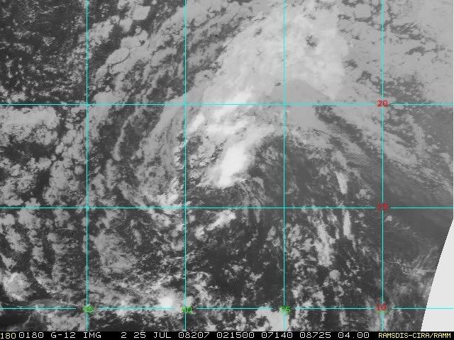
Hurakan's graphic pretty much sums it up. 97L seems to be fish bound in my opinion. Look for possible slow development in about 2 days but gradually curving NW and eventually North. It's looking less likely we will see a tropical storm or greater system out of this though.
0 likes
-
gatorcane
- S2K Supporter
- Posts: 23708
- Age: 48
- Joined: Sun Mar 13, 2005 3:54 pm
- Location: Boca Raton, FL
Re:
bob rulz wrote:What happened to ex-97L? I went to work, I come back, and it's not even mentioned in the TWO anymore, nor is it on the NRL site. Did it really dissipate that fast?
Pretty much, its struggling in the SAL and cooler SSTs at the moment.
0 likes


Re: Ex 97L in East Atlantic
gatorcane wrote:blp wrote:Seems to me like the GFS is a little off. GFS wants to start moving this WNW to NW in 24 hrs and has it above 20N at 36hrs. I don't see how this can move that far North considering it is quite shallow and I don't see this getting any deeper in the next several days with all that dry air.
http://moe.met.fsu.edu/cgi-bin/gfstc2.c ... hour=036hr
I might be reading this chart wrong, but if it stays shallow it should continue moving W or WNW further than the GFS portrays.
http://cimss.ssec.wisc.edu/tropic/real- ... 8dlm1.html
Either way it seems like the ridge will weaken considerably if it gets closer to the islands.
Hurakan's graphic pretty much sums it up. 97L seems to be fish bound in my opinion. Look for possible slow development in about 2 days but gradually curving NW and eventually North. It's looking less likely we will see a tropical storm or greater system out of this though.
I do see the southerly trajectory more likely and I agree it looks fishy. I just don't see this going that North that quickly. Does anyone have a link to steering current forecasts that go further out than the +3hrs that we see at CIMMS.
0 likes

Re: Ex 97L in East Atlantic
RL3AO wrote:Tropical waves don't recurve (at least I've never seen one). It will continue to move west until it develops, hits the East coast, or hits the GOM coast.
A HIGH AMPLITUDE TROPICAL WAVE IS ALONG 35W/36W S OF 23N MOVING
W NEAR 20 KT. VIS SATELLITE IMAGERY INDICATES A BROAD CYCLONIC
CIRCULATION AND A 1010 MB LOW ALONG THE WAVE AXIS NEAR 14N.
Latest Quickscat
http://manati.orbit.nesdis.noaa.gov/dat ... Bds112.png
0 likes
Who is online
Users browsing this forum: No registered users and 69 guests