Possible Development in C Atlantic Wave (Is invest 92L)
Moderator: S2k Moderators
Forum rules

The posts in this forum are NOT official forecasts and should not be used as such. They are just the opinion of the poster and may or may not be backed by sound meteorological data. They are NOT endorsed by any professional institution or STORM2K. For official information, please refer to products from the National Hurricane Center and National Weather Service.
-
Emmett_Brown

- Category 5

- Posts: 1433
- Joined: Wed Aug 24, 2005 9:10 pm
- Location: Sarasota FL
Re: Tropical Wave SW of the Cape Verde Islands
Moving W at 10-15. That's a fairly lazy pace for this part of the ocean, so definitely indicates a weak high to the north. Interesting. This wave is definitely steady state for the moment, but worth watching in a couple of days as it moves west.
0 likes
-
Gustywind

- Category 5
- Posts: 12334
- Joined: Mon Sep 03, 2007 7:29 am
- Location: Baie-Mahault, GUADELOUPE
Wayne Verno, Lead Meteorologist, The Weather Channel
5:46 a.m. ET 8/8/2008
Wayne Verno, Lead Meteorologist, The Weather Channel http://www.weather.com/newscenter/tropical/
One area of showers was embedded within the monsoon trough to the south-southeast of the Cape Verde Islands, but is showing no signs of organization or development.
5:46 a.m. ET 8/8/2008
Wayne Verno, Lead Meteorologist, The Weather Channel http://www.weather.com/newscenter/tropical/
One area of showers was embedded within the monsoon trough to the south-southeast of the Cape Verde Islands, but is showing no signs of organization or development.
0 likes
-
Mecklenburg
Re:
Gustywind wrote:Wayne Verno, Lead Meteorologist, The Weather Channel
5:46 a.m. ET 8/8/2008
Wayne Verno, Lead Meteorologist, The Weather Channel http://www.weather.com/newscenter/tropical/
One area of showers was embedded within the monsoon trough to the south-southeast of the Cape Verde Islands, but is showing no signs of organization or development.
it may have it soon...
0 likes

-
AtlanticWind

- S2K Supporter

- Posts: 1898
- Age: 67
- Joined: Sun Aug 08, 2004 9:57 pm
- Location: Plantation,Fla
-
Weatherfreak000

-
HURAKAN

- Professional-Met

- Posts: 46084
- Age: 39
- Joined: Thu May 20, 2004 4:34 pm
- Location: Key West, FL
- Contact:
Loop: http://oiswww.eumetsat.org/SDDI/cgi/lis ... 0#controls
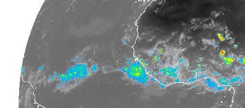
Circulation is visible north of the convection. Convection continues to be related to the ITCZ.
Circulation is visible north of the convection. Convection continues to be related to the ITCZ.
0 likes
-
AtlanticWind
- S2K Supporter
- Posts: 1898
- Age: 67
- Joined: Sun Aug 08, 2004 9:57 pm
- Location: Plantation,Fla
Re: Tropical Wave SW of the Cape Verde Islands
http://www.ssd.noaa.gov/goes/east/catl/loop-rgb.html
Convection starting to reach alittle further north , I think this one could have a chance at forming in the next 2-4 days
Convection starting to reach alittle further north , I think this one could have a chance at forming in the next 2-4 days
0 likes
-
Ed Mahmoud
Re: Tropical Wave SW of the Cape Verde Islands
Ok, it is the Canadian Global, but it says this very little wave hits the Northeast Caribbean next Thursday...

0 likes

-
cycloneye

- Admin

- Posts: 149504
- Age: 69
- Joined: Thu Oct 10, 2002 10:54 am
- Location: San Juan, Puerto Rico
Re: Tropical Wave SW of the Cape Verde Islands
They haved been running tests on this wave since 00z last night.This is AL88,not official invest.
BEGIN
HPC
invest_al882008.invest
FSTDA
R
U
040
010
0000
200808081827
NONE
NOTIFY=ATRP
END
TEST, AL, L, , , , , 88, 2008, TD, O, 2008080818, 9999999999, , , , , , METWATCH, , AL882008
AL, 88, 2008080800, , BEST, 0, 123N, 324W, 25, 1005, TD, 0, , 0, 0, 0, 0,
AL, 88, 2008080806, , BEST, 0, 123N, 333W, 25, 1005, TD, 0, , 0, 0, 0, 0,
AL, 88, 2008080812, , BEST, 0, 123N, 342W, 25, 1005, TD, 0, , 0, 0, 0, 0,
AL, 88, 2008080818, , BEST, 0, 123N, 352W, 25, 1005, TD, 34, NEQ, 0, 0, 0, 0, 1008, 150, 0, 0, 0,
ftp://ftp.tpc.ncep.noaa.gov/atcf/tcweb/
0 likes

-
Mecklenburg
Re: Tropical Wave SW of the Cape Verde Islands
AtlanticWind wrote:http://www.ssd.noaa.gov/goes/east/catl/loop-rgb.html
Convection starting to reach alittle further north , I think this one could have a chance at forming in the next 2-4 days
not until it develops a low i think...
0 likes
-
AtlanticWind
- S2K Supporter
- Posts: 1898
- Age: 67
- Joined: Sun Aug 08, 2004 9:57 pm
- Location: Plantation,Fla
Re: Tropical Wave SW of the Cape Verde Islands
...TROPICAL WAVES...
A LOW AMPLITUDE TROPICAL WAVE IS ALONG 31/32W S OF 16N MOVING W
AROUND 15 KT. 850 MB SATELLITE DERIVED VORTICITY AND THE
MIMIC-TPW FROM CIMSS SUPPORT THE WAVE POSITION. A CYCLONIC
TURNING IS SEEN ALONG THE WAVE AXIS NEAR 11N. SCATTERED MODERATE
CONVECTION IS MAINLY AHEAD OF THE WAVE AND NEAR THE INTERSECTION
OF THE WAVE AND THE ITCZ FROM 6N-10N BETWEEN 32W-40W. SCATTERED
SHOWERS ARE NEAR 11N32W.
0 likes
-
Mecklenburg
Re: Tropical Wave SW of the Cape Verde Islands
hmmm... my hopes are high on this one, also to the next weak about to emerge of africa... 
0 likes
-
Mecklenburg
Re: Tropical Wave SW of the Cape Verde Islands
looks pretty measly right now, though SAL is evaporating, what about the shear around this sytem?
0 likes
-
Category 5

- Category 5
- Posts: 10074
- Age: 36
- Joined: Sun Feb 11, 2007 10:00 pm
- Location: New Brunswick, NJ
- Contact:
Re: Tropical Wave SW of the Cape Verde Islands
Mecklenburg wrote:looks pretty measly right now, though SAL is evaporating, what about the shear around this sytem?

0 likes
-
Mecklenburg
Re: Tropical Wave SW of the Cape Verde Islands
Category 5 wrote:Mecklenburg wrote:looks pretty measly right now, though SAL is evaporating, what about the shear around this sytem?
not too bad... i give it a chance..
0 likes
Who is online
Users browsing this forum: No registered users and 173 guests