pattern change?:HPC extended forecast
Moderator: S2k Moderators
Forum rules

The posts in this forum are NOT official forecasts and should not be used as such. They are just the opinion of the poster and may or may not be backed by sound meteorological data. They are NOT endorsed by any professional institution or STORM2K. For official information, please refer to products from the National Hurricane Center and National Weather Service.
-
weatherwindow

- Category 4

- Posts: 904
- Joined: Mon Sep 20, 2004 9:48 am
- Location: key west/ft lauderdale
pattern change?:HPC extended forecast
per the HPC........valid 14aug-17aug......"leading to a retrogression of a trough, previously out east, back into the mid-mississippi and lower ohio valley. the height fields for this trough are 3-4 standard deviations below normal for aug...very similiar to the early to mid august 2004 pattern. this trough pumps up the ridge in the western atlantic enough to allow for the possibility of a tropical disturbance near the greater antilles/caribbean http://www.hpc.ncep.noaa.gov/preepd/preepd.html
0 likes
-
weatherwindow
- Category 4
- Posts: 904
- Joined: Mon Sep 20, 2004 9:48 am
- Location: key west/ft lauderdale
Re: pattern change?:HPC extended forecast
the significance of the above forecast...for the first time in some weeks, the axis of the longwave trough, which has been a semi permanent fixture along the eastern seaboard, will retrograde to a midcontinental position....with the resultant bump in western atlantic ridging...it remains to be seen whether this will, indeed, mark a pattern change which may impact the remainder of the atlantic season or just a short term deviation from the norm...rich
0 likes
-
x-y-no

- Category 5

- Posts: 8359
- Age: 65
- Joined: Wed Aug 11, 2004 12:14 pm
- Location: Fort Lauderdale, FL
Re: pattern change?:HPC extended forecast
weatherwindow wrote:per the HPC........valid 14aug-17aug......"leading to a retrogression of a trough, previously out east, back into the mid-mississippi and lower ohio valley. the height fields for this trough are 3-4 standard deviations below normal for aug...very similiar to the early to mid august 2004 pattern. this trough pumps up the ridge in the western atlantic enough to allow for the possibility of a tropical disturbance near the greater antilles/caribbean http://www.hpc.ncep.noaa.gov/preepd/preepd.html
Huh ... I really don't want to hear about a 2004 like pattern just as the wave train gets going ... 2004 was an ugly year for Florida.
0 likes
-
DESTRUCTION5

- Category 5
- Posts: 4430
- Age: 44
- Joined: Wed Sep 03, 2003 11:25 am
- Location: Stuart, FL
Re: pattern change?:HPC extended forecast
x-y-no wrote:weatherwindow wrote:per the HPC........valid 14aug-17aug......"leading to a retrogression of a trough, previously out east, back into the mid-mississippi and lower ohio valley. the height fields for this trough are 3-4 standard deviations below normal for aug...very similiar to the early to mid august 2004 pattern. this trough pumps up the ridge in the western atlantic enough to allow for the possibility of a tropical disturbance near the greater antilles/caribbean http://www.hpc.ncep.noaa.gov/preepd/preepd.html
Huh ... I really don't want to hear about a 2004 like pattern just as the wave train gets going ... 2004 was an ugly year for Florida.
I just thought about this, same strong trough that ate up charley out there right now, followed by the monster ridge that lasted thru Sept 04...I was in Western NC this week and it was 52 for a low in august...Not very typical for a trough this strong for this time of year...
0 likes

Re: pattern change?:HPC extended forecast
Discussion from one of the METs at the Central Florida Hurricane Center:
There are some intriguing changes suggested by the balance of the Global numerical models, regarding the orientation of the long wave features from the Pacific, across north America, and into the western-central Atlantic at mid latitudes.
Currently, the North Atlantic Oscillation is rising very fast; it has recovered nearly 1 Standard Deviation in just less than a week, and continues to rise. The 7 and 7-10 day outlooks regarding this index suggests that it will rise to approximately +.5 SD, or a total recovery of nearly 1.5! Normally in the summer time, subtle changes in this index will have less correlation to patterns at middle latitudes, do to a typically more nebular flow (short wave lengths among a weaker gradient field). However, we have been running along with anomalously strong gradients this summer, which has kept both the wave lengths a bit longer than usual, but also has provided for steeper gradients in the overall geopotential medium. If you understand the NAO (read primer above if you do not), a positive NAO correlates to a strengthening of the subtropical ridge in the western/central Atlantic Basin.
In simpler terms, the flow thus far this season has been more amplified than normal, and that opens the suggestion to being more sensitive to changes in the NAO. That said, a 1.5 modality in the index is fairly significant during any time so one would expect a flow morphology away from the recent eastern N/A trough plague, to take place at middle latitudes. What we are seeing is, thus, a retrograde in the trough axis longitude, to roughly the Great Lakes and Mississippi Valley areas, for the middle and extended range - again, a pleasing fit for a rising NAO. This opens a lot of questions and concerns regarding longer term steering fields, to put it conservatively.
This is important because as we head into what appears more and more likely to be an active period in the 2008 hurricane season, we would like to have some intuitive idea on what that may mean, and for whom. The strengthening plausibility in the subtropical ridge nearing mid month is physically being modeled by most operational Global numerical models, but also in their ensemble means (which makes sense in the latter for the GFS, considering that the NAO index is computed off the ensemble mean). That is why seeing these waves develop and push mightily in to the Puerto Rican archipelago and/or Caribbean and Bahamas should be raising eyebrows.
Another clue as to the potentially active interval nearing in this season is the MJO related 200mb level vertical velocity anomalies. We can see that the entire Basin has lost the DVM (Downward Vertical Motion) anomalies, and has replaced the region by neutral to UVM (Upward Vertical Motion) potential. This upward motion is a reflection of strengthening anticyclonic motions in the upper levels, and the restoring force for outward motion at those levels is upwelling as a mean tendency - hence the UVM anomaly potential.
What all this means in totality is that, yes...INDEED, things should be getting active in a hurry. It would not shock this Meteorologist to see several concurrent cyclones generated during the next 2 week interval of time. And, it wouldn't be too absurd to at least consider threats to the Islands and Mainland of the U.S., given the fairly obvious paradigm shift in the pattern as discussed above.
0 likes
-
canetracker

- S2K Supporter

- Posts: 751
- Age: 63
- Joined: Wed Jul 27, 2005 8:49 pm
- Location: Suburbia New Orleans...Harahan, LA
Re: pattern change?:HPC extended forecast
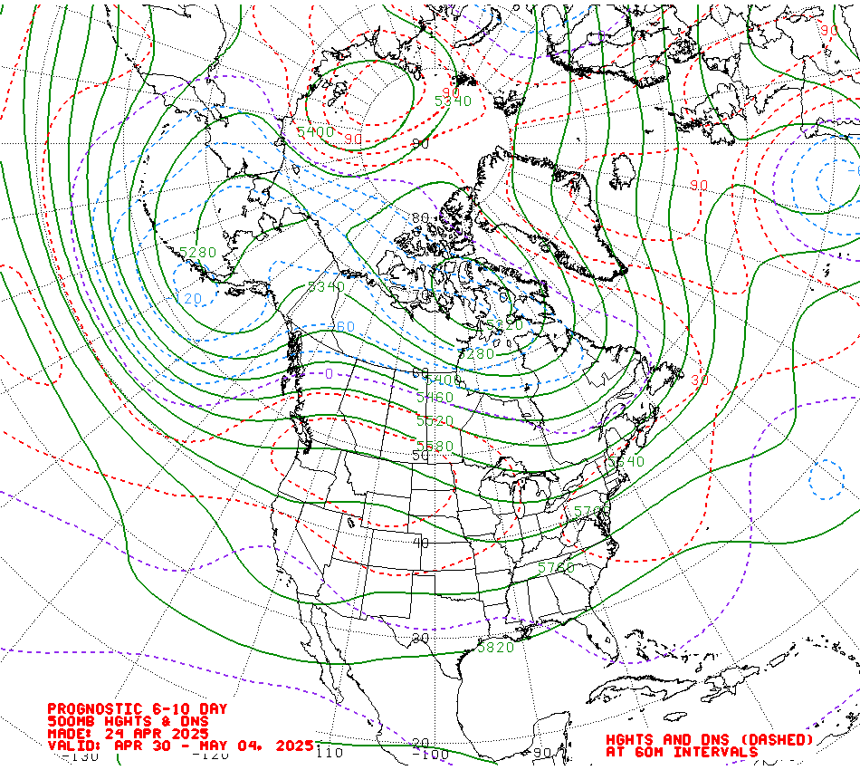
http://www.hpc.ncep.noaa.gov/medr/day6nav.html
Interesting graphic model from the HPC
Interesting graphic model from the HPC
0 likes
-
x-y-no
- Category 5
- Posts: 8359
- Age: 65
- Joined: Wed Aug 11, 2004 12:14 pm
- Location: Fort Lauderdale, FL
Re: pattern change?:HPC extended forecast
ronjon wrote:Discussion from one of the METs at the Central Florida Hurricane Center:
Two things:
The amount you quoted goes rather beyond fair use.
It's unclear that the author is a meteorologist. Note from their About Us page:
It is important to note we are not Meteorologists, and this is not an official source of information.
0 likes
-
stormchazer

- Category 5
- Posts: 2462
- Joined: Fri Aug 29, 2003 12:00 pm
- Location: Lakeland, Florida
- Contact:
Re: pattern change?:HPC extended forecast
I disagree. You have to read the whole discussion to get value from it.
Also, the author has been verified to be a Meteorologist by the Admins at CFHC in much the same way, the storm2k Admins certify those identified on this site. The line you quoted is the standard disclaimer they use, just like we have one here at S2K.
Also, the author has been verified to be a Meteorologist by the Admins at CFHC in much the same way, the storm2k Admins certify those identified on this site. The line you quoted is the standard disclaimer they use, just like we have one here at S2K.
0 likes
Re: pattern change?:HPC extended forecast
good find ronjon, eyes will be peeled a little more than usual.
0 likes
-
SouthFloridawx

- S2K Supporter
- Posts: 8346
- Age: 47
- Joined: Tue Jul 26, 2005 1:16 am
- Location: Sarasota, FL
- Contact:

Jeff Masters mentioned this today.
Major shift in steering currents coming
As I discussed in last week's blog on steering currents, the hurricane steering pattern for all of July and the first two weeks of August over the North Atlantic has predominantly acted to recurve hurricanes out to sea. The jet stream has been "stuck" in a standing wave pattern, where it dips southward over the East Coast of the U.S., creating a trough of low pressure capable of recurving tropical storms once they get north of the Caribbean Sea (20° latitude). This pattern is in contrast to the steering pattern that set up in 2004 and 2005, when a ridge of high pressure set got stuck over the Eastern U.S. A ridge in this location does not allow hurricanes to recurve, and the U.S. took a terrific battering those years.
This year's steering pattern is about to make a major shift towards the steering pattern observed in 2004 and 2005. According to recent 500 millibar (mb) upper-air forecasts from the GFS model. and ECMWF model, the trough of low pressure over the U.S. East Coast will be replaced by a ridge of high pressure 7-10 days from now. As a result, the surface Bermuda High will extend far to the west over the Eastern U.S. This pattern will mean that fewer hurricanes will be recurving beginning a week from now, and the threat to the U.S. Gulf Coast will increase. Conversely, the threat to Bermuda and the Northeast U.S. will diminish.
There is no way of telling how long this new steering pattern might stay in place. It could last only a few days, or remain in place for several months.
http://www.wunderground.com/blog/JeffMasters/comment.html?entrynum=1019&tstamp=200808
0 likes
Who is online
Users browsing this forum: No registered users and 219 guests