She's generated a flawless looking outflow canopy over the last few hours. Based on the persistent nature of the southern blob of convection, I believe we finally have ourselves a "runaway" here.Aric Dunn wrote:check out how fast that upper low is moving out of the way now.. upper environment should be great for the next couple of days
ATL: Tropical Depression Fay
Moderator: S2k Moderators
-
Honeyko
Re:
0 likes
-
cycloneye

- Admin

- Posts: 149325
- Age: 69
- Joined: Thu Oct 10, 2002 10:54 am
- Location: San Juan, Puerto Rico
Re: ATL: Invest 92L - TCFA re-issued
Here waiting for the TWO.It will be interesting to see what they will say.
0 likes
-
Evil Jeremy

- S2K Supporter

- Posts: 5463
- Age: 32
- Joined: Mon Apr 10, 2006 2:10 pm
- Location: Los Angeles, CA

-
Matt-hurricanewatcher
Re:
Evil Jeremy wrote:I say that we get an upgrade from orange to red at 2 AM.
I agree, because there is something trying to get going. I would say no higher then 3,000 feet up based on those clouds...Also, I think the overall circulation shows that it is very sharp if it don't have a LLC at the surface.
0 likes
-
Honeyko
Sneaking hunch: If recon goes chasing after a surface whorl off the southern end of the convection, they're going to get faked out just like Debby did to 'em off the Yucatan. My guess is that a small, tight mid-level center has developed inside the roundish southern cell, and will dig down and intensify quickly the moment it reaches the surface.
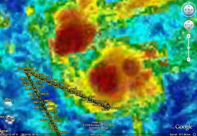
18N/59W, smack center of that tower, me says....
18N/59W, smack center of that tower, me says....
0 likes
-
Honeyko
Re:
Er, yeah. Derek and I were just talking about the other one a few pages ago.HURAKAN wrote::uarrow: You mean Dolly, right? Last Debby was in 2006. Similar to 92L in 2000.
(While a Hispaniola gutting is a distinct possibility, there are fewsimilarities between 92 and Debby environment-wise.)

0 likes


-
Aric Dunn
- Category 5

- Posts: 21238
- Age: 43
- Joined: Sun Sep 19, 2004 9:58 pm
- Location: Ready for the Chase.
- Contact:
Re: ATL: Invest 92L - TCFA re-issued
nice burst its pretty large burst ...
thats what 2hours has done to it...


thats what 2hours has done to it...
0 likes
-
HURAKAN

- Professional-Met

- Posts: 46084
- Age: 39
- Joined: Thu May 20, 2004 4:34 pm
- Location: Key West, FL
- Contact:
951
ABNT20 KNHC 140558
TWOAT
TROPICAL WEATHER OUTLOOK
NWS TPC/NATIONAL HURRICANE CENTER MIAMI FL
200 AM EDT THU AUG 14 2008
FOR THE NORTH ATLANTIC...CARIBBEAN SEA AND THE GULF OF MEXICO...
 AN AREA OF LOW PRESSURE ASSOCIATED WITH A TROPICAL WAVE IS
CENTERED ABOUT 175 MILES EAST OF THE LEEWARD ISLANDS AND IS MOVING
GENERALLY WESTWARD AT ABOUT 10 MPH. THE SHOWERS AND THUNDERSTORMS
ACCOMPANYING THIS SYSTEM HAVE BECOME A LITTLE MORE CONCENTRATED
DURING THE PAST SEVERAL HOURS. UPPER-LEVEL WINDS ARE GRADUALLY
BECOMING MORE CONDUCIVE FOR DEVELOPMENT...AND THIS SYSTEM COULD
BECOME A TROPICAL DEPRESSION TODAY OR ON FRIDAY AS IT MOVES OVER OR
JUST NORTH OF THE NORTHERN LEEWARD ISLANDS. AN AIR FORCE RESERVE
RECONNAISSANCE AIRCRAFT IS SCHEDULED TO INVESTIGATE THIS SYSTEM
LATER TODAY...IF NECESSARY.
A VERY BROAD AREA OF LOW PRESSURE IS LOCATED ABOUT 1350 MILES EAST
OF THE LESSER ANTILLES. SHOWER ACTIVITY ASSOCIATED WITH THIS
SYSTEM REMAINS LIMITED AND DISORGANIZED AND DEVELOPMENT...IF
ANY...IS EXPECTED TO BE SLOW TO OCCUR AS THE SYSTEM CONTINUES
MOVING SLOWLY WESTWARD.
ELSEWHERE.. TROPICAL CYCLONE FORMATION IS NOT EXPECTED DURING THE
NEXT 48 HOURS.
$$
FORECASTER KNABB
ABNT20 KNHC 140558
TWOAT
TROPICAL WEATHER OUTLOOK
NWS TPC/NATIONAL HURRICANE CENTER MIAMI FL
200 AM EDT THU AUG 14 2008
FOR THE NORTH ATLANTIC...CARIBBEAN SEA AND THE GULF OF MEXICO...
CENTERED ABOUT 175 MILES EAST OF THE LEEWARD ISLANDS AND IS MOVING
GENERALLY WESTWARD AT ABOUT 10 MPH. THE SHOWERS AND THUNDERSTORMS
ACCOMPANYING THIS SYSTEM HAVE BECOME A LITTLE MORE CONCENTRATED
DURING THE PAST SEVERAL HOURS. UPPER-LEVEL WINDS ARE GRADUALLY
BECOMING MORE CONDUCIVE FOR DEVELOPMENT...AND THIS SYSTEM COULD
BECOME A TROPICAL DEPRESSION TODAY OR ON FRIDAY AS IT MOVES OVER OR
JUST NORTH OF THE NORTHERN LEEWARD ISLANDS. AN AIR FORCE RESERVE
RECONNAISSANCE AIRCRAFT IS SCHEDULED TO INVESTIGATE THIS SYSTEM
LATER TODAY...IF NECESSARY.
A VERY BROAD AREA OF LOW PRESSURE IS LOCATED ABOUT 1350 MILES EAST
OF THE LESSER ANTILLES. SHOWER ACTIVITY ASSOCIATED WITH THIS
SYSTEM REMAINS LIMITED AND DISORGANIZED AND DEVELOPMENT...IF
ANY...IS EXPECTED TO BE SLOW TO OCCUR AS THE SYSTEM CONTINUES
MOVING SLOWLY WESTWARD.
ELSEWHERE.. TROPICAL CYCLONE FORMATION IS NOT EXPECTED DURING THE
NEXT 48 HOURS.
$$
FORECASTER KNABB
0 likes
-
Evil Jeremy
- S2K Supporter
- Posts: 5463
- Age: 32
- Joined: Mon Apr 10, 2006 2:10 pm
- Location: Los Angeles, CA
Who is online
Users browsing this forum: No registered users and 46 guests