East atlantic

This is the general tropical discussion area. Anyone can take their shot at predicting a storms path.

Moderator: S2k Moderators

Forum rules

The posts in this forum are NOT official forecasts and should not be used as such. They are just the opinion of the poster and may or may not be backed by sound meteorological data. They are NOT endorsed by any professional institution or STORM2K. For official information, please refer to products from the National Hurricane Center and National Weather Service.

Help Support Storm2K
Message
Author
chadtm80

East atlantic

#1 Postby chadtm80 » Sat Jul 12, 2003 5:32 pm

0 likes   

User avatar
cycloneye
Admin
Admin
Posts: 145308
Age: 68
Joined: Thu Oct 10, 2002 10:54 am
Location: San Juan, Puerto Rico

#2 Postby cycloneye » Sat Jul 12, 2003 5:42 pm

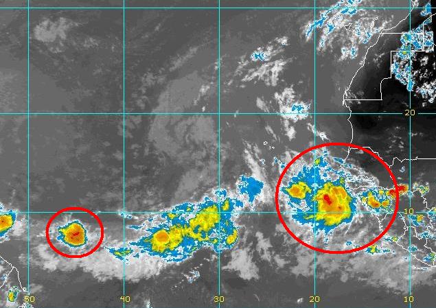
Chad there is a big turning in the stratus clouds around 17n-33w west of the cape verde islands but you have to look it close because it is void of deep convection.Ummm that wave off africa looks good but will it survive is the question as dry air and climatology are against in july normally.
0 likes   
Visit the Caribbean-Central America Weather Thread where you can find at first post web cams,radars
and observations from Caribbean basin members Click Here

chadtm80

#3 Postby chadtm80 » Sat Jul 12, 2003 5:43 pm

0 likes   

User avatar
cycloneye
Admin
Admin
Posts: 145308
Age: 68
Joined: Thu Oct 10, 2002 10:54 am
Location: San Juan, Puerto Rico

#4 Postby cycloneye » Sat Jul 12, 2003 5:48 pm

Anyone has information about models jumping on atlantic in comming days?
0 likes   
Visit the Caribbean-Central America Weather Thread where you can find at first post web cams,radars
and observations from Caribbean basin members Click Here


Return to “Talkin' Tropics”

Who is online

Users browsing this forum: Cpv17, duilaslol, MONTEGUT_LA, Ulf and 48 guests