ATL: Tropical Depression Fay
Moderator: S2k Moderators

Re: ATL: Tropical Storm Fay
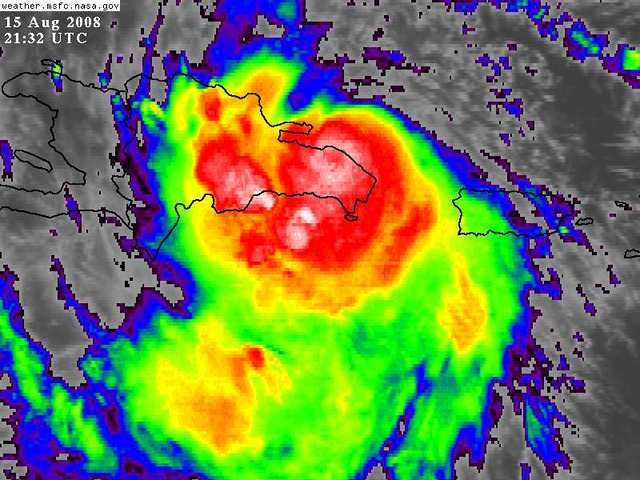
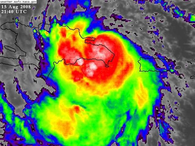
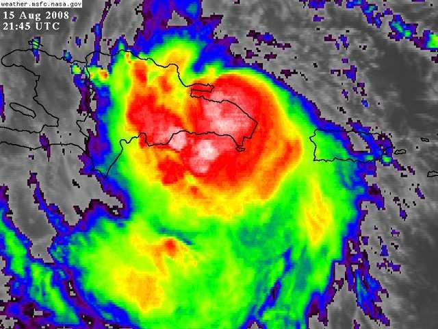
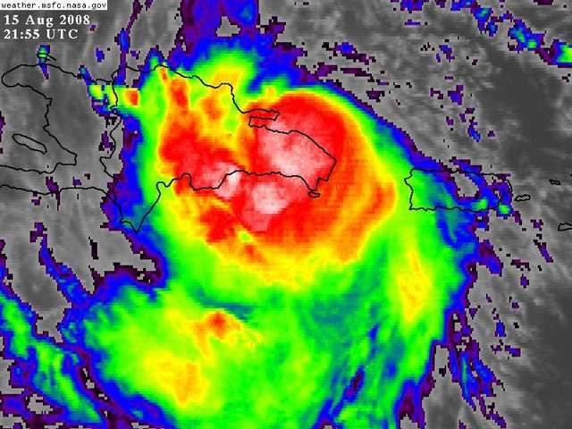
Rainfall is gonna be deadly for Hispanola....seems like Fay is deepening for some odd reason despite being over DR. Satellite presentation has only improved since it came ashore.
0 likes
-
DESTRUCTION5

- Category 5

- Posts: 4430
- Age: 44
- Joined: Wed Sep 03, 2003 11:25 am
- Location: Stuart, FL
Re:
Vortex wrote:my concern for the peninsula would be a cleo type track feeding off the extremely high oceanic heat content just south of cuba then a north turn up the spine..
http://en.wikipedia.org/wiki/Image:Cleo_1964_track.png
She's feeding on something right now Vortex..LOL
0 likes

-
Dean4Storms
- S2K Supporter

- Posts: 6358
- Age: 63
- Joined: Sun Aug 31, 2003 1:01 pm
- Location: Miramar Bch. FL
Re:
Vortex wrote:my concern for the peninsula would be a cleo type track feeding off the extremely high oceanic heat content just south of cuba then a north turn up the spine..
http://en.wikipedia.org/wiki/Image:Cleo_1964_track.png
Actually thats the BEST case to happen, it'd only get about 12hrs over water in Cuba which won't be enough time to totally sort out its core again after being over DR for 24hrs or so, then back over Cuba which will maybe only slightly weaken it then another 18hrs of maybe quick strengthening possibly to strong TS strength...much better option then going west, getting 24hrs over water before Cuba, then another 2-3 days over the loop current as well.
0 likes
-
Shockwave
- Tropical Storm

- Posts: 167
- Joined: Fri Jul 25, 2008 7:33 am
- Location: Lafayette, TN
- Contact:
Re: ATL: Tropical Storm Fay
With this thing still bursting convection, the more time over the waters could only mean ONE thing...a rapid intensification process and possibly major hurricane status. Are most of the models leaning towards a gulf tracker or are they 50 gulf/50 florida? The bad thing is, is that this will affect the US in some shape form or fashion.
0 likes

Re: ATL Invest 92L Pet and Wildlife Reactions
greels wrote:artist,
I am involved in Disaster Management here where I live in the Turks & Caicos. I had prior experience in DM back in the States where I hail from (New England) and now with a different flair, this being the Caribbean where we live.
At a recent seminar I attended which was hosted by USAID, the subject of animal behavior prior to a weather event (more speciafically disasters in this instance)was discussed at length.....it made mention (of course) of the tsunami several years back and also, on patterns of animal behavior which have been observed prior to earthquakes. It is said the animals' behavior is a type of "sixth sense" which we humans have somehow lost.
There are currently some studies underway on animal behavior in these types of situations, but nothing is "set-in-stone". So, you are definately on to something....
The threat to us here in the T&C is now over (for this storm at least) and I wish everyone to be safe and well in the path of Fay.
greels, how interesting! I do seem to recall how the elephants sought higher ground or something along those lines with the tsunami. I don't doubt we have lost that sense ourselves sinc ewe have the NHC, etc., etc. to rely on anymore rather than ourselves. It's kind of sad in a way. To have the USAID to bring it up makes me think we do need to study it further. So glad you are safe now, just remember things can still change and it is just close enough to you to keep your eye out.
LSU - now that is funny!
0 likes
-
Dean4Storms
- S2K Supporter
- Posts: 6358
- Age: 63
- Joined: Sun Aug 31, 2003 1:01 pm
- Location: Miramar Bch. FL
-
OuterBanker
- S2K Supporter
- Posts: 1761
- Joined: Wed Feb 26, 2003 10:53 am
- Location: Nags Head, NC
- Contact:
Re: ATL: Tropical Storm Fay
Wow, just returned from vet. Really like tpc track. Only a ts through Fl and probably providing much needed rains in se. Great scenario.
0 likes
-
fasterdisaster
- Category 5
- Posts: 1868
- Joined: Mon Sep 19, 2005 4:41 pm
- Location: Miami, Florida
-
txwatcher91
- Category 5
- Posts: 1498
- Joined: Tue Aug 02, 2005 2:29 pm
-
HURAKAN

- Professional-Met

- Posts: 46084
- Age: 39
- Joined: Thu May 20, 2004 4:34 pm
- Location: Key West, FL
- Contact:
Re: ATL: Tropical Storm Fay
OuterBanker wrote:Wow, just returned from vet. Really like tpc track. Only a ts through Fl and probably providing much needed rains in se. Great scenario.
60-knot TS.
0 likes

Re: ATL: Tropical Storm Fay
HURAKAN wrote:OuterBanker wrote:Wow, just returned from vet. Really like tpc track. Only a ts through Fl and probably providing much needed rains in se. Great scenario.
60-knot TS.
But if it was 65 knots, the reaction would be OH MY GOD A HURRICANE INTO FLORIDA!!!. But its "only" a tropical storm.
0 likes
-
Evil Jeremy

- S2K Supporter
- Posts: 5463
- Age: 32
- Joined: Mon Apr 10, 2006 2:10 pm
- Location: Los Angeles, CA
Re: ATL: Tropical Storm Fay Pet and Wildlife Reactions
Artist,,,,,
Exactly! The reason why this was pointed out to us,in particular, is that we do not have the all the "tools " you folks have back in the States to give us the immediate weather data we might like to have...the majority of the population here does not have access to internet, much less some of them....televisions...so...when it's back to the very basics...."watch the animals" so to speak .....
Exactly! The reason why this was pointed out to us,in particular, is that we do not have the all the "tools " you folks have back in the States to give us the immediate weather data we might like to have...the majority of the population here does not have access to internet, much less some of them....televisions...so...when it's back to the very basics...."watch the animals" so to speak .....
0 likes
Who is online
Users browsing this forum: No registered users and 16 guests