ATL: Tropical Depression Fay
Moderator: S2k Moderators
-
CalmBeforeStorm

- Category 2

- Posts: 600
- Age: 72
- Joined: Tue Aug 10, 2004 7:55 pm
- Location: Stuart, Florida
Re: ATL: Tropical Storm Fay South of Cuba
Well, I'll tell ya. that Fay's organization is excellent considering the shear and proximity to land. If the shear abates when/after she crosses Cuba she has the core to intensify quite well, particularly if she slows down. I think the NHC is a bit too far west, but only by 25 - 30 miles or so, but that Euro solution concerns me a bit. Question is, does the guidance shift right again? Similar situation as Charley as far as track is concerned, but I think she will certainly not get that intense. She really is bigger than Charley, looking at the overall envelope. Therefore it will take her a bit longer to tighten up. Interesting days ahead - HPC even looking at the cyclone potential for next weekend already. 
0 likes
-
TCmet
- Professional-Met

- Posts: 106
- Age: 45
- Joined: Sat Jul 14, 2007 4:00 pm
- Location: New York, NY
- Contact:
Re: ATL: Tropical Storm Fay South of Cuba
Hurricanewatcher2007 wrote:Based on where recon found the center looks like it has moved a little south of due west to me!
Dropsonde Diagram:
1st fix might have been a bit too far south.
2nd fix looked to be right on.
3rd (most recent) fix was again too far south, IMO (dropsonde had 12kt wind at splashdown).
Path is still a tad south, but mostly west of NHC 11am track. Motion is about 300.
0 likes

Re: ATL: Tropical Storm Fay South of Cuba
So now that South FL isn't in the cone (Eastern Side) would it be safe to assume that the watches will not become warnings?
0 likes
-
johngaltfla

- Category 5

- Posts: 2073
- Joined: Sun Jul 10, 2005 9:17 pm
- Location: Sarasota County, FL
- Contact:
Re: ATL: Tropical Storm Fay South of Cuba
Steve H. wrote:Well, I'll tell ya. that Fay's organization is excellent considering the shear and proximity to land. If the shear abates when/after she crosses Cuba she has the core to intensify quite well, particularly if she slows down. I think the NHC is a bit too far west, but only by 25 - 30 miles or so, but that Euro solution concerns me a bit. Question is, does the guidance shift right again? Similar situation as Charley as far as track is concerned, but I think she will certainly not get that intense. She really is bigger than Charley, looking at the overall envelope. Therefore it will take her a bit longer to tighten up. Interesting days ahead - HPC even looking at the cyclone potential for next weekend already.
If she crosses Cuba with an intact inner core, I think we are looking at a repeat of C, not quite in intensity (but who knows) but definitely on a similar path.
Once again, I think the 0500 NHC update is the big one for the West Coast of Florida. Your concerns are exactly mine as we dodged a bullet with Charley and I pray we do again....
0 likes
-
Ground_Zero_92

- S2K Supporter

- Posts: 292
- Joined: Thu Sep 04, 2003 11:23 am
- Location: South Hutchinson Island / Stuart, FL
Re: ATL: Tropical Storm Fay South of Cuba
IMO, it's too early to make that assumption. I think the forecast confidence will be better when Fay exits Cuba.
tgenius wrote:So now that South FL isn't in the cone (Eastern Side) would it be safe to assume that the watches will not become warnings?
0 likes
-
CrazyC83
- Professional-Met
- Posts: 34315
- Joined: Tue Mar 07, 2006 11:57 pm
- Location: Deep South, for the first time!
Re: ATL: Tropical Storm Fay South of Cuba
tgenius wrote:So now that South FL isn't in the cone (Eastern Side) would it be safe to assume that the watches will not become warnings?
Depends on the size of the storm after it leaves Cuba. It might be prudent to put up tropical storm warnings in case it grows or shifts back eastward.
0 likes
Its still too soon to discount anywhere in Florida given it may have a slight NNE motion but right now the threat seems to be biggest to the central and northern portions of the western coast of Florida.
Last edited by KWT on Sun Aug 17, 2008 5:03 pm, edited 1 time in total.
0 likes

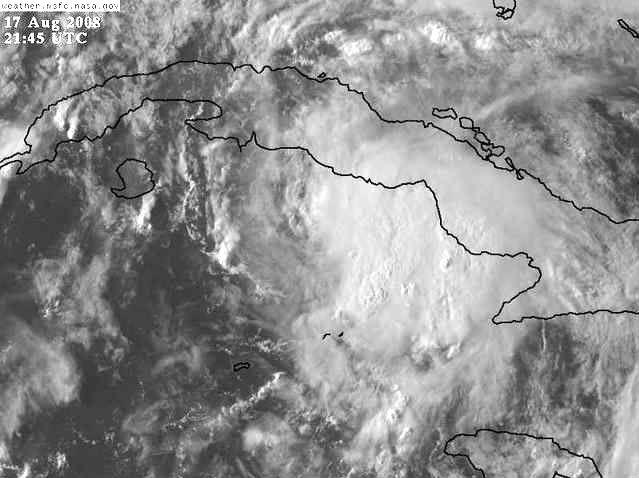
Slowly looking better Hurakan, loops of the Vis imagery also shows that convection is still inching closer to the center as well. I reckon whats helped is the fact that this system has slowed down and thus relative shear has decreased compared to what it was when it was hurtling along at 16-20kts.
0 likes
-
Toyota Thundra
- Tropical Low

- Posts: 33
- Joined: Sat Aug 16, 2008 1:35 am
- Location: Riverview FL
Re: ATL: Tropical Storm Fay South of Cuba
She seems to be trying real hard to close up that core....
EDIT: Beat me to it
EDIT: Beat me to it
0 likes
-
johngaltfla
- Category 5
- Posts: 2073
- Joined: Sun Jul 10, 2005 9:17 pm
- Location: Sarasota County, FL
- Contact:
Re: ATL: Tropical Storm Fay South of Cuba
FWIW, Newschannel 8 in Tampa just showed their VIPIR model which indicated a Manatee County landfall. That is fascinating as it was one of the few that projected a relatively decent path for Charley.
Just a heads up, not a forecast, prediction nor wishcast.
Just a heads up, not a forecast, prediction nor wishcast.
0 likes

-
TCmet
- Professional-Met
- Posts: 106
- Age: 45
- Joined: Sat Jul 14, 2007 4:00 pm
- Location: New York, NY
- Contact:
Re: ATL: Tropical Storm Fay South of Cuba
brand new convective cell just west of the center, per 1km vis. let's see if it holds together.
0 likes

Re: TS Fay Personal forecasts
My post is NOT an official forecast and should not be used as such. They are just the opinion of the poster and may or may not be backed by sound meteorological data. They are NOT endorsed by any professional institution or storm2k.org. For official information, please refer to the NHC and NWS products.
Tropical Storm Fay has 50 mile per hour winds as of Sunday evening and is situated south of the Cuban coastline. Its west-northwest movement has varied during the day but the storm hasn't varied in organization as interaction with the island to its north plus dry air aloft has made this storm quite asymmetrical as the stronger storms are on the eastern side of the storm. Fay should cross Cuba later tonight and by midday Monday be in the Florida straits, southwest of Key West and traversing into the eastern half of the Gulf of Mexico.
While it is true that with tropical systems it is important to focus on the "whole" of the storm and not just the coordinates of where the center/eye are, it is important that in a storm that takes a track such as Fay's that a 20 or 30 mile change in longitude makes all the difference in not only how strong Fay can get but also where Fay's center crosses land. A storm that takes a more northwestward track across the open Gulf and makes landfall in the Florida panhandle will have several more hours over open water to organize and strengthen whereas a storm that comes ashore farther east will have less time to strengthen. In the case of Fay, the whole of Florida will stand to see some significant rainfall. However, where Fay comes ashore is still highly up in the air.
Computer guidance from this afternoon has a large cone of uncertainty over the next two days, with landfall points ranging from Fort Myers to Mobile. Where the uncertainty lies is with the interaction between Fay and two factors. One is an upper level low to its southwest. This low will travel away, which will allow Fay to be pulled towards an upper level trough across the Southeastern US. This trough extends from the Gulf Coast up through the Atlantic off of the Carolinas. Fay will be pulled towards the trough as the trough itself retreats some to the north. How fast this trough lifts north will determine how far west Fay gets and also if there's any slight turn to the north-northeast along the west coast of Florida. A slight turn to the northeast or even northwest changes the final landfall location markedly due to the angle of the Florida coastline.
Final landfall intensity: 75 mph
Final landfall zone of concern: From Apalachicola to Sarasota. Keep in mind that much of Florida will see rain and at least some wind from the storm, with highest impacts nearest to storm center.
More: http://philadelphiaweather.blogspot.com ... n-air.html
0 likes
-
johngaltfla
- Category 5
- Posts: 2073
- Joined: Sun Jul 10, 2005 9:17 pm
- Location: Sarasota County, FL
- Contact:
Re: ATL: Tropical Storm Fay South of Cuba
Steve H. wrote:ok, I apologize, where is Manatee county?
Bradenton, FL is the largest city. It is the county at the southern mouth to Tampa Bay.
0 likes
-
Toyota Thundra
- Tropical Low
- Posts: 33
- Joined: Sat Aug 16, 2008 1:35 am
- Location: Riverview FL
Re: ATL: Tropical Storm Fay South of Cuba
johngaltfla wrote:FWIW, Newschannel 8 in Tampa just showed their VIPIR model which indicated a Manatee County landfall. That is fascinating as it was one of the few that projected a relatively decent path for Charley.
Just a heads up, not a forecast, prediction nor wishcast.
That's something to think about, does any one know the tech, or modeling behind the Vipir data?
Manatee is just south of Tampa, north of Sarasota.
0 likes
-
johngaltfla
- Category 5
- Posts: 2073
- Joined: Sun Jul 10, 2005 9:17 pm
- Location: Sarasota County, FL
- Contact:
Re:
artist wrote:I know VIPIR has not been reliable with other storms though.
No disagreement there. It's moment of glory was 2004. Then again they did just update the software package last year, so we'll see. I do not think any model has a great fix until the storm is north of Cuba. Just my opinion.
0 likes
Who is online
Users browsing this forum: No registered users and 7 guests