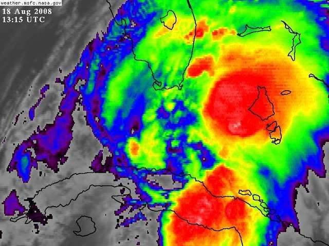
Sanibel wrote:Yeah, that muscular core band is shouting hurricane. All a matter of track now.
Um, it's a couple of rain showers spinning around a weak LLC? Did I miss something?
Moderator: S2k Moderators

Sanibel wrote:Yeah, that muscular core band is shouting hurricane. All a matter of track now.
Sanibel wrote:Yeah, that muscular core band is shouting hurricane. All a matter of track now.
Phoenix's Song wrote:tolakram wrote:
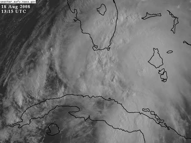
Is that a eye I see?

Phoenix's Song wrote:artist wrote:GreenSky wrote:With that Upper Level Low basically tailgating her, Fay should remain a tropical storm and may even be a weak tropical storm when impacting Florida...Fay is also moving faster and should not be over water for much longer if models keep trending east...in maybe 12 hours all this speculation will cease as Fay makes landfall as a laughable 55mph sheared tropical storm somewhere in the everglades.
correct me if i'm wrong
if she hits the everglades she will probably intensify quickly as most do that hit them.
Katrina weakened over the Everglades.
cpdaman wrote:it's pouring cats and dogs in SE palm beach county, and certainly not too windy now.
watching to see if the rainbands can consolidate and get closer to the recon fixed center.


GreenSky wrote:No, she actually strengthened 5 or 10 mph to a decent 85mph category 1 hurricane while over southwestern Miami-Dade County (aka everglades)


Phoenix's Song wrote:artist wrote:GreenSky wrote:With that Upper Level Low basically tailgating her, Fay should remain a tropical storm and may even be a weak tropical storm when impacting Florida...Fay is also moving faster and should not be over water for much longer if models keep trending east...in maybe 12 hours all this speculation will cease as Fay makes landfall as a laughable 55mph sheared tropical storm somewhere in the everglades.
correct me if i'm wrong
if she hits the everglades she will probably intensify quickly as most do that hit them.
Katrina weakened over the Everglades.
PurdueWx80 wrote:i think the longer-duration loops from college of dupage will help you guys see the several circulation centers better. the old low-level center has been nearly stationary for the last couple of hours, and it seems that the quickly-organizing low- to mid-level center is moving northwest and pulling in the old circulation. there's a lot going on in that loop, as you can see returns going every which way near the center. once these all stack over the next several hours, it looks like there could be some pretty quick organization/intensification.
loop it


Users browsing this forum: No registered users and 14 guests