Bgator wrote:E. 045 deg 57 nm
NNE? Probably just a wobble.
That's not the direction the storm is traveling... Without looking it up, I think it's the direction and distance from the center that the strongest winds were found.
Moderator: S2k Moderators


Bgator wrote:E. 045 deg 57 nm
NNE? Probably just a wobble.


Lifesgud2 wrote:I must say that the wind here in lauderdale is still as can be. I havent seen a gust over 5mph today.

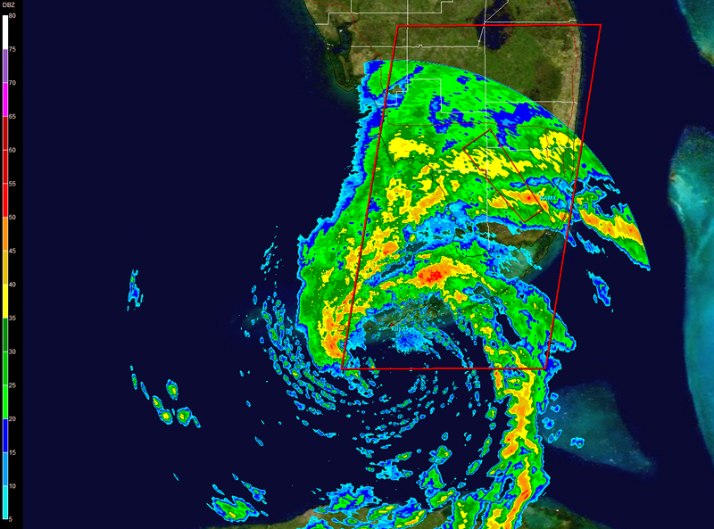
capepoint wrote:Wow, I just got some very useful information from TWC. The live shot from Key West. If that guy would have gotten out from in front of the camera , you could have seen bright skies, near calm winds, and calm water other than a little ground swell rolling in. That and radar basicly shows that there is no real southern portion of this storm. The only real weather is in the storms to the NE quad area. I'm finding it hard to see any real rapid intensifying until it can get some weather on the southern side of center.

Bands are now starting to develop on the south side of the center...capepoint wrote:Wow, I just got some very useful information from TWC. The live shot from Key West. If that guy would have gotten out from in front of the camera , you could have seen bright skies, near calm winds, and calm water other than a little ground swell rolling in. That and radar basicly shows that there is no real southern portion of this storm. The only real weather is in the storms to the NE quad area. I'm finding it hard to see any real rapid intensifying until it can get some weather on the southern side of center.


Users browsing this forum: No registered users and 17 guests