Extratropical1 wrote:So why cant the NHC in all the conference calls tell local officials to stay open dont evacuate and keep schools open if they are so accurate??? The local EOC;s take there word as God and I am on the inside so I know what i am talkin about
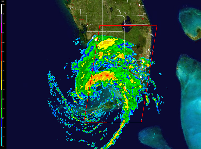
no idea why I am feeding the troll but why in the world would you want people to be stuck in cars with flash flooding going on, power lines crashing, branches and trees falling all around..and that is just from the 40+ mph winds which do extend out over 100 miles....I am just north of Orlando and I am sure glad my child isn't going out on the bus in those conditions