ATL: Tropical Depression Fay

Moderator: S2k Moderators

Message
Author
paintplaye
Category 1
Category 1
Posts: 380
Joined: Sun Jul 20, 2008 11:25 pm

Re: ATL: Tropical Storm Fay in East Coast of Florida

#11281 Postby paintplaye » Wed Aug 20, 2008 1:45 pm

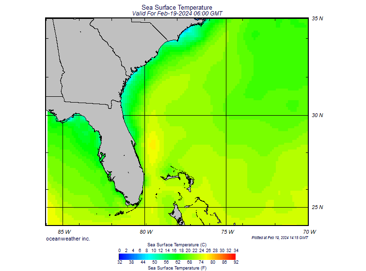
green eyed girl wrote:Do we have any idea when the westward movement should begin?


When it starts moving it should start moving NW-West. The reason it stopped is because the currents that are pushing it are changing. If this thing does not move in the next 5 hours there will be no more of Melbourne to see.
0 likes   

User avatar
KWT
Category 5
Category 5
Posts: 31415
Joined: Tue Aug 17, 2004 11:02 am
Location: UK!!!

#11282 Postby KWT » Wed Aug 20, 2008 1:45 pm

I think the system may well beef up a little today given the heating that should occur inland will help to sharpen the lapse rates, will be interesting to see what happens given this has a broad circulation half over the water now.
0 likes   

User avatar
mutley
S2K Supporter
S2K Supporter
Posts: 311
Joined: Wed Aug 15, 2007 7:18 am
Location: Gainesville, FL

Re:

#11283 Postby mutley » Wed Aug 20, 2008 1:51 pm

KWT wrote:I think the system may well beef up a little today given the heating that should occur inland will help to sharpen the lapse rates, will be interesting to see what happens given this has a broad circulation half over the water now.


If the radar presentation can be believed, Fay seems to have drifted/wobbled east a bit in the last hour, and is now mostly sucking water.
0 likes   

User avatar
wxman57
Moderator-Pro Met
Moderator-Pro Met
Posts: 22987
Age: 67
Joined: Sat Jun 21, 2003 8:06 pm
Location: Houston, TX (southwest)

Re: ATL: Tropical Storm Fay in East Coast of Florida

#11284 Postby wxman57 » Wed Aug 20, 2008 1:53 pm

You might find this comparison of Fay's "eye-like feature" between GOES-12 and GOES-13 interesting. It's a split screen showing the difference in the navigation system on the new GOES-13 satellite. Note the trochoidal motion evident on the GOES-12 image on the left (the wobbling)? Note that it's not there on the GOES-13 image. The apparent wobbling is an artifact caused by the GOES-12 navigation system:

Image
0 likes   

NFLnut
Category 2
Category 2
Posts: 541
Joined: Sun Aug 29, 2004 7:37 pm

Re: ATL: Tropical Storm Fay in East Coast of Florida

#11285 Postby NFLnut » Wed Aug 20, 2008 1:54 pm

cpdaman wrote:
NFLnut wrote:
tolakram wrote:Mercy

http://hadar.cira.colostate.edu/ramsdis ... ive_0.html

Good thing the waters are cool and this is close to shore.


The low sea temps there (upper 60s) are the only good thing, but still .. FAY needs to kick it and getouttahere!


actually water temps did go from 81 to 75 at the inner bouy . crikey what a savior

http://www.ndbc.noaa.gov/station_page.php?station=41009


upper 60's LOL 79 near shore (with gulf stream mid 80's) http://www.ndbc.noaa.gov/station_page.php?station=41113


When I posted that, they were still showing SST's off of NSB/Daytona at upper 60s. There were light greens in that area and down to the Cape. That apparently was from shortly after midnight last night. It's updated now to be in the 70s.


http://www.oceanweather.com/data/SE-US/SST.GIF
0 likes   

CajunMama
Retired Staff
Retired Staff
Posts: 10791
Joined: Thu Feb 06, 2003 9:57 pm
Location: 30.22N, 92.05W Lafayette, LA

#11286 Postby CajunMama » Wed Aug 20, 2008 1:56 pm

Hey wxman57, could be the end of the wobble wars? :lol:
0 likes   

User avatar
wxman57
Moderator-Pro Met
Moderator-Pro Met
Posts: 22987
Age: 67
Joined: Sat Jun 21, 2003 8:06 pm
Location: Houston, TX (southwest)

Re: ATL: Tropical Storm Fay in East Coast of Florida

#11287 Postby wxman57 » Wed Aug 20, 2008 2:03 pm

Here's a shot of the 18Z models (really 12z models that come out at 18Z, I guess). Pretty good consensus. Only HWFI takes the center over water for any length of time.

Image
0 likes   

HurricaneHunter914
Category 5
Category 5
Posts: 4439
Age: 31
Joined: Fri Mar 10, 2006 7:36 pm
Location: College Station, TX

#11288 Postby HurricaneHunter914 » Wed Aug 20, 2008 2:05 pm

http://www.ssd.noaa.gov/goes/flt/t1/loop-vis.html
It might be my eyes, but it looks like she wobbled west on the last few images.
0 likes   

User avatar
KWT
Category 5
Category 5
Posts: 31415
Joined: Tue Aug 17, 2004 11:02 am
Location: UK!!!

#11289 Postby KWT » Wed Aug 20, 2008 2:06 pm

The problem is aren't most of them based off GFS or nogaps data wxman57 or am I totally wrong with that?

The thing that makes me curious is still the ECM, it was one of the better models at forecasting the NNE motion even if it was a little too far to the east to start with.
0 likes   

User avatar
stormy1970al
Tropical Storm
Tropical Storm
Posts: 158
Age: 55
Joined: Sat May 31, 2008 12:54 pm
Location: Fairhope AL

Re: ATL: Tropical Storm Fay in East Coast of Florida

#11290 Postby stormy1970al » Wed Aug 20, 2008 2:07 pm

This is what scares me...If Fay does make it to the GOM will there be enough time to get people prepare along the Gulf Coast. Just with the amount of rain this system has it could mean disaster for those who live in low lying areas along the Gulf Coast.

Each afternoon it has rained at my house and this rain has nothing to do with Fay. The ground is already saturated.
0 likes   

tolakram
Admin
Admin
Posts: 20012
Age: 62
Joined: Sun Aug 27, 2006 8:23 pm
Location: Florence, KY (name is Mark)

Re: ATL: Tropical Storm Fay in East Coast of Florida

#11291 Postby tolakram » Wed Aug 20, 2008 2:08 pm

Precip totals catastrophic.

Image

And it does not appear to be moving.

http://www.wunderground.com/weatherstat ... ?ID=MTRDF1
Image
0 likes   

paintplaye
Category 1
Category 1
Posts: 380
Joined: Sun Jul 20, 2008 11:25 pm

Re: ATL: Tropical Storm Fay in East Coast of Florida

#11292 Postby paintplaye » Wed Aug 20, 2008 2:10 pm

tolakram wrote:Precip totals catastrophic.

Image

And it does not appear to be moving.

http://www.wunderground.com/weatherstat ... ?ID=MTRDF1
Image


Yes I know how they feel. i went through Allison down here in Houston.
0 likes   

User avatar
Lowpressure
S2K Supporter
S2K Supporter
Posts: 2032
Age: 58
Joined: Sun Sep 14, 2003 9:17 am
Location: Charlotte, North Carolina

Re:

#11293 Postby Lowpressure » Wed Aug 20, 2008 2:11 pm

CajunMama wrote:Hey wxman57, could be the end of the wobble wars? :lol:

That aspect of the two satellites was something I had no idea about, very good info.
0 likes   

TideJoe
Tropical Storm
Tropical Storm
Posts: 155
Joined: Fri Aug 15, 2008 1:05 pm

Re: ATL: Tropical Storm Fay in East Coast of Florida

#11294 Postby TideJoe » Wed Aug 20, 2008 2:11 pm

tolakram wrote:Precip totals catastrophic.

Image

And it does not appear to be moving.

http://www.wunderground.com/weatherstat ... ?ID=MTRDF1
Image


Parts of Mobile County got 37+ inches from Danny in 1997.
0 likes   

tolakram
Admin
Admin
Posts: 20012
Age: 62
Joined: Sun Aug 27, 2006 8:23 pm
Location: Florence, KY (name is Mark)

Re: ATL: Tropical Storm Fay in East Coast of Florida

#11295 Postby tolakram » Wed Aug 20, 2008 2:12 pm

Area forecast discussion...corrected wwa section
National Weather Service Melbourne Florida
257 PM EDT Wednesday Aug 20 2008


Discussion...


..extreme flooding danger continuing in south Brevard...
..Travel is not recommended!!!...


Tonight...the center of Tropical Storm Fay continues to drift north
and according to the wind towers at Cape Canaveral...the center was
just along the north side at the coast. However...a convergence
zone continued to the south of the center and was resulting in a
persistent band of showers producing heavy rainfall. Amounts are
being measured in feet...with one report in north Melbourne over 24
inches and several other spots around Melbourne at 16-18 inches.
These rain amounts are easily records and will turn out to be
historical for the local area. The Hydrometeorological Prediction
Center anticipates storm totals near 30 inches in a few spots.


The resulting flooding has produced life threatening flooding in
south Brevard...especially Melbourne...and continues to be the main
hazard in the short term.


The center of Fay is forecast to continue drifting slowly north
through this evening...with a turn to the northwest tonight into the
Volusia County coast.


Stay tuned to the latest statements about what may turn out to be a
historic flood event for south Brevard County.
0 likes   

User avatar
dixiebreeze
S2K Supporter
S2K Supporter
Posts: 5140
Joined: Wed Sep 03, 2003 5:07 pm
Location: crystal river, fla.

Re: ATL: Tropical Storm Fay in East Coast of Florida

#11296 Postby dixiebreeze » Wed Aug 20, 2008 2:17 pm

I do think Fay will be paying us a visit on the Gulf coast. Pressure here is 29.79 and falling.
0 likes   

User avatar
wxman57
Moderator-Pro Met
Moderator-Pro Met
Posts: 22987
Age: 67
Joined: Sat Jun 21, 2003 8:06 pm
Location: Houston, TX (southwest)

Re:

#11297 Postby wxman57 » Wed Aug 20, 2008 2:19 pm

KWT wrote:The problem is aren't most of them based off GFS or nogaps data wxman57 or am I totally wrong with that?

The thing that makes me curious is still the ECM, it was one of the better models at forecasting the NNE motion even if it was a little too far to the east to start with.


Most of the better consensus models incorporate the GFS as a member. Since the GFS has been left of other model guidance, it could be pulling the consensus models too far south. Just a possibility.
0 likes   

Ed1

Re: ATL: Tropical Storm Fay in East Coast of Florida

#11298 Postby Ed1 » Wed Aug 20, 2008 2:20 pm

I'm Apopka, FL

I got .08 inch of rain yesterday and today sofar .18 inch of rain

yesterday graph
Image
0 likes   

User avatar
wxman57
Moderator-Pro Met
Moderator-Pro Met
Posts: 22987
Age: 67
Joined: Sat Jun 21, 2003 8:06 pm
Location: Houston, TX (southwest)

Re: ATL: Tropical Storm Fay in East Coast of Florida

#11299 Postby wxman57 » Wed Aug 20, 2008 2:22 pm

Here's a close-up of my GARP screen with surface plots and visible satellite. Note the WNW winds now at the Shuttle Launch Facility, indicating the center has moved a little north in the past few hours. That observation has been from the ENE all morning. Also note the highest wind I've seen reported so far just offshore - 40 kts.

Image
0 likes   

User avatar
KWT
Category 5
Category 5
Posts: 31415
Joined: Tue Aug 17, 2004 11:02 am
Location: UK!!!

#11300 Postby KWT » Wed Aug 20, 2008 2:25 pm

Yep I think a slight drift north seems to be the best way to describe the current movement.

Also that 40kts being recorded would support obviously 40kts :D
0 likes   


Return to “2008”

Who is online

Users browsing this forum: No registered users and 5 guests