ATL: Tropical Depression Fay
Moderator: S2k Moderators

-
paintplaye
- Category 1

- Posts: 380
- Joined: Sun Jul 20, 2008 11:25 pm
Re:
hiflyer wrote:Just about no movement last 2 hrs...one foot in the atlantic and the other in the gulf and pretty much stationary throwing up rain from South Carolina to South Florida....
She saw the gulf so she stopped. What do you expect.
0 likes
-
Frank P
- S2K Supporter

- Posts: 2779
- Joined: Fri Aug 29, 2003 10:52 am
- Location: Biloxi Beach, Ms
- Contact:
Re: ATL: Tropical Storm Fay over northern Florida Penninsula
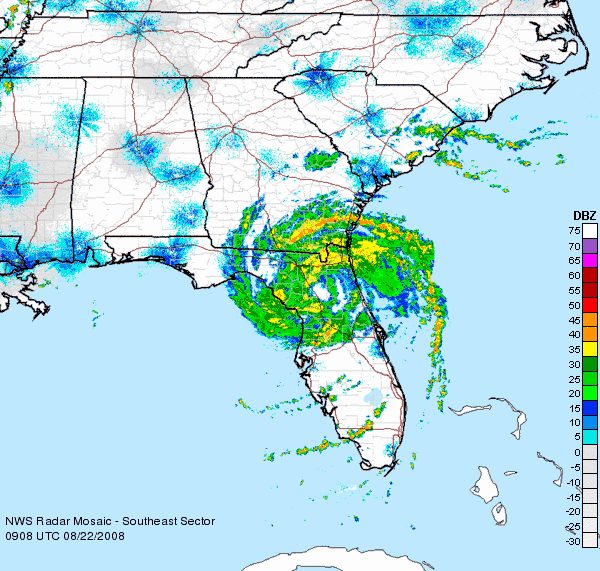
got up to finally see her moving.. radar pix ATTM doesn't look all that bad... COC looks quite well as does her overall signature, not bad for half of this system being over land for almost two days I might add, actually the best I've seem the center in quite some time.. at least from this link - movement appears north of due west or might be wnw
http://my.sfwmd.gov/portal/page?_pageid ... ema=PORTAL
http://my.sfwmd.gov/portal/page?_pageid ... ema=PORTAL
0 likes

Seemingly such a large swing between the north and south part of that cone. To the naked eye, a touch above the line means a dying tropical depression mostly over land. A touch below and all bets are off. However, he 5AM discussion mentions this variance:
IF FAY MOVES TO THE RIGHT OF THE FORECAST TRACK...IT WILL MOVE INLAND EARLIER AND WEAKEN FASTER. IF IT MOVES LEFT OF THE FORECAST TRACK MORE OVER OPEN WATER...IT COULD GET STRONGER THAN FORECAST. HOWEVER... THE CURRENT BROAD STRUCTURE IS LIKELY TO PRECLUDE RAPID INTENSIFICATION. THE LARGE-SCALE MODELS FORECAST WESTERLY SHEAR TO IMPACT FAY STARTING IN ABOUT 72 HR...WHICH SHOULD STOP INTENSIFICATION REGARDLESS OF WHETHER IT IS OVER WATER OR NOT.
Fay is broad and pretty beat up at the moment, but 3 days seems like a looong time over the GOM, if a slightly left path were to happen. Would it even have to undergo rapid intensification (a 24 hour term I thought) to become strong, like this seemly implies? Haven't we seen lowly invests develop into hurricanes under far worse conditions in 72 hours?
Regardless, per the 5AM advisory:
AT 500 AM EDT...0900Z...THE CENTER OF TROPICAL STORM FAY WAS LOCATED NEAR LATITUDE 29.6 NORTH...LONGITUDE 82.2 WEST OR NEAR GAINESVILLE FLORIDA. THIS POSITION IS ALSO ABOUT 65 MILES...105 KM... EAST-NORTHEAST OF CEDAR KEY FLORIDA. FAY IS MOVING TOWARD THE WEST NEAR 6 MPH...9 KM/HR...AND THIS GENERAL MOTION IS EXPECTED TO CONTINUE FOR THE NEXT DAY OR TWO
65 miles from Cedar Key on the GOM coast, 6MPH, about 11 more hours over land apparently, if she keeps up the pace.
Last edited by Nexus on Fri Aug 22, 2008 4:56 am, edited 1 time in total.
0 likes
-
Frank P
- S2K Supporter
- Posts: 2779
- Joined: Fri Aug 29, 2003 10:52 am
- Location: Biloxi Beach, Ms
- Contact:
Re: ATL: Tropical Storm Fay over northern Florida Penninsula
convection on the increase around the COC looking at this IR loop..
http://www.ssd.noaa.gov/goes/east/gmex/loop-avn.html
http://www.ssd.noaa.gov/goes/east/gmex/loop-avn.html
0 likes


Re: ATL: Tropical Storm Fay over northern Florida Penninsula
Frank P wrote:convection on the increase around the COC looking at this IR loop..
http://www.ssd.noaa.gov/goes/east/gmex/loop-avn.html
Yes, Fay is looking better on the Intellicast radar as well
http://www.intellicast.com/National/Rad ... imate=true
Some new feeder bands. New convection wrapping around the center.
0 likes


Yeah its wrapping back round a little again in terms of convection, still can't see this having much time in water in the gulf apart from west of the north Florida unless it does decide to have a little wobble to the WSW.
Last edited by KWT on Fri Aug 22, 2008 5:35 am, edited 1 time in total.
0 likes

Re: ATL: Tropical Storm Fay over northern Florida Penninsula
You can see it tighten up on the regional
Makes you wonder how long it has over land before it hits the gulf and falls apart.</sarc>
Makes you wonder how long it has over land before it hits the gulf and falls apart.</sarc>
0 likes
-
Frank P
- S2K Supporter
- Posts: 2779
- Joined: Fri Aug 29, 2003 10:52 am
- Location: Biloxi Beach, Ms
- Contact:
Re: ATL: Tropical Storm Fay over northern Florida Penninsula
looks about 275-280 deg west... nice steady movement... present pace will only clip the extreme NE GOM.. but regardless, looks like she will get there...
0 likes
-
stormy1970al

- Tropical Storm

- Posts: 158
- Age: 56
- Joined: Sat May 31, 2008 12:54 pm
- Location: Fairhope AL
Looks like my worse nightmare scenario is coming true. A system in the GOM near me. Well, I have to get the girls ready for school and then head to Target. I know we are going to be busy. At least this is my weekend off and I have already reached 40 hours by 4pm today.
I think this system is a wait and see. She could do anything. SCARY!
I think this system is a wait and see. She could do anything. SCARY!
0 likes
-
TreasureIslandFLGal

- S2K Supporter
- Posts: 1584
- Age: 58
- Joined: Sun Aug 15, 2004 6:16 pm
- Location: Cancun, Mexico (northeast Yucatan coast)
-
HURAKAN

- Professional-Met

- Posts: 46084
- Age: 39
- Joined: Thu May 20, 2004 4:34 pm
- Location: Key West, FL
- Contact:
Fay's tenacity has allowed her to pass Dolly and become the 2nd storm with the highest ACE this season for the moment. Of course, Forever Fay is way, way behind Big Bertha.
Link: http://en.wikipedia.org/wiki/2008_Atlan ... ane_season
Link: http://en.wikipedia.org/wiki/2008_Atlan ... ane_season
0 likes
-
Sabanic

- Category 2

- Posts: 683
- Age: 66
- Joined: Wed Aug 01, 2007 7:01 am
- Location: Mobile, AL
- Contact:
Re: ATL: Tropical Storm Fay over northern Florida Penninsula
xironman wrote:You can see it tighten up on the regional
Makes you wonder how long it has over land before it hits the gulf and falls apart.</sarc>
Not forecast to fall apart until 3 or so days from now. Forecast by NHC to reach here as a TS. I believe they even mention a slight chance of strengthening.
Ooops just caught the SARCASTIC part. Sorry bout that.
0 likes
-
Frank P
- S2K Supporter
- Posts: 2779
- Joined: Fri Aug 29, 2003 10:52 am
- Location: Biloxi Beach, Ms
- Contact:
Re:
KWT wrote:You can also see the ever so slight north of west motion on that, probasbly only 273.
Yeah, last couple of radar frames looked like it wobbled back to the west... overall probably just stair stepping with a slight northerly component...
this loop shows it a tad above the projected forecast point, but could easily be corrected with a couple of wobbles due west..
http://my.sfwmd.gov/portal/page?_pageid ... ema=PORTAL
0 likes
Re: ATL: Tropical Storm Fay over northern Florida Penninsula
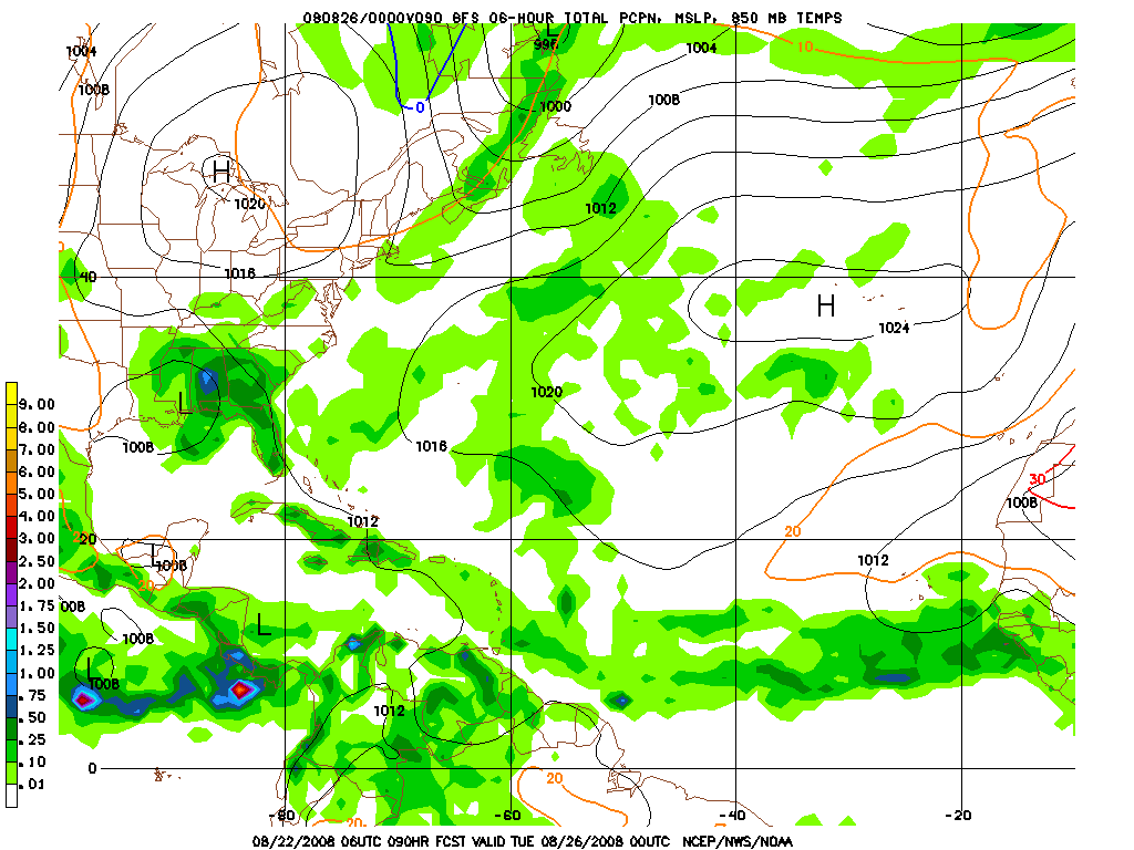
It is a bit worrying the way the GFS has it sitting around NOLA for a couple of days, if it is a hundred miles too far north the story will change.
0 likes
Who is online
Users browsing this forum: No registered users and 20 guests