ATL: Tropical Depression Fay
Moderator: S2k Moderators

AREA FORECAST DISCUSSION
NATIONAL WEATHER SERVICE MOBILE AL
516 AM CDT FRI AUG 22 2008
.SHORT TERM...(TODAY THROUGH TONIGHT)HIGHER CLOUDS(CIRRUS) WILL BE
ON THE INCREASE THROUGH THE DAY AS TROPICAL STORM FAY MOVES INTO THE
EXTREME NORTHEAST GULF OF MEXICO. FAY IS EXPECTED TO STAY CLOSE
ENOUGH TO LAND TO NOT CHANGE IN STRENGTH MUCH...IF IT MOVES MUCH
FURTHER SOUTH AND SPENDS MORE TIME OVER THE NORTHERN GULF THAN
FORECAST WE WOULD EXPECT A STRONGER STORM...BUT THAT IS NOT THE
FORECAST AT THIS TIME. MAY BE SOME SCATTERED SHOWERS OR ISOLATED
THUNDERSTORMS AROUND TODAY BUT SHOULD NOT BEGIN TO SEE MUCH RAIN
UNTIL TONIGHT AS THE RAIN SHIELD AROUND FAY CREEPS INTO THE EASTERN
ZONES OF THE FORECAST AREA. HEAVIEST RAIN NOT EXPECTED UNTIL DURING
THE DAY SATURDAY.
TODAY`S WET MICROBURST POTENTIAL IS LOW BUT INCREASING TO MODERATE
OVER THE EAST THIS AFTERNOON.
SATURDAY THROUGH SUNDAY NIGHT...HEAVY RAINS SHOULD BEGIN TO FALL
OVER THE EASTERN ZONES...GENERALLY EAST OF INTERSTATE 65 BY SATURDAY
AFTERNOON AS A WEAK BUT WET TROPICAL STORM FAY APPROACHES THE
WESTERN PANHANDLE. IT LOOKS AS IF IT WILL SPEND A LITTLE TIME JUST
OFFSHORE MOVING WEST NORTHWEST JUST SOUTH OF PANAMA CITY. HEAVY RAIN
AND ISOLATED THUNDERSTORMS SPREADING SLOWLY WEST THROUGH SATURDAY
NIGHT. THE LATEST TRACK FORECAST OF TROPICAL STORM FAY HAS NOT
CHANGED SIGNIFICANTLY FROM PREVIOUS...NHC DID MOVE IT ACROSS THE
FORECAST AREA A BIT QUICKER BEFORE SLOWING IT DOWN OVER SOUTHERN
MISSISSIPPI. THIS WOULD PUT AREA IN THE MOIST SOUTHERLY FLOW AROUND
THE REMNANT LOW AND CHANGE US OVER FROM A HEAVY RAIN AND ISOLATED
THUNDERSTORMS SITUATION TO A MORE CONVECTIVE TYPE SETUP. STILL
CALLING FOR RAINFALL AMOUNTS OF AROUND 10 INCHES POSSIBLE...MAINLY
ALONG AND NORTH OF THE LOW CENTER. COULD EASILY BE SOME HIGHER
AMOUNTS IF FAY LINGERS TO THE WEST. FLOODING BOTH FLASH AND URBAN
WILL BE LIKELY WITH RIVER FLOODING THE FIRST OF THE WEEK. FLASH
FLOOD WATCH ALREADY UP FOR THE EASTERN ZONES STARTING SATURDAY
AFTERNOON AND WILL LIKELY BE EXPANDED WEST LATER TODAY OR TONIGHT.
/11
.LONG TERM...(MONDAY THROUGH THURSDAY)
AS LONG AS THE REMNANTS OF FAY STAY TO THE WEST THE FORECAST AREA
WILL REMAIN IN A MOIST SOUTH AND SOUTHWESTERLY FLOW WITH SCATTERED
SHOWERS AND THUNDERSTORMS INTO AT LEAST MID WEEK. OF COURSE IF FAY
TURNS OUT TO MOVE FASTER/SLOWER OR MORE NORTHERLY/SOUTHERLY THAN
EXPECTED THE FORECAST WILL NEED ADJUSTMENTS. OTHERWISE WARM AND
HUMID WITH SCATTERED SHOWERS AND THUNDERSTORMS...SOME OF THE SHOWERS
OR THUNDERSTORMS ON MONDAY COULD STILL PRODUCE LOCALLY HEAVY RAIN TO
AGGRAVATE WHAT WILL LIKELY BE SATURATED SOILS. /11
&&
.MARINE...TROPICAL STORM FAY WILL MOVE WEST INTO THE EXTREME
NORTHEAST GULF OF MEXICO LATER TODAY AND EARLY TONIGHT. NORTHERLY
WINDS AND SEAS WILL STEADILY BUILD LATER TODAY AND TONIGHT AS FAY
APPROACHES FROM THE EAST. AS A RESULT A TROPICAL STORM WATCH WILL
LIKELY BE ISSUED FOR THE COASTAL WATERS OF NORTHWEST FLORIDA AND
POSSIBLY ALABAMA LATER TODAY. A STRONG SOUTHERLY WIND FLOW AND ROUGH
SEAS WILL DEVELOP OVER THE MARINE AREA LATE SUNDAY THROUGH EARLY
NEXT WEEK AS FAY MOVES OFF TO THE WEST. MARINE INTERESTS SHOULD
CLOSELY MONITOR THE LATEST FORECASTS FROM THE NATIONAL HURRICANE ON
THE TRACK AND STRENGTH OF FAY THROUGH EARLY NEXT WEEK. /32
http://www.srh.noaa.gov/mob/productview ... fd&sid=mob
0 likes

-
wxman57

- Moderator-Pro Met

- Posts: 23172
- Age: 68
- Joined: Sat Jun 21, 2003 8:06 pm
- Location: Houston, TX (southwest)
Re:
Sabanic wrote:Kind of surprises me that they don't mention anything at all about winds. I realize it won't be strong, but she is forecast by the NHC to be a TS when she is knocking on our door.
An TS force winds are out along the east coast of FL now on the beaches. Inland, winds are in the 15-25 mph range around Fay. By the time it passes west of the FL Peninsula, the only TS winds may be in a few areas out over the northern Gulf south of Fay's center. Wind won't be a significant factor with Fay any longer (at least sustained winds).
0 likes
-
Smurfwicked
- Tropical Storm

- Posts: 164
- Age: 41
- Joined: Mon Sep 03, 2007 7:47 pm
- Location: SETX
Re: ATL: Tropical Storm Fay over northern Florida Penninsula
I think the worst part is the fact shes going to be moving parallel with the coast once into the GOM that makes the cone cover lots of area with the slightest movement making a huge difference where the next landfall will be.
I've been checking the models the last 2 days and they really don't seem to know just what shes going to do, with that said I think its safe say this could be a very unpredictable system.
I know shes been a land lover but I don't see her making any hard turn towards land once in the GOM I think she might very well walk the coast line beyond the state of Florida. It looks like it'll be hard for her to miss Apalachicola, Fl but only brushing against it. I think New Orleans should keep a close eye on this, not that I see this intensifying much but more so based on the potential flooding rains it could bring.
This post is a NOT official forecast and should not be used as such. It is just the opinion of me and is not be backed by sound meteorological data. It's NOT endorsed by any professional institution or storm2k.org. For official information, please refer to the NHC and NWS products.
0 likes
-
Emmett_Brown

- Category 5

- Posts: 1433
- Joined: Wed Aug 24, 2005 9:10 pm
- Location: Sarasota FL
Re: ATL: Tropical Storm Fay over northern Florida Penninsula
Still getting some very healthy 40+ gusts in NEFL with heavy bands. Just got power back.
0 likes
-
tolakram
- Admin

- Posts: 20179
- Age: 62
- Joined: Sun Aug 27, 2006 8:23 pm
- Location: Florence, KY (name is Mark)
Re: ATL: Tropical Storm Fay over northern Florida Penninsula
3 point extrapolation, moving north of west.
0 likes
-
Noles2006

- Category 1

- Posts: 424
- Joined: Thu Jun 08, 2006 9:57 am
- Location: Tallahassee, Florida
- Contact:
Re: ATL: Tropical Storm Fay over northern Florida Penninsula
I think it's 50/50 that she even makes it out over the extreme NE GOM at this time...
In any event, I have my camera ready and the day off, so I'm probably heading to the beach (Shell Point)... I am hopeful there will be some kite surfers!
In any event, I have my camera ready and the day off, so I'm probably heading to the beach (Shell Point)... I am hopeful there will be some kite surfers!
0 likes
-
wxman57
- Moderator-Pro Met
- Posts: 23172
- Age: 68
- Joined: Sat Jun 21, 2003 8:06 pm
- Location: Houston, TX (southwest)
Re: ATL: Tropical Storm Fay over northern Florida Penninsula
Smurfwicked wrote:I think the worst part is the fact shes going to be moving parallel with the coast once into the GOM that makes the cone cover lots of area with the slightest movement making a huge difference where the next landfall will be... snip
Don't think of Fay as your typical tropical storm. It really has no core of high winds. The strongest winds are not near Fay's center, they're out over the water well to the east of the center. The lightest winds in Florida now are within 30-40 miles of Fay's center. It's that ring of squalls well away from Fay's center that has the wind and rain (mostly rain). So if a location is hit directly by Fay it will likely receive less wind/rain than a location that Fay misses by 40-50 miles, as that location will be in this ring of convection/wind for an extended period (like Jacksonville and Melbourne).
Here's a current surface plot with wind speeds identified:

0 likes

Re: ATL: Tropical Storm Fay over northern Florida Penninsula
wxman57 wrote:Don't think of Fay as your typical tropical storm. It really has no core of high winds. The strongest winds are not near Fay's center, they're out over the water well to the east of the center. The lightest winds in Florida now are within 30-40 miles of Fay's center. It's that ring of squalls well away from Fay's center that has the wind and rain (mostly rain). So if a location is hit directly by Fay it will likely receive less wind/rain than a location that Fay misses by 40-50 miles, as that location will be in this ring of convection/wind for an extended period (like Jacksonville and Melbourne).
That's a fact. Center is about 15-20 miles south of me currently, with no wind at all and very little rain. My question is, will those winds and rain to the east eventually get here near Gainesville? Worst weather here so far was yesterday afternoon.
0 likes

-
MetsIslesNoles

- S2K Supporter

- Posts: 64
- Joined: Thu Jul 07, 2005 10:42 pm
- Location: Tallahassee, FL
Re:
rockyman wrote:Depth of warm waters (not much in Apalachee Bay but deeper south of the western Fla Panhandle):
Part of that is because Apalachee Bay is shallow
0 likes
-
wxman57
- Moderator-Pro Met
- Posts: 23172
- Age: 68
- Joined: Sat Jun 21, 2003 8:06 pm
- Location: Houston, TX (southwest)
Re:
Sabanic wrote:And by the way land has not really disrupted her over the last few days the environment should be rather favorable so what's to slow her down alot now as long as she has a little bit of HOT water to drink??
Lacking a core, there is not much low-level convergence at the center. This will make it a long, slow process to redevelop if the center was out over the Gulf.
0 likes
Re: ATL: Tropical Storm Fay over northern Florida Penninsula
Bird Island on the west coast has had steady winds over 30mph for a while now
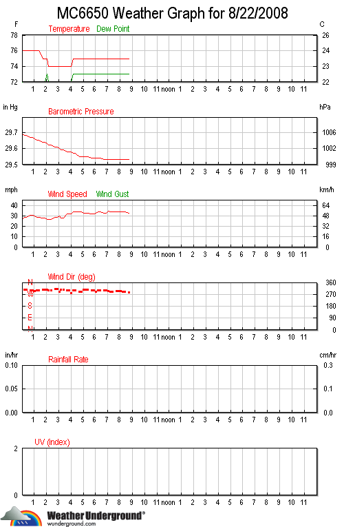
http://www.wunderground.com/weatherstation/WXDailyHistory.asp?ID=MC6650
Edit: still learning to spell
http://www.wunderground.com/weatherstation/WXDailyHistory.asp?ID=MC6650
Edit: still learning to spell
0 likes
Re:
TreasureIslandFLGal wrote:Will Fay's name be retired?
There have been deaths, and definately some lost $$$ due to the incredible flooding in Florida. -and she still has at least 1 more landfall, maybe 2 or 3!
Doesn't seem to be enough deaths in places that usually lobby to have storm names retired to have it happen from that perspective. I'd guess that it would take $3-4 billion in insured damages, and we'll have to see what happens in that regard.
0 likes
-
jasons2k

- Storm2k Executive
- Posts: 8290
- Age: 52
- Joined: Wed Jul 06, 2005 12:32 pm
- Location: The Woodlands, TX
Re: ATL: Tropical Storm Fay in East Coast of Florida
Let this be a lesson to be very sure you know what you're talking about when you question Dr. Lyons.
This is from today's NHC discussion:
http://weather.cod.edu/kamala/TPC/lates ... .KNHC.html
This is from today's NHC discussion:
http://weather.cod.edu/kamala/TPC/lates ... .KNHC.html
THE LARGE-SCALE MODELS FORECAST WESTERLY SHEAR TO IMPACT FAY STARTING IN ABOUT 72 HR...WHICH SHOULD STOP INTENSIFICATION REGARDLESS OF WHETHER IT IS OVER WATER OR NOT.
fasterdisaster wrote:jasons wrote:Dr. Lyons showed the WV loop and showed the SW winds ahead of Fay - even if she makes it into the GOM he was very pessimistic for any intensification - he said, in fact, Fay could weaken while over the GOM if she goes back over water....
I have to say that's ridiculous.
0 likes
Who is online
Users browsing this forum: No registered users and 8 guests