ATL Tropical Depression GUSTAV - Model Runs

Moderator: S2k Moderators

Message
Author
T'Bonz
Category 1
Category 1
Posts: 421
Joined: Wed Sep 01, 2004 5:23 pm
Location: Cary, North Carolina

Re: ATL: Invest 94L in Eastern Caribbean Sea Model Runs

#361 Postby T'Bonz » Sun Aug 24, 2008 10:10 am

I hope this tanks.

Last week was all Fay, all the time. Tuesday here. Later in the week, affecting travel for my middle girl, who was going to Melbourne. My youngest couldn't get back up to Tallahassee until Fay fell apart today.

Is the hurricane season over yet? One long-lasting annoying tropical storm and I'm ready for it to end! :cheesy:

May they all be fishes from here on out.
0 likes   

Dean4Storms
S2K Supporter
S2K Supporter
Posts: 6358
Age: 62
Joined: Sun Aug 31, 2003 1:01 pm
Location: Miramar Bch. FL

Re: ATL: Invest 94L in Eastern Caribbean Sea Model Runs

#362 Postby Dean4Storms » Sun Aug 24, 2008 10:23 am

Looks to be organizing this morning. I agree on a more WNW motion toward Jamaica or Eastern Cuba, she would have to start turning soon to make it to Hispaniola IMO.
0 likes   

User avatar
gatorcane
S2K Supporter
S2K Supporter
Posts: 23691
Age: 47
Joined: Sun Mar 13, 2005 3:54 pm
Location: Boca Raton, FL

#363 Postby gatorcane » Sun Aug 24, 2008 10:35 am

I think the models may have initialized this low too far south. Looking at the latest VIS loops, I see some broad cyclonic turning at a lattitude of about 13-14N heading WNW.

http://www.ssd.noaa.gov/goes/east/tatl/loop-vis.html
0 likes   

User avatar
ConvergenceZone
Category 5
Category 5
Posts: 5194
Joined: Fri Jul 29, 2005 1:40 am
Location: Northern California

Re: ATL: Invest 94L in Eastern Caribbean Sea Model Runs

#364 Postby ConvergenceZone » Sun Aug 24, 2008 11:43 am

Derek Ortt wrote:
cpdaman wrote:derek do you actually think conditions will be favorable in the central northern caribean

i mean there is some heavy shear from the north around that ULL that doesn't appear to be in a hurry to move, isn't this shear a bit of a wild card, or am i wrong.


I dont see favorable conditions

if this develops, it could easily go the way of HWRF... a short lived sheared TS


hmm, if so, that follows right in line with my original thinking, just one of those "unfavorable conditions" years....... Seems to hit every storm that develops....
0 likes   

User avatar
DESTRUCTION5
Category 5
Category 5
Posts: 4423
Age: 43
Joined: Wed Sep 03, 2003 11:25 am
Location: Stuart, FL

#365 Postby DESTRUCTION5 » Sun Aug 24, 2008 12:48 pm

Who has the 12Z canadian?
0 likes   

Derek Ortt

Re: ATL: Invest 94L in Eastern Caribbean Sea Model Runs

#366 Postby Derek Ortt » Sun Aug 24, 2008 1:18 pm

ConvergenceZone wrote:
Derek Ortt wrote:
cpdaman wrote:derek do you actually think conditions will be favorable in the central northern caribean

i mean there is some heavy shear from the north around that ULL that doesn't appear to be in a hurry to move, isn't this shear a bit of a wild card, or am i wrong.


I dont see favorable conditions

if this develops, it could easily go the way of HWRF... a short lived sheared TS


hmm, if so, that follows right in line with my original thinking, just one of those "unfavorable conditions" years....... Seems to hit every storm that develops....


That's not entirely accurate

Fay had very favorable conditions, except for a brief time in the WC.

most systems, even in very active years, even at the peak, do not encounter very favorable conditions. Those that do are called Andrew, Katrina, Wilma, etc
0 likes   

Dean4Storms
S2K Supporter
S2K Supporter
Posts: 6358
Age: 62
Joined: Sun Aug 31, 2003 1:01 pm
Location: Miramar Bch. FL

#367 Postby Dean4Storms » Sun Aug 24, 2008 1:27 pm

When is the next QScat Pass? I see rotation and convection refiring around the center of rotation which is not a good sign. The 12Z Canadian develops this and takes it towards eastern Cuba then what appears to be a deepening TC toward the SE GOM.
0 likes   

User avatar
Meso
Category 5
Category 5
Posts: 1609
Age: 38
Joined: Mon Aug 09, 2004 12:14 pm
Location: South Africa
Contact:

#368 Postby Meso » Sun Aug 24, 2008 1:50 pm

Image
0 likes   

User avatar
DESTRUCTION5
Category 5
Category 5
Posts: 4423
Age: 43
Joined: Wed Sep 03, 2003 11:25 am
Location: Stuart, FL

Re:

#369 Postby DESTRUCTION5 » Sun Aug 24, 2008 1:51 pm

DESTRUCTION5 wrote:Who has the 12Z canadian?


http://moe.met.fsu.edu/cgi-bin/cmctc2.c ... =Animation

Guess I do..LOL

How many inches of rain FL get?
0 likes   

User avatar
Tampa Bay Hurricane
Category 5
Category 5
Posts: 5597
Age: 37
Joined: Fri Jul 22, 2005 7:54 pm
Location: St. Petersburg, FL

#370 Postby Tampa Bay Hurricane » Sun Aug 24, 2008 2:28 pm

Some of the models look concerning. Is there forecasted
to be a trough that turns this northward towards the Gulf of
Mexico???
0 likes   

User avatar
deltadog03
Professional-Met
Professional-Met
Posts: 3580
Joined: Tue Jul 05, 2005 6:16 pm
Location: Macon, GA

#371 Postby deltadog03 » Sun Aug 24, 2008 2:32 pm

Yes, there will be a weakness in the GOM...From fay!!
0 likes   

User avatar
Tampa Bay Hurricane
Category 5
Category 5
Posts: 5597
Age: 37
Joined: Fri Jul 22, 2005 7:54 pm
Location: St. Petersburg, FL

#372 Postby Tampa Bay Hurricane » Sun Aug 24, 2008 2:41 pm

Thanks deltadog!
This will have to be watched closely.
0 likes   


User avatar
x-y-no
Category 5
Category 5
Posts: 8359
Age: 65
Joined: Wed Aug 11, 2004 12:14 pm
Location: Fort Lauderdale, FL

Re: ATL: Invest 94L in Eastern Caribbean Sea Model Runs

#374 Postby x-y-no » Sun Aug 24, 2008 4:11 pm


In terms of intensity, that's true - it keeps it very weak.

In terms of track, a little concerning - it turns it north across Cuba headed at SFL on day 7.
0 likes   

DeanDaDream
Tropical Low
Tropical Low
Posts: 25
Joined: Tue Aug 12, 2008 9:44 pm
Location: Keystone Heights, Florida

Re: ATL: Invest 94L in Eastern Caribbean Sea Model Runs

#375 Postby DeanDaDream » Sun Aug 24, 2008 4:38 pm

In terms of track, a little concerning - it turns it north across Cuba headed at SFL on day 7

What model shows this?
0 likes   

JonathanBelles
Professional-Met
Professional-Met
Posts: 11430
Age: 35
Joined: Sat Dec 24, 2005 9:00 pm
Location: School: Florida State University (Tallahassee, FL) Home: St. Petersburg, Florida
Contact:

Re: ATL: Invest 94L in Eastern Caribbean Sea Model Runs

#376 Postby JonathanBelles » Sun Aug 24, 2008 4:39 pm

DeanDaDream wrote:In terms of track, a little concerning - it turns it north across Cuba headed at SFL on day 7

What model shows this?


The one that he quoted :lol: The Euro.
0 likes   

NOLA 30N90W
Tropical Wave
Tropical Wave
Posts: 7
Joined: Sun Aug 03, 2008 9:07 pm

Re: ATL: Invest 94L in Eastern Caribbean Sea Model Runs

#377 Postby NOLA 30N90W » Sun Aug 24, 2008 4:43 pm

The weakness from Fay in the GOM, will be in the central GOM, not the eastern.

Again, outside of 72hrs., it's a roll of the dice. No need to be alarmed at this point.
0 likes   

DeanDaDream
Tropical Low
Tropical Low
Posts: 25
Joined: Tue Aug 12, 2008 9:44 pm
Location: Keystone Heights, Florida

Re: ATL: Invest 94L in Eastern Caribbean Sea Model Runs

#378 Postby DeanDaDream » Sun Aug 24, 2008 4:44 pm

fact789 wrote:
DeanDaDream wrote:In terms of track, a little concerning - it turns it north across Cuba headed at SFL on day 7

What model shows this?


The one that he quoted :lol: The Euro.


Thanks I see it now.
0 likes   

User avatar
gatorcane
S2K Supporter
S2K Supporter
Posts: 23691
Age: 47
Joined: Sun Mar 13, 2005 3:54 pm
Location: Boca Raton, FL

Re: ATL: Invest 94L in Eastern Caribbean Sea Model Runs

#379 Postby gatorcane » Sun Aug 24, 2008 4:45 pm

x-y-no wrote:


In terms of intensity, that's true - it keeps it very weak.

In terms of track, a little concerning - it turns it north across Cuba headed at SFL on day 7.


Yes, a hit from the Caribbean tracking right through SE FL -- a bit concerning I have to admit. Although models are likely to change, the weakness left behind by Fay may turn out to be problematic and should turn whatever heads into the Caribbean NW before reaching the Western Caribbean.
0 likes   

User avatar
gatorcane
S2K Supporter
S2K Supporter
Posts: 23691
Age: 47
Joined: Sun Mar 13, 2005 3:54 pm
Location: Boca Raton, FL

#380 Postby gatorcane » Sun Aug 24, 2008 5:03 pm

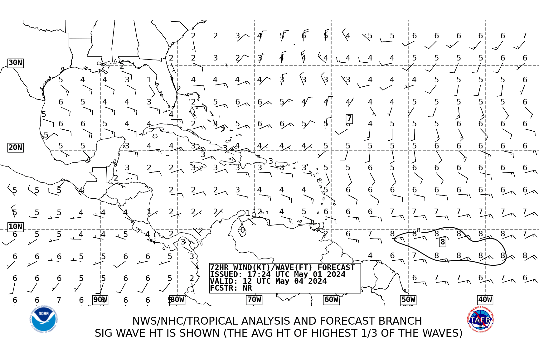
TAFB wind forecast shows 94L moving generally NW or WNW towards Jamaica:

Image
0 likes   


Return to “2008”

Who is online

Users browsing this forum: No registered users and 9 guests