ATL GUSTAV: Tropical Depression - Discussion

Moderator: S2k Moderators

Message
Author
jlauderdal
S2K Supporter
S2K Supporter
Posts: 7240
Joined: Wed May 19, 2004 5:46 am
Location: NE Fort Lauderdale
Contact:

Re:

#5521 Postby jlauderdal » Fri Aug 29, 2008 4:27 am

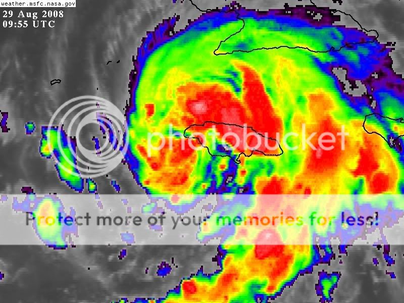
HarlequinBoy wrote:The new 5 day cone is a nightmare for the Louisiana coastline.


yep, normally im a naysayer on 5 day landfall points but that track has not changed much, there are a few factors later on that could move it a 100 miles or so but this one seems to have less error in in its future, if i lived 100 miles on either side of that line i would be preparing starting today like im getting it, standing in gas lines is for fools, any gas you buy for your generator and hopefully its not used you just put it in your tank. I have 50 in my garage from fay, didnt use it but maybe for hannah and if not my car drinks it. Good Luck north gulf coast, you probably have a 3/4 early next week.
0 likes   

xironman
S2K Supporter
S2K Supporter
Posts: 2535
Joined: Sun Jun 10, 2007 4:53 pm
Location: NoVA

Re: ATL: Tropical Storm Gustav in Central Caribbean Sea

#5522 Postby xironman » Fri Aug 29, 2008 4:28 am

From the recon it seemed the only place to put it was somewhere around here

Image
0 likes   

jlauderdal
S2K Supporter
S2K Supporter
Posts: 7240
Joined: Wed May 19, 2004 5:46 am
Location: NE Fort Lauderdale
Contact:

Re: ATL: Tropical Storm Gustav in Central Caribbean Sea

#5523 Postby jlauderdal » Fri Aug 29, 2008 4:28 am

mpic wrote:Since Cuba is much bigger than Jamaica, will we see more of the same when it reaches Cuba? Or does Cuba have less mountains and Gustav will just steam roll over it?


western cuba is narrow and flat, very minimal effects on intensity or structure of a system unless it stalls and that is very unlikely
0 likes   

jlauderdal
S2K Supporter
S2K Supporter
Posts: 7240
Joined: Wed May 19, 2004 5:46 am
Location: NE Fort Lauderdale
Contact:

Re: ATL: Tropical Storm Gustav in Central Caribbean Sea

#5524 Postby jlauderdal » Fri Aug 29, 2008 4:29 am

deltadog03 wrote:That is an interesting track.....


talk about fine tuning some ridging building back in, i guess you call it like you see it and they did
0 likes   

User avatar
MONTEGUT_LA
Tropical Storm
Tropical Storm
Posts: 105
Joined: Sun Jul 20, 2003 7:29 pm
Location: Montegut, Louisiana

Re: ATL: Tropical Storm Gustav in Central Caribbean Sea

#5525 Postby MONTEGUT_LA » Fri Aug 29, 2008 4:46 am

Jagno wrote:I wish she'd call him home to TC Heaven then. Why do I get the feeling I'm gonna wake up in a couple of hours to more shock and awe with this storm? Oh wait, I've got to go to bed first...........this is all a bad nightmare for coastal residents in LA.


Well, this LA resident is leaving town with many others who seem to be leaving early as well...it might turn into a vacation, but I don't like to swim in 10 + feet of water.

I hope everyone leaves when called to do so. I have a few family members who are going to ride it out. I will worry the whole time I'm gone.

Tina
0 likes   

User avatar
KWT
Category 5
Category 5
Posts: 31416
Joined: Tue Aug 17, 2004 11:02 am
Location: UK!!!

#5526 Postby KWT » Fri Aug 29, 2008 4:55 am

Well the cone is even more important in the set-up the NHC expects because a slight northward wobble would bring it ashore a fair bit further east which is very bad for N.O. At least the track isn't quite as bad for them now.
0 likes   

User avatar
Cookiely
S2K Supporter
S2K Supporter
Posts: 3211
Age: 74
Joined: Fri Aug 13, 2004 7:31 am
Location: Tampa, Florida

Re: ATL: Tropical Storm Gustav in Central Caribbean Sea

#5527 Postby Cookiely » Fri Aug 29, 2008 4:59 am

Interesting discussion NWS Mobile
.LONG TERM (SATURDAY THROUGH THURSDAY)...THE STORY ON GUSTAV MAY BE
A COMPLICATED ONE WHEN ALL IS SAID AND DONE BY THIS TIME NEXT WEEK.
GUSTAV WILL PROBABLY START TO HAVE SOME IMPACTS ON OUR AREA BY LATE
THIS LABOR DAY WEEKEND...BUT THE MAGNITUDE OF THOSE IMPACTS ARE
STILL UNCERTAIN AT THIS TIME. SATELLITE AND AIR FORCE RECONAISANCE
DATA SHOWS GUSTAV GETTING MORE ORGANIZED THIS MORNING OVER THE
NORTHERN CARIBBEAN. THE OFFICIAL NHC TRACK STILL TAKES GUSTAV
ACROSS THE SOUTHERN/CENTRAL GULF AS A MAJOR HURRICANE...THEN TO
SOUTH CENTRAL LOUISIANA BY TUESDAY...CLOSE TO THE PREVIOUS FORECASTS
MADE OVER THE PAST 24 HOURS. MANY OF US ALONG THE ALABAMA...
NORTHWEST FLORIDA GULF COAST MAY HAVE BEGUN TO ENTERTAIN THE IDEA
THAT GUSTAV WOULD MORE LIKELY MAKE LANDFALL FARTHER WEST OF OUR
AREA...BUT BEING THIS EARLY IN THE GAME THAT IS PRE-MATURE. THERE
ARE COMPLICATING FACTORS IN THE FORECAST MAKING THE TRACK FORECAST
OF GUSTAV PROBLEMATIC. THE MAIN FACTOR THAT COULD HAVE A
SIGNIFICANT INFLUENCE ON THE TRACK OF GUSTAV EARLY ON IS THE UPPER
TROUGH EXTENDING SOUTHWARD OVER THE GULF FROM THE UPPER LOW OVER
NORTHEAST GEORGIA. THAT TROUGH EXTENDS DEEPER INTO THE GULF THAN
WHAT MAY HAVE BEEN PREVIOUSLY THOUGHT...AND APPEARS TO STILL BE
DIGGING AS IT IS SHARPENED UP TO THE SOUTH BY THE SMALL UPPER VORTEX
SEEN SOUTH OF APALACHICOLA. THAT TROUGH MAY START TO INFLUENCE THE
MOTION OF GUSTAV EARLY ON IN THE GAME...AND COULD REQUIRE A BIT OF A
SHIFT OF THE OFFICIAL TRACK BACK TO THE EAST ON SUBESQUENT FORECAST
PACKAGES (THAT IS NOT CERTAIN...BUT A POSSIBILITY). WE CAUTION OUR
COMMUNITIES TO NOT FOCUS ON THE LITTLE BLACK DOTTED LINE ON THE
INTERNET IMAGES...AND INSTEAD WE SHOULD STRESS THAT THERE ARE LIKELY
TRACK ERRORS INVOLVED HERE. THE AREA OF UNCERTAINTY (THE "CONE")
STILL ENCOMPASSES MUCH OF OUR AREA FOR VERY GOOD REASONS...AND WE
ARE NOT OUT OF THE WOODS YET.

HAVING SAID ALL OF THAT...THE 4 AM FORECAST PACKAGE TODAY IS
PREDICATED UPON THE OFFICIAL FORECAST (WHICH IS ABOUT THE BEST
EDUCATED GUESS THE NWS CAN MAKE RIGHT NOW)...BRINGING POPS UP
SIGNIFICANTLY LATE SUNDAY THROUGH TUESDAY AS WE GET ON THE WET
EASTERN SIDE OF GUSTAV...WITH THE CENTER OF GUSTAV MAKING LANDFALL
OVER SOUTHERN LOUISIANA. MOST OF THE NUMERICAL NHC TRACK GUIDANCE
(INCLUDING THE HWRF) IS STILL CLUSTERED WEST OF OUR AREA TOWARDS
SOUTHERN LOUISIANA THIS MORNING...WITH THE ECMWF A BIT FARTHER TO
THE EAST. THE GFDL AND GFS ARE THE FARTHEST EAST TAKING THE CENTER
OF THEN HURRICANE GUSTAV CLOSER TO THE MOBILE AREA. THE LONGER TERM
TRACK OF GUSTAV OVER THIS WEEKEND WOULD STILL LIKELY BE INFLUENCED
BY HIGH PRESSURE BUILDING IN FROM THE WESTERN ATLANTIC...WITH THE
DEGREE OF WEAKNESS ON THE WEST SIDE OF THAT RIDGE DETERMINING HOW
FAR EAST OR WEST GUSTAV MAKES LANDFALL. FORTUNATELY, THE NOAA
RECONNAISSANCE G-IV AIRCRAFT WILL BE DOWN THERE TONIGHT GETTING A
MUCH BETTER LOOK AT THE COMPLICATED UPPER AIR PATTERN OVER THE
GULF. THE MORE DETAILED DATA FROM THOSE MISSIONS SHOULD START
GETTING INTO THE TRACK MODELS AND SHOULD HELP THE NWS GAIN A
SOMEWHAT CLEARER PICTURE AS TO THE EVENTUAL TRACK EVOLUTION OF
GUSTAV. STAY TUNED.
0 likes   

User avatar
KWT
Category 5
Category 5
Posts: 31416
Joined: Tue Aug 17, 2004 11:02 am
Location: UK!!!

#5528 Postby KWT » Fri Aug 29, 2008 5:02 am

Pressure seems to be dropping slowly now its finally coming offshore, pressure down to 989mbs according to recon.
0 likes   

User avatar
HURAKAN
Professional-Met
Professional-Met
Posts: 46086
Age: 38
Joined: Thu May 20, 2004 4:34 pm
Location: Key West, FL
Contact:

Re: ATL: Tropical Storm Gustav in Central Caribbean Sea

#5529 Postby HURAKAN » Fri Aug 29, 2008 5:03 am

jlauderdal wrote:
mpic wrote:Since Cuba is much bigger than Jamaica, will we see more of the same when it reaches Cuba? Or does Cuba have less mountains and Gustav will just steam roll over it?


western cuba is narrow and flat, very minimal effects on intensity or structure of a system unless it stalls and that is very unlikely


The province of Pinar del Río, westernmost Cuba, is mostly hilly but has no mountains or high peaks. Jamaica has mountains and peaks that are higher than most of Cuba. Jamaica's peak is higher than Cuba's highest peak.

Image
0 likes   

User avatar
deltadog03
Professional-Met
Professional-Met
Posts: 3580
Joined: Tue Jul 05, 2005 6:16 pm
Location: Macon, GA

Re: ATL: Tropical Storm Gustav in Central Caribbean Sea

#5530 Postby deltadog03 » Fri Aug 29, 2008 5:04 am

There are too many timing issues to be positive in one solution right now. However, I hope this won't be a lets hope on a prayer that it goes west at the last min. and goes west of nola. (I know thats still bad for yall further west of nola) I am not sure about the western movement.. Seems like most the reputable models actually went a bit east on the 00z runs. Most notably is the GFS and the HWRF.. Gfdl about the same, maybe a smidge east. Here is how I take it....The GFS is prolly a bit too far east and the EURO is abit too far west. Nogaps and UKIE=blah. Either way you split the D and you have (a bad crappy solution, but maybe the right one) a strike on NOLA.
0 likes   

User avatar
KWT
Category 5
Category 5
Posts: 31416
Joined: Tue Aug 17, 2004 11:02 am
Location: UK!!!

#5531 Postby KWT » Fri Aug 29, 2008 5:09 am

The thing is there is still reasonable spread as well deltadog, its really not easy to call. I think the NHC is wise to show some sort of bendback given there are quite a few models that show a westward bend.
0 likes   

MJA
Tropical Low
Tropical Low
Posts: 19
Joined: Wed Aug 24, 2005 12:37 pm

Re: ATL: Tropical Storm Gustav in Central Caribbean Sea

#5532 Postby MJA » Fri Aug 29, 2008 5:11 am

deltadog03 wrote:There are too many timing issues to be positive in one solution right now. However, I hope this won't be a lets hope on a prayer that it goes west at the last min. and goes west of nola. (I know thats still bad for yall further west of nola) I am not sure about the western movement.. Seems like most the reputable models actually went a bit east on the 00z runs. Most notably is the GFS and the HWRF.. Gfdl about the same, maybe a smidge east. Here is how I take it....The GFS is prolly a bit too far east and the EURO is abit too far west. Nogaps and UKIE=blah. Either way you split the D and you have (a bad crappy solution, but maybe the right one) a strike on NOLA.


Delta, I really do appreciate all of your posts, as well as those from other pro mets. I have been interested in the tropics for a while and do not recall ever seeing such uncertainty on a storm of this (possible) magnitude.
0 likes   

xironman
S2K Supporter
S2K Supporter
Posts: 2535
Joined: Sun Jun 10, 2007 4:53 pm
Location: NoVA

Re: ATL: Tropical Storm Gustav in Central Caribbean Sea

#5533 Postby xironman » Fri Aug 29, 2008 5:13 am

Nice little pop of convection right where Gus is coming off shore

Image
0 likes   

sphelps8681
Category 2
Category 2
Posts: 785
Joined: Thu Aug 16, 2007 5:37 pm
Location: Somewhere over the rainbow

Re: ATL: Tropical Storm Gustav in Central Caribbean Sea

#5534 Postby sphelps8681 » Fri Aug 29, 2008 5:16 am

sphelps8681 wrote:
GG wrote:
sphelps8681 wrote:Local Met just forcasted landfall sw la/se tx.


which one??!!


Channel 6 Met at 10:00.


I watched too. What I heard was him saying he was concerned for our area, but he didn't pinpoint a landfall. In fact, he mentioned Freeport to NOLA, if I recall correctly.[/quote]

Sorry wrong Channel it was Channel 12.My cable channel is 5. It was late, I was tired.
0 likes   

jlauderdal
S2K Supporter
S2K Supporter
Posts: 7240
Joined: Wed May 19, 2004 5:46 am
Location: NE Fort Lauderdale
Contact:

Re: ATL: Tropical Storm Gustav in Central Caribbean Sea

#5535 Postby jlauderdal » Fri Aug 29, 2008 5:18 am

xironman wrote:Nice little pop of convection right where Gus is coming off shore

Image


you havent seen anything yet as far as a pop of convection, its all systems go sooner rather than later for this system
0 likes   

User avatar
KWT
Category 5
Category 5
Posts: 31416
Joined: Tue Aug 17, 2004 11:02 am
Location: UK!!!

#5536 Postby KWT » Fri Aug 29, 2008 5:19 am

Nice convection bursting near the center now, but equally the convection isn't super deep generally, I suppose thats to be expected when a system transitions from land into water, would think that will change quite a lot soon.
0 likes   

xironman
S2K Supporter
S2K Supporter
Posts: 2535
Joined: Sun Jun 10, 2007 4:53 pm
Location: NoVA

Re: ATL: Tropical Storm Gustav in Central Caribbean Sea

#5537 Postby xironman » Fri Aug 29, 2008 5:21 am

Gus looks like he has gained quite a bit of size of the past day. Nothing like coming off Haiti.
0 likes   

User avatar
Sabanic
Category 2
Category 2
Posts: 683
Age: 66
Joined: Wed Aug 01, 2007 7:01 am
Location: Mobile, AL
Contact:

Re: ATL: Tropical Storm Gustav in Central Caribbean Sea

#5538 Postby Sabanic » Fri Aug 29, 2008 5:21 am

I think that all areas are very concerned at this time. Today and tomorrow will tell everyone alot about which way Gus will go. As for now we are all basically under the gun. No area more than another from AL/FL to TX.
0 likes   

User avatar
KWT
Category 5
Category 5
Posts: 31416
Joined: Tue Aug 17, 2004 11:02 am
Location: UK!!!

#5539 Postby KWT » Fri Aug 29, 2008 5:27 am

Its general circulation certainly has grown but the inner core is real key, if it once again develops a small inner core then this will still ramp very rapidly.

Also the thing I note is the really good sturcture it has, still has really good wrap round into the center.
0 likes   

User avatar
deltadog03
Professional-Met
Professional-Met
Posts: 3580
Joined: Tue Jul 05, 2005 6:16 pm
Location: Macon, GA

Re: ATL: Tropical Storm Gustav in Central Caribbean Sea

#5540 Postby deltadog03 » Fri Aug 29, 2008 5:39 am

KWT, I agree with you on the model spred...I did notice what Mobile NWS was talking about last night before I went too bed. That trof in the GOM looked like it was in no hurry to leave. GFS has been hinting at that upper air feature for a couple of runs now. Will be more than interesting to see what shakes looks.
0 likes   


Return to “2008”

Who is online

Users browsing this forum: No registered users and 19 guests