#212 Postby cycloneye » Tue Sep 02, 2008 1:29 pm
Detailed VDM:
Product: Air Force Vortex Message (URNT12 KNHC)
Transmitted: 2nd day of the month at 18:06Z
Aircraft: Air Force Aircraft (Last 3 digits of the tail number are 303)
Storm Number & Year: 08L in 2008
Storm Name: Hanna (in the North Atlantic basin)
Mission Number: 3
Observation Number: 05
A. Time of Center Fix: 2nd day of the month at 17:49:00Z
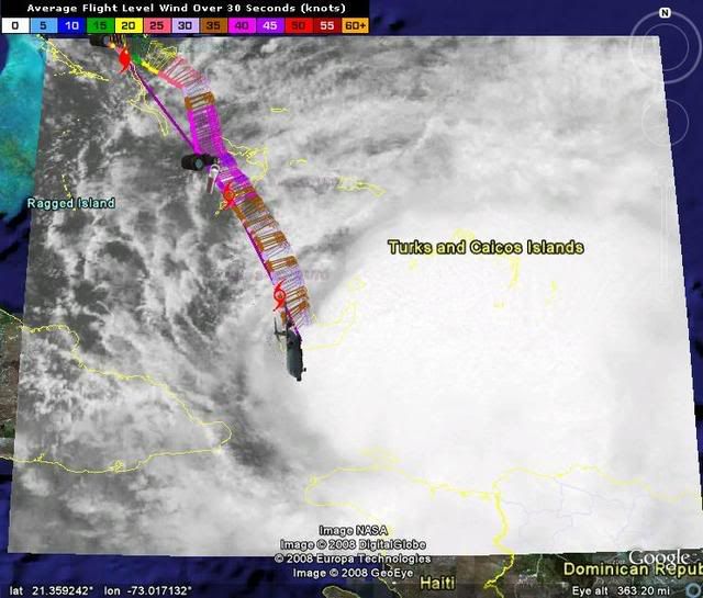
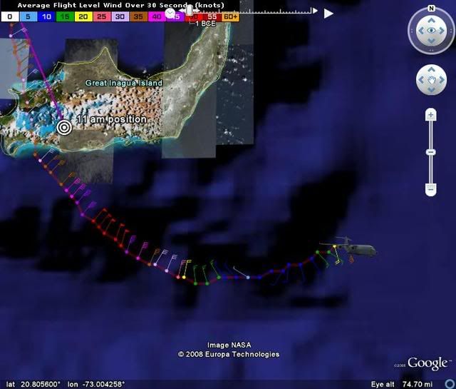
B. Center Fix Coordinates: 20°35'N 72°55'W (20.5833N 72.9167W) (View map)
B. Center Fix Location: 130 miles (209 km) to the WSW (242°) from Cockburn Town, Turks and Caicos Islands (GBR).
C. Minimum Height at Standard Level: 1,296m (4,252ft) at an unspecified standard level
D. Estimated (by SFMR or visually) Maximum Surface Wind: 60kts (~ 69.0mph)
E. Location of the Estimated Maximum Surface Wind: 21 nautical miles (24 statute miles) to the W (279°) of center fix
F. Maximum Flight Level Wind Inbound: From 34° at 56kts (From the NE at ~ 64.4mph)
G. Location of Maximum Flight Level Wind Inbound: 26 nautical miles (30 statute miles) to the WNW (285°) of center fix
H. Minimum Sea Level Pressure: 985mb (29.09 inHg)
I. Maximum Flight Level Temp & Pressure Altitude Outside Eye: 19°C (66°F) at a pressure alt. of 1,525m (5,003ft)
J. Maximum Flight Level Temp & Pressure Altitude Inside Eye: 22°C (72°F) at a pressure alt. of 1,524m (5,000ft)
K. Dewpoint Temp (collected at same location as temp inside eye): 17°C (63°F)
K. Sea Surface Temp (collected at same location as temp inside eye): Not Available
L. Eye Character: Not Available
M. Eye Shape: Not Available
N. Fix Determined By: Penetration, Radar, Wind, Pressure and Temperature
N. Fix Level: Was not in vortex message
Remarks Section - Remarks That Were Decoded...
Maximum Flight Level Wind: 56kts (~ 64.4mph) in the northwest quadrant at 17:40:50Z
Remarks Section - Additional Remarks...
RAINBANDS N AND E QUADS
MAX CONVECTION IN E QUAD
0 likes