
cycloneye wrote:

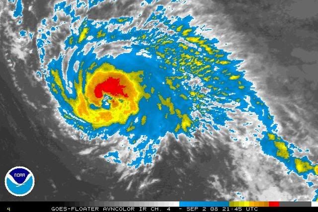
no weakness seen there.....
Moderator: S2k Moderators


ROCK wrote:no weakness seen there.....


KWT wrote:Agreed CZ i see a major hurricane out of this as well some time down the line and given its current trend of organisation I wouldn't rule out one within 72hrs as the heat content only increases from now on for Ike.
Also if that is the eye feature starting to come through then its certainly north of the forecasted position, not by a huge amount but north none the less and it may make a big difference down the road for Cuba if the NHC track remains on course, though note there is a pretty big cone of uncertainty by that time...


Users browsing this forum: No registered users and 99 guests


