ATL: IKE Discussion
Moderator: S2k Moderators
-
deltadog03

- Professional-Met

- Posts: 3580
- Joined: Tue Jul 05, 2005 6:16 pm
- Location: Macon, GA
-
ConvergenceZone
.gif)
- Category 5

- Posts: 5241
- Joined: Fri Jul 29, 2005 1:40 am
- Location: Northern California
-
Ed Mahmoud
Re: ATL Tropical Storm IKE - Discussion
masaji79 wrote:Ike sure looks to be a hurricane now! I wonder why NHC has not upgraded yet?
They will in ten minutes or so...
0 likes

deltadog03, its one of those set-ups rather sinmilar to Donna in that the whole east coast needs to watch because we still don't know how sharp the trough will be when it does eventually pick up Ike. Whilst for now the main question has to be the track of Ike within the next 120hrs and the threat to the Bahamas, if we have a fairly flat trough then this could well recurve out sea like the GFS shows, a sharp trough, depeneding of course on where Ike is, could lead a big threat the whole way up the coast.
0 likes
-
Ed Mahmoud
Re: ATL Tropical Storm IKE - Discussion
Brent wrote:HURRICANE IKE FORECAST/ADVISORY NUMBER 10
HURRICANE IKE FORECAST/ADVISORY NUMBER 10
NWS TPC/NATIONAL HURRICANE CENTER MIAMI FL AL092008
2100 UTC WED SEP 03 2008
HURRICANE CENTER LOCATED NEAR 21.6N 52.7W AT 03/2100Z
POSITION ACCURATE WITHIN 30 NM
PRESENT MOVEMENT TOWARD THE WEST-NORTHWEST OR 290 DEGREES AT 16 KT
ESTIMATED MINIMUM CENTRAL PRESSURE 984 MB
MAX SUSTAINED WINDS 70 KT WITH GUSTS TO 85 KT.
0 likes


The biggest concern has to the risk to the Bahamas it seems from that track, there is enough distance from Florida on the NHC to allow safe passage out to sea but we shall have to see...
The path is quite close to the ECM as it happens...
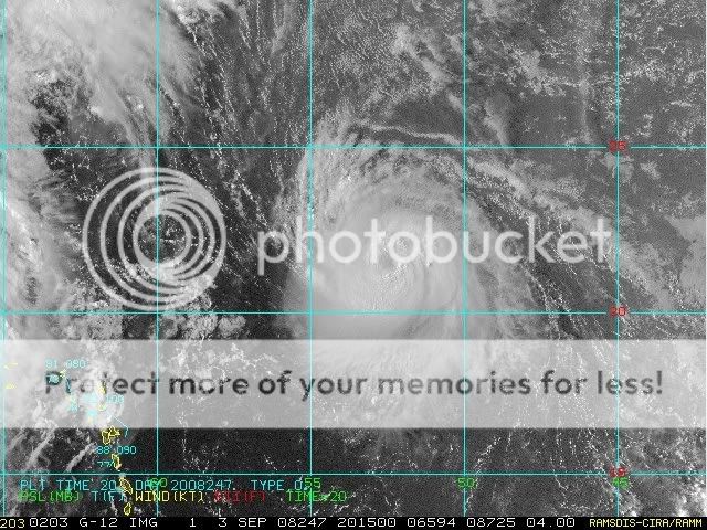
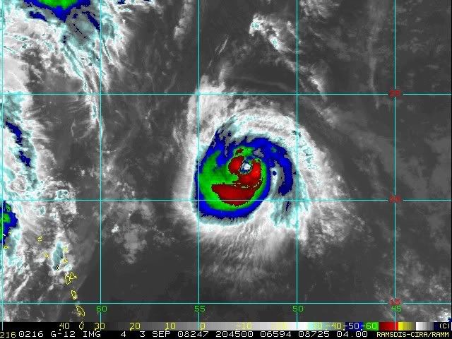
Anyway hurricane Ike is looking very good tonight, I fully expect it to be close to major status in 24-36hrs time.
The path is quite close to the ECM as it happens...
Anyway hurricane Ike is looking very good tonight, I fully expect it to be close to major status in 24-36hrs time.
0 likes
-
fasterdisaster
- Category 5
- Posts: 1868
- Joined: Mon Sep 19, 2005 4:41 pm
- Location: Miami, Florida
Re:
Nexus wrote:Hurricane Ike:
70 kts is an irresponsibly low estimate for this quickly strengthening storm IMO. It wouldn't shock me if this was Category 2 right now.
0 likes
-
Blown Away

- S2K Supporter

- Posts: 10253
- Joined: Wed May 26, 2004 6:17 am
-
Tampa_God

- Category 1

- Posts: 333
- Age: 36
- Joined: Wed May 31, 2006 7:27 pm
- Location: New Port Richey/Trinity, FL
Re: ATL Hurricane IKE - Discussion
Ike already seems to be Category 2 status right now, anyone expect a Cat 2 Ike by the next Advisory?
0 likes
gatorcane, I think it's the LINE where if you're at the target 5 days out, you're okay. Cones are something different, simply because they do take in account error. In any event, this is a rather simple forcast, I think. How fast Hanna goes up, and how hard that ridge rebuilds. That's it. This is going to be like Floyd all over again, in terms of waiting for the gap.
0 likes
I'd go for 75kts right now, it is certainly strengthening at a decent clip looking at the eye emerging and the good shape the hurricane has.
Blown_away, I think that is indeed a hint of a recurve, the NHC won't dare go the full hog yet simply because most models only really start the recurve outside 120hrs, so the NHC can't really do anymore then show a WNW bend, expect the runs tomorrow to reflect any curve far greater.
Blown_away, I think that is indeed a hint of a recurve, the NHC won't dare go the full hog yet simply because most models only really start the recurve outside 120hrs, so the NHC can't really do anymore then show a WNW bend, expect the runs tomorrow to reflect any curve far greater.
0 likes
Who is online
Users browsing this forum: No registered users and 22 guests