ATL: IKE Discussion
Moderator: S2k Moderators

Re: ATL IKE: Category 4 - Discussion
Just read JB's 9am discussion. The short of it is, he doesn't have a clue where Ike is going. 
0 likes

-
jlauderdal
- S2K Supporter

- Posts: 7240
- Joined: Wed May 19, 2004 5:46 am
- Location: NE Fort Lauderdale
- Contact:
Re: Re:
wxman57 wrote:Vortex wrote:12Z NAM is even further north. In 18 hours a fair distance of the cuban coast.
http://www.nco.ncep.noaa.gov/pmb/nwprod ... p_018l.gif
NAM is about the worst model to use for hurricanes. I think even CLipper beats it.
maybe for the hurricane itself but what about the flow around the hurricane?
0 likes
-
jlauderdal
- S2K Supporter
- Posts: 7240
- Joined: Wed May 19, 2004 5:46 am
- Location: NE Fort Lauderdale
- Contact:
Re: ATL IKE: Category 4 - Discussion
cycloneye wrote:jlauderdal wrote:gatorcane wrote:west movement commencing folks.
4 frames of west movement isnt enough to declare that gator, we need more
More than 6 hours.
there has been 6 hours of movement at 270 plus or minus 10 degrees?
0 likes


-
gatorcane

- S2K Supporter
- Posts: 23708
- Age: 48
- Joined: Sun Mar 13, 2005 3:54 pm
- Location: Boca Raton, FL
Re: ATL IKE: Category 4 - Discussion
cycloneye wrote:jlauderdal wrote:gatorcane wrote:west movement commencing folks.
4 frames of west movement isnt enough to declare that gator, we need more
More than 6 hours.
Looks west to me....I would doubt its going WSW any longer.
0 likes

Re:
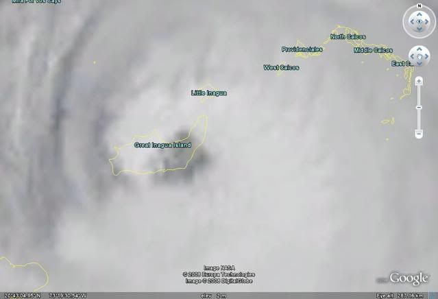
KWT wrote:I wonder whether the land interaction will be enough to weaken Ike to a cat-3. It was borderline last recon mission and that may make the difference.
The highest point in the entire Bahamas is 206ft, and it certainly isn't found on Inagua. Most of the island is salt flats, so I really doubt it.
0 likes

Re: ATL IKE: Category 4 - Discussion
Ike's inflow and outflow in most quadrants is outstanding. If Ike doesn't spend too much time over Cuba it will become a monster in the gulf, and even if it does get shredded it could still become a serious problem in the gulf. Considering it's getting fed well, I think that most likely it will become a monster in the gulf, extremely large, even if it doesn't reach super high end cat4/5 power. Poor Cuba though.
0 likes
-
jlauderdal
- S2K Supporter
- Posts: 7240
- Joined: Wed May 19, 2004 5:46 am
- Location: NE Fort Lauderdale
- Contact:
Re: Re:
bahamaswx wrote:KWT wrote:I wonder whether the land interaction will be enough to weaken Ike to a cat-3. It was borderline last recon mission and that may make the difference.
The highest point in the entire Bahamas is 206ft, and it certainly isn't found on Inagua. Most of the island is salt flats, so I really doubt it.
there is a couple of lighthouses 206 feet,
0 likes
-
TTheriot1975
- Tropical Storm

- Posts: 113
- Age: 51
- Joined: Thu Aug 16, 2007 8:12 pm
- Location: Southeast Texas
Yeah but given it was very marginal even flat land for a few hours may make the difference between 115-110kts and given the eye is totally inland there may be some very slight weakening which would take it down.
I personally doubt it will weaken but its a possiblity. Either way any weakening will be very short lived and no doubt it'll strengthen again before Cuba, I'm sure.
I personally doubt it will weaken but its a possiblity. Either way any weakening will be very short lived and no doubt it'll strengthen again before Cuba, I'm sure.
0 likes
-
Frank P
- S2K Supporter
- Posts: 2779
- Joined: Fri Aug 29, 2003 10:52 am
- Location: Biloxi Beach, Ms
- Contact:
Re: ATL IKE: Category 4 - Discussion
This is such a great Sat loop.. notice that the convection on the west side just explodes in the last couple of frames and must be really pummeling the west side of the island right now... also watch the lat lines to see if they are moving up any.. which would indicate if Ike still has any southerly component... hard to say..
http://hadar.cira.colostate.edu/ramsdis ... ive_0.html
http://hadar.cira.colostate.edu/ramsdis ... ive_0.html
Last edited by Frank P on Sun Sep 07, 2008 9:37 am, edited 1 time in total.
0 likes
-
cycloneye

- Admin

- Posts: 149320
- Age: 69
- Joined: Thu Oct 10, 2002 10:54 am
- Location: San Juan, Puerto Rico
Re: ATL IKE: Category 4 - Discussion
AT 11 AM EDT...1500 UTC...A HURRICANE WATCH HAS BEEN ISSUED FOR THE
FLORIDA KEYS FROM OCEAN REEF SOUTHWARD...INCLUDING THE DRY TORTUGAS.
FLORIDA KEYS FROM OCEAN REEF SOUTHWARD...INCLUDING THE DRY TORTUGAS.
0 likes

INITIAL 07/1500Z 21.0N 73.4W 115 KT
12HR VT 08/0000Z 20.9N 75.2W 120 KT
24HR VT 08/1200Z 21.4N 77.6W 85 KT...INLAND
36HR VT 09/0000Z 22.2N 79.9W 70 KT...INLAND
48HR VT 09/1200Z 23.0N 81.8W 65 KT...INLAND
72HR VT 10/1200Z 24.5N 85.0W 70 KT
96HR VT 11/1200Z 26.0N 87.5W 85 KT
120HR VT 12/1200Z 27.0N 90.5W 100 KT
12HR VT 08/0000Z 20.9N 75.2W 120 KT
24HR VT 08/1200Z 21.4N 77.6W 85 KT...INLAND
36HR VT 09/0000Z 22.2N 79.9W 70 KT...INLAND
48HR VT 09/1200Z 23.0N 81.8W 65 KT...INLAND
72HR VT 10/1200Z 24.5N 85.0W 70 KT
96HR VT 11/1200Z 26.0N 87.5W 85 KT
120HR VT 12/1200Z 27.0N 90.5W 100 KT
0 likes
Re: ATL IKE: Category 4 - Discussion
gatorcane wrote:
Looks west to me....I would doubt its going WSW any longer.
I think about 265 is about right based on current motion, not really losing much latitude now though, looks like its rightr on the NHC forecast...therefore I suspect this will be a TS when it exits Cuba...
0 likes
-
Evil Jeremy

- S2K Supporter
- Posts: 5463
- Age: 32
- Joined: Mon Apr 10, 2006 2:10 pm
- Location: Los Angeles, CA
AT 11 AM EDT...1500 UTC...A HURRICANE WATCH HAS BEEN ISSUED FOR THE
FLORIDA KEYS FROM OCEAN REEF SOUTHWARD...INCLUDING THE DRY TORTUGAS.
IKE IS MOVING TOWARD THE WEST NEAR 13 MPH...20 KM/HR..A WEST TO
WEST-SOUTHWEST MOTION IS EXPECTED TO CONTINUE TODAY WITH A TURN
TOWARD THE WEST-NORTHWEST EXPECTED ON MONDAY.
MAXIMUM SUSTAINED WINDS ARE NEAR 135 MPH...215 KM/HR...WITH HIGHER
GUSTS.
HURRICANE FORCE WINDS EXTEND OUTWARD UP TO 60 MILES...95 KM...FROM
THE CENTER...AND TROPICAL STORM FORCE WINDS EXTEND OUTWARD UP TO 145
MILES...230 KM.
ALL INTERESTS IN THE REMAINDER OF THE BAHAMAS...CUBA...AND SOUTH
FLORIDA SHOULD CLOSELY MONITOR THE PROGRESS OF THIS POTENTIALLY
DANGEROUS HURRICANE.
As long as SFL is being mentioned, I am watching Ike closely.
0 likes

-
El Nino

- Category 1

- Posts: 454
- Age: 48
- Joined: Sun Oct 16, 2005 3:18 pm
- Location: Lima - Miraflores (Peru)
- Contact:
Re: ATL IKE: Category 4 - Discussion
All forecasts in the AF Forum indicate a rapid re-intensification when Ike emerges into the GOM. And it will be quite a long tracker over there. I think Louisiana and Texas should really keep an eye over that. Btw, Ike will be a TS over Cuba, and I think it's more accurate to me.
0 likes
Who is online
Users browsing this forum: No registered users and 49 guests