ATL: IKE Discussion
Moderator: S2k Moderators
-
fasterdisaster
- Category 5

- Posts: 1868
- Joined: Mon Sep 19, 2005 4:41 pm
- Location: Miami, Florida
-
expat2carib

- S2K Supporter

- Posts: 458
- Joined: Tue Jul 22, 2008 1:44 pm
- Location: Sint Maarten
Re: ATL IKE Category 3 - Discussion
Hurricane Ike still affecting the Turks and Caicos Islands and the Southeastern Bahamas
Situation Report #1
The Event: Hurricane Ike impacts Turks and Caicos and the southern Bahamas islands as a Category four Hurricane on the Saffir-Simpson scale. A Hurricane Warning for Hurricane Ike (Category Three) remains in effect for the Turks and Caicos Islands and the southeastern Bahamas, including the Acklins Crooked Island, the Inaguas, Mayaguana, and the Ragged Islands, and for the central Bahamas including Cat Island, the Exumas, Long Island, Rum Cay, and San Salvador. A Hurricane Warning means that hurricane conditions are expected within the warning area within the next 24 hours. Preparations to protect life and property should be rushed to completion.
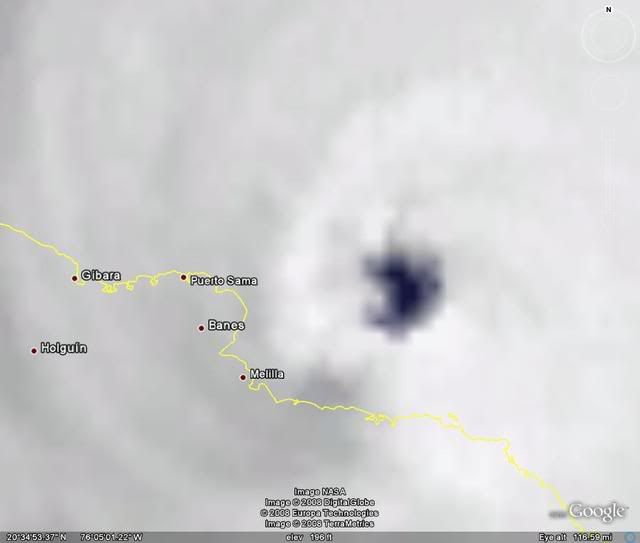
Prognosis: At 5:00 pm EDT on Sun Sep 07, 2008, the center of Hurricane Ike was located near latitude 21.1North longitude and 74.6 West, west or about 90 miles (145 km) west of Great Inagua island and about 75 miles (120 km) north-northeast of Guantanamo Cuba. Ike is moving toward the west near 13 mph (21 km/hr). A west to west-southwest motion is expected to continue this afternoon with a turn toward the west-northwest expected on Monday. On this track, the core of the hurricane will move away from the southeastern Bahamas this afternoon and move near or over eastern Cuba tonight.
Maximum sustained winds have decreased to near 120 mph (195 km/hr) with higher gusts. Ike is a category three hurricane on the Saffir-Simpson scale. Fluctuations in strength are possible tonight but Ike is expected to remain a major hurricane as it approaches eastern Cuba. Ike is expected to weaken as it moves over eastern and central Cuba on Monday.
Hurricane force winds extend outward up to 60 miles (95 km) from the center...and tropical storm force winds extend outward up to 145 miles (230 km). Storm surge flooding of 9 to 12 feet above normal tide levels along with large and dangerous battering waves can be expected within the warning area in areas of onshore winds.
Ike is expected to produce rainfall accumulations of 6 to 10 inches over eastern and central Cuba with isolated maximum amounts of up to 15 inches possible. These rains are likely to cause life-threatening flash floods and mud slides over mountainous terrain. The Southern Bahamas could see rainfall totals of 4 to 8 inches from Ike. Portions of Hispaniola could receive additional amounts of 3 to 5 inches. Additional rainfall amounts of 2 to 4 inches are possible over the Turks and Caicos Islands. Rainfall accumulations of 1 to 3 inches are possible over the Florida Keys.
Status:
Turks and Caicos Islands (TCI)
At 3:40 pm EDT on Sep 7, 2008, no casualties have been reported in the Turks and Caicos.
Grand Turk suffered approximately 85% damage to housing and infrastructure of which 50% is major.
South Caicos suffered major damage with approximately 65% of roofs blown off. Report from Middle Caicos and North Caicos indicated that there was only minor damage to roofs.
There is major flooding in South Caicos due in part to previous ground saturation from Tropical Storm Hanna. North and Middle Caicos had minimal flooding of roads.
In Grand Turk, roads are impassable due to fallen poles and electrical wires.
Grand Turk, North, Middle, and South Caicos, and Salt Cay have lost electricity and water.
While Provo has suffered some roof damage and some poles, all utilities and major infrastructure are still intact
TCI Government priorities at this time are:
To re-establish communication for each island;
Deploying emergency response teams;
Damage and needs assessment;
Search and rescue; and
Clearing access areas.
The Initial Damage Assessment (IDA) Report is currently under development by a team of government officials and trained technicians.
A reconnaissance flight over all the islands as well as ground truthing exercises will inform the IDA.
There will be a policy level meeting this evening (Sep 07, 2008) in Provo to discuss the initial national plan of action.
These discussions will inform the scope of the regional support from CDERA and its partners.
The Bahamas
At 3:40 pm EDT on Sep 7, 2008, there were no fatalities reported thus far in The Bahamas.
Inaugua seems to be the only island severely affected by Hurricane Ike. The southern Bahamas is still experiencing some effects of the storm.
Assessment teams will be deployed to assess damages as soon as the all clear is issued.
The National Emergency Operations Centre (NEOC) remains activated and is preparing an updated brief for the Prime Minister at 5:00pm this evening (Sep 07, 2008).
Regional and Other Response
The CDERA CU is in the process of:
Finalizing arrangements for the first Damage Assessment Team of approximately 6 persons to be deployed from Jamaica at 6am on Monday September 8, 2008. The team comprises of representatives from the Jamaica Power Service (JPS), National Works Ministry and the Office of Disaster Preparedness and Emergency Management. The advanced Jamaica team will assess the logistics for relief requirements and requirements for the engineering battalion, which is on stand by. The team will be deployed with support from the Sky King aircraft, which is being provided free of cost.
Finalizing arrangements for Ms. Andria Grosvenor, Technical Manager for Preparedness and Country Support, of CDERA CU to be deployed to TCI on September 8, 2008.
Mobilizing the CARICOM Disaster Relief Unit (34 military/police) through the Regional Security System (RSS) for possible deployment on Tuesday 9 September, 2008.
Deploying a CDERA Technical Team of approximately 2 persons on Monday, September 9, 2008.
Mobilizing the Military Engineers from the region to assist with restoration of critical services if required.
The UK Department for International Development (DFID) is making arrangements for the possible deployment of a humanitarian expert.
A Pan American Health Organization (PAHO) Representative, Ms. Monica Zaccarelli will be deployed on September 8, 2008.
HMS Iron Duke Helicopter took the TCI officials for a reconnaissance on Sep 7, 2008.
Helicopters from the USA will be available in TCI on Sep 7, 2008.
CDERA will continue to monitor and provide updates as necessary.
Stand by Support Arrangements
The Caribbean Electric Utilities Services Cooperation (CARILEC) has been notified to be on standby to support restoration of electricity services.
The Caribbean Disaster Relief Unit (CDRU) is on standby for possible deployment on Tuesday September 9, 2008 should this be required.
Additional technical support from CDERA System has been placed on stand by for immediate deployment as required.
Caribbean Community (CARICOM) Heads of Government Meeting:
Mr. Jeremy Collymore, the CDERA Coordinator, will brief CARICOM Heads of Government at a Meeting on Wednesday, 10 Sep, 2008 on the 2008 Hurricane Season to date. The CDERA CU will prepare a consolidated report to inform the meeting.
More details will be provided following the initial damage assessment.
Next Advisory: CDERA will continue to monitor the situation and provide advisories as necessary.
Contact Details: The CDERA CU 24hr contact number is 246 425 0386
Situation Report #1
The Event: Hurricane Ike impacts Turks and Caicos and the southern Bahamas islands as a Category four Hurricane on the Saffir-Simpson scale. A Hurricane Warning for Hurricane Ike (Category Three) remains in effect for the Turks and Caicos Islands and the southeastern Bahamas, including the Acklins Crooked Island, the Inaguas, Mayaguana, and the Ragged Islands, and for the central Bahamas including Cat Island, the Exumas, Long Island, Rum Cay, and San Salvador. A Hurricane Warning means that hurricane conditions are expected within the warning area within the next 24 hours. Preparations to protect life and property should be rushed to completion.
Prognosis: At 5:00 pm EDT on Sun Sep 07, 2008, the center of Hurricane Ike was located near latitude 21.1North longitude and 74.6 West, west or about 90 miles (145 km) west of Great Inagua island and about 75 miles (120 km) north-northeast of Guantanamo Cuba. Ike is moving toward the west near 13 mph (21 km/hr). A west to west-southwest motion is expected to continue this afternoon with a turn toward the west-northwest expected on Monday. On this track, the core of the hurricane will move away from the southeastern Bahamas this afternoon and move near or over eastern Cuba tonight.
Maximum sustained winds have decreased to near 120 mph (195 km/hr) with higher gusts. Ike is a category three hurricane on the Saffir-Simpson scale. Fluctuations in strength are possible tonight but Ike is expected to remain a major hurricane as it approaches eastern Cuba. Ike is expected to weaken as it moves over eastern and central Cuba on Monday.
Hurricane force winds extend outward up to 60 miles (95 km) from the center...and tropical storm force winds extend outward up to 145 miles (230 km). Storm surge flooding of 9 to 12 feet above normal tide levels along with large and dangerous battering waves can be expected within the warning area in areas of onshore winds.
Ike is expected to produce rainfall accumulations of 6 to 10 inches over eastern and central Cuba with isolated maximum amounts of up to 15 inches possible. These rains are likely to cause life-threatening flash floods and mud slides over mountainous terrain. The Southern Bahamas could see rainfall totals of 4 to 8 inches from Ike. Portions of Hispaniola could receive additional amounts of 3 to 5 inches. Additional rainfall amounts of 2 to 4 inches are possible over the Turks and Caicos Islands. Rainfall accumulations of 1 to 3 inches are possible over the Florida Keys.
Status:
Turks and Caicos Islands (TCI)
At 3:40 pm EDT on Sep 7, 2008, no casualties have been reported in the Turks and Caicos.
Grand Turk suffered approximately 85% damage to housing and infrastructure of which 50% is major.
South Caicos suffered major damage with approximately 65% of roofs blown off. Report from Middle Caicos and North Caicos indicated that there was only minor damage to roofs.
There is major flooding in South Caicos due in part to previous ground saturation from Tropical Storm Hanna. North and Middle Caicos had minimal flooding of roads.
In Grand Turk, roads are impassable due to fallen poles and electrical wires.
Grand Turk, North, Middle, and South Caicos, and Salt Cay have lost electricity and water.
While Provo has suffered some roof damage and some poles, all utilities and major infrastructure are still intact
TCI Government priorities at this time are:
To re-establish communication for each island;
Deploying emergency response teams;
Damage and needs assessment;
Search and rescue; and
Clearing access areas.
The Initial Damage Assessment (IDA) Report is currently under development by a team of government officials and trained technicians.
A reconnaissance flight over all the islands as well as ground truthing exercises will inform the IDA.
There will be a policy level meeting this evening (Sep 07, 2008) in Provo to discuss the initial national plan of action.
These discussions will inform the scope of the regional support from CDERA and its partners.
The Bahamas
At 3:40 pm EDT on Sep 7, 2008, there were no fatalities reported thus far in The Bahamas.
Inaugua seems to be the only island severely affected by Hurricane Ike. The southern Bahamas is still experiencing some effects of the storm.
Assessment teams will be deployed to assess damages as soon as the all clear is issued.
The National Emergency Operations Centre (NEOC) remains activated and is preparing an updated brief for the Prime Minister at 5:00pm this evening (Sep 07, 2008).
Regional and Other Response
The CDERA CU is in the process of:
Finalizing arrangements for the first Damage Assessment Team of approximately 6 persons to be deployed from Jamaica at 6am on Monday September 8, 2008. The team comprises of representatives from the Jamaica Power Service (JPS), National Works Ministry and the Office of Disaster Preparedness and Emergency Management. The advanced Jamaica team will assess the logistics for relief requirements and requirements for the engineering battalion, which is on stand by. The team will be deployed with support from the Sky King aircraft, which is being provided free of cost.
Finalizing arrangements for Ms. Andria Grosvenor, Technical Manager for Preparedness and Country Support, of CDERA CU to be deployed to TCI on September 8, 2008.
Mobilizing the CARICOM Disaster Relief Unit (34 military/police) through the Regional Security System (RSS) for possible deployment on Tuesday 9 September, 2008.
Deploying a CDERA Technical Team of approximately 2 persons on Monday, September 9, 2008.
Mobilizing the Military Engineers from the region to assist with restoration of critical services if required.
The UK Department for International Development (DFID) is making arrangements for the possible deployment of a humanitarian expert.
A Pan American Health Organization (PAHO) Representative, Ms. Monica Zaccarelli will be deployed on September 8, 2008.
HMS Iron Duke Helicopter took the TCI officials for a reconnaissance on Sep 7, 2008.
Helicopters from the USA will be available in TCI on Sep 7, 2008.
CDERA will continue to monitor and provide updates as necessary.
Stand by Support Arrangements
The Caribbean Electric Utilities Services Cooperation (CARILEC) has been notified to be on standby to support restoration of electricity services.
The Caribbean Disaster Relief Unit (CDRU) is on standby for possible deployment on Tuesday September 9, 2008 should this be required.
Additional technical support from CDERA System has been placed on stand by for immediate deployment as required.
Caribbean Community (CARICOM) Heads of Government Meeting:
Mr. Jeremy Collymore, the CDERA Coordinator, will brief CARICOM Heads of Government at a Meeting on Wednesday, 10 Sep, 2008 on the 2008 Hurricane Season to date. The CDERA CU will prepare a consolidated report to inform the meeting.
More details will be provided following the initial damage assessment.
Next Advisory: CDERA will continue to monitor the situation and provide advisories as necessary.
Contact Details: The CDERA CU 24hr contact number is 246 425 0386
0 likes
-
jlauderdal
- S2K Supporter
- Posts: 7240
- Joined: Wed May 19, 2004 5:46 am
- Location: NE Fort Lauderdale
- Contact:
Re:
CronkPSU wrote:i've seen Tip superimposed onto a map of the us before and I believ it pretty much took up half of the lower 48...I am sure someone has that image handy
compact and weak

0 likes
-
Sabanic

- Category 2

- Posts: 683
- Age: 66
- Joined: Wed Aug 01, 2007 7:01 am
- Location: Mobile, AL
- Contact:
Re: ATL IKE Category 3 - Discussion
Latest GFDL model run has moved back eastward a bit with an earlier Northward turn right into Gustav's old stomping grounds.
0 likes
-
tolakram
- Admin

- Posts: 20179
- Age: 62
- Joined: Sun Aug 27, 2006 8:23 pm
- Location: Florence, KY (name is Mark)
Re: ATL IKE Category 3 - Discussion


Last edited by tolakram on Sun Sep 07, 2008 6:55 pm, edited 1 time in total.
0 likes
Re: ATL IKE Category 3 - Discussion
Thanks y'all for the GoM hurricane data...
And I kinda left out the "all I can find is" Tip vs Tracy but ty for those graphics too!
Hard to type and watch the Cowboys game
And I kinda left out the "all I can find is" Tip vs Tracy but ty for those graphics too!
Hard to type and watch the Cowboys game
0 likes
Re:
jasons wrote:Just to clarify, the update above is NOT Jeff Masters, it is Jeff Lindner - a local pro-met with the Harris County Flood Control District.
Man, I REALLY wish Ed wouldn't have posted that "Texas coast season over" thread a few weeks back.
We just don't need to be in any more cones this year, and I hope he didn't jinx us.
0 likes
Re: ATL IKE Category 3 - Discussion
Shoshana wrote:Thanks y'all for the GoM hurricane data...
And I kinda left out the "all I can find is" Tip vs Tracy but ty for those graphics too!
Hard to type and watch the Cowboys game
In an effort to stay on-topic, it appears that the turks and the browns got a real pounding today.
0 likes
-
Derek Ortt
-
Pearl River

- S2K Supporter
- Posts: 825
- Age: 66
- Joined: Fri Dec 09, 2005 6:07 pm
- Location: SELa
Re: ATL IKE Category 3 - Discussion
Last edited by Pearl River on Sun Sep 07, 2008 7:04 pm, edited 1 time in total.
0 likes
-
apocalypt-flyer
- Category 1

- Posts: 468
- Joined: Sat Aug 27, 2005 11:51 am
Re: ATL IKE Category 3 - Discussion
We worries me is that fact that Ike will have a LOT of time, a LOT of high SSTs and not a lot of shear ahead of him after crossing Cuba. So even if Ike weakens considerably over the next 48 hours or so, there's still a LOT of potential for him ahead.
0 likes
-
cycloneye

- Admin
- Posts: 149310
- Age: 69
- Joined: Thu Oct 10, 2002 10:54 am
- Location: San Juan, Puerto Rico
Re: ATL IKE Category 3 - Discussion
tolakram wrote:
Ike will avoid the tallest mountains of Cuba as those are in the SE part.
0 likes
-
MGC

- S2K Supporter
- Posts: 5940
- Joined: Sun Mar 23, 2003 9:05 pm
- Location: Pass Christian MS, or what is left.
Re: ATL IKE: Category 3 - Discussion
Lets just hope Ike's central core is disrupted and he won't recover to a major once back over the GOM......MGC
0 likes
Re: ATL IKE: Category 3 - Discussion
lets just see if he takes the short road across ( due west) or the long road......most models have him taking the long road...but who knows
0 likes


-
Matt-hurricanewatcher
Re: ATL IKE: Category 3 - Discussion
What are the chances this keeps going west for the next 24 hours in moves into the Caribbean south of Cuba?
0 likes
-
Matt-hurricanewatcher
Re: ATL IKE: Category 3 - Discussion
UZNT13 KNHC 072339
XXAA 57238 99212 70751 08015 99953 24400 06120 00928 ///// /////
92259 23004 07138 85997 21001 08613 88999 77999
31313 09608 82323
51515 10190 70665
61616 NOAA2 WXWXA IKE OB 10
62626 SPL 2123N07516W 2326 MBL WND 07131 AEV 20704 =
XXBB 57238 99212 70751 08015 00953 24400 11850 21001 22750 16402
33722 14400
21212 00953 06120 11948 06624 22941 06637 33929 07140 44899 07618
55881 08630 66864 08617 77850 08613 88722 10611
31313 09608 82323
51515 10190 70665
61616 NOAA2 WXWXA IKE OB 10
62626 SPL 2123N07516W 2326 MBL WND 07131 AEV 20704 =
120kt surface winds from dropsonde
Why did the nhc hold it at 105 knots???
0 likes
Who is online
Users browsing this forum: No registered users and 8 guests