ATL: IKE Discussion
Moderator: S2k Moderators
- HouTXmetro
- Category 5

- Posts: 3949
- Joined: Sun Jun 13, 2004 6:00 pm
- Location: District of Columbia, USA
HouTXmetro, very true and the thing is whilst it is starting to degrade it does have an inner core still so it could well breifly strengthen again.
It seems like its only an hour or so away from the waters of the Caribbean, if it stays heading near due west (even slightly north of west) then its going to have a lot less time over land...
It seems like its only an hour or so away from the waters of the Caribbean, if it stays heading near due west (even slightly north of west) then its going to have a lot less time over land...
0 likes
- stormhorn
- Tropical Low

- Posts: 25
- Age: 59
- Joined: Sun Aug 12, 2007 1:59 pm
- Location: Gulf Shores, Al.
Re: ATL IKE: Category 2 - Discussion
hial2 wrote:TampaFl wrote:hial2 wrote:How strong is the high? could Ike go as far as Nicaragua/Mexico?
Very Strong!
That would be a HISTORIC track!
Do my amateur eyes fail me or does that look Mexico bound??
0 likes
Re:
HouTXmetro wrote:Is that the correct steering layer? I can't believe it's that strong.
Yes it is - the 8:00am advisorie stated a pressure of 960mb. The steering flow map is for TC MSLP/Vmax 950-969mb/90-112knts. Time stamp 0900UTC 9/8/2008
0 likes
-
Air Force Met
- Military Met

- Posts: 4372
- Age: 57
- Joined: Tue Jul 08, 2003 9:30 am
- Location: Roan Mountain, TN
Re: ATL IKE: Category 2 - Discussion
stormhorn wrote:
Do my amateur eyes fail me or does that look Mexico bound??
Yes...your eyes are failing you. That is very weak flow on the west end and would not steer Ike into Mexico. Something else would have to appear in order for that to happen.
IMO...these steering charts are WAY overused...they are only good for RIGHT NOW...and you can get that from satellite.
0 likes
- cycloneye
- Admin

- Posts: 149303
- Age: 69
- Joined: Thu Oct 10, 2002 10:54 am
- Location: San Juan, Puerto Rico
Re: ATL IKE: Category 2 - Discussion
Still moving due west at 270 degrees per 12:00 UTC model guidance.
LATCUR = 21.1N LONCUR = 77.9W DIRCUR = 270DEG SPDCUR = 12KT
LATCUR = 21.1N LONCUR = 77.9W DIRCUR = 270DEG SPDCUR = 12KT
0 likes
- alan1961
- Category 2

- Posts: 771
- Joined: Mon Mar 20, 2006 11:58 am
- Location: Derby, Derbyshire, England
- Contact:
Re: ATL IKE: Category 3 - Discussion
Air Force Met wrote:alan1961 wrote: yes and that man should be watching his p's and q's this time..remember his words with Gustav?...''people get scared'' and ''storm of the century''..he's a mayor of a big American city and should have responsibility not to scare the c**p out of everybody there..leave that to the media hype..and yes it was witnessed over here in England..sorry for the rant, just couldn't understand anyone with responsibilities like he has.
Always helpful if you know which political hack said what...before you slam them.
yes ok..apologies..it was the mayor but the wrong name..and thank you to Bob Rulz for correcting me too..dont you think it was a bit irresponsible though for a man of this higher standing to be saying stuff like that airforce met?
0 likes
-
apocalypt-flyer
- Category 1

- Posts: 468
- Joined: Sat Aug 27, 2005 11:51 am
Re:
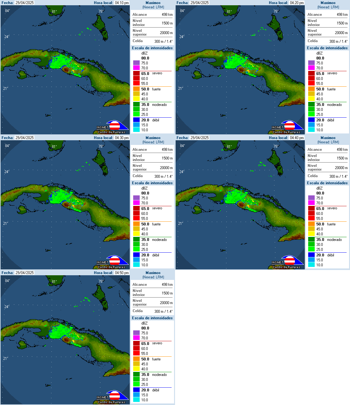
dwg71 wrote:cuban radar shows more wnw motion last hour or so, hard to tell.
WOBBLES WARS
Nah, it will definately get over water for some time but let's hope it won't be enough to for it to properly reintensify.
0 likes
- Houstonia
- S2K Supporter

- Posts: 829
- Age: 61
- Joined: Fri Oct 11, 2002 9:45 am
- Location: Sharpstown, Houston, Harris County, Southeast Texas.
Re: ATL IKE: Category 2 - Discussion
Link to Texas Emergency Management Situation reports:
http://www.txdps.state.tx.us/dem/sitrepindex.htm
http://www.txdps.state.tx.us/dem/sitrepindex.htm
0 likes
Re:
dwg71 wrote:cuban radar shows more wnw motion last hour or so, hard to tell.
It looks like it maybe on a slightly north of west motion but the eye is pretty much gone on the radar so its not easy to tell, the eyewall still seems to be around the same latitude as its beeen, maybe a touch north of where it was an hour ago but only by a tiny amount it seems.
Either way its stil lgoing to get into the Caribbean unless it takes a sharp NW wobble right now.
0 likes
- cape_escape
- Category 2

- Posts: 745
- Age: 57
- Joined: Fri Aug 13, 2004 2:39 am
- Location: Cape Coral Florida
- Contact:
Re: ATL IKE: Category 2 - Discussion
apocalypt-flyer wrote:To cape_escape:
Can definately see your concern but we really will have to wait and see when Ike's anticipated motion towards the WNW begins and until Ike enters the Gulf it will be hard to say where exactly he'll end up along the Gulf Coast.
But I have quite a bit of faith in the NHC since they did very well with the last Gulf Coast system Gustav and I hope they'll done just as well this time around.
I know the NHC has been doing a great job, thank you for your reply
I never have been a very patient person.....I need to learn the art of patience
0 likes
Re: ATL IKE: Category 2 - Discussion
Will the track and possible slowdown over the NW Caribbean change the track?
This could get interesting!!
This could get interesting!!
0 likes
Who is online
Users browsing this forum: No registered users and 47 guests


