
When would evacuations begin?
I'm not settled back in yet from Gustav, as I"m sure many of you are not. sigh
Texans and anyone else who may be getting this storm, START EARLY WITH PREPARATIONS, it helps sooo much. Those who left 1 day after me had hell with traffic, supplies, etc.
ATL: IKE Discussion
Moderator: S2k Moderators
Re:
[quote="BigB0882"]What does this further south movement mean for its track? I am thinking two scenarios. The first is that it shifts landfall further west. That seems obvious but then I got to thinking. Does this also delay landfall and by how much? Does that give the trough more time to come down and pick this thing up? I've read where the trough isn't expected to have an impact on Ike until AFTER landfall but that's assuming this makes landfall when planned.[/quote]
Well, by this weekend the High is progg'd to start breaking down and Ike would lose alot of his steering mechanism...I think this is kind of what the GFS has been saying but per the NHC they are completely disregarding that...you still have to go w / the NHC right now and as everything seems to be trending wwd it's not looking too good for the folks in the Hou / Gal area IMO...this could be a real, real ugly situation for them...
Well, by this weekend the High is progg'd to start breaking down and Ike would lose alot of his steering mechanism...I think this is kind of what the GFS has been saying but per the NHC they are completely disregarding that...you still have to go w / the NHC right now and as everything seems to be trending wwd it's not looking too good for the folks in the Hou / Gal area IMO...this could be a real, real ugly situation for them...
0 likes

Re: ATL IKE: Category 2 - Discussion
gotcha thanks....and i do ask because i love breezy days like this...helps with the heat and is neat to listen to out your window at night...and do no real harm save some rip currents. This is a total admission wishcaster of gusty weather that does no harm except to those who hate listening to other people's windchimes..lol
cpdaman wrote:jinftl
on TWC they said that the winds above s.fl are very high "very high" and that these winds could/would be pulled down in squalls.
i also wonder how the pressure gradient would change (and thus tweak the wind forecast), should the system be 75 miles further south , yet perhaps maintain a lower pressure (since it would be over land yes) i would guess the two differences; further away, yet lower pressure would = pretty much no change "a wash" and winds would probably verify as forecast
Last edited by jinftl on Mon Sep 08, 2008 9:38 am, edited 1 time in total.
0 likes

Given the models are only suggesting a 285 type motion if it can stay on its current heading for a little while longer it may well stay in the water for a good length of time given the way the land curves but thats the difference between a 40kts TS emerging and a 60-70kts system emerging IMO, big difference for the gulf states.
0 likes


Re: ATL IKE: Category 2 - Discussion
cpdaman wrote:jinftl
on TWC they said that the winds above s.fl are very high "very high" and that these winds could/would be pulled down in squalls.
i also wonder how the pressure gradient would change (and thus tweak the wind forecast), should the system be 75 miles further south , yet perhaps maintain a lower pressure (since it would be over land less)
it may depend on wether the high winds above the ground in s.fl were directly due to the forecast proximity of the hurricane, but i would guess the two differences i mentioned would likely result in minimal change in the forecast, regardless
I don't see us getting the rain from Ike just the 20-30mph winds.I think the northern extend of the rain should be in the Keys.
0 likes
-
AJC3

- Admin

- Posts: 4152
- Age: 62
- Joined: Tue Aug 31, 2004 7:04 pm
- Location: Ballston Spa, New York
- Contact:
Re: Re:
tallywx wrote: If that outer eyewall becomes the dominant feature, would that still be categorized as an "inner core"? Wouldn't that produce an area 60-70 miles in diameter with light winds - meaning it would lack an inner core? How is that any different from Wilma/Jeanne/Frances, storms that also lacked "inner cores" with calm areas that large?
Some poor phraseology on my part. It will probably become the central feature of Ike, eventually - I suppose it shouldn't be called an 'inner core' unless it does and then contracts some.
Last edited by AJC3 on Mon Sep 08, 2008 9:45 am, edited 2 times in total.
0 likes
Re: ATL IKE: Category 2 - Discussion
boca wrote:cpdaman wrote:jinftl
on TWC they said that the winds above s.fl are very high "very high" and that these winds could/would be pulled down in squalls.
i also wonder how the pressure gradient would change (and thus tweak the wind forecast), should the system be 75 miles further south , yet perhaps maintain a lower pressure (since it would be over land less)
it may depend on wether the high winds above the ground in s.fl were directly due to the forecast proximity of the hurricane, but i would guess the two differences i mentioned would likely result in minimal change in the forecast, regardless
I don't see us getting the rain from Ike just the 20-30mph winds.I think the northern extend of the rain should be in the Keys.
that's a fair point, with ike being further south , we would probably get less "squalls" and thus less chance for the storms to pull down the higher winds .
also don't forget that they tremdously fumbled the rain amounts with hanna in s. fl .......they called for 30% showers and we got widespread 3-6 inches of rain lol... they probably don't want to take the chance to underforecast rain amounts like that again
Last edited by cpdaman on Mon Sep 08, 2008 9:44 am, edited 1 time in total.
0 likes
Re: ATL IKE: Category 2 - Discussion
awesome...may turn out to be actualy quite a nice few days then...breezy, subsidence induced sunshine maybe...good surf in the atlantic for those who dare and know the rip current danger....
boca wrote:cpdaman wrote:jinftl
on TWC they said that the winds above s.fl are very high "very high" and that these winds could/would be pulled down in squalls.
i also wonder how the pressure gradient would change (and thus tweak the wind forecast), should the system be 75 miles further south , yet perhaps maintain a lower pressure (since it would be over land less)
it may depend on wether the high winds above the ground in s.fl were directly due to the forecast proximity of the hurricane, but i would guess the two differences i mentioned would likely result in minimal change in the forecast, regardless
I don't see us getting the rain from Ike just the 20-30mph winds.I think the northern extend of the rain should be in the Keys.
0 likes

-
carversteve

- Tropical Storm

- Posts: 161
- Joined: Sat Aug 18, 2007 7:40 am
Re: ATL IKE: Category 2 - Discussion
Would i be correct in saying, Ike is going to miss the next forecast point to the south by quite a bit?
0 likes
Re:
Local met said the same thing this am.....look for a huge windfield (diameter) akin to any of the bigger gulf systems we have seen in recent memory.
I would think a large windfield has surge implications as water over a big area gets in the act?
I would think a large windfield has surge implications as water over a big area gets in the act?
gboudx wrote:To those doubting jeff on the windfield expansion, he said on a recent conference call he sees a Katrina/Carla sized storm. But not as big as Gilbert. I didn't realize we had so many experts on this board. We are so blessed.
Last edited by jinftl on Mon Sep 08, 2008 9:50 am, edited 1 time in total.
0 likes
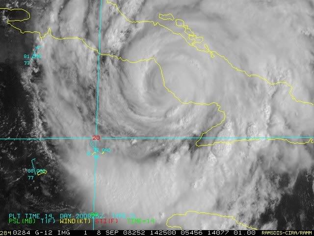
gboudx, the idea that it would expand into a very large hurricane wa son the assumption that the core would unwrap overland and therefore 'grow'. However the track has meant that it won't travel over Cuba totally but instead over the Caribbean for a good period of time it appears. Therefore the core will probably stay as it is now, maybe even tighten up a litytle bit if it can continue due west for a little bit longer.
0 likes
Re:
gboudx wrote:To those doubting jeff on the windfield expansion, he said on a recent conference call he sees a Katrina/Carla sized storm. But not as big as Gilbert. I didn't realize we had so many experts on this board. We are so blessed.
Agreed we ARE BLESSED...
0 likes
-
Galvestongirl

- Category 1

- Posts: 288
- Joined: Fri Aug 22, 2003 8:13 am
Re: ATL IKE: Category 2 - Discussion
I dont know if this has been mentioned, but earlier this morning on the television it was mentioned that the "track is earily like the great storm of 1900."
0 likes
Re: ATL IKE: Category 2 - Discussion
I hope this keeps on going due west because whats this storm going to do to our gas prices with those oil rigs in the NW GOM.
0 likes
Who is online
Users browsing this forum: No registered users and 12 guests