ATL: IKE Discussion
Moderator: S2k Moderators
-
deltadog03

- Professional-Met

- Posts: 3580
- Joined: Tue Jul 05, 2005 6:16 pm
- Location: Macon, GA
Re: ATL IKE: Category 1 - Discussion
If it can maintain this speed and heading...(290-300) then there is room for it too go north righ now.
0 likes

Its going to be close Deltadog, I get the feeling the GFS is too fast and you mentioned the same thing in the other thread.
Anyway right now still seems like Texas has the main threat, would have to be a big change around for it not to hit Texas or Mexico now.
Anyway it does seem like for now Ike is a little north now of its forecast point, nothing too extreme but just a touch.
Anyway right now still seems like Texas has the main threat, would have to be a big change around for it not to hit Texas or Mexico now.
Anyway it does seem like for now Ike is a little north now of its forecast point, nothing too extreme but just a touch.
0 likes
-
Emmett_Brown

- Category 5

- Posts: 1433
- Joined: Wed Aug 24, 2005 9:10 pm
- Location: Sarasota FL
Re: ATL IKE: Category 1 - Discussion
deltadog03 wrote:If it can maintain this speed and heading...(290-300) then there is room for it too go north righ now.
Mr Delta Dog, can you clarify "room"... do you mean that there is room synoptically north of his current position?
0 likes
-
Hurricanewatcher2007

- Category 2

- Posts: 578
- Joined: Sat Jul 05, 2008 8:10 pm
Re: ATL IKE: Category 1 - Discussion
Based on Cuban Radar looks to me like a EWRC is about to start.
0 likes
Isaw no signs of an EWRC in the latest microwave imagery I saw earlier to be honest but that was a little old now.
Anyway inner core still looks tight and compact...its going to come inland nearly *exactly* where Gustav made landfall which is not what they need!
This systrem is almost like several of the last systems into one, Bertha's early track in the Atlantic (till Ike bent back WSW) Fay's skim of the Cuba coast, Gustav's hit on Cuba and early GoM track and Dolly's westward track in the western part...
0 likes
-
deltadog03
- Professional-Met
- Posts: 3580
- Joined: Tue Jul 05, 2005 6:16 pm
- Location: Macon, GA
Re: ATL IKE: Category 1 - Discussion
On the Cimss site there is a ridge over the western gom and the main one that comes in and sprawls across the gom from the east. There is a little weakness right now, according to that map, to its north. I am just saying it should not move straight west for the time being.
0 likes
-
Sabanic

- Category 2
- Posts: 683
- Age: 66
- Joined: Wed Aug 01, 2007 7:01 am
- Location: Mobile, AL
- Contact:
Re: ATL IKE: Category 1 - Discussion
Basically Ike has done just what he has wanted to do the entire time. If I am not mistaken he has rarely taken the route of the NHC, and it seems like they have had to adjust their track each update based on where he has gone. I realize that is how it usually is, but he has yet to follow it if I'm not mistaken. Just a question, but with a few of the models showing a rather strong northward turn prior to landfalling the TX coast, dd is there any possibility he makes this turn any sooner, and goes further eastward. Such as LA?
0 likes
-
jlauderdal
- S2K Supporter

- Posts: 7240
- Joined: Wed May 19, 2004 5:46 am
- Location: NE Fort Lauderdale
- Contact:
Re: ATL IKE: Category 1 - Discussion
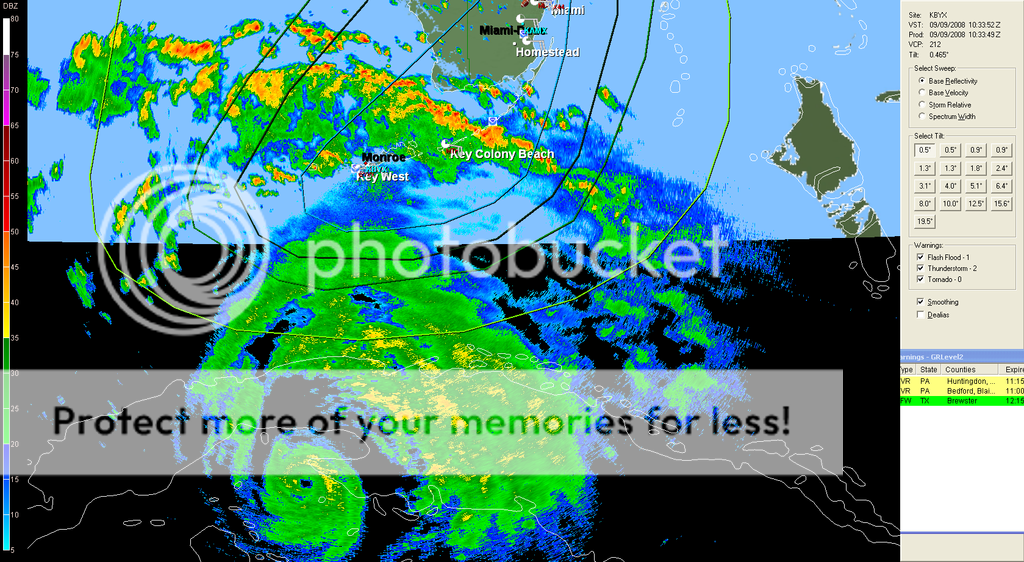
the general has a small eye, they just showed key west on local news and plenty of street flooding there
0 likes
-
Hurricanewatcher2007
- Category 2
- Posts: 578
- Joined: Sat Jul 05, 2008 8:10 pm
Re: ATL IKE: Category 1 - Discussion
Sabanic wrote:Basically Ike has done just what he has wanted to do the entire time. If I am not mistaken he has rarely taken the route of the NHC, and it seems like they have had to adjust their track each update based on where he has gone. I realize that is how it usually is, but he has yet to follow it if I'm not mistaken. Just a question, but with a few of the models showing a rather strong northward turn prior to landfalling the TX coast, dd is there any possibility he makes this turn any sooner, and goes further eastward. Such as LA?
Well the NHC still says that its to early to say for sure where Ike will go so if your in LA then still keep an eye on Ike cause things can and often times do change this far out!
0 likes
-
Emmett_Brown
- Category 5
- Posts: 1433
- Joined: Wed Aug 24, 2005 9:10 pm
- Location: Sarasota FL
Re: ATL IKE: Category 1 - Discussion
deltadog03 wrote:On the Cimss site there is a ridge over the western gom and the main one that comes in and sprawls across the gom from the east. There is a little weakness right now, according to that map, to its north. I am just saying it should not move straight west for the time being.
Interesting. Thanks for the clarification. Actually, I was looking at steering that was progged recently by GFS at 500mb, and the ridge does look at bit thin on this map; suppose it is the short wave that is going to miss to the north. Might provide for some fun wobble watching before the next ridge builds. Is there a good link that I can use to show steering currents that are currently in place? Also should we use 500 mb steering for this situation, or is the steering being governed at an even higher altitude?
Thanks,
Dr Brown
0 likes
Re: ATL IKE: Category 1 - Discussion
deltadog03 wrote:On the Cimss site there is a ridge over the western gom and the main one that comes in and sprawls across the gom from the east. There is a little weakness right now, according to that map, to its north. I am just saying it should not move straight west for the time being.
Yeah theres a little bit of the weakness and thats clearly where Ike will gain most of its latitude, quite how much will probably go a long way to knowing exactly where Ike will threaten in the weekend.
LA isn't in the clear yet, its looking less likely the region will get hit but its still far enough away for big changes.
0 likes
-
Portastorm

- Storm2k Moderator

- Posts: 9955
- Age: 63
- Joined: Fri Jul 11, 2003 9:16 am
- Location: Round Rock, TX
- Contact:
Re: ATL IKE: Category 1 - Discussion
The question has been raised about the possibility of dry-air intrusion with Ike as it would near the western Gulf coastline. Normally this would be the case. But a perusal of the 500mb plots of the 0z GFS shows a south to southwest flow from the Pacific (i.e. moist). In fact, some of the moisture from Lowell is blowing over Texas right now at the higher levels of the atmosphere. Looks like this would continue. Not certain but it looks to me like there may not be a lot of dry-air intrusion at play when Ike nears the coastline, albeit Mexico or Texas.
0 likes
-
deltadog03
- Professional-Met
- Posts: 3580
- Joined: Tue Jul 05, 2005 6:16 pm
- Location: Macon, GA
Re: ATL IKE: Category 1 - Discussion
To be quite honest, If I were in LA, TX, or MX I would be watching this like a hawk. The american models want to take this straight W'wd into mexico or southern TX. Euro models want to show north pull at the end and are further NE (SE TX). We shall see. Movement over the next 24 is crucial imo.
0 likes
Well as I said Delta I think how far north it gets now will give a good indication of where is in most danger in terms of regions anyway, because the motion once its lifted up around 36-48hrs should be pretty much Westerly, maybe north of west and so its not going to gain a huge amount of latitude.
The other thing to note if this sticks close to 26N then this is going to have very high heat content for a good 36=48hrs period after it emerges off Cuba, that is ideal with conditions aloft for a 150mph plus type hurricane...
The other thing to note if this sticks close to 26N then this is going to have very high heat content for a good 36=48hrs period after it emerges off Cuba, that is ideal with conditions aloft for a 150mph plus type hurricane...
0 likes
-
Emmett_Brown
- Category 5
- Posts: 1433
- Joined: Wed Aug 24, 2005 9:10 pm
- Location: Sarasota FL
I think the biggest enemy of the forecast track would be a prolonged slowdown of some kind. Not saying that this is or is going to happen, but if it did, it obviously could cause shifts downstream. I notice that the trough late in the week shown by the GFS is digging fairly far south on the model, but Ike would be far west at that point. My point being that rate of speed could have bigger downstream affects than wobbles IMO.
0 likes
-
Hurricanewatcher2007
- Category 2
- Posts: 578
- Joined: Sat Jul 05, 2008 8:10 pm
Re: ATL IKE: Category 1 - Discussion
Based on the recon fixes this morning I would say Ike has started more of a northern trek now. Yes I know that recon fixes aren't the best for deciding motion but considering Ike only has about a 9 mile wide eye each fix is with in 9 miles of the true center so I would say its safe to at the very least get a general est. of the motion based on the center fixes.
0 likes
-
Portastorm
- Storm2k Moderator
- Posts: 9955
- Age: 63
- Joined: Fri Jul 11, 2003 9:16 am
- Location: Round Rock, TX
- Contact:
Re:
Emmett_Brown wrote:I think the biggest enemy of the forecast track would be a prolonged slowdown of some kind. Not saying that this is or is going to happen, but if it did, it obviously could cause shifts downstream. I notice that the trough late in the week shown by the GFS is digging fairly far south on the model, but Ike would be far west at that point. My point being that rate of speed could have bigger downstream affects than wobbles IMO.
Doc Brown, I think that is an excellent point and a slowdown would most certainly -- it seems -- encourage a more northward movement. That being said, there doesn't appear to be any atmospheric parameter that would significantly slow down Ike at all. You have a ridge ... you have a hurricane. Fairly simple.
0 likes
-
deltadog03
- Professional-Met
- Posts: 3580
- Joined: Tue Jul 05, 2005 6:16 pm
- Location: Macon, GA
Re: ATL IKE: Category 1 - Discussion
Agreed Doc...Any slow down in this will have huge implications....
0 likes
-
sphelps8681
- Category 2
- Posts: 785
- Joined: Thu Aug 16, 2007 5:37 pm
- Location: Somewhere over the rainbow
Who is online
Users browsing this forum: No registered users and 33 guests