ATL: IKE Discussion
Moderator: S2k Moderators
Re: ATL IKE: Category 2 - Discussion
OK I am shocked ... we are getting some pretty rough winds right now. I live just east of Baton Rouge and its like Gustav all over again ... howling winds and everything. Just from a different direction. I am sure they are not as strong as with Gustav. They can't be. But I am floored at how bad it is right now ....
0 likes
-
alan1961

- Category 2

- Posts: 771
- Joined: Mon Mar 20, 2006 11:58 am
- Location: Derby, Derbyshire, England
- Contact:
Re:
KWT wrote:Well as someone has put up here is the streaming tv:
http://flhurricane.com/ikecoverage.html
Outer storms showing up very nicely on the radar now despite another 18hrs till landfall.
KWT...24 HOUR streaming on khou
http://www.khou.com/video/?nvid=178826& ... s&noad=yes
0 likes
-
jaxfladude
- Category 5

- Posts: 1249
- Joined: Wed Aug 24, 2005 9:36 pm
- Location: Jacksonville, Fla
Re: ATL IKE: Category 2 - Discussion
Prayers for all in Ike's path and for those already impacted by Ike...
I hope the hurricane weakens somewhat before landfall, but given it's size..................ouch.....
I hope the hurricane weakens somewhat before landfall, but given it's size..................ouch.....
0 likes
-
Lowpressure

- S2K Supporter

- Posts: 2032
- Age: 59
- Joined: Sun Sep 14, 2003 9:17 am
- Location: Charlotte, North Carolina
Re: ATL IKE: Category 2 - Discussion
wjs3 wrote:Just a point on that Marine ob of 90+ kts--yes it's impressive, but it needs to be reduced. It's taken at 122 meters--not the meteorological standard of 10M. Here's description from NDBC:
Air temp height: 37 m above site elevation
Anemometer height: 122 m above site elevation
Barometer elevation: 37 m above mean sea level
Water depth: 872 m
edit: Looks like drezee beat me to this point. Sorry!
How many buildings in Houston are at or over 122m? In this case it actually does matter as far as a damage aspect to taller buildings.
0 likes
-
HURAKAN

- Professional-Met

- Posts: 46084
- Age: 39
- Joined: Thu May 20, 2004 4:34 pm
- Location: Key West, FL
- Contact:
Re: ATL IKE: Category 2 - Discussion
weunice wrote:OK I am shocked ... we are getting some pretty rough winds right now. I live just east of Baton Rouge and its like Gustav all over again ... howling winds and everything. Just from a different direction. I am sure they are not as strong as with Gustav. They can't be. But I am floored at how bad it is right now ....

You should be experiencing sustained TS winds.
0 likes
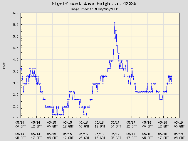
Station 42035 - GALVESTON 22NM East of Galveston, TX
Owned and maintained by National Data Buoy Center
3-meter discus buoy
ARES 4.4 payload
29.246 N 94.408 W (29°14'47" N 94°24'30" W)
Site elevation: sea level
Air temp height: 4 m above site elevation
Anemometer height: 5 m above site elevation
Barometer elevation: sea level
Sea temp depth: 0.6 m below site elevation
Water depth: 15.9 m
Watch circle radius: 52 yards
0 likes

Re: ATL IKE: Category 2 - Discussion
As i see media have their knifes sharpened, guns loaded and are ready for assault.
Last edited by Bunkertor on Fri Sep 12, 2008 6:48 am, edited 1 time in total.
0 likes
-
Sonica
- Tropical Low

- Posts: 30
- Age: 62
- Joined: Sun Sep 17, 2006 3:07 pm
- Location: shop's in Baton Rouge-house in Walker
- Contact:
Re: ATL IKE: Category 2 - Discussion
weunice wrote:OK I am shocked ... we are getting some pretty rough winds right now. I live just east of Baton Rouge and its like Gustav all over again ... howling winds and everything. Just from a different direction. I am sure they are not as strong as with Gustav. They can't be. But I am floored at how bad it is right now ....
We're under tornado watch...but yeah, this is bad!
0 likes
-
southerngale

- Retired Staff

- Posts: 27418
- Joined: Thu Oct 10, 2002 1:27 am
- Location: Southeast Texas (Beaumont area)
Re:


I haven't seen anything since last night... just now checking things. How accurate are those maps supposed to be? I live in Jefferson County.
Ugh... I think I'm gonna be sick!
0 likes
-
apocalypt-flyer
- Category 1

- Posts: 468
- Joined: Sat Aug 27, 2005 11:51 am
Re: ATL IKE: Category 2 - Discussion
If those maps verify this will be BAD BAD STUFF.
Last edited by apocalypt-flyer on Fri Sep 12, 2008 6:41 am, edited 1 time in total.
0 likes
-
Rod Hagen
- Tropical Storm

- Posts: 237
- Joined: Fri Sep 23, 2005 6:22 am
- Location: Lives in Melbourne, works in N Queensland
From the look of the loop at http://www.ssd.noaa.gov/goes/flt/t3/loop-avn.html Ike isn't going anywhere fast, north, south m, east or west. (Its an hour or so since I last looked). It is pretty much sitting still and re-organising.
0 likes
-
deltadog03

- Professional-Met
- Posts: 3580
- Joined: Tue Jul 05, 2005 6:16 pm
- Location: Macon, GA
Re: ATL IKE: Category 2 - Discussion
I hope everyone is safe who is in the path of this storm. I hope they took the warnings to leave and left. I know there will be some that didn't, but I hope most did. Good thing, IMO, is that IKE looks like he might have bottomed out. I just don't think IKE is gonna do a whole lot more. Looks like somewhere around 100-105 mph at landfall. Oh, the trof is moving in quickly, but not quick enough to deflect it like my map said so. I would change my landfall point to just on the north (east) side of galveston. Stay safe everyone.
0 likes
-
AZRainman

- Tropical Storm
- Posts: 146
- Joined: Fri Sep 23, 2005 12:48 pm
- Location: Sonoran Desert
- Contact:
Re: Re:
southerngale wrote:AZRainman wrote:Latest surge maps
[I haven't seen anything since last night... just now checking things. How accurate are those maps supposed to be? I live in Jefferson County.
New item, guess we shall see how accurate they prove to be..
The SLOSH model is generally accurate within plus or minus 20 percent.
In addition, SLOSH data is available from two FTP sites at the current time; namely
primary: ftp://ftp.nhc.noaa.gov/surge/ and backup: ftp://ftp.tpc.ncep.noaa.gov/surge,
which are not hosted at NHC and have magnitudes more capacity than the original NHC
FTP server. It appears once the data is on the NHC web site plus the ftp sites, everyone's
requirement for SLOSH data should be easily fulfilled. .
http://www.fema.gov/plan/prevent/nhp/slosh_link.shtm
0 likes
-
Sonica
- Tropical Low
- Posts: 30
- Age: 62
- Joined: Sun Sep 17, 2006 3:07 pm
- Location: shop's in Baton Rouge-house in Walker
- Contact:
Re: ATL IKE: Category 2 - Discussion
Sonica wrote:superfly wrote:Sonica wrote:It's exploding! It will be at least a 3 IMO!
It's not "exploding." It's a mess right now with the western side of the storm completely missing on microwave. The middle "CDO" is what's left of the inner eyewall and there is a clear moat between that area and the dominant outer eyewall.
Yeah, sorry but it's true!

I could see this at 3:45 am and I hate that it was true.
0 likes

Re:
dwg71 wrote:Just went outside in SE Houston (Pasadena) eerily still winds and hot and humid..hard to believe its only 18 hours or so from landfall.
Saturday before Katrina, I spent the day boarding up the house and all that jazz, it was the hottest most humid day. It makes the prep that much worse.
0 likes

Re: ATL IKE: Category 2 - Discussion
deltadog03 wrote:I hope everyone is safe who is in the path of this storm. I hope they took the warnings to leave and left. I know there will be some that didn't, but I hope most did. Good thing, IMO, is that IKE looks like he might have bottomed out. I just don't think IKE is gonna do a whole lot more. Looks like somewhere around 100-105 mph at landfall. Oh, the trof is moving in quickly, but not quick enough to deflect it like my map said so. I would change my landfall point to just on the north (east) side of galveston. Stay safe everyone.
Ike seems to have some similarity to Isabel in terms of being a big storm with a wide wind field...there are different dynamics at play compared to Isabel but both were immense storms with large wind fields. Impacts won't be felt just close to the center but over a good sized chunk of Southeast Texas and Western Louisiana.
0 likes


-
deltadog03
- Professional-Met
- Posts: 3580
- Joined: Tue Jul 05, 2005 6:16 pm
- Location: Macon, GA
Re: ATL IKE: Category 2 - Discussion
Oh, I agree....Spatial wise this is a monster. Lots of people are going to feel his wrath. I guess my only thing is, it could be worse as far as winds. Thankfully this won't be a 4 at landfall. Surge...well, thats gonna be the biggest story....
0 likes
Who is online
Users browsing this forum: No registered users and 65 guests