ATL: IKE Discussion
Moderator: S2k Moderators
-
Extremeweatherguy

- Category 5

- Posts: 11095
- Joined: Mon Oct 10, 2005 8:13 pm
- Location: Florida
-
Ed Mahmoud
Re: ATL IKE: Category 2 - Discussion
pablolopez26 wrote:Some photos i took right before sundown. It was orange outside tonight. Weird.
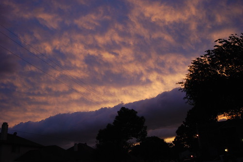
I saw that, was beautiful, and the winds had briefly dropped under 20 mph, if I had to guess. Must be gusting well over 50 mph, looking outside, my electricity is on borrowed time.
0 likes
-
MetSul Weather Center
- Tropical Storm

- Posts: 103
- Joined: Wed Dec 06, 2006 9:08 pm
- Location: São Leopoldo, Brazil
Re: ATL IKE: Category 2 - Discussion
Hurricane Ike surge breaches, overtops some levees, floods homes, roadways across state
by Mark Schleifstein, The Times-Picayune Friday September 12, 2008, 2:58 PM
Storm surge from Hurricane Ike is causing widespread flooding in communities outside levees in the New Orleans area, however earlier reports of a levee breach in Plaquemines Parish were false.
Elsewhere in the state, surge from Ike has breached or overtopped levees in Terrebonne and St. Mary Parish.
A storm surge model produced by the Center for the Study of Public Heath Effects of Hurricanes at LSU predicts surge from Ike will reach near 10 feet on the east bank of the Mississippi River in Plaquemines Parish and could reach that high in southeasternmost St. Tammany Parish.
The National Weather Service has predicted up to 9 feet of surge on east-facing coastlines in the New Orleans area through this evening.
According to the state Office of Coastal Protection and Restoration, widespread flooding is occurring at Shell Beach, Yscloskey, Alluvial City, Delacroix and Hopedale in St. Bernard Parish, all outside levees.
In Plaquemines Parish, contractors hired by the parish are sandbagging levees in the Caernarvon and Braithwaite areas that experienced breaching during Hurricane Gustav last week. An earlier report of a six-foot-wide breach today in a non-federal parish levee near the towns of Caernarvon, Scarsdale, White Ditch and Braithwaite was false, officials acknowledged later.
However, there has been some minor overtopping of that levee, but the flooding is being contained officials said. As of 11:45 a.m., no reports of flooded homes had been reported in that area.
The state has opened a siphon at the Caernarvon Freshwater Diversion Project that usually moves Mississippi River water into wetlands so storm surge in the marshes can flow into the river. Officials are closely monitoring the levels in both the river and the nearby marshes.
On the parish's West Bank, meanwhile, Plaquemines officials are pessimistic about winning a fight against overtopping of a levee in Pointe Celeste. With higher tides later tonight, however, officials fear that fight will not be successful.
In New Orleans, water continues to rise along Lake Pontchartrain, but may be dropping in the Industrial Canal. At the Industrial Canal lock, the water was at 8.56 feet at noon, down from 9.27 feet at 9 a.m.
Floodgates have been closed at the mouths of the London Avenue and 17th Street canals, and no significant flooding is expected in the city, state officials said.
In Jefferson Parish, flooding is reported in Lafitte, where the Pontchartrain Levee District is sending sandbags to protecte critical areas. Grand Isle reported surge flooding covering the island, and water levels may be higher than experienced during Hurricane Gustav on Sept. 1
Floodgates have been closed throughout the parish, including at Company Canal and the Harvey Canal.
Neighborhoods along the north shore of Lake Pontchartrain in St. Tammany Parish began flooding Friday morning. The Mandeville lakefront and areas near Slidell such as Eden Isles, Coin du Lestin and Lakeview Drive were swamped by rising water encroaching from the lake Ike's winds pushed through from the southeast.
Numerous roads and bridges were closed from Madisonville to the Slidell area.
In Terrebonne Parish, flooding is reported in the towns of Isle de Jean Charles, Montegute, Pointe Aux Chenes, Cocodrie and Dulac, with parish levees overtopped at several locations.
Surge overtopped a St. Mary Parish levee near the town of Gordy.
State officials expect additional flooding reports as Ike's surge enters coastal communities farther west. The LSU surge model predicts water levels greater than 14 feet in parts of Cameron and Calcasieu parishes. National Weather Service predictions actually are for even higher surge levels in that area, with 15 to 20 feet of surge accompanied by large, battering waves expected in Cameron by tonight.
http://www.nola.com
0 likes
Re: ATL IKE: Category 2 - Discussion
CNN reporter clocked 90mph gust in Galveston 20 minutes ago.
0 likes
Re: ATL IKE: Category 2 - Discussion
people are driving up the price....creating a frenzy...simple supply and demand...that's a whole other story....so far haven't seen gas lines or much increase by me...as of a few hrs ago. we will not run out of gas. 13% of oil refining capacity is shut now...that leaves 87%.
Stratusxpeye wrote:Anyone else well outside of Texas, experiencing HUGE lines at gas stations and panic that there will be no gas? It's crazy around here. My local station in the town I'm in had lines out to the road at 10pm (usually pretty empty) People are going crazy. Saying they heard it's going to be $5 a gallon and gas cashiers are agreeing?? I haven't heard of this but if it's the case glad I filled up just now.
0 likes
-
dolebot_Broward_NW
- Category 2

- Posts: 529
- Joined: Fri Sep 10, 2004 6:38 am
Re: ATL IKE: Category 2 - Discussion
Anyone else well outside of Texas, experiencing HUGE lines at gas stations and panic that there will be no gas? It's crazy around here. My local station in the town I'm in had lines out to the road at 10pm (usually pretty empty) People are going crazy. Saying they heard it's going to be $5 a gallon and gas cashiers are agreeing?? I haven't heard of this but if it's the case glad I filled up just now.
No runs in south FL - but a nice spike from $3.75-$3.79 up to $3.99.
0 likes
-
HarlequinBoy

- Category 5
- Posts: 1400
- Age: 35
- Joined: Wed Nov 29, 2006 1:57 am
- Location: Memphis
Re: ATL IKE: Category 2 - Discussion
gboudx wrote:HarlequinBoy wrote:Jijenji wrote:Failed levee in Jefferson Parish, LA.
Hmm. Jefferson Parish? That's odd.
Not odd. It's down in a small town outside the hurricane protection levees. It's called Lafitte. I have lots of family down there and we were thinking everything was gonna be fine. This sucks. My father-in-laws house got 8" of water for Rita.
Oh okay. I thought that was near New Orleans. It just seemed weird to have major effects that far away.
0 likes

Re: ATL IKE: Category 2 - Discussion
An organizing squall band will sweep through portions of South Houston metro area over the next 30 minutes. It will likely be accompanied by wind gusts of 40 to 60 mph. Farther east, the core squalls continue to move onshore between about Sabine Pass and Galveston Island. Widespread sustained winds of 50 to 65 mph, but higher along the immediate coast, can be expected along with wind gusts above hurricane force.
(This is not an official product.)
- Jay
(This is not an official product.)
- Jay
0 likes
-
HurryKane

- Category 5
- Posts: 1941
- Joined: Sun Sep 12, 2004 8:08 pm
- Location: Diamondhead, Mississippi
Re: ATL IKE: Category 2 - Discussion
Stratusxpeye wrote:Anyone else well outside of Texas, experiencing HUGE lines at gas stations and panic that there will be no gas? It's crazy around here. My local station in the town I'm in had lines out to the road at 10pm (usually pretty empty) People are going crazy. Saying they heard it's going to be $5 a gallon and gas cashiers are agreeing?? I haven't heard of this but if it's the case glad I filled up just now.
On another board I've read reports of gas rushes in nearly the entire Southeast, all the way up to Michigan and on over to New Jersey. Panic spreads exponentially quickly in the internet age.
0 likes
-
O Town
- S2K Supporter

- Posts: 5205
- Age: 52
- Joined: Wed Sep 07, 2005 9:37 pm
- Location: Orlando, Florida 28°35'35"N 81°22'55"W
Re: ATL IKE: Category 2 - Discussion
HarlequinBoy wrote:Oh okay. I thought that was near New Orleans. It just seemed weird to have major effects that far away.
It is near NO, 17 miles due south according to google earth.
0 likes
-
CrazyC83
- Professional-Met

- Posts: 34315
- Joined: Tue Mar 07, 2006 11:57 pm
- Location: Deep South, for the first time!
Re: ATL IKE: Category 2 - Discussion
Jijenji wrote:Last advisory before landfall in the next half hour...last chance for it to get to a Cat 3. Not that it matters that much right now.
If surface observations support such an upgrade, the TCR will show it.
0 likes


Re: ATL IKE: Category 2 - Discussion
Fox News met pointed out low tide was just over an hour ago in Galveston. Tide rising. Expect overall water level to go up another 10 feet.
0 likes
-
PTrackerLA

- Category 5
- Posts: 5281
- Age: 42
- Joined: Thu Oct 10, 2002 8:40 pm
- Location: Lafayette, LA
Re: ATL IKE: Category 2 - Discussion
Getting pounded by a nasty squall here in Lafayette for the past 30 minutes. Had a tornado warning for it not too long ago either, wait, just issued again. Hopefully no surprises here tonight.
0 likes
-
Innotech

- Category 5
- Posts: 1031
- Joined: Mon Aug 30, 2004 5:32 pm
- Location: Lafayette, Louisiana
- Contact:
Re: ATL IKE: Category 2 - Discussion
Stratusxpeye wrote:Anyone else well outside of Texas, experiencing HUGE lines at gas stations and panic that there will be no gas? It's crazy around here. My local station in the town I'm in had lines out to the road at 10pm (usually pretty empty) People are going crazy. Saying they heard it's going to be $5 a gallon and gas cashiers are agreeing?? I haven't heard of this but if it's the case glad I filled up just now.
THERE IS NO GAS SHORTAGE.
Locally perhaps, but not a major one. please dont get panicky over it.
0 likes

>>Oh okay. I thought that was near New Orleans. It just seemed weird to have major effects that far away.
I was in town this morning and there were plenty of power outages. My exwife had even lost power in Old Metairie as did her whole neighborhood. They got a gust to 75 at the Lakefront in the 7:00 hour. I'm maybe 55 miles (driving) SW of the city and it's stil tropical storm conditions here - dry though. We expect to see some bands back through at some point. Thing is, there is some push from the east - high pressure? - that kind of moved the rest of the wrap around further to our west. The winds are rushing though - prety much sustained in the 20's gusting occasionally into the high 40's with an isolated 50ish. We're a long way from the storm and it's been like this for well over 24 hours.
I shot a video this afternoon back behind the tracks in a cane field when winds were sustained into the 30's. I'll offload and upload it.
Steve
0 likes

Re: ATL IKE: Category 2 - Discussion
KPRC reported a potential tsunami type surge up the bay. Sorry I didn't catch the source.
http://www.click2houston.com/video/10903347/index.html
http://www.click2houston.com/video/10903347/index.html
0 likes
-
fasterdisaster
- Category 5
- Posts: 1868
- Joined: Mon Sep 19, 2005 4:41 pm
- Location: Miami, Florida
Re: ATL IKE: Category 2 - Discussion
Jijenji wrote:Last advisory before landfall in the next half hour...last chance for it to get to a Cat 3. Not that it matters that much right now.
No, I'm pretty sure there will be at least 1 more advisory before landfall after this one.
0 likes
Who is online
Users browsing this forum: No registered users and 6 guests