Subtropical Development in the NE Atlantic? New System

This is the general tropical discussion area. Anyone can take their shot at predicting a storms path.

Moderator: S2k Moderators

Forum rules

The posts in this forum are NOT official forecasts and should not be used as such. They are just the opinion of the poster and may or may not be backed by sound meteorological data. They are NOT endorsed by any professional institution or STORM2K. For official information, please refer to products from the National Hurricane Center and National Weather Service.

Help Support Storm2K
Message
Author
Matt-hurricanewatcher

Re: Subtropical Development in the NE Atlantic?

#21 Postby Matt-hurricanewatcher » Fri Sep 19, 2008 9:09 pm

Image

Image
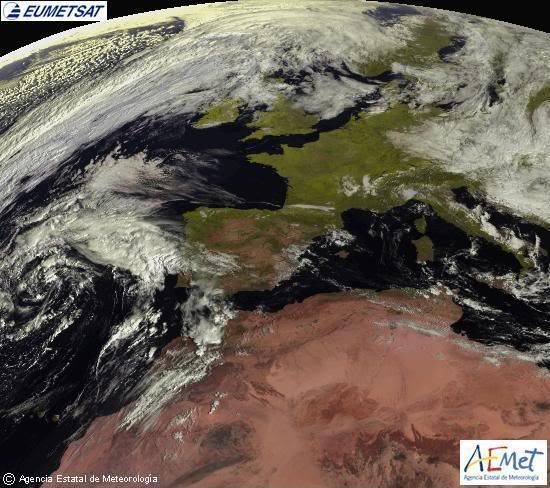
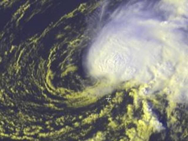
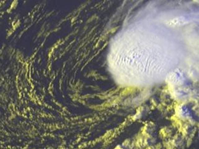
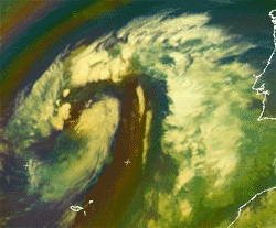
Nice cirulation and convection developing over the center...
0 likes   

User avatar
HURAKAN
Professional-Met
Professional-Met
Posts: 46086
Age: 38
Joined: Thu May 20, 2004 4:34 pm
Location: Key West, FL
Contact:

Re: Subtropical Development in the NE Atlantic?

#22 Postby HURAKAN » Fri Sep 19, 2008 9:53 pm

Image
0 likes   

User avatar
Chacor
Category 5
Category 5
Posts: 10229
Joined: Mon Oct 02, 2006 10:43 pm
Location: Singapore

#23 Postby Chacor » Fri Sep 19, 2008 10:09 pm

Few hours old:

FQNT52 LFPW 192015

A
SECURITE
Weather bulletin for METAREA 2, METEO-FRANCE
Toulouse, Friday 19 September 2008 at 21 UTC.

- Wind speed in BEAUFORT SCALE - Sea : Total significant -
- Please be aware, wind gusts can be a further 40 percent stronger
than the averages given here, and maximum waves may be up to twice
the significant height.


Part 1 : WARNING : NR 426


Part 2 : General synopsis, Friday 19 at 12 UTC

Thundery low 1005 35N18W, moving northwest and deepening, expected
1002 37N19W by 20/12UTC, then 1004 by 21/00UTC.
Disturbance crossing FARADAY overnight, and reaching Northwest
ALTAIR later.

High 1030 south of Ireland drifting northeast and building,
expected 1032 just east Netherland by 20/12UTC.
New high expected 1034 47N39W by 21/00UTC.

Tropical wave along 26W/27W south of 18N, moving west 10 kt.
ITCZ along 11N15W 10N18W 12N25W 10N35W.

<snip>
0 likes   

User avatar
HURAKAN
Professional-Met
Professional-Met
Posts: 46086
Age: 38
Joined: Thu May 20, 2004 4:34 pm
Location: Key West, FL
Contact:

#24 Postby HURAKAN » Sat Sep 20, 2008 5:11 am

Image

Convection has not develop near or over the center.
0 likes   

User avatar
littlevince
S2K Supporter
S2K Supporter
Posts: 768
Joined: Fri Oct 21, 2005 10:45 am
Location: Portugal

Re: Subtropical Development in the NE Atlantic?

#25 Postby littlevince » Sat Sep 20, 2008 5:41 am

This was a cut-off low that yesterday reflected his center at surface. As always with these lows, for us here in Portugal we have some hope of having at least one Invest for some subtropical fun 8-)

But the problem is always the same. Initially we have convention near the center because we have cold in the upper levels that compensate unfavorable water temperature. But when the core warms a little, convention immediately decrease.

Image
0 likes   

User avatar
HURAKAN
Professional-Met
Professional-Met
Posts: 46086
Age: 38
Joined: Thu May 20, 2004 4:34 pm
Location: Key West, FL
Contact:

#26 Postby HURAKAN » Sat Sep 20, 2008 7:27 am

Image
0 likes   

User avatar
littlevince
S2K Supporter
S2K Supporter
Posts: 768
Joined: Fri Oct 21, 2005 10:45 am
Location: Portugal

Re: Subtropical Development in the NE Atlantic?

#27 Postby littlevince » Sat Sep 20, 2008 8:13 am

Image
0 likes   

User avatar
tailgater
S2K Supporter
S2K Supporter
Posts: 3339
Joined: Sun Jul 11, 2004 9:13 pm
Location: St. Amant La.

Re: Subtropical Development in the NE Atlantic?

#28 Postby tailgater » Sat Sep 20, 2008 9:44 am

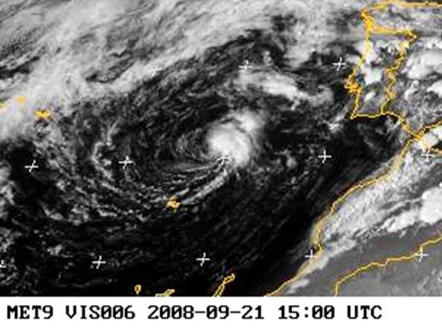
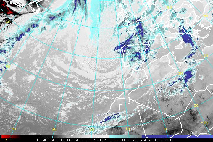
littlevince wrote:This was a cut-off low that yesterday reflected his center at surface. As always with these lows, for us here in Portugal we have some hope of having at least one Invest for some subtropical fun 8-)

But the problem is always the same. Initially we have convention near the center because we have cold in the upper levels that compensate unfavorable water temperature. But when the core warms a little, convention immediately decrease.

Image

Do you have a detailed map of the Tchp for this region?
0 likes   

User avatar
littlevince
S2K Supporter
S2K Supporter
Posts: 768
Joined: Fri Oct 21, 2005 10:45 am
Location: Portugal

Re: Subtropical Development in the NE Atlantic?

#29 Postby littlevince » Sat Sep 20, 2008 11:04 am

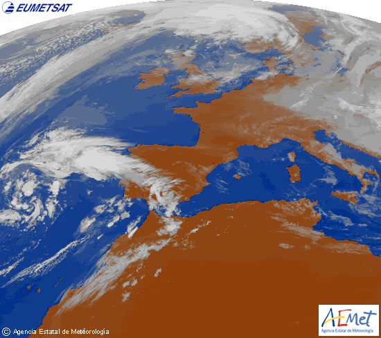
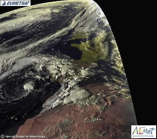
tailgater wrote: Do you have a detailed map of the Tchp for this region?


TCHP no, I suppose it's near zero. But have these one with SST:


Image
0 likes   

User avatar
HURAKAN
Professional-Met
Professional-Met
Posts: 46086
Age: 38
Joined: Thu May 20, 2004 4:34 pm
Location: Key West, FL
Contact:

#30 Postby HURAKAN » Sat Sep 20, 2008 11:06 am

Image

12Z: Moving SE-ward.
0 likes   

User avatar
HURAKAN
Professional-Met
Professional-Met
Posts: 46086
Age: 38
Joined: Thu May 20, 2004 4:34 pm
Location: Key West, FL
Contact:

#31 Postby HURAKAN » Sat Sep 20, 2008 1:19 pm

Image

Looking worse.
0 likes   

User avatar
littlevince
S2K Supporter
S2K Supporter
Posts: 768
Joined: Fri Oct 21, 2005 10:45 am
Location: Portugal

Re: Subtropical Development in the NE Atlantic?

#32 Postby littlevince » Sun Sep 21, 2008 10:09 am

13:00 UTC
Image
Last edited by littlevince on Sun Sep 21, 2008 10:12 am, edited 1 time in total.
0 likes   

User avatar
HURAKAN
Professional-Met
Professional-Met
Posts: 46086
Age: 38
Joined: Thu May 20, 2004 4:34 pm
Location: Key West, FL
Contact:

#33 Postby HURAKAN » Sun Sep 21, 2008 10:10 am

littlevince, it looks much better now. How did you get that image?
0 likes   

User avatar
littlevince
S2K Supporter
S2K Supporter
Posts: 768
Joined: Fri Oct 21, 2005 10:45 am
Location: Portugal

Re:

#34 Postby littlevince » Sun Sep 21, 2008 10:13 am

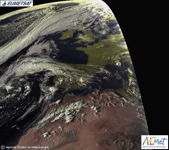
HURAKAN wrote:littlevince, it looks much better now. How did you get that image?


http://oiswww.eumetsat.int/IPPS/html/De ... /index.htm
0 likes   

User avatar
HURAKAN
Professional-Met
Professional-Met
Posts: 46086
Age: 38
Joined: Thu May 20, 2004 4:34 pm
Location: Key West, FL
Contact:

#35 Postby HURAKAN » Sun Sep 21, 2008 10:17 am

Image

It's exposed and moving eastward.
0 likes   

User avatar
HURAKAN
Professional-Met
Professional-Met
Posts: 46086
Age: 38
Joined: Thu May 20, 2004 4:34 pm
Location: Key West, FL
Contact:

#36 Postby HURAKAN » Sun Sep 21, 2008 11:33 am

Image

This system may not develop but it's looking quite good. Maybe the NHC will look at it in the post-analysis.
0 likes   

User avatar
HURAKAN
Professional-Met
Professional-Met
Posts: 46086
Age: 38
Joined: Thu May 20, 2004 4:34 pm
Location: Key West, FL
Contact:

#37 Postby HURAKAN » Sun Sep 21, 2008 12:02 pm

16Z:

Image

Does it need to look even better?
0 likes   

User avatar
Chacor
Category 5
Category 5
Posts: 10229
Joined: Mon Oct 02, 2006 10:43 pm
Location: Singapore

#38 Postby Chacor » Sun Sep 21, 2008 12:07 pm

I strongly doubt they will look at it too closely. It had frontal origins and at any rate is not within the NWS' high seas purview. They would have to confer with Meteo-France.
0 likes   

User avatar
HURAKAN
Professional-Met
Professional-Met
Posts: 46086
Age: 38
Joined: Thu May 20, 2004 4:34 pm
Location: Key West, FL
Contact:

#39 Postby HURAKAN » Sun Sep 21, 2008 12:44 pm

Image

Image

Image

Looking even better now.
0 likes   

User avatar
HURAKAN
Professional-Met
Professional-Met
Posts: 46086
Age: 38
Joined: Thu May 20, 2004 4:34 pm
Location: Key West, FL
Contact:

#40 Postby HURAKAN » Sun Sep 21, 2008 1:39 pm

Image

Image

NE Atlantic System vs 2006 Unnamed Tropical Storm
0 likes   


Return to “Talkin' Tropics”

Who is online

Users browsing this forum: abajan, duilaslol, Ulf and 49 guests