Wave entering the Windward Islands

This is the general tropical discussion area. Anyone can take their shot at predicting a storms path.

Moderator: S2k Moderators

Forum rules

The posts in this forum are NOT official forecasts and should not be used as such. They are just the opinion of the poster and may or may not be backed by sound meteorological data. They are NOT endorsed by any professional institution or STORM2K. For official information, please refer to products from the National Hurricane Center and National Weather Service.

Help Support Storm2K
Message
Author
User avatar
catastrophic
Tropical Low
Tropical Low
Posts: 35
Joined: Wed Jul 23, 2008 1:50 pm
Location: palm bay FL

Wave entering the Windward Islands

#1 Postby catastrophic » Wed Oct 01, 2008 9:44 pm

I noticed this persistent area of convection along this wave and it has had a fair amount of convection for more than 24hr now. It has a good moisture envelope. There is an ULL in front of it that is dropping WSW, causing some shear, but it is supposed to weaken according to this:

http://www.nlmoc.navy.mil/cgi-bin/movie ... gpshrcolor

Heres a visible loop:

http://www.ssd.noaa.gov/goes/east/catl/loop-vis.html

ImageImage

ImageImage
0 likes   

Sanibel
Category 5
Category 5
Posts: 10375
Joined: Mon Aug 30, 2004 11:06 pm
Location: Offshore SW Florida

Tobago Wave

#2 Postby Sanibel » Thu Oct 02, 2008 10:44 pm

Is there a Low associated with that Tobago wave? It appears to have a weak surface spiral to its north.
0 likes   

User avatar
Gustywind
Category 5
Category 5
Posts: 12334
Joined: Mon Sep 03, 2007 7:29 am
Location: Baie-Mahault, GUADELOUPE

Re: Tobago Wave

#3 Postby Gustywind » Fri Oct 03, 2008 6:48 am

Sanibel wrote:Hate to make a thread about this because it will probably dissipate over night, but is there a Low associated with that Tobago wave? It appears to have a weak surface spiral to its north.

Why hate? If you were living in Tobago and in the Lesser Antilles sure you will not say that Sanibel, i can't be agree with that as i'm a carib islander!!! Try to make sense a bit :spam: ?, dissipate or not it's always a pleasure to be informed here and it's the goal no?!, i don't understand your statement, but i take it easy afterall :)
http://www.meteo.fr/temps/domtom/antill ... Tagant.jpg
http://cimss.ssec.wisc.edu/tropic/real- ... g8sht.html
I don't expect much from this with these strong winds shearing this twave...
http://cimss.ssec.wisc.edu/tropic/real- ... g8shr.html

000
AXNT20 KNHC 031029
TWDAT

TROPICAL WEATHER DISCUSSION
NWS TPC/NATIONAL HURRICANE CENTER MIAMI FL
805 AM EDT FRI OCT 03 2008

TROPICAL WEATHER DISCUSSION FOR NORTH AMERICA...CENTRAL
AMERICA...GULF OF MEXICO...CARIBBEAN SEA...NORTHERN SECTIONS
OF SOUTH AMERICA...AND ATLANTIC OCEAN TO THE AFRICAN COAST
FROM THE EQUATOR TO 32N. THE FOLLOWING INFORMATION IS BASED
ON SATELLITE IMAGERY...METEOROLOGICAL ANALYSIS...WEATHER
OBSERVATIONS...AND RADAR.

BASED ON 0600 UTC SURFACE ANALYSIS AND SATELLITE IMAGERY THROUGH
0945 UTC.

...TROPICAL WAVES...

TROPICAL WAVE IS ALONG 56W S OF 18N MOVING W 10-15 KT. WELL
DEFINED INVERTED-V CURVATURE IS OBSERVED IN THE LOW LEVEL CLOUDS
N OF 13N ON SATELLITE IMAGERY AND COINCIDES WITH A MAXIMUM IN
MIMIC TPW ANIMATION. SCATTERED MODERATE/STRONG CONVECTION IS
FROM 9N-13N BETWEEN 53W-60W WITH SCATTERED MODERATE/ISOLATED
STRONG CONVECTION FROM 8N-11N BETWEEN 58W-62W.
0 likes   

HURRICANELONNY
Category 5
Category 5
Posts: 1383
Joined: Wed May 07, 2003 6:48 am
Location: HOLLYWOOD.FL

Re: Tobago Wave

#4 Postby HURRICANELONNY » Fri Oct 03, 2008 7:32 am

For what it's worth . There was one model that develops this wave.
http://moe.met.fsu.edu/cgi-bin/mm5fsu-g ... =Animation
0 likes   

User avatar
Gustywind
Category 5
Category 5
Posts: 12334
Joined: Mon Sep 03, 2007 7:29 am
Location: Baie-Mahault, GUADELOUPE

#5 Postby Gustywind » Fri Oct 03, 2008 7:53 am

000
FXCA62 TJSJ 030820
AFDSJU

AREA FORECAST DISCUSSION
NATIONAL WEATHER SERVICE SAN JUAN PR
420 AM AST FRI OCT 3 2008

.DISCUSSION...EXPECT TODAY TO BE ANOTHER DAY OF LOCALIZED
CONVECTION...ALBEIT A SLIGHT INCREASE IN COVERAGE FROM
THURSDAY...AS AVAILABLE MOISTURE GRADUALLY INCREASES AND MORE
FAVORABLE DYNAMICS ASSOCIATED WITH APPROACHING TUTT LOW BEGIN TO
AFFECT THE LOCAL AREA BY LATER IN THE DAY. THIS TUTT LOW WILL
CONTINUE TO MOVE WEST SOUTHWEST INTO AND THEN ACROSS THE EASTERN
CARIBBEAN EARLY TONIGHT...PASSING SOUTH OF THE LOCAL AREA LATE
TONIGHT THROUGH SATURDAY AND THEN MOVING AWAY FROM THE LOCAL AREA
SATURDAY NIGHT AND SUNDAY. THIS FEATURE WILL GENERALLY PROVIDE
MORE FAVORABLE DYNAMICS LOCALLY FOR CONVECTIVE DEVELOPMENT FOR
SATURDAY AND PROBABLY SUNDAY TOO. AT THE SAME TIME...TROPICAL WAVE
ALONG 55W AND GENERALLY IN PHASE WITH WESTWARD MOVING TUTT
LOW...WILL MOVE ACROSS THE LOCAL AREA LATER SATURDAY THROUGH
SUNDAY AND AN INITIALLY "DRY" AIR MASS EARLY SATURDAY...WILL BE
REPLACED BY DEEPER MOISTURE LATE SATURDAY/SATURDAY NIGHT AND INTO
SUNDAY. THUS...EXPECT A MORE ACTIVE WEATHER PATTERN FOR THE
WEEKEND...WITH THE POTENTIAL FOR A FEW STRONG BOOMERS AND SOME
LOCALIZED HEAVY RAINFALL AND FLOODING...BUT DO NOT EXPECT ANY
WIDESPREAD ACTIVITY.

&&

.AVIATION...PREVAILING VFR CONDITIONS WILL CONTINUE ACROSS ALL
THE TAF SITES THROUGH AT LEAST 16Z UNDER A GENERALLY EASTERLY
TRADE WIND FLOW OF 10 TO 15 KNOTS. AFT 16Z...EXPECT DIURNALLY
INDUCED CONVECTION OVER THE CORDILLERA CENTRAL TO RESULT IN
TEMPORARY MOUNTAIN OBSCURATIONS OVER THE INTERIOR OF PR THIS
AFTERNOON...WITH BRIEF MVFR CONDITIONS EXPECTED ACROSS TJMZ
BETWEEN 17-22Z.

&&

.MARINE...EXPECT WINDS OF 18 KNOTS OR LESS AND SEAS OF 6 FEET OR
LESS ACROSS THE REGIONAL WATERS THROUGH AT LEAST SUNDAY.

&&
0 likes   

User avatar
Gustywind
Category 5
Category 5
Posts: 12334
Joined: Mon Sep 03, 2007 7:29 am
Location: Baie-Mahault, GUADELOUPE

#6 Postby Gustywind » Fri Oct 03, 2008 7:54 am

000
AWCA82 TJSJ 030901
RWSVI

WEATHER SUMMARY FOR THE U.S. VIRGIN ISLANDS
NATIONAL WEATHER SERVICE SAN JUAN PR
501 AM AST FRI OCT 3 2008

PARTLY CLOUDY SKIES PREVAILED ACROSS THE U.S. VIRGIN ISLANDS OVERNIGHT.
DOPPLER WEATHER RADAR DETECTED SCATTERED SHOWERS ACROSS THE LOCAL
COASTAL WATERS THIS MORNING...WITH A FEW OF THESE SHOWERS PASSING
ACROSS SECTIONS OF THE ISLANDS FROM TIME TO TIME. THE WINDS WERE
MAINLY OUT OF THE EAST NORTHEAST AT LESS THAN 10 MPH.

EXPECT THE COMBINATION OF AN UPPER LEVEL TROUGH...LOCAL ISLAND
EFFECTS AND AVAILABLE LOW LEVEL MOISTURE TO RESULT IN SCATTERED
PASSING SHOWERS ACROSS THE U.S. VIRGIN ISLANDS TODAY. CONTINUED
FAVORABLE UPPER LEVEL CONDITIONS...A PASSING TROPICAL WAVE TO THE
SOUTH OF THE ISLANDS AND A SLIGHT INCREASE IN LOW LEVEL
MOISTURE...WILL ALL COMBINE TO BRING SCATTERED SHOWERS AND
ISOLATED THUNDERSTORMS FROM TIME TO TIME ACROSS THE LOCAL AREA
THROUGH THIS UPCOMING WEEKEND.

ACROSS THE LOCAL WATERS...SMALL CRAFTS ARE URGED TO EXERCISE
CAUTION ACROSS THE LOCAL ATLANTIC WATERS AND OFFSHORE CARIBBEAN
WATERS WHERE WINDS UP TO 18 KNOTS CAN BE EXPECTED TODAY.

$$

SR
0 likes   

User avatar
knotimpaired
Category 1
Category 1
Posts: 495
Joined: Fri May 20, 2005 4:14 am
Location: Vieques, PR
Contact:

Re: wave East of lesser antilles

#7 Postby knotimpaired » Fri Oct 03, 2008 8:32 am

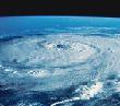
catastrophic wrote:I noticed this persistent area of convection along this wave and it has had a fair amount of convection for more than 24hr now. It has a good moisture envelope. There is an ULL in front of it that is dropping WSW, causing some shear, but it is supposed to weaken according to this:

http://www.nlmoc.navy.mil/cgi-bin/movie ... gpshrcolor

Heres a visible loop:

http://www.ssd.noaa.gov/goes/east/catl/loop-vis.html

Any better suggestions for a title would be appreciated.

ImageImage

ImageImage


Yes, my suggestion is "Make it go away".
0 likes   

FireBird
Tropical Storm
Tropical Storm
Posts: 133
Joined: Tue Jul 22, 2008 1:44 pm
Location: NorthWest Trinidad, SE Caribbean

Re: wave East of lesser antilles

#8 Postby FireBird » Fri Oct 03, 2008 8:43 am

I was wondering last night why it was so humid?! One could almost always tell when some good tropical weather is coming!
So here in Trinidad, the morning has started just as it looks on the satellite. Lightning flashes, moderate rain, etc. A gloomy day. Good thing the umbrella's handy. 8-)
0 likes   

Sanibel
Category 5
Category 5
Posts: 10375
Joined: Mon Aug 30, 2004 11:06 pm
Location: Offshore SW Florida

Re: Wave entering the Windward Islands

#9 Postby Sanibel » Fri Oct 03, 2008 9:43 am

Missed this thread last night, and I looked for it too.

Anyhow it is very close to land but I think we have our second potential system here. The MJO up phase is panning out.
0 likes   

Sanibel
Category 5
Category 5
Posts: 10375
Joined: Mon Aug 30, 2004 11:06 pm
Location: Offshore SW Florida

Re: Wave entering the Windward Islands

#10 Postby Sanibel » Fri Oct 03, 2008 10:10 am

I think the shear timing and location are better for this one:


Image
0 likes   

caribsue
Tropical Depression
Tropical Depression
Posts: 96
Joined: Mon Jul 14, 2008 3:54 pm
Location: Barbados

Re: Wave entering the Windward Islands

#11 Postby caribsue » Fri Oct 03, 2008 10:46 am

Sanibel wrote:I think the shear timing and location are better for this one:


Image


Barbados experiencing very heavy showers with thunder, fork lightning,and gusty winds since about 10:00am
0 likes   

User avatar
HURAKAN
Professional-Met
Professional-Met
Posts: 46086
Age: 38
Joined: Thu May 20, 2004 4:34 pm
Location: Key West, FL
Contact:

#12 Postby HURAKAN » Fri Oct 03, 2008 12:48 pm

TROPICAL WEATHER OUTLOOK
NWS TPC/NATIONAL HURRICANE CENTER MIAMI FL
200 PM EDT FRI OCT 03 2008

FOR THE NORTH ATLANTIC...CARIBBEAN SEA AND THE GULF OF MEXICO...

A BROAD AREA OF LOW PRESSURE OVER THE NORTHWESTERN CARIBBEAN SEA IS
PRODUCING DISORGANIZED SHOWERS AND THUNDERSTORMS BETWEEN HONDURAS
AND WESTERN CUBA. SURFACE PRESSURES ARE NOT FALLING AND ADDITIONAL
DEVELOPMENT IS NOT ANTICIPATED AS THE SYSTEM DRIFTS WESTWARD DURING
THE NEXT COUPLE OF DAYS.

:rarrow: SHOWERS AND THUNDERSTORMS OVER THE WINDWARD ISLANDS AND ADJACENT
ATLANTIC ARE ASSOCIATED WITH WESTWARD MOVING TROPICAL WAVE
INTERACTING WITH A UPPER-LEVEL LOW. THIS ACTIVITY IS EXPECTED TO
MOVE WESTWARD WITH NO DEVELOPMENT.

ELSEWHERE...TROPICAL CYCLONE FORMATION IS NOT EXPECTED DURING THE
NEXT 48 HOURS.

$$

FORECASTER AVILA
0 likes   

User avatar
Gustywind
Category 5
Category 5
Posts: 12334
Joined: Mon Sep 03, 2007 7:29 am
Location: Baie-Mahault, GUADELOUPE

#13 Postby Gustywind » Fri Oct 03, 2008 1:01 pm

http://www.meteo.fr/temps/domtom/antill ... Tagant.jpg
Nice convection popping and expanding...
0 likes   

User avatar
Gustywind
Category 5
Category 5
Posts: 12334
Joined: Mon Sep 03, 2007 7:29 am
Location: Baie-Mahault, GUADELOUPE

#14 Postby Gustywind » Fri Oct 03, 2008 1:07 pm

From a carib islander....of St Vincent
http://stormcarib.com/reports/current/stvincent.shtml
- wind, rain & thunder
From: "Greg & Liz" <cabana at vincysurf.com>
Date: Fri, 3 Oct 2008 12:13:50 -0400

Well there goes another day of outdoor work lost to rain…


The rain started about 11, and we’ve had about an inch of rain already…it’s blowing pretty good…I had to close all the windows and doors on the east, south and west…thunder and lightning now too…fortunately the temperature has dropped a little, down to 88F from 90F…


--------------------------------------------------------------------------------
- another wet weekend?
From: "Greg & Liz" <cabana at vincysurf.com>
Date: Fri, 3 Oct 2008 09:28:35 -0400

From the direction the big blob just east of the Lesser Antilles seems to be moving, it looks like we are in for another wet weekend…
0 likes   

User avatar
Gustywind
Category 5
Category 5
Posts: 12334
Joined: Mon Sep 03, 2007 7:29 am
Location: Baie-Mahault, GUADELOUPE

#15 Postby Gustywind » Fri Oct 03, 2008 1:21 pm

000
AXNT20 KNHC 031810
TWDAT

TROPICAL WEATHER DISCUSSION
NWS TPC/NATIONAL HURRICANE CENTER MIAMI FL
205 PM EDT FRI OCT 03 2008

TROPICAL WEATHER DISCUSSION FOR NORTH AMERICA...CENTRAL
AMERICA...GULF OF MEXICO...CARIBBEAN SEA...NORTHERN SECTIONS
OF SOUTH AMERICA...AND ATLANTIC OCEAN TO THE AFRICAN COAST
FROM THE EQUATOR TO 32N. THE FOLLOWING INFORMATION IS BASED
ON SATELLITE IMAGERY...METEOROLOGICAL ANALYSIS...WEATHER
OBSERVATIONS...AND RADAR.

BASED ON 1200 UTC SURFACE ANALYSIS AND SATELLITE IMAGERY THROUGH
1545 UTC.

...TROPICAL WAVES...

TROPICAL WAVE IS ALONG 58W BETWEEN 9N AND 18N MOVING W 10-15 KT.
NUMEROUS MODERATE/SCATTERED STRONG CONVECTION IS OCCURRING
WITHIN 120 NM ON EITHER SIDE OF THE WAVE AXIS SOUTH OF 16N.
WAVE IS WELL-DEFINED ON VISIBLE SATELLITE IMAGERY...CIMSS
WAVETRAK VORTICITY...AND TOTAL PRECIPITABLE WATER IMAGERY...BUT
NOT IN THE MODEL ANALYSES.
0 likes   

Sanibel
Category 5
Category 5
Posts: 10375
Joined: Mon Aug 30, 2004 11:06 pm
Location: Offshore SW Florida

Re: Wave entering the Windward Islands

#16 Postby Sanibel » Fri Oct 03, 2008 4:05 pm

If MJO is prime we could see a late Caribbean crosser from this.
0 likes   

User avatar
boca
Category 5
Category 5
Posts: 6365
Age: 60
Joined: Mon Dec 15, 2003 8:49 am
Location: Boca Raton,FL

Re: Wave entering the Windward Islands

#17 Postby boca » Fri Oct 03, 2008 4:09 pm

I wonder if this would be a southern low tracker across the Caribbean into Central America due to the strong high that will be along the east coast.I would see a greater chance of that in August rather than October.
0 likes   

User avatar
Gustywind
Category 5
Category 5
Posts: 12334
Joined: Mon Sep 03, 2007 7:29 am
Location: Baie-Mahault, GUADELOUPE

#18 Postby Gustywind » Fri Oct 03, 2008 7:31 pm

000
AXNT20 KNHC 040005
TWDAT

TROPICAL WEATHER DISCUSSION
NWS TPC/NATIONAL HURRICANE CENTER MIAMI FL
805 PM EDT FRI OCT 03 2008

TROPICAL WEATHER DISCUSSION FOR NORTH AMERICA...CENTRAL
AMERICA...GULF OF MEXICO...CARIBBEAN SEA...NORTHERN SECTIONS
OF SOUTH AMERICA...AND ATLANTIC OCEAN TO THE AFRICAN COAST
FROM THE EQUATOR TO 32N. THE FOLLOWING INFORMATION IS BASED
ON SATELLITE IMAGERY...METEOROLOGICAL ANALYSIS...WEATHER
OBSERVATIONS...AND RADAR.

BASED ON 1800 UTC SURFACE ANALYSIS AND SATELLITE IMAGERY THROUGH
2315 UTC.

TROPICAL WAVE IS ALONG 58W/59W S OF 17N MOVING W 10-15 KT. THIS
WAVE COINCIDES WITH A MAXIMUM IN CIMSS WAVETRACK DERIVED LOW
LEVEL CIRCULATION...AS WELL AS A MAXIMUM IN TOTAL PRECIPITABLE
WATER. SCATTERED MODERATE CONVECTION IS WITHIN 120 NM EITHER
SIDE OF THE WAVE AXIS N OF 13N...WITH ISOLATED MODERATE
CONVECTION WITHIN 90 NM EITHER SIDE OF THE WAVE AXIS S OF 10N.

Tkanks for the shear:)....winds are increasing in vicinity and ...all the islands should be protected, so no invest in tape, "just" unstelled weather conditions (but a bit monitoring the probable amount) in some islands added to thunderstorms, but nothing too bad, whereas as usual we keep a little eye on it in case of...
http://cimss.ssec.wisc.edu/tropic/real- ... g8sht.html :D
0 likes   

Sanibel
Category 5
Category 5
Posts: 10375
Joined: Mon Aug 30, 2004 11:06 pm
Location: Offshore SW Florida

Re: Wave entering the Windward Islands

#19 Postby Sanibel » Fri Oct 03, 2008 9:32 pm

Nothing at the surface.
0 likes   

Ed Mahmoud

Re: Wave entering the Windward Islands

#20 Postby Ed Mahmoud » Sat Oct 04, 2008 9:18 am

(Double Post from West Caribbean thread)


I'd say the Pacific system South of this and East of 15-E is probably already darn close to being a depression. Looks like the future 16-E will move parallel to this as this crosses the Yucatan, at least in the short term.


In my unofficial and amateur opinion, 5% of less chance of this area becoming a TC.


However, as in past MJO pulses, the EastPac up-ticked first, and this area certainly showed a lot of convection, so I'd say the system passing the Lesser Antilles just North of Venezuela has a shot in a few days.

Image
0 likes   


Return to “Talkin' Tropics”

Who is online

Users browsing this forum: RomP and 207 guests