1800z: 60 knots.
200810141800 13.8 -68.9 60
Link: http://rammb.cira.colostate.edu/product ... r=AL152008
ATL OMAR: Remnant Low - Discussion
Moderator: S2k Moderators
-
tolakram
- Admin

- Posts: 20179
- Age: 62
- Joined: Sun Aug 27, 2006 8:23 pm
- Location: Florence, KY (name is Mark)
Re: ATL OMAR: Tropical Storm - Discussion

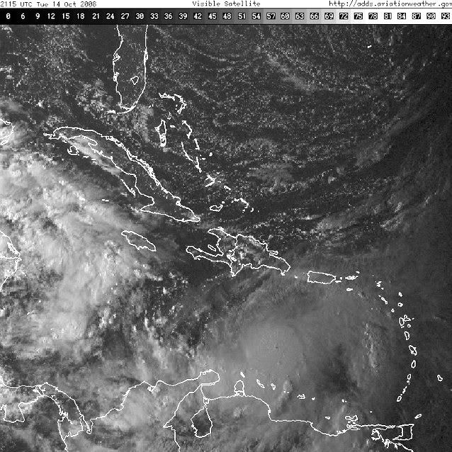
Derek's sat images are also proving there worth. You can see the ring here too.

0 likes

-
Just Joshing You

- Category 2

- Posts: 512
- Joined: Sat Nov 03, 2007 10:29 am
- Location: Nova Scotia


Well, msbee, there's your warning...
TROPICAL STORM OMAR FORECAST/ADVISORY NUMBER 6
NWS TPC/NATIONAL HURRICANE CENTER MIAMI FL AL152008
2100 UTC TUE OCT 14 2008
AT 5 PM AST...2100 UTC...A HURRICANE WATCH AND A TROPICAL STORM
WARNING HAVE BEEN ISSUED FOR PUERTO RICO AND THE U.S. VIRGIN
ISLANDS.
AT 5 PM AST...THE GOVERNMENTS OF THE NETHERLANDS ANTILLES...ANTIGUA
AND BARBUDA...AND FRANCE...HAVE ALSO ISSUED A HURRICANE WATCH AND A
TROPICAL STORM WARNING FOR THE BRITISH VIRGIN ISLANDS AND THE
ISLANDS OF ANGUILLA...ST. KITTS...NEVIS...SABA...ST. EUSTATIUS...
ST. MAARTEN...ST. MARTIN...AND ST. BARTHELEMY.
0 likes

ATL OMAR: Advisories
I heard that at this time of the year storms have very erratic motions and are very hard to predict there future track. What are the chances that the forecast track changes?
0 likes


-
HURAKAN

- Professional-Met

- Posts: 46084
- Age: 39
- Joined: Thu May 20, 2004 4:34 pm
- Location: Key West, FL
- Contact:
Re: ATL OMAR: Tropical Storm - Discussion
1992: "Super Typhoon Omar was the 15th tropical depression (15W), the 15th named storm." Link: http://en.wikipedia.org/wiki/Typhoon_Omar
2008: Tropical Storm Omar is the 15th tropical depression, and the 15th named storm.
0 likes
-
bvigal

- S2K Supporter

- Posts: 2276
- Joined: Sun Jul 24, 2005 8:49 am
- Location: British Virgin Islands
- Contact:
Re: ATL OMAR: Tropical Storm - Discussion
Oh I'm so glad I read that... NOT!! 
I've seen too many storms change drastically in intensity forecasts in only a few hours. It's still the most difficult part of the forecast. I hope this doesn't get any stronger, but honestly, while it's in the Caribbean, I don't see anything to stop it.
I've seen too many storms change drastically in intensity forecasts in only a few hours. It's still the most difficult part of the forecast. I hope this doesn't get any stronger, but honestly, while it's in the Caribbean, I don't see anything to stop it.
0 likes
Re: ATL OMAR: Tropical Storm - Discussion
NE turn commenced.
RI Look.
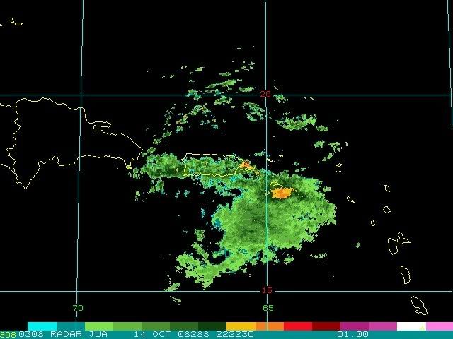
St Croix in extrapolated track. I'd be raising the hurricane flags in St Croix fast!
RI Look.
St Croix in extrapolated track. I'd be raising the hurricane flags in St Croix fast!
0 likes
-
CrazyC83
- Professional-Met
- Posts: 34315
- Joined: Tue Mar 07, 2006 11:57 pm
- Location: Deep South, for the first time!
Re: ATL OMAR: Tropical Storm - Discussion
UW - CIMSS
ADVANCED DVORAK TECHNIQUE
ADT-Version 7.2.3
Tropical Cyclone Intensity Algorithm
----- Current Analysis -----
Date : 14 OCT 2008 Time : 204500 UTC
Lat : 14:02:00 N Lon : 68:34:49 W
CI# /Pressure/ Vmax
4.4 / 983.7mb/ 74.6kt
Final T# Adj T# Raw T#
(3hr avg)
4.4 4.6 4.7
Latitude bias adjustment to MSLP : +3.1mb
Center Temp : -76.4C Cloud Region Temp : -81.6C
Scene Type : UNIFORM CDO CLOUD REGION
Positioning Method : SPIRAL ANALYSIS
Ocean Basin : ATLANTIC
Dvorak CI > MSLP Conversion Used : ATLANTIC
Tno/CI Rules : Constraint Limits : 1.2T/12hr
Weakening Flag : OFF
Rapid Dissipation Flag : OFF
0 likes
-
dixiebreeze

- S2K Supporter
- Posts: 5140
- Joined: Wed Sep 03, 2003 5:07 pm
- Location: crystal river, fla.
Re: ATL OMAR: Tropical Storm - Discussion
Omar sure looks like a hurricane now in the latest IR loop.
0 likes

Who is online
Users browsing this forum: No registered users and 5 guests