ATL: PALOMA - Tropical Depression - Discussion
Moderator: S2k Moderators
- Category 5
- Category 5

- Posts: 10074
- Age: 36
- Joined: Sun Feb 11, 2007 10:00 pm
- Location: New Brunswick, NJ
- Contact:
Re: ATL: Invest 93L - Discussion - TCFA
Models show a Michelle type track (a bit further east though).

Cuba, the Caymans, Jamaica, and the Bahamas should be on alert.

Cuba, the Caymans, Jamaica, and the Bahamas should be on alert.
0 likes
- HURAKAN
- Professional-Met

- Posts: 46084
- Age: 39
- Joined: Thu May 20, 2004 4:34 pm
- Location: Key West, FL
- Contact:
TROPICAL WEATHER DISCUSSION
NWS TPC/NATIONAL HURRICANE CENTER MIAMI FL
105 PM EST WED NOV 05 2008
...SPECIAL FEATURE...
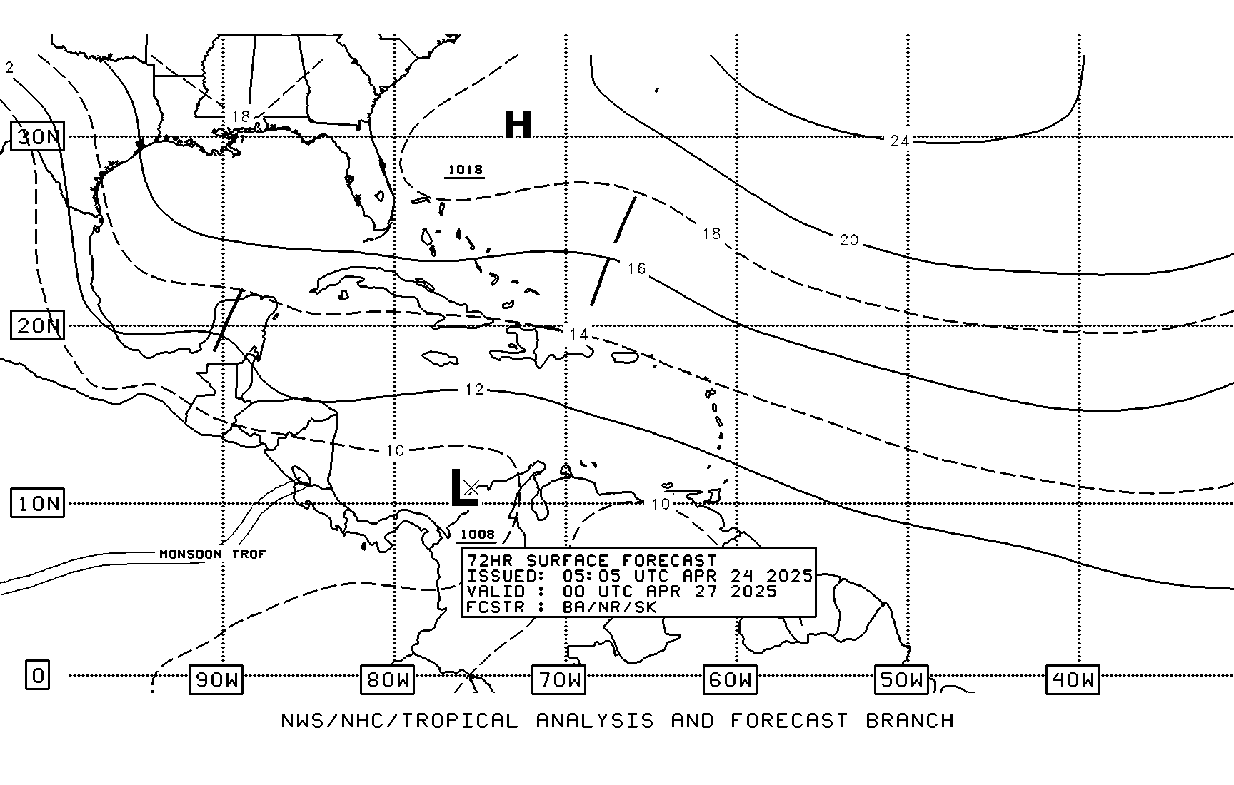
A 1008 MB LOW IS IN THE CARIBBEAN NEAR 14N82W WITH SATELLITE
IMAGES AND SURFACE OBSERVATIONS INDICATING THAT A TROPICAL
DEPRESSION MAY BE FORMING. ENVIRONMENTAL CONDITIONS APPEARS
FAVORABLE FOR FURTHER DEVELOPMENT AND AN AIR FORCE RESERVE
HURRICANE HUNTER AIRCRAFT IS ENROUTE TO DETERMINE IF A
DEPRESSION HAS FORMED. THIS SYSTEM IS EXPECTED TO MOVE SLOWLY TO
THE N OR NW FOR THE NEXT COUPLE OF DAYS. LARGE CLUSTERS OF
SCATTERED MODERATE/STRONG CONVECTION ARE FROM 11N-17N BETWEEN
78W-84W INCLUDING THE COASTAL AREAS OF NICARAGUA AND NE
HONDURAS. SCATTERED SHOWERS/ISOLATED THUNDERSTORMS COVER THE
REMAINDER OF THE AREA S OF 20N BETWEEN 73W-85W.
0 likes
- HURAKAN
- Professional-Met

- Posts: 46084
- Age: 39
- Joined: Thu May 20, 2004 4:34 pm
- Location: Key West, FL
- Contact:
939
ABNT20 KNHC 051735
TWOAT
TROPICAL WEATHER OUTLOOK
NWS TPC/NATIONAL HURRICANE CENTER MIAMI FL
100 PM EST WED NOV 5 2008
FOR THE NORTH ATLANTIC...CARIBBEAN SEA AND THE GULF OF MEXICO...
SATELLITE IMAGES AND SURFACE OBSERVATIONS INDICATE THAT A TROPICAL
DEPRESSION MAY BE FORMING IN THE SOUTHWESTERN CARIBBEAN SEA ABOUT
150 MILES SOUTHEAST OF CABO GRACIAS A DIOS ON THE BORDER OF
NICARAGUA AND HONDURAS. ENVIRONMENTAL CONDITIONS APPEARS FAVORABLE
FOR FURTHER DEVELOPMENT AND AN AIR FORCE RESERVE HURRICANE HUNTER
AIRCRAFT IS ENROUTE TO DETERMINE IF A DEPRESSION HAS FORMED. THIS
SYSTEM IS EXPECTED TO MOVE SLOWLY TO THE NORTH OR NORTHWEST FOR THE
NEXT COUPLE OF DAYS.
ELSEWHERE...TROPICAL CYCLONE FORMATION IS NOT EXPECTED DURING THE
NEXT 48 HOURS.
$$
FORECASTER BLAKE
0 likes
- gatorcane
- S2K Supporter

- Posts: 23708
- Age: 48
- Joined: Sun Mar 13, 2005 3:54 pm
- Location: Boca Raton, FL
Reliable models continue to show a major hurricane impacting Cuba with winds up to 140mph.. I just looked at the 12Z guidance (GFDL/HWRF)
Folks lets hope these models are not right or future Paloma may go down as one of the strongest systems of the 2008 season and yes it is NOVEMBER and is likely going to impact somebody in the Caribbean.
Folks lets hope these models are not right or future Paloma may go down as one of the strongest systems of the 2008 season and yes it is NOVEMBER and is likely going to impact somebody in the Caribbean.
0 likes
- bvigal
- S2K Supporter

- Posts: 2276
- Joined: Sun Jul 24, 2005 8:49 am
- Location: British Virgin Islands
- Contact:
Re: ATL: Invest 93L - TWO "TD may be forming"
Gatorcane, you hit this nail on the head a week ago, good job!!!
(sorry links aren't live, the thread is locked so could not utilize "reply". Here's thread link: http://www.storm2k.org/phpbb2/viewtopic.php?f=31&t=103716gatorcane wrote: Post subject: Re: GFS/Euro Long-Range Show a Tropical Cyclone in SW Caribbean
Posted: Wed Oct 29, 2008 9:37 amwxman57 wrote: Right, a hurricane in the Caribbean and snowing in Dallas on the same day. I believe the 15-day GFS.
Wxman the GFS has been pegging this tropical cyclone in the 8-10 (not 15) day range and has been very consistent. Now it shows a formidable system in the Western Caribbean that moves NE over Cuba staying well south of the CONUS and Southern Florida on this run. I believe it is predicting this low to form off the tail end of the powerful CONUS front that has moved into the Western Caribbean and is pulling up stationary in the Western Caribbean.
Here we are with the low forming in the SW Caribbean 5 days from now:
(model pic)
At 204 hours it has deepened into a formidable system moving off to the NNE
(model pic)
Then by 276 hours it starts to move quickly off to the NE through Cuba and the Bahamas (east of South Florida):
(model pic)
This blowup in the SW Caribbean could be the seminal stages of the GFS tropical cyclone:
(model pic)
Last edited by gatorcane on Wed Oct 29, 2008 9:48 am, edited 2 times in total.
0 likes
- gatorcane
- S2K Supporter

- Posts: 23708
- Age: 48
- Joined: Sun Mar 13, 2005 3:54 pm
- Location: Boca Raton, FL
Re: ATL: Invest 93L - TWO "TD may be forming"
It's interesting to note that TAFB is not comitting to a path yet...still stationary at 72 hours even with the front diving down in the GOM. That tells me they must be some doubt in where future Paloma will end up.


0 likes
- hurricanefloyd5
- Category 5

- Posts: 1659
- Age: 45
- Joined: Sun May 02, 2004 10:53 am
- Location: Spartanburg
- Contact:
Re: ATL: Invest 93L - TWO "TD may be forming"
Think we need to start a recon thread now concidering the plane i now on the way to this system?
0 likes
- cycloneye
- Admin

- Posts: 149275
- Age: 69
- Joined: Thu Oct 10, 2002 10:54 am
- Location: San Juan, Puerto Rico
Re: ATL: Invest 93L - TWO "TD may be forming"
05/1745 UTC 13.9N 82.2W T2.0/2.0 93L -- Atlantic
0 likes
- DESTRUCTION5
- Category 5

- Posts: 4430
- Age: 44
- Joined: Wed Sep 03, 2003 11:25 am
- Location: Stuart, FL
Re: ATL: Invest 93L - TWO "TD may be forming"
hurricanefloyd5 wrote:Think we need to start a recon thread now concidering the plane i now on the way to this system?
viewtopic.php?f=59&t=103813
Said the blind man...
0 likes
- Category 5
- Category 5

- Posts: 10074
- Age: 36
- Joined: Sun Feb 11, 2007 10:00 pm
- Location: New Brunswick, NJ
- Contact:
Re:
gatorcane wrote:Reliable models continue to show a major hurricane impacting Cuba with winds up to 140mph.. I just looked at the 12Z guidance (GFDL/HWRF)
Folks lets hope these models are not right or future Paloma may go down as one of the strongest systems of the 2008 season and yes it is NOVEMBER and is likely going to impact somebody in the Caribbean.
This is always a concern, the western Caribbean has produced some late season monsters in recent history.
0 likes
- cycloneye
- Admin

- Posts: 149275
- Age: 69
- Joined: Thu Oct 10, 2002 10:54 am
- Location: San Juan, Puerto Rico
Re: ATL: Invest 93L - TWO "TD may be forming"
AL, 93, 2008110518, , BEST, 0, 134N, 816W, 25, 1006, DB, 34
0 likes
- wxman57
- Moderator-Pro Met

- Posts: 23172
- Age: 68
- Joined: Sat Jun 21, 2003 8:06 pm
- Location: Houston, TX (southwest)
Re: ATL: Invest 93L - TWO "TD may be forming"
There's little doubt we have TD 17 there now. Convection increasing fast, banding, good outflow. Should be a hurricane in 48 hours. I still don't see a threat to the Gulf or south Florida, though. Watch out Cayman Islands, Jamaica, and eastern Cuba!


0 likes
-
Derek Ortt
- wyq614
- Category 3

- Posts: 827
- Age: 37
- Joined: Sun Dec 02, 2007 12:32 am
- Location: Beijing, China (Hometown: Qingdao, China, 36.06N 120.43E)
- Contact:
I also think we should keep an eye on this system. On 8 Nov the Chinese Education Ministry delegation would come to Cuba and we are settled to perform Cuban songs for them, if the cyclone allows us...
And, we all have Spanish names. Yo soy Vicente and in my class there is a girl named Paloma...
And, we all have Spanish names. Yo soy Vicente and in my class there is a girl named Paloma...
0 likes
-
CaneMaster
- cycloneye
- Admin

- Posts: 149275
- Age: 69
- Joined: Thu Oct 10, 2002 10:54 am
- Location: San Juan, Puerto Rico
Re:
RL3AO wrote:I guess its time to start watching the tropics again. Whats the shear like? I know for sure the waters are still warm enough.
According to the 18:00 UTC SHIP forecast,shear will be low for the next 72 hours.
Code: Select all
SHEAR (KTS) 6 6 3 2 1 2 2 8 11 26 30 32 36
0 likes
Who is online
Users browsing this forum: No registered users and 107 guests


