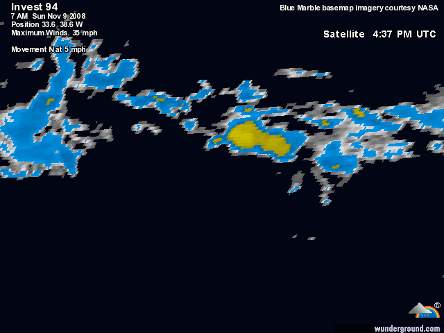
ATL: INVEST 94L - Discussion
Moderator: S2k Moderators
-
Just Joshing You

- Category 2

- Posts: 512
- Joined: Sat Nov 03, 2007 10:29 am
- Location: Nova Scotia
-
Blown Away

- S2K Supporter

- Posts: 10253
- Joined: Wed May 26, 2004 6:17 am
Re: Re:
cycloneye wrote:CrazyC83 wrote:This really came out of nowhere...
It means that you haved not gone to Talking Tropics forum since last thursday.
Your right, funny how you get attached to the "Active Forum".
0 likes

-
MGC

- S2K Supporter
- Posts: 5940
- Joined: Sun Mar 23, 2003 9:05 pm
- Location: Pass Christian MS, or what is left.
Re: ATL: INVEST 94L - Discussion
Excellent low leve circulation. Just needs a bit more convection than just that one little ole thundstorm that has sprung up.....MGC
0 likes
-
cycloneye

- Admin

- Posts: 149275
- Age: 69
- Joined: Thu Oct 10, 2002 10:54 am
- Location: San Juan, Puerto Rico
Re: ATL: INVEST 94L - Discussion
No mention of this area in the Tropical Weather Outlook.I guess that the invest will be deactivated soon.
ABNT20 KNHC 092347
TWOAT
TROPICAL WEATHER OUTLOOK
NWS TPC/NATIONAL HURRICANE CENTER MIAMI FL
700 PM EST SUN NOV 9 2008
FOR THE NORTH ATLANTIC...CARIBBEAN SEA AND THE GULF OF MEXICO...
THE NATIONAL HURRICANE CENTER IS ISSUING ADVISORIES ON
RECENTLY-DOWNGRADED TROPICAL DEPRESSION PALOMA...LOCATED INLAND
NEAR CAMAGUEY CUBA.
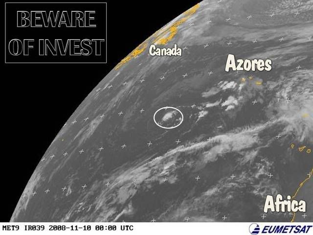
AN NEARLY STATIONARY AREA OF LOW PRESSURE LOCATED ABOUT 700 MILES
EAST OF THE LEEWARD ISLANDS IS PRODUCING DISORGANIZED SHOWERS AND
THUNDERSTORMS. UPPER-LEVEL WINDS ARE NOT FAVORABLE FOR SIGNIFICANT
DEVELOPMENT AS THIS SYSTEM DRIFTS WEST-NORTHWESTWARD.
ELSEWHERE...TROPICAL CYCLONE FORMATION IS NOT EXPECTED DURING THE
NEXT 48 HOURS.
$$
FORECASTER STEWART
ABNT20 KNHC 092347
TWOAT
TROPICAL WEATHER OUTLOOK
NWS TPC/NATIONAL HURRICANE CENTER MIAMI FL
700 PM EST SUN NOV 9 2008
FOR THE NORTH ATLANTIC...CARIBBEAN SEA AND THE GULF OF MEXICO...
THE NATIONAL HURRICANE CENTER IS ISSUING ADVISORIES ON
RECENTLY-DOWNGRADED TROPICAL DEPRESSION PALOMA...LOCATED INLAND
NEAR CAMAGUEY CUBA.
AN NEARLY STATIONARY AREA OF LOW PRESSURE LOCATED ABOUT 700 MILES
EAST OF THE LEEWARD ISLANDS IS PRODUCING DISORGANIZED SHOWERS AND
THUNDERSTORMS. UPPER-LEVEL WINDS ARE NOT FAVORABLE FOR SIGNIFICANT
DEVELOPMENT AS THIS SYSTEM DRIFTS WEST-NORTHWESTWARD.
ELSEWHERE...TROPICAL CYCLONE FORMATION IS NOT EXPECTED DURING THE
NEXT 48 HOURS.
$$
FORECASTER STEWART
0 likes
-
Matt-hurricanewatcher
Re: ATL: INVEST 94L - Discussion
Makes no sense to me that they would deactive it, but hey I don't control that.
0 likes
-
Matt-hurricanewatcher
Re: ATL: INVEST 94L - Discussion
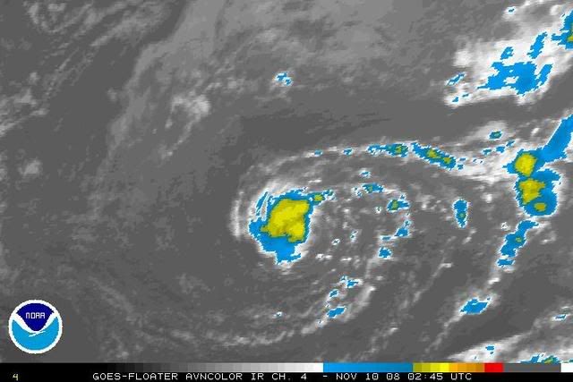
http://www.ssd.noaa.gov/goes/flt/t2/avn-l.jpg
Looking tropical to me. Within the next 24 hours maybe a tropical storm?
Looking tropical to me. Within the next 24 hours maybe a tropical storm?
0 likes
-
Matt-hurricanewatcher
Re:
HURAKAN wrote:Convection needs to persist, it's a must for any kind of subtropical or tropical development.
Sure, but it is doing a darn good job of it right now. It also looks very tropical with banding features trying to form. So your right it needs to persist for another 12 hours, before a upgrade can be done.
0 likes
-
AJC3

- Admin
- Posts: 4153
- Age: 62
- Joined: Tue Aug 31, 2004 7:04 pm
- Location: Ballston Spa, New York
- Contact:
Re: Re:
Matt-hurricanewatcher wrote:HURAKAN wrote:Convection needs to persist, it's a must for any kind of subtropical or tropical development.
Sure, but it is doing a darn good job of it right now. It also looks very tropical with banding features trying to form. So your right it needs to persist for another 12 hours, before a upgrade can be done.
Darn good job? LOL...It has ONE thunderstorm over the center...not even close to being worthy of an upgrade.
0 likes
-
wxman57

- Moderator-Pro Met

- Posts: 23172
- Age: 68
- Joined: Sat Jun 21, 2003 8:06 pm
- Location: Houston, TX (southwest)
Re: ATL: INVEST 94L - Discussion
It's not even an invest any longer. Shouldn't this thread go back to Talkin' Tropics?
0 likes
-
cycloneye
- Admin
- Posts: 149275
- Age: 69
- Joined: Thu Oct 10, 2002 10:54 am
- Location: San Juan, Puerto Rico
Re: ATL: INVEST 94L - Discussion
wxman57 wrote:It's not even an invest any longer. Shouldn't this thread go back to Talkin' Tropics?
The floater page still has 94L and the ATCF site still hasnt deactivated it.
http://www.ssd.noaa.gov/PS/TROP/floaters.html
ftp://ftp.tpc.ncep.noaa.gov/atcf/tcweb/
The NRL site never put 94L since it appeared on Saturday.
0 likes
-
wxman57
- Moderator-Pro Met
- Posts: 23172
- Age: 68
- Joined: Sat Jun 21, 2003 8:06 pm
- Location: Houston, TX (southwest)
Re: ATL: INVEST 94L - Discussion
There's not much left but a weak low-level swirl today over SSTs in the low 70s.
0 likes
-
cycloneye
- Admin
- Posts: 149275
- Age: 69
- Joined: Thu Oct 10, 2002 10:54 am
- Location: San Juan, Puerto Rico
Re: ATL: INVEST 94L - Discussion
I think that today they will finnally take out 94L.
10/1145 UTC 32.0N 38.0W TOO WEAK 94L -- Atlantic
10/1145 UTC 32.0N 38.0W TOO WEAK 94L -- Atlantic
0 likes
-
HURAKAN

- Professional-Met

- Posts: 46084
- Age: 39
- Joined: Thu May 20, 2004 4:34 pm
- Location: Key West, FL
- Contact:
Loop: http://www.ssd.noaa.gov/goes/flt/t2/loop-vis.html
It's moving SSEward and toward warmer temps but convection is scarce to put it in a favorable way for 94L!!
It's moving SSEward and toward warmer temps but convection is scarce to put it in a favorable way for 94L!!
0 likes
-
cycloneye
- Admin
- Posts: 149275
- Age: 69
- Joined: Thu Oct 10, 2002 10:54 am
- Location: San Juan, Puerto Rico
Re: ATL: Ex INVEST 94L - Discussion
If they resume the running of models,then the thread will be moved back to Active Storms forum.
0 likes
-
wxman57
- Moderator-Pro Met
- Posts: 23172
- Age: 68
- Joined: Sat Jun 21, 2003 8:06 pm
- Location: Houston, TX (southwest)
Re: ATL: Ex INVEST 94L - Discussion
And with the demise of 94L, so ends the 2008 hurricane season. I don't think we'll see any more named storms this season. Heck, I'm so sure the season's over that if we get one more storm, then Matt will eat his other sock!

0 likes
Who is online
Users browsing this forum: No registered users and 32 guests