2008 Severe Weather Thread
Moderator: S2k Moderators
Forum rules

The posts in this forum are NOT official forecast and should not be used as such. They are just the opinion of the poster and may or may not be backed by sound meteorological data. They are NOT endorsed by any professional institution or STORM2K.


Re: 2008 Severe Weather Thread

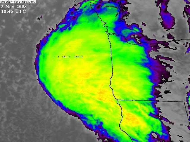
0738 3 ESE DUNN SAMPSON NC 3530 7857 WIND DAMAGE AND DEBRIS REPORTED AT 12000 HARNETT/DUNN HIGHWAY. (RAH)
0748 4 ESE BENSON JOHNSTON NC 3535 7849 DAMAGE TO HOUSE AT WOODS CROSSROADS AND FIVE POINTS ROADS. BARN ALSO DESTROYED AND TREES DOWN. TIME EST BY LAW ENFORCEMENT AND RADAR. (RAH)
0800 5 ESE SMITHFIELD JOHNSTON NC 3547 7826 COUNTY OFFICIALS REPORT DAMAGE IN SEVERAL LOCATIONS ACROSS JOHNSTON COUNTY. UNKNOWN NUMBER OF INJURIES REPORTED. RESCUE OPERATIONS IN PROGRESS. (RAH)
0810 KENLY JOHNSTON NC 3559 7813 LAW ENFORCEMENT OFFICIALS REPORT DAMAGE IN KENLY FROM THE TORNADO. (RAH)
0820 1 NE LUCAMA WILSON NC 3565 7800 HOMES DAMAGED IN LUCAMA. (RAH)
0840 3 WSW ELM CITY WILSON NC 3579 7791 LAW ENFRCEMENT REPORT DAMAGE TO SEVERAL HOMES AND SEARCH IS IN PROGRESS FOR RESIDENTS. (RAH)
0 likes
-
Weatherfreak14

- Category 5

- Posts: 1381
- Joined: Sat Sep 24, 2005 3:40 pm
- Location: Beaufort, SC
- Contact:
Re: 2008 Severe Weather Thread
Well sad thing is this deadly tornado season got worse last night. By SPC Storm reports 2 fatalities on last night. http://www.spc.noaa.gov/climo/reports/yesterday.html
0 likes
-
Squarethecircle
- Category 5
- Posts: 2165
- Joined: Fri Oct 19, 2007 4:00 pm
- Location: Fairfax, VA


-
Ed Mahmoud
Re: 2008 Severe Weather Thread
Not every mid November day one sees a tornado watch for New Jersey, but no severe warnings as of post time...

Sun is out further South in NC and VA

Sun is out further South in NC and VA
0 likes
-
Ed Mahmoud
Re: 2008 Severe Weather Thread
May rain before the end of the still close Notre Dame at Navy game. if Notre Dame can hold the 3 point lead, barring late season miracles, this will be the only Irish defeat of a winning team all season.
ETA: Not a close game anymore. As often happens, a scrappy but out-matched team hangs close, but eventually fatigue and less skill on the second string sets in. Notre Dame now comfortably ahead. But I laught at a team that needed a big come back and OT to beat Temple.
ETA: Not a close game anymore. As often happens, a scrappy but out-matched team hangs close, but eventually fatigue and less skill on the second string sets in. Notre Dame now comfortably ahead. But I laught at a team that needed a big come back and OT to beat Temple.
Last edited by Ed Mahmoud on Sat Nov 15, 2008 2:46 pm, edited 1 time in total.
0 likes
-
Squarethecircle
- Category 5
- Posts: 2165
- Joined: Fri Oct 19, 2007 4:00 pm
- Location: Fairfax, VA
-
Ed Mahmoud
Re: 2008 Severe Weather Thread
I wouldn't be surprised by a few severe weather reports in the ArkLaTex regions this evening based on WRF soundings and precipitation forecasts.

SPC has a "See Text" for the area, discussion indicates warm EML will inhibit pre-frontal storm activity, meaning hail and straight line wind gusts are more likely than tornadoes.
SPC has a "See Text" for the area, discussion indicates warm EML will inhibit pre-frontal storm activity, meaning hail and straight line wind gusts are more likely than tornadoes.
0 likes
-
Ed Mahmoud
Re: 2008 Severe Weather Thread
Nice compact little short wave visible on WV imagery diving into the Texas Panhandle.
Front becoming active in Northeast Texas.

We've had a few heavy showers, convective in nature, but without thunder, around the Galleria. I suspect these showers are under the inversion around the 750 mb level.
No meso discussions, and this area is still in a "See Text" risk area from SPC.
Front becoming active in Northeast Texas.
We've had a few heavy showers, convective in nature, but without thunder, around the Galleria. I suspect these showers are under the inversion around the 750 mb level.
No meso discussions, and this area is still in a "See Text" risk area from SPC.
0 likes
-
Ed Mahmoud
Re: 2008 Severe Weather Thread
Ed Mahmoud wrote:Nice compact little short wave visible on WV imagery diving into the Texas Panhandle.
Front becoming active in Northeast Texas.
We've had a few heavy showers, convective in nature, but without thunder, around the Galleria. I suspect these showers are under the inversion around the 750 mb level.
No meso discussions, and this area is still in a "See Text" risk area from SPC.

MESOSCALE DISCUSSION 2411
NWS STORM PREDICTION CENTER NORMAN OK
0507 PM CST WED DEC 03 2008
AREAS AFFECTED...EAST TX...NW LA...SRN AR
CONCERNING...SEVERE POTENTIAL...WATCH UNLIKELY
VALID 032307Z - 040030Z
A MARGINAL SEVERE THREAT WILL CONTINUE ACROSS PARTS OF EAST TX...SRN
AR AND NW LA THROUGH EARLY EVENING. HAIL AND GUSTY WINDS WILL BE
POSSIBLE WITH THE STRONGER CELLS. THE THREAT SHOULD REMAIN TOO
MARGINAL TO WARRANT WW ISSUANCE.
23Z SFC ANALYSIS SHOWS A COLD FRONT EXTENDING SWWD ACROSS WRN AR
INTO NERN AND CNTRL TX WITH A LOW CENTERED NEAR TEXARKANA. A LINE OF
THUNDERSTORMS IS ONGOING JUST AHEAD OF THE FRONT ALONG AN AXIS OF
STRONG LOW-LEVEL CONVERGENCE AS DEPICTED BY THE RUC. IN
ADDITION...RUC ANALYSIS SHOWS SBCAPE VALUES FROM 500 TO 1000 J/KG
FROM SRN AR SSWWD INTO SE TX WHERE SFC DEWPOINTS ARE IN THE UPPER
50S TO LOWER 60S F. THIS THERMODYNAMIC ENVIRONMENT COUPLED WITH
ABOUT 60 KT OF 0-6 KM SHEAR EVIDENT ON THE PALESTINE TX PROFILER
SHOULD SUPPORT MARGINALLY SEVERE STORMS. ALTHOUGH LAPSE RATES ARE
NOT PARTICULARLY STEEP...THE SHEAR COMBINED WITH MID-LEVEL TEMPS OF
ABOUT -15C SHOULD BE SUFFICIENT FOR HAIL IN THE STRONGEST OF
UPDRAFTS. A FEW STRONG WIND GUSTS MAY ALSO ACCOMPANY THE MORE
ORGANIZED LINE SEGMENTS.
..BROYLES.. 12/03/2008
ATTN...WFO...LZK...LCH...SHV...HGX...FWD...
0 likes
-
Ed Mahmoud
Re: 2008 Severe Weather Thread
Monday severe near Louisiana?
Not sure the quality of moisture return...
40 knot low level jet off the Gulf and turning with height between 850 mb and 500 mb, with some suggestion of diffluent flow approaching Louisiana from Texas.


Looks like 850 mb and 700 mb RH are high enough that the cap probably isn't overwhelming

GFS is a less amplified, and a bit slower, Canadian seems to be between the two.
SPC not impressed.
Not sure the quality of moisture return...
40 knot low level jet off the Gulf and turning with height between 850 mb and 500 mb, with some suggestion of diffluent flow approaching Louisiana from Texas.
Looks like 850 mb and 700 mb RH are high enough that the cap probably isn't overwhelming
GFS is a less amplified, and a bit slower, Canadian seems to be between the two.
SPC not impressed.
DAY 4-8 CONVECTIVE OUTLOOK
NWS STORM PREDICTION CENTER NORMAN OK
0348 AM CST THU DEC 04 2008
VALID 071200Z - 121200Z
...DISCUSSION...
GFS AND ECMWF IN DECENT AGREEMENT THROUGH DAY 5 /MON. 12-8/...BUT
DIFFERENCES INCREASE SUBSTANTIALLY FROM THE START OF DAY 6 ONWARD
SUCH THAT PREDICTABILITY IS TOO LOW TO WARRANT ANY DEPICTION OF
POTENTIAL SEVERE THREATS.
IN THE MEAN TIME...BOTH MODELS FORECAST A SLOW EWD PROGRESSION OF
THE ERN U.S. UPPER TROUGH...WITH THIS FEATURE EXPECTED TO MOVE OFF
THE ATLANTIC DAY 5. MEANWHILE...A SECOND TROUGH IS PROGGED TO DIG
SEWD ACROSS THE ROCKIES...MAINTAINING LONG-WAVE TROUGHING OVER THE
CONUS. AS THE WRN TROUGH DIGS RAPIDLY SEWD TOWARD THE SRN
PLAINS...CYCLOGENESIS IS FORECAST OVER THE S CENTRAL CONUS.
RESULTING NWD RETURN OF MOISTURE COULD ALLOW AMPLE DESTABILIZATION
TO SUPPORT CONVECTIVE DEVELOPMENT DURING THE SECOND HALF OF DAY
5...BUT ATTM EXPECT THAT DESTABILIZATION WOULD BE INSUFFICIENT FOR A
SIGNIFICANT SEVERE EVENT.
0 likes
-
Ed Mahmoud
Re: 2008 Severe Weather Thread
New 12Z WRF suggests the warm front in Northeast Texas will become active Monday afternoon...

0 likes
-
Ed Mahmoud
Re: 2008 Severe Weather Thread
Models seem to have delayed the action, 12 to 24 hours, storms in Texas may occur well prior to peak heating Tuesday, but I'm not sure how much breaks in the clouds would occur this time of year to allow a big diurnal swing anyway in this situation.
0 likes

Return to “USA & Caribbean Weather”
Who is online
Users browsing this forum: Brent, Stratton23 and 67 guests