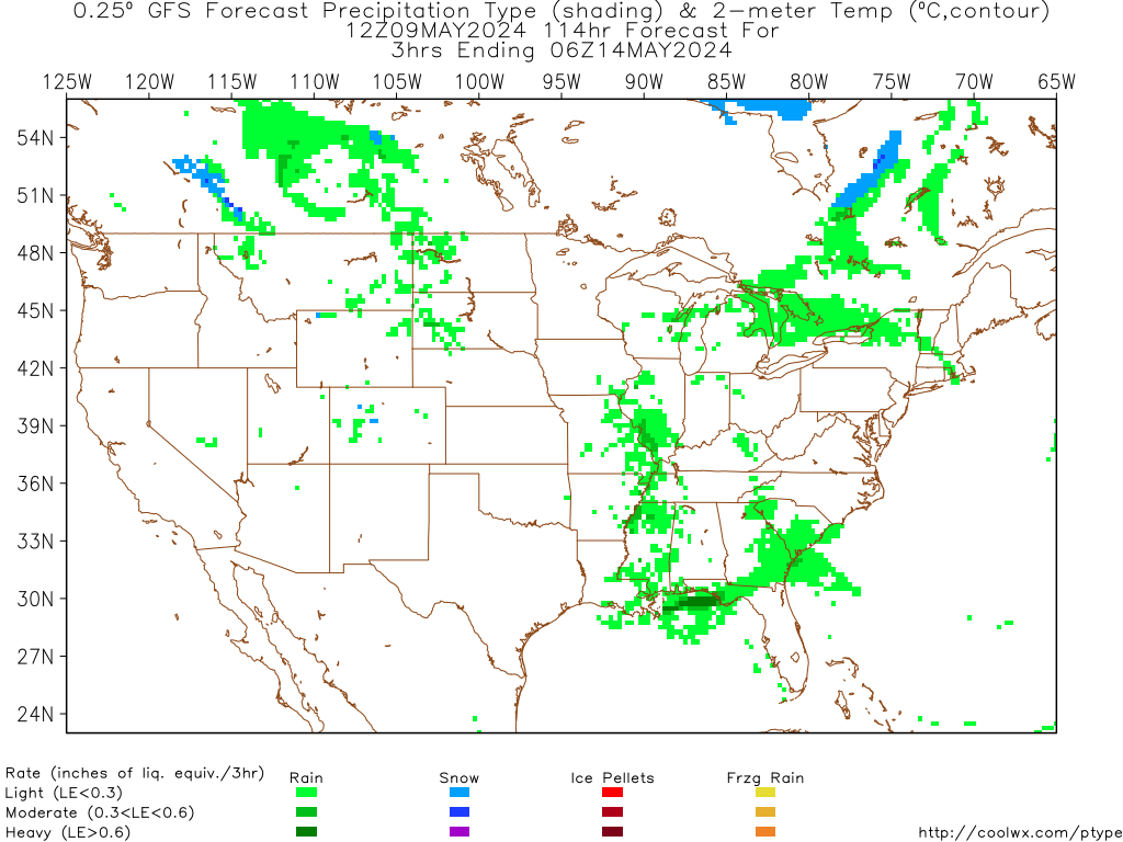
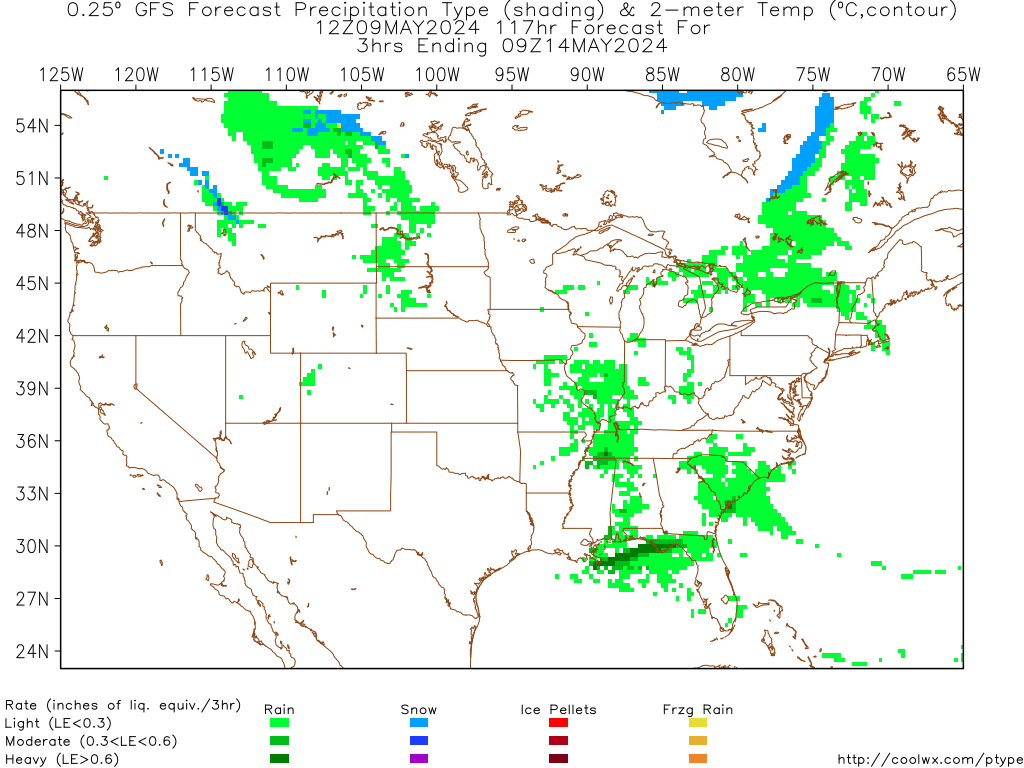
Much better setup than the last couple of runs, now for some consistency. Euro is showing a similar storm as well(though a bit less impressive)
Moderator: S2k Moderators
 The posts in this forum are NOT official forecast and should not be used as such. They are just the opinion of the poster and may or may not be backed by sound meteorological data. They are NOT endorsed by any professional institution or STORM2K.


Ivanhater wrote:I think it is going to be close along the Gulfcoast..only 78 and 84 hours out..if the GFS is just a wee bit slow, could be even heavier..grabed this quote from wxman..
Again, classic cross-Polar flow pattern with the leading edge of Arctic air already in Texas and maybe not far to our north. With southwest flow aloft, this is the type of pattern that would lay down a snow pack as it moves south through the Plains. Could get "interesting" across the Gulf Coast with this type of flow pattern, but I'm not making any predictions of a coastal snow/ice event yet.


Users browsing this forum: No registered users and 121 guests